Mountain Weather for 11,000ft. Wednesday 3/18

CB Avalanche CenterWeather

Date: 03/18/2020

A dynamic spring storm is making its way through the Great Basin towards Colorado today. Energy will split with the stronger northern Low “slinging” the southern Low into our area. Timing and track of these types of storms are crucial to snowfall amounts and there remains a bit of uncertainty regarding both of those factors. One thing is certain and that is large amounts of moisture will be available. Clouds will thicken today with accumulating snow holding off until this evening.

Snowfall ramps up tonight and into tomorrow as the flow will shift from south to west with colder air filtering in. The heaviest snow for our area will most likely occur after the winds switch, allowing orographics to lift available moisture. Plan on overcast skies, gusty winds and snowfall throughout the day tomorrow with below-average temperatures.

  • Today

    High Temperature: 37 to 41
    Winds/Direction: 8 to 18/ SSW
    Sky Cover: Increasing clouds
    Irwin Snow: 0 to 1″
    Elkton Snow: 0 to 1″
    Friend’s Hut Snow: 0 to 1″

  • Tonight

    Low Temperature: 20 to 24
    Winds/Direction: 5 to 10/ S switching to W
    Sky Cover: Overcast
    Irwin Snow: 3 to 7″
    Elkton Snow: 3 to 7″
    Friend’s Hut Snow: 2 to 5″

  • Tomorrow

    High Temperature: 26 to 30
    Winds/Direction: 10 to 20/ W G30
    Sky Cover: Overcast
    Irwin Snow: 5 to 10″
    Elkton Snow: 5 to 10″
    Friend’s Hut Snow: 3 to 7″

Mountain Weather for 11,000ft. Tuesday 3/17

CB Avalanche CenterWeather

Date: 03/17/2020

A broad area of Low pressure off the coast of California has cut off from the main flow and will be slowly drifting south today before energy splits and stalls over the Great Basin. Under moist southerly flow, we will see another mild day with above-average temperatures and passing clouds. Winds will increase as the pressure gradient tightens and the jet stream moves closer.

Expect clouds to increase tomorrow as the splitting shortwave moves closer drawing in even more moisture in SSW flow. Temperatures will cool a bit tomorrow with cloud cover and increasing winds. Significant precipitation looks to hold off until late tomorrow into Thursday when the shortwave finally moves through with unsettled weather hanging around the Western US through the weekend.

  • Today

    High Temperature: 42 to 46
    Winds/Direction: 5 to 15, SSW
    Sky Cover: Partly Cloudy
    Irwin Snow: 0 to 1″
    Elkton Snow: 0 to 1″
    Friend’s Hut Snow: 0 to 1″

  • Tonight

    Low Temperature: 20 to 25
    Winds/Direction: 5 to 15, SSW
    Sky Cover: Partly Cloudy
    Irwin Snow: 0″
    Elkton Snow: 0″
    Friend’s Hut Snow: 0″

  • Tomorrow

    High Temperature: 37 to 41
    Winds/Direction: 5 to 15, SSW G25
    Sky Cover: Increasing clouds
    Irwin Snow: 0 to 1″
    Elkton Snow: 0 to 1″
    Friend’s Hut Snow: 1 to 2″

Wet snow and dry pow

CB Avalanche Center2019-20 Observations

Location: Crested Butte Area
Date of Observation: 03/16/2020
Name: Eric Murrow
Subject: wet snow and dry pow
Aspect: North, North East, East, South East
Elevation: 8700′ – 12500′

Avalanches: observed a couple of recent small Wet Loose avalanches on steep rocky east-facing near treeline feature.

Weather: Warm day, with light winds, and increasing high-clouds.

Snowpack: Shaded slopes below about 10,000 feet had thin soft crusts at the surface in the morning that softened by late afternoon but I did not find any concerns for loose activity on shady low elevation slopes.

While ascending east-southeast near treeline terrain at 1pm, found 4 to 5 inches of wet snow sitting on an old crust. The old crust was often supportive to boots except for shallowest spots or around vegetation. Felt like you could trigger small loose slides in this terrain by afternoon, but the intact crust would have limited the amount of entrainment. Beneath the old curst, the snowpack was uniform, soft and very moist. Snow depths through this terrain were 65-85cm.

Descended northerly-facing terrain at all elevation bands without signs of instability.  Surfaces were generally soft, well-settled snow.

Photos:

Near and Below tree line surface conditions

CB Avalanche Center2019-20 Observations

Location: Crested Butte Area
Date of Observation: 03/16/2020
Name: Zach Kinler
Subject: Near and Below tree line surface conditions
Aspect: North, North East, East, South East, South, South West, West, North West
Elevation: 9000-11,000′
Avalanches:
A few very small Wet Loose releases from steep southerly slopes which remained in the surface snow.

Weather: Increasing high-level clouds for this afternoon tour. Temps were above freezing at 11K. Calm winds even near ridgeline.

Snowpack: North aspects above 10K are dry while below 10K there are surface crusts and a crust from the previous warming cycle just over a week ago. These get thicker as you descend below 9K where they will soon be welded together. There were no wet loose concerns on this aspect. NW and NE aspects above 10.5K were dry while below, crusts were similar to N aspects getting thicker as you descended or moved towards S. Minimal Wet Loose concerns were seen here.

Moving towards the sunny side of the compass, the upper few inches of recent snow have been wetted down to the previous crusts which are still supportive. With strong overnight freezes and gradual warming trends, these aspects have transitioned very well. Most concerning areas are the steep, shallow areas near rocks, cliffs and dark timber. Cornices have grown large on certain easterly slopes and are starting to see warming…


A few small wet releases on a SE aspect with some overhanging cornices catching some sun.

Redwell Cornice Release

CB Avalanche Center2019-20 Observations

Location: Crested Butte Area
Date of Observation: 03/15/2020
Subject: Redwell Cornice Release
Aspect: East
Elevation: 12,000ft

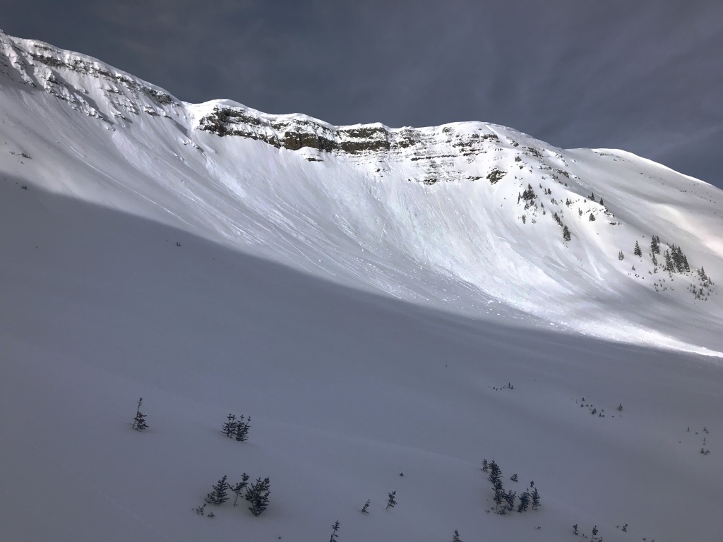
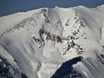
Avalanches: Estimated 3/14. A large cornice released above Redwell Basin on an easterly facing slope. That cornice gouged into a thin snowpack over rocky cliffs.

Mountain Weather for 11,000ft. Monday 3/16

CB Avalanche CenterWeather

Date: 03/16/2020

We have another dry and warm day coming up. Partly cloudy sky remains in Mondays forecast, though I expect to see fewer clouds than yesterday, and the cloud forecast getting closer to few or the mostly sunny line. We didn’t see winds mixings down to mountain top elevations yesterday, 12,000ft winds have increased over the last few hours and we again have the chance for upper elevation winds to reach into the 30’s today. Otherwise expect another day of calm conditions. High temperatures on Tuesday increase another few degrees, but increasing cloud cover may help keep a lid on temperatures getting two crazy.

The mid to late weak weather will come from the low-pressure system moving from the California Coast, up through the desert Southwest and eventually through Colorado. Precipitation looks to start late on Wednesday and could continue through Friday. Snow totals are unsure at the moment and those estimates will be getting dialed in soon.

  • Today

    High Temperature: 40 to 44
    Winds/Direction: 2 to 12/WSW
    Sky Cover: Partly Cloudy
    Irwin Snow: 0
    Elkton Snow: 0
    Friend’s Hut Snow: 0

  • Tonight

    Low Temperature: 23 to 27
    Winds/Direction: 5 to 15/SW
    Sky Cover: Partly Cloudy
    Irwin Snow: 0
    Elkton Snow: 0
    Friend’s Hut Snow: 0

  • Tomorrow

    High Temperature: 42 to 46
    Winds/Direction: 5 to 15/SW
    Sky Cover: Increasing clouds
    Irwin Snow: 0
    Elkton Snow: 0
    Friend’s Hut Snow: 0

Northern Ruby Range

CB Avalanche Center2019-20 Observations

Location: Paradise Divide Area
Date of Observation: 03/15/2020
Name: Zach Kinler & Evan Ross
Aspect: North, North East, East
Elevation: 9,000-12,400′

Avalanches: D1.5 slab avalanche Augusta Mt. SE 12,400′. Estimated 3/14 early AM.
D1.5 Wind Slab in Coon Basin SE 11.800′ , just below the ridge. Estimated 3/14 early AM.
3x D1 Wet Loose avalanches on an East aspect 10,000′

Weather: Partly Cloudy, Calm winds up to ridgeline in the am, light SW winds in the afternoon. Temps remained below freezing in the alpine while areas near and below treeline warmed above freezing.

Snowpack: 4-5″ of recently settled snow from late Fri/early Sat. The newest snow was bonding well with the old interface which was 2-4 mm graupel. No wind slab issues encountered on leeward slopes. Northerly slopes above stayed dry down to our observed elevation of 10,500ft on that aspect. East aspects 11-12K were slightly moist with no wet loose activity while below 11K had enough moisture to initiate rollerballs and a few small wet loose slides from steep, rocky terrain. Southerly aspects were moist with rollerballs.


Mountain Weather for 11,000ft. Sunday 3/15

CB Avalanche CenterWeather

Date: 03/15/2020

Here we go, it’s going to be a beautiful day to get outside. 11,000ft temperatures will rise to near 40, and low valleys like Crested Butte and Gunnison will be even warmer of course. Winds on the high peaks could get into the 20-30mph range, but those winds don’t look to mix down to lower elevations, so we are mostly looking at fairly calm conditions out there. We’ll get more sun than the last few days, but still partly cloudy sky with a few clouds rolling through.

Dry weather starts off next week and next week will nearly be a copy of last week. Another low-pressure system is moving down the West Coast to California, and then it looks to lift up and through Colorado over the mid-week. Precipitation looks to start up late on Wednesday and continue into at least Thursday.

  • Today

    High Temperature: 38 to 42
    Winds/Direction: 5 to 15/SW
    Sky Cover: Partly Cloudy
    Irwin Snow: 0
    Elkton Snow: 0
    Friend’s Hut Snow: 0

  • Tonight

    Low Temperature: 16 to 20
    Winds/Direction: 5 to 15/WSW
    Sky Cover: Partly Cloudy
    Irwin Snow: 0
    Elkton Snow: 0
    Friend’s Hut Snow: 0

  • Tomorrow

    High Temperature: 38 to 42
    Winds/Direction: 2 to 12/W
    Sky Cover: Partly Cloudy
    Irwin Snow: 0
    Elkton Snow: 0
    Friend’s Hut Snow: 0

Mountain Weather for 11,000ft. Saturday 3/14

CB Avalanche CenterWeather

Date: 03/14/2020

The weather looks to be all about tapering today. Snowfall looks to taper, cloud cover is going to taper, winds are doing the tapering thing, and well temperatures want to do their own thing and will climb to just above freezing at 11,000ft. The Ruby Range may hold onto mostly cloudy sky, while areas near and east of Crested Butte will fall closer to a partly cloudy sky.

Sunday looks like it could be a beautiful day with generally dry weather heading into the start of next week. Hopefully, the weather is tapering off so it can rest up and get ready for its next big event. Another low-pressure system will again be dropping down the West Coast over the next several days and looks to begin impacting our area with the next storm Wednesday night into Thursday.

  • Today

    High Temperature: 33 to 37
    Winds/Direction: 8 to 18/WSW
    Sky Cover: Mostly Cloudy
    Irwin Snow: 1 to 3
    Elkton Snow: 0 to 2
    Friend’s Hut Snow: 0 to 2

  • Tonight

    Low Temperature: 18 to 22
    Winds/Direction: 5 to 15/WSW
    Sky Cover: Partly Cloudy
    Irwin Snow: 0
    Elkton Snow: 0
    Friend’s Hut Snow: 0

  • Tomorrow

    High Temperature: 36 to 40
    Winds/Direction: 8 to 18/WSW
    Sky Cover: Partly Cloudy
    Irwin Snow: 0
    Elkton Snow: 0
    Friend’s Hut Snow: 0

Obs around Crested Butte

CB Avalanche Center2019-20 Observations

Location: Crested Butte Area
Date of Observation: 03/12/2020
Subject: Obs around Crested Butte

Avalanches: Small wet loose avalanche cycle in the warming storm snow. In very shallow areas below treeline a few gouged to ground. The cycle appeared confined to areas close to Crested Butte where temps warmed up more. In the high peaks of the Elks and Ruby Range, no evidence of a wet cycle. Also numerous shallow avalanches in steep terrain that ran during the 3/11 rain event, with debris piles buried by the few inches of new snow overnight.

Weather: Warm calm day. Felt greenhouse-like.

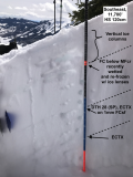
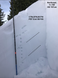
Snowpack: Tested persistent weak layers on northeast and southeast facing slopes near treeline. No problematic structures observed at this location. On the southeast-facing slope, recent meltwater has drained down through the upper snowpack leaving frozen vertical ice bodies, with frozen spreading ice lenses welding the upper weak layers to the slabs. The deepest ice bodies were around 70 cm from the surface. On the northeast facing slope, we dug not in a deep spot, not in a shallow spot, but a mid-slope site with about average depth. The snowpack is right side up, with no propagating test results on any faceted layers.

Photos: