Larger Than Expected Propagations

CB Avalanche Center2020-21 Observations

Date of Observation: 12/29/2020
Name: Drew Kelly


Zone: Southeast Mountains
Location: Red Coon Glades
Aspect: South East
Elevation: 11,100K


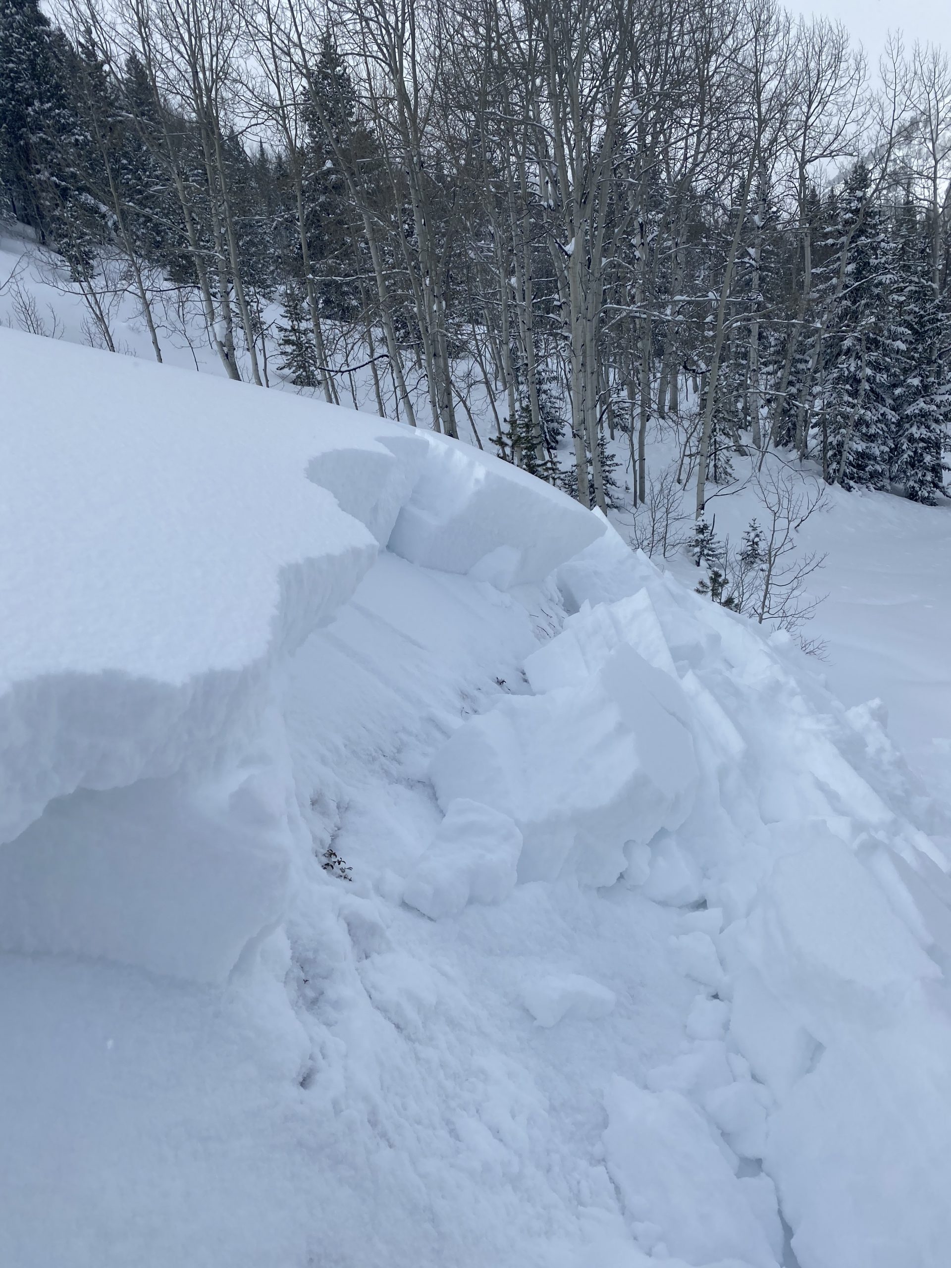
Avalanches: Lots of collapsing, and long shooting cracks. We climbed and “skied” terrain less than about 31 degrees. Nearing the 30 degree angle (+/- a degree or two) nearly everything collapsed and fractured. We sent continuous cracks nearly 200 ft across one slope, a distance that surprised us (see picture). There were numerous other slopes where cracks travelled 50+ft.

All moving snow seemed to break at the interface between the last few days’ storm slab and the older decomposing snow from previous weeks.
Weather: Occasional light breeze mostly near and above treeline, intermittent cloud cover, ~10-20F, light snow.
Snowpack: Snow depths varied between 1-2ft. In some places recent storm snow sat on bare ground; in other places that recent storm snow sat on a melt-freeze crust that was on top of faceting older snow.


Photos:

More persistent slabs

CB Avalanche Center2020-21 Observations

Date of Observation: 12/29/2020


Zone: Northwest Mountains
Location: Gunsight road
Aspect: North East
Elevation: 10,000

Avalanches: Intentionally triggered several road banks and small steeper rolls. All D1-1.5. Persistent slab problem was very reactive today. Poor vis limited obs in other areas.
Weather: Warmest in the morning with cold temps in the afternoon. Light snow and light winds throughout the day with maybe an additional inch or two of accumulation.
Snowpack: It’s broke. Multiple large booming collapses. Many shooting cracks. Surprisingly some steeper slopes around 35* cracked but did not slide. Snowpack was less reactive in areas that slide last week.


Photos:

Gothic 7 a.m.

CBAC2020-21 Observations

Date of Observation: 12/29/2020
Name: billy barr


Zone: Southeast Mountains
Location: Gothic

Avalanches: No visibility to see if any slide activity.
Weather: There was 10½” new snow with water total of 0.75″ as the snowpack sits at 32½”. Wind is calm now and the snowfall has stopped. Mild with yesterday’s high 24ºF and the current is the morning low of 11º.


Storm obs from Slate

CBAC2020-21 Observations

Date of Observation: 12/29/2020
Name: Zach Guy


Zone: Northwest Mountains
Location: Slate River drainage
Aspect: North East, East
Elevation: 9,000 to 11,200 ft

Avalanches: Decent storm slab cycle last night from Happy to Climax to Schuylkill Ridge along with a few persistent slab avalanches
Happy Chutes: Lots of small slabs and sluffs, mostly D1. A D2 persistent slab
Climax: Debris through several of the chokes, looked like more shallow storm snow instabilities but light was flat, probably D1.5 to D2.
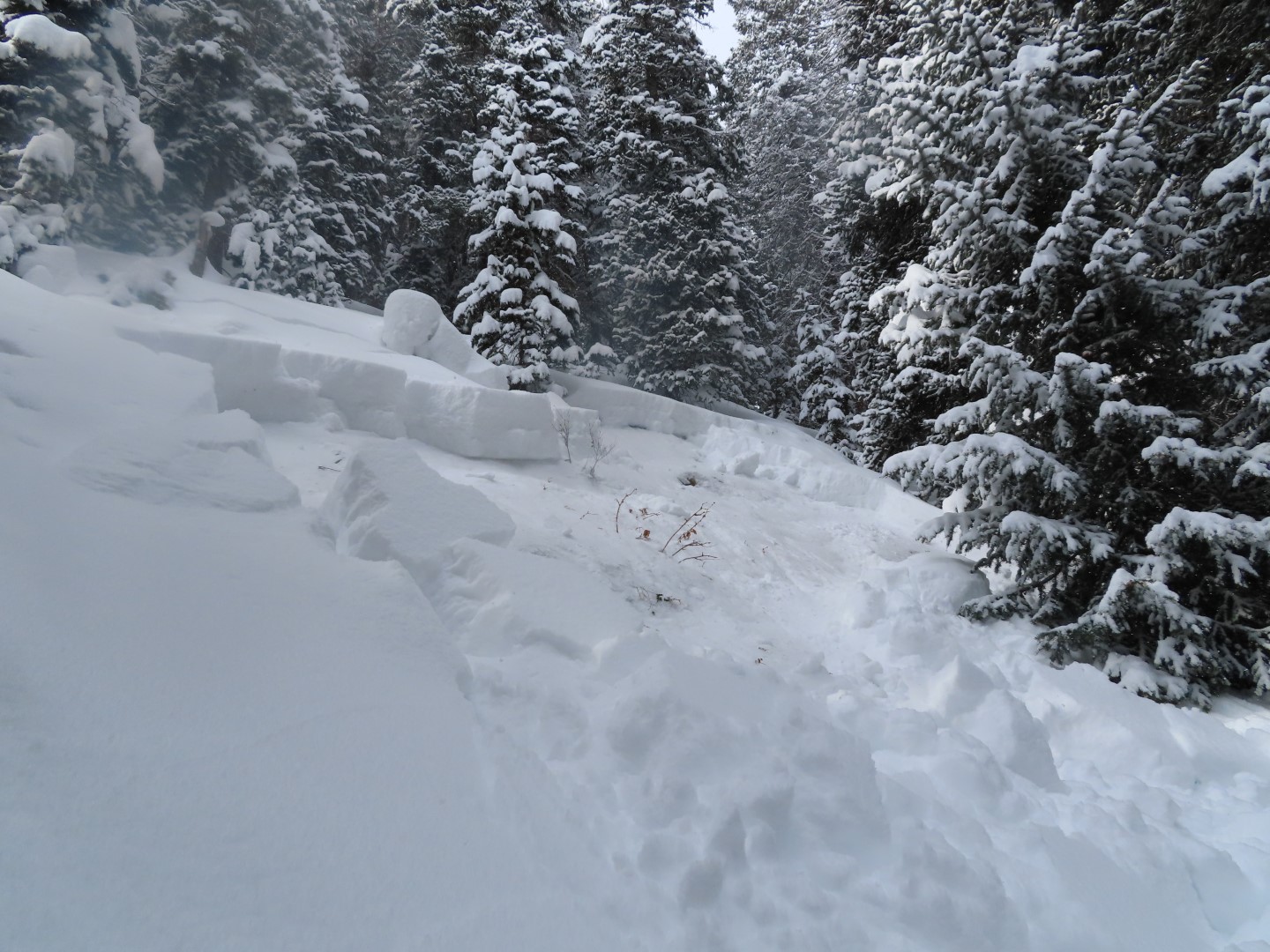
Schuylkill: Numerous storm slabs about a foot deep that ran near to the bench, D1.5 to D2. Two small persistent slabs on lower rollers that either ran last night or today. We remotely triggered two small persistent slabs on small terrain features, about 3 feet thick.
Wash Gulch: Plow triggered persistent slab, D2.
Weather: Light snowfall in the morning. Light winds. About an inch of accumulation. Overcast in the Upper Slate, broken skies near town.
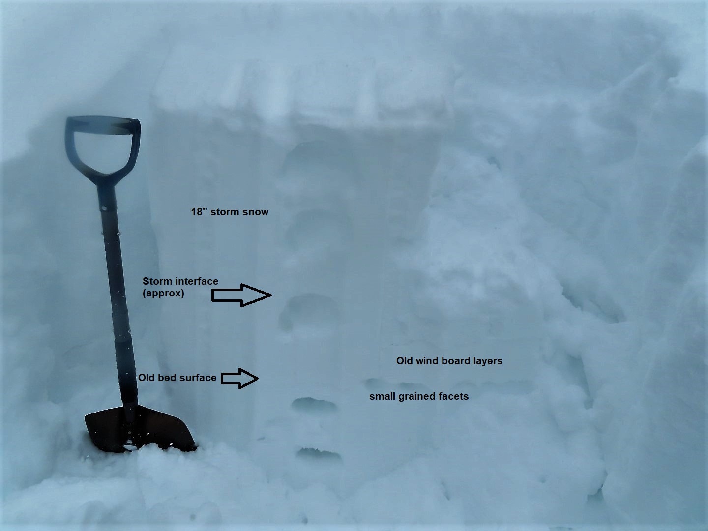
Snowpack: Numerous large collapses in open slopes on low angled terrain and in small clearings in steeper trees. Storm snow is about 12″ to 15″ below treeline and 18″ near treeline, fist hard. Persistent slab structure is about 3 feet thick below treeline (Fist down to 4Finger). Cracking at or near the storm interface, especially as we gained elevation. We tested for “repeat persistent slab structure” in terrain that slid earlier this month. The structure was not reactive in pits, but there is still a lingering persistent weak layer near the ground, just denser and smaller with less of a slab than a pristine snowpack that hasn’t slid.


Photos:

Lower Snodgrass

CB Avalanche Center2020-21 Observations

Date of Observation: 12/28/2020
Name: Steve Banks


Zone: Southeast Mountains
Location: Lower Snodgrass
Aspect: North East
Elevation: 9800


Avalanches: None noted
Weather: Light snow throughout the day with even lighter winds. Mild temps felt like low 20’s. New snow accumulation of about 3-4” from overnight and through the day.
Snowpack: Weak AF. There is about a foot and a half of snow where we were. 4” below the surface is a thin buried weak layer (suspect SH/SF) which popped out in CT tests but did now propagate in ECTs. This will be another one to watch with this incoming storm or the next. Midway through the snowpack is the horribly weak weak layer. 2-4mm facets. This was resting on a 2” thick decomposing crust, with weak faceted snow (just becoming DH) on the ground. Multiple Easy to Moderate CT and ECTP test results on this weak layer, all above the crust.


A lot of bark and some bite too

CBAC2020-21 Observations

Date of Observation: 12/28/2020
Name: Zach Guy, Zach Kinler, Jack Caprio


Zone: Southeast Mountains
Location: Gothic Road
Aspect: East
Elevation: Below treeline


Avalanches: Intentionally triggered a couple of small persistent slabs, about 15″ thick and up to 50 feet wide on small terrain features, failing on fist hard facets near the ground.
Weather: Light snowfall mid-afternoon started picking up in intensity to S2 around 3:30 p.m as we were leaving. Calm winds.
Snowpack: About 3″ of new snow so far. Frequent rumbling collapses and shooting cracks traveling about 30 to 50 feet. Slabs were somewhat discontinuous across terrain due to previous wind loading and scouring effects. It was easy to trigger collapses in the transition from stiffer, supportive snow to unsupportive, softer snow or vice versa. Of the few test slopes we poked at, a couple slid, while most just cracked and slumped.
The 12/22 interface is down about 5″ (mix of near surface facets and surface hoar). It was producing cracking underfoot but not shooting past skis.


Photos:

Irwin

CBAC2020-21 Observations

Date of Observation: 12/28/2020
Name: Irwin Guides


Zone: Northwest Mountains
Location: Irwin Tenure

Avalanches: SS-ASc-D1.5-O 40cmx5mx100m Thorntons. Remaining persistent slab is notably more resistant to triggers than last week. This past weeks skiff of new snow sluffs easily off old bed surfaces. Anticipate repeat offenders.
Snowpack: Continued local collapsing in previously untrammeled areas.


The many shades of Yellow

CB Avalanche Center2020-21 Observations

Date of Observation: 12/27/2020
Name: Zach Kinler
Zone: Northwest Mountains
Location: Evans Basin

Aspect: East, South East, South

Elevation: 9300′-11,000′

Avalanches: No recent activity

Weather: Mostly sunny and pleasant on this afternoon tour. Winds were calm in sheltered areas. Highs remained below freezing.

Snowpack: The snowpack is still grumbling a bit, like a Stubborn old man sending back soup at the deli. There are a few steep slopes that have not avalanched and SOME of them produced collapses and cracking while others did not. The slopes that cracked did not run. Sensitivity has decreased however specific areas require thoughtful evaluation.

2-3″ new snow. Toured mainly on aspects from S through E. HS 60-70cm in sheltered terrain. Recent crusts from 12/22 and 12/26 have welded themselves into one thick crust 2-3 inches thick on steep south-facing slopes. Moving towards east, the crusts taper with faceting around the 12/22 MFcr. Small surface hoar capping facets was found at this interface once on due east.


[/gravityforms]