Date of Observation: 01/31/2021
Name: Zach Guy
Zone: Northwest Mountains
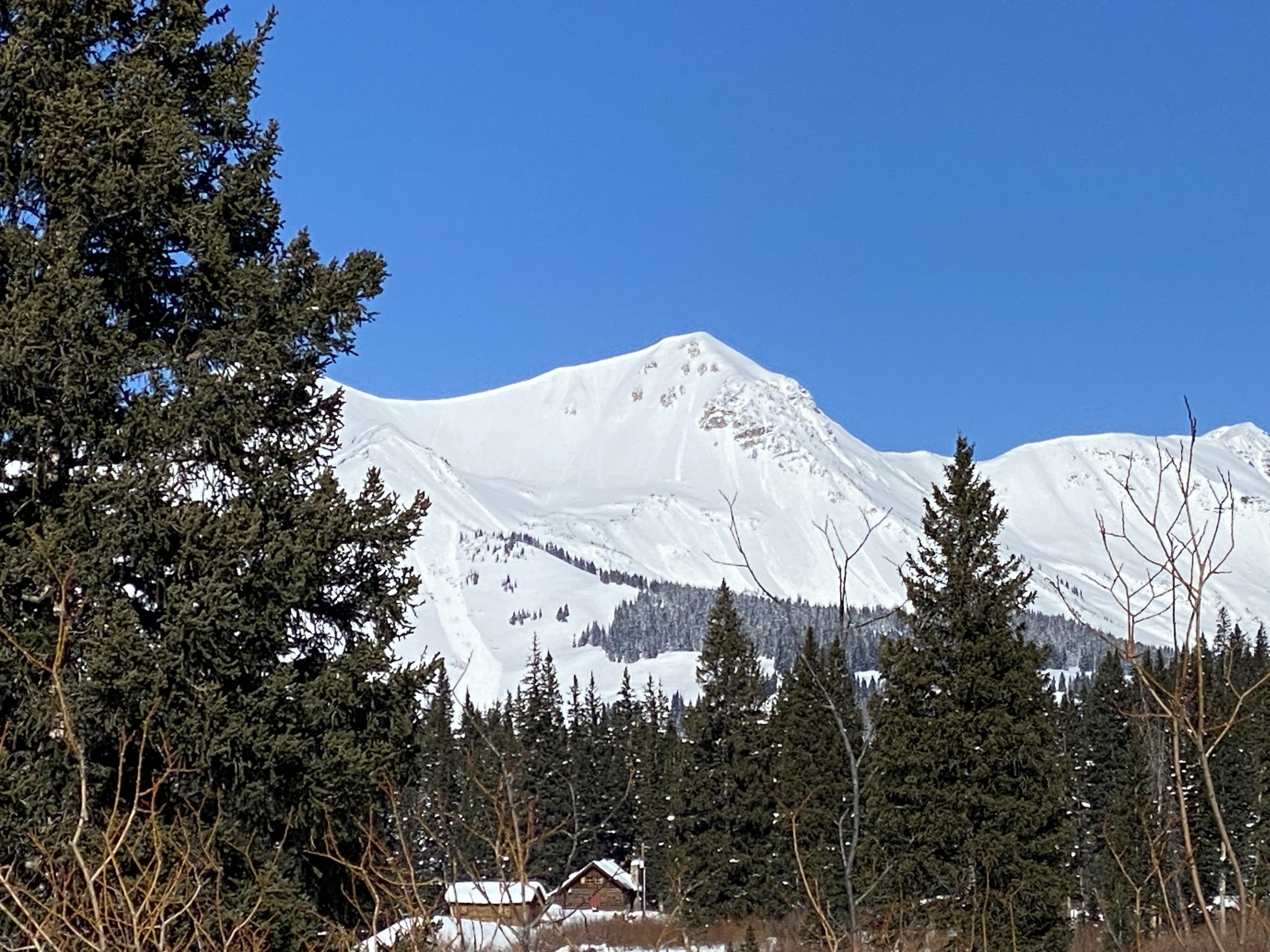
Location: Baxter Basin
Elevation: 9,600 – 11,700 ft
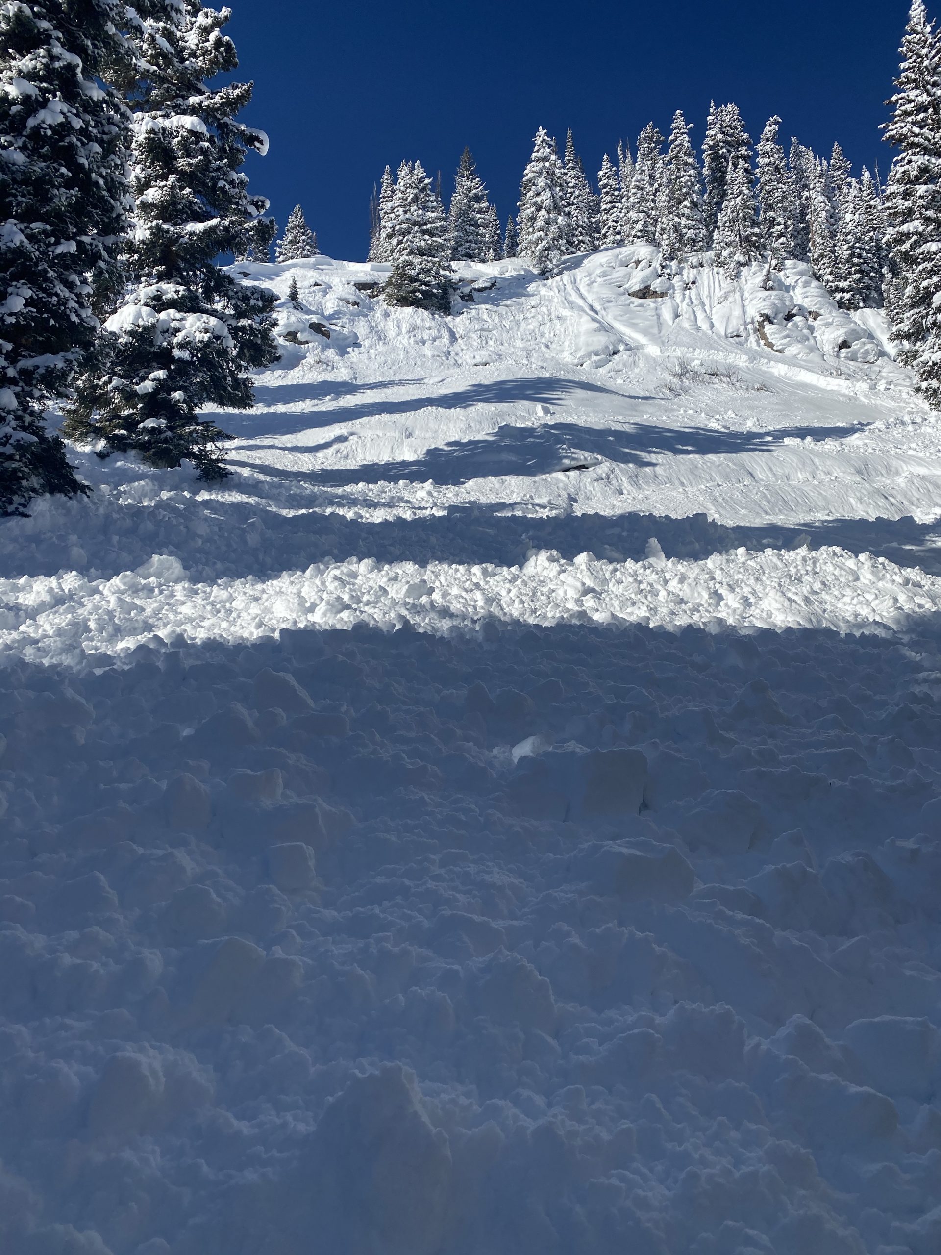
Avalanches: Numerous natural D2 to D3 persistent slabs ran yesterday or today, mostly above treeline, appeared to be all on 1/19 interface, 3 to 6 feet deep. See photos/captions for details.
Handful of smaller windslabs D1 to D2 ran yesterday, near and above treeline. No natural wind slabs today.
Active loose avalanches throughout the day on the southern and eastern halves of the rose, all elevations, starting as dry loose and evolving to moist or wet loose by end of day. Mostly D1-D1.5 and a couple of D2. Countless small loose dry ran yesterday.
Weather: Unseasonably warm on sunny slopes. Clear skies. Calm winds
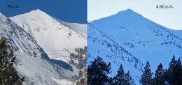
Snowpack: 15″ of settled new snow at basin bottom, about 20″ at upper elevations. The 1/19 facet layer is down 4 feet deep below treeline. No shooting cracks or collapses underfoot, but we mostly traveled on a skin track that someone else put in this morning. Rollerballs, ongoing natural avalanche activity (both sluffs and slabs), and rapid warming of the upper snowpack on sunny aspects were all glaring signs of instability to stick to mellow terrain and give runouts a wide berth, which we did. Trailhead was the most crowded I’ve ever seen, but glad to see conservative terrain choices and simple terrain selection by users today.
Photos:
-
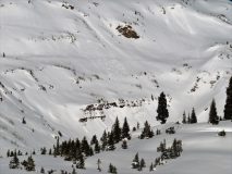
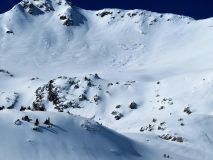
- D2.5 persistent slab, East aspect ATL, Peeler Peak. Ran today

-
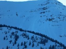
- 2xD2 Peeler Peak, East aspect ATL. I think these ran today

-
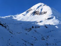
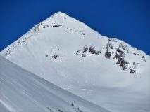
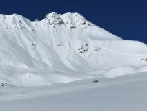
- D3 persistent slab, Mineral Point, SE aspect ATL. Likely ran yesterday

-
- D2 loose wet, SW aspect NTL. Ran this afternoon

-
- Closer look at the persistent slab on Mineral Point which likely failed on the crust/facet 1/19 layer about 4 feet deep

-
- Small wind slab ran yesterday

-
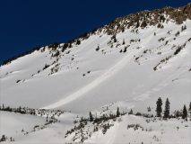
- D2 persistent slab, east aspect, likely ran this morning

-
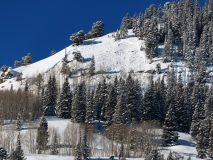
- D2 wind slab(?) on Purple Peak, S/SE aspect ATL, ran yesterday.

-
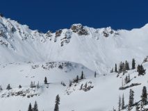
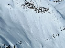
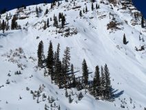
- 2x D2 persistent slab, East aspect ATL, likely ran yesterday. Note the numerous loose dry/loose wet that ran today onto the bedsurface

-
- D2 on Richmond, East aspect ATL. Ran early in the storm

-
- D2.5, SE Aspect ATL, Baxter Basin. Looks like it ran yesterday. Loose slides covering bed surface today.

-
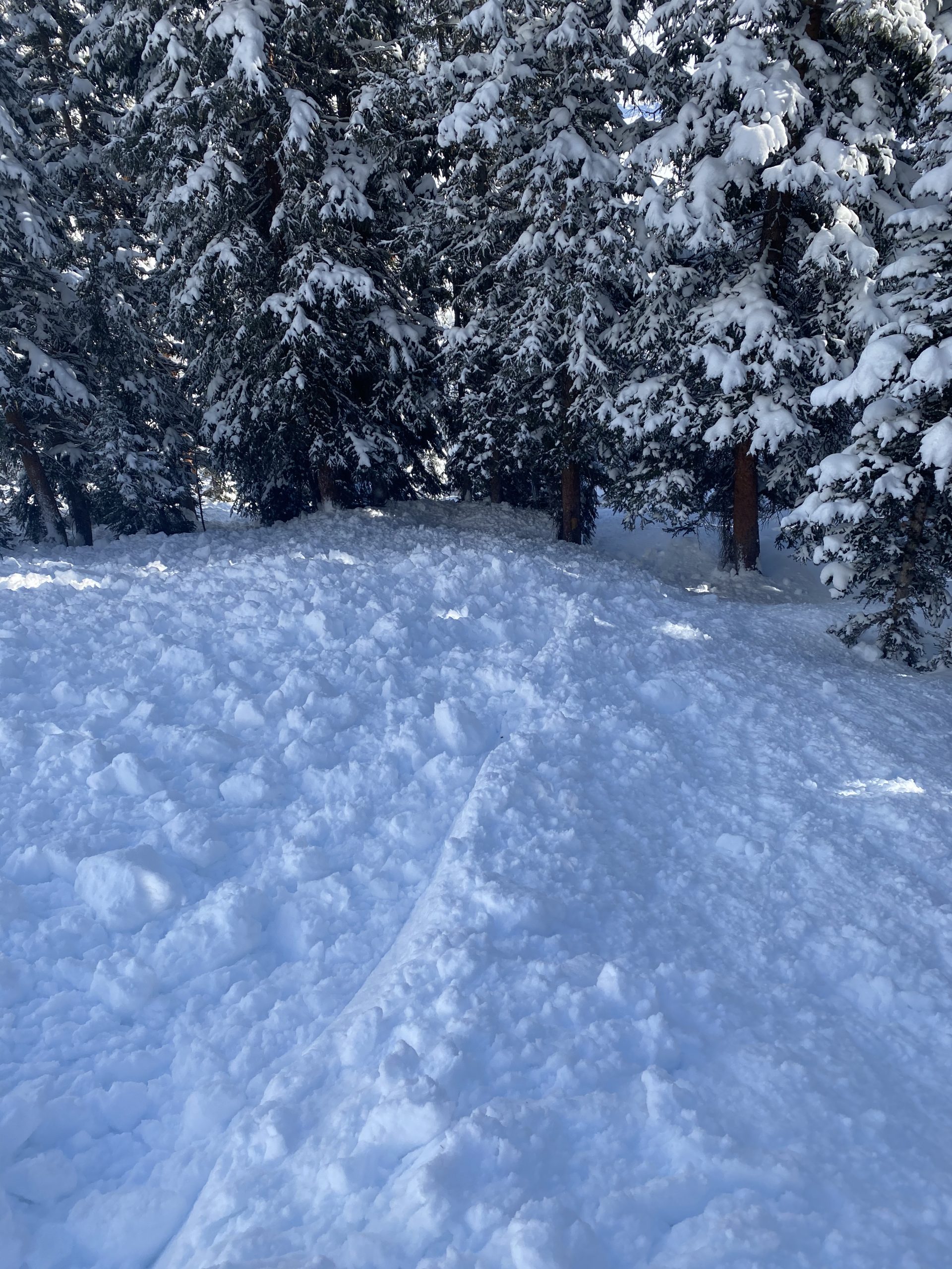
- Numerous loose slides like this ran today, mostly D1 to D1.5