Date of Observation: 04/01/2021
Name: Zach Kinler Evan Ross
Zone: Northwest Mountains
Location: Southern Ruby Range
Aspect: East, South East, South
Elevation: 9,000′-12,600′
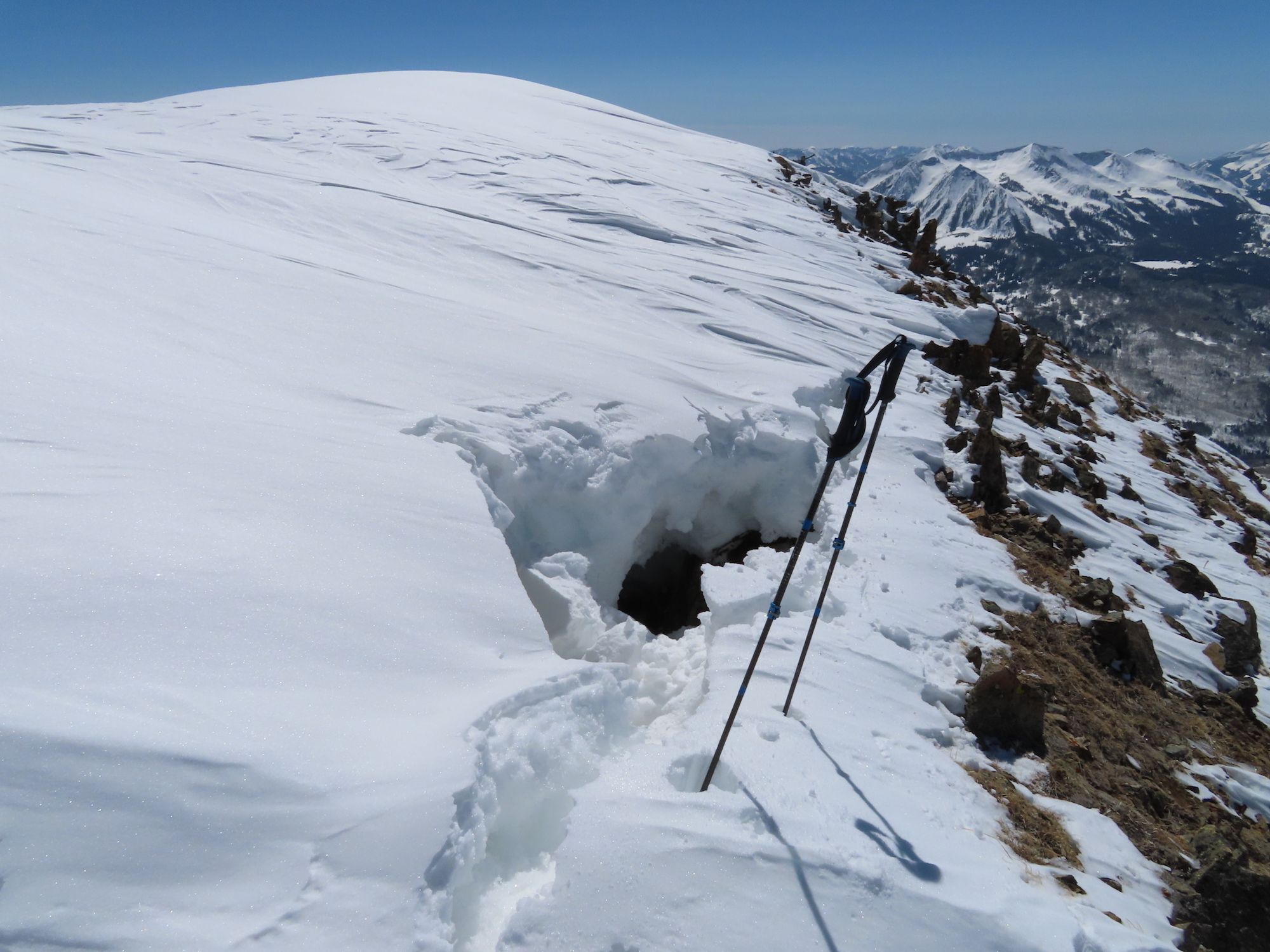
Avalanches: Observed several Wet Loose avalanches, both natural and human triggered. Size ranged from D1-D1.5 with activity primarily on steep East, South and Southwest slopes near and above tree line. While traversing the Ruby spine we encountered several large overhanging Cornices which had begun to pull back from the ridge. Two of these were triggered from dry ground on the ridge by simply “pole whacking” the gap.
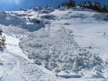
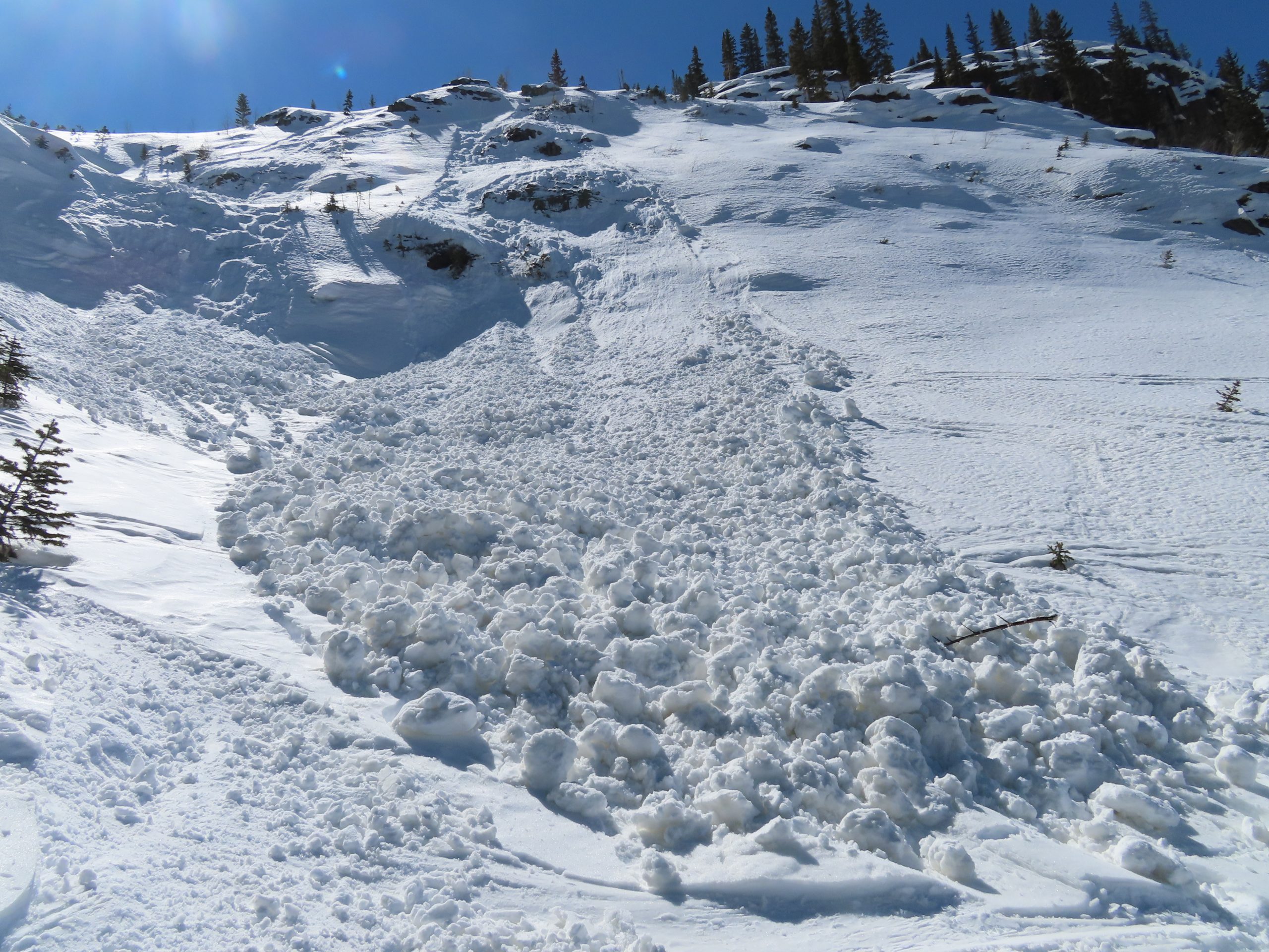
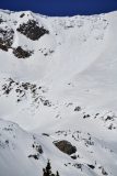
We got a close look at the previously reported Cornice Avalanche on the SE flanks of Mt Owen. This was a big section of cornice that fell down and resulted in a large D2.5 avalanche. The cornice initially gouged close to the ground in steep rocky terrain, then appeared to run on March interfaces as dust layers can be seen on the bed surface.
Weather: It’s heating up! We skinned in t-shirts most of the day. Temps soared above freezing at all elevations today under abundant sunshine. Westerly winds were light at rideline.
Snowpack: We travelled primarily on sunny aspects from E-S near and above treeline. By 12:00, we observed several small natural Wet Loose avalanches on steep East aspects near tree line. As the day progressed, action moved to South aspects and eventually Southwest slope near and above treeline. While these avalanches were only entraining the upper few inches of wet snow, they were gaining momentum on larger slopes. Skiing off the ridge in the late afternoon, we choose to avoid our intended ski objectives that was south east facing above 12,oooft to due to the fact that we would be triggering loose wet avalanches and didn’t feel we could safely manage the problem on that terrain feature. While briefly hanging out on the bed surface of an old cornice avalanche you could actually hear water cascading somewhere. Sounded like you were standing next to a running water fountain.
Cornices, which have grown large throughout this season on certain leeward aspects, proved to be sensitive where large portions are overhanging ridges and are beginning to pull back from ridgeline. These babies are very unpredictable with some being resistent to cutting while others may be triggered by simply hitting the right spot or right time of day. These beasts were best managed by avoiding traveling on or below slopes where present.
-

-
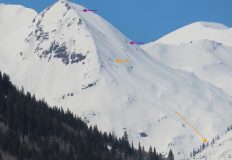
Natural Wet Loose, South ATL
-
-
Small intentional-skier triggered Wet Loose, South NTL
-

-
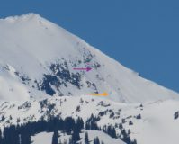
A large section of cornice pulling back from the ridge. This cornice released after a few pole whacks near the gap minutes after this photo.
-
-
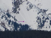
Looking up towards the large triggered cornice fall with previous avalanche to the looker’s right.
-

-
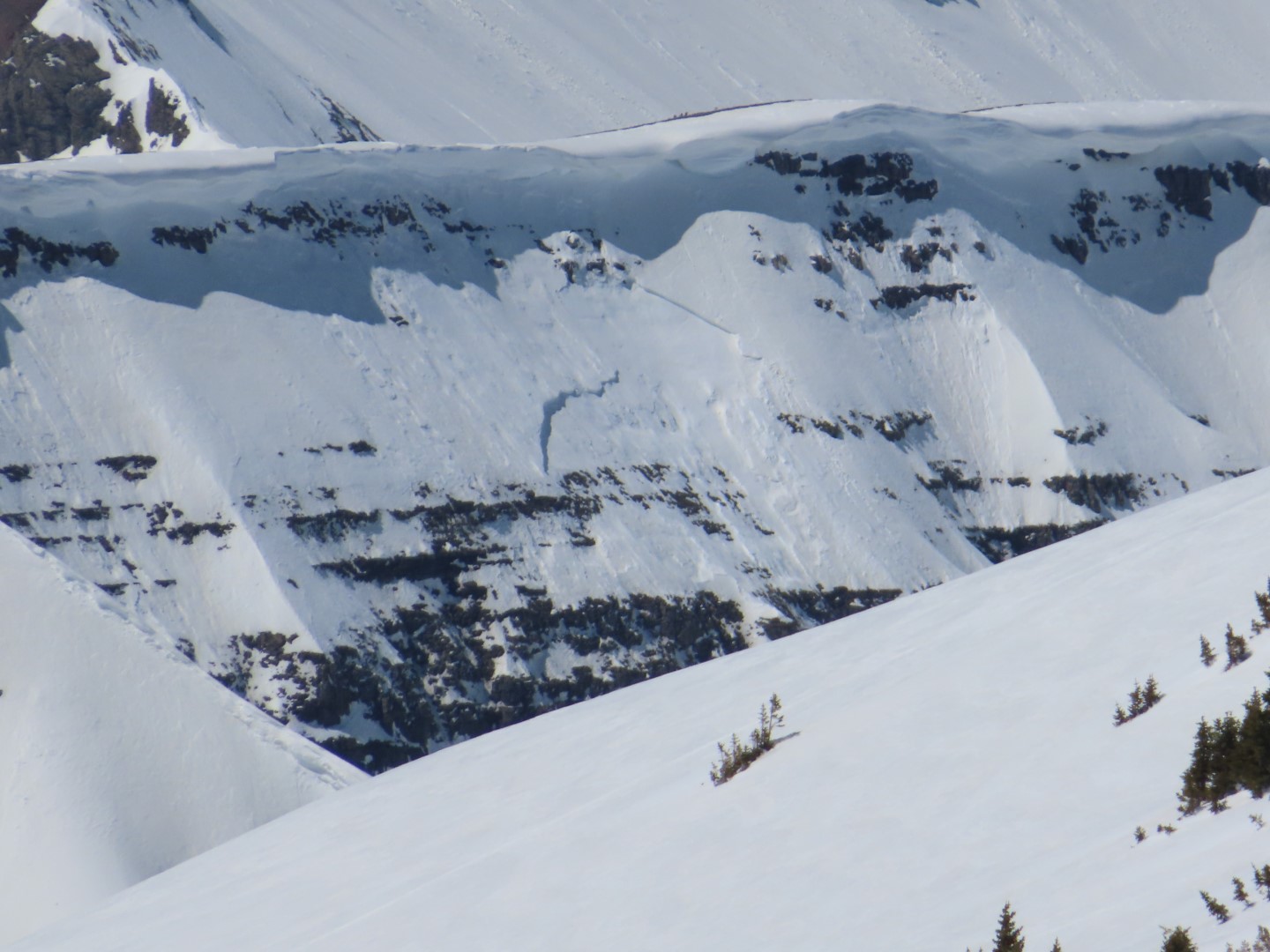
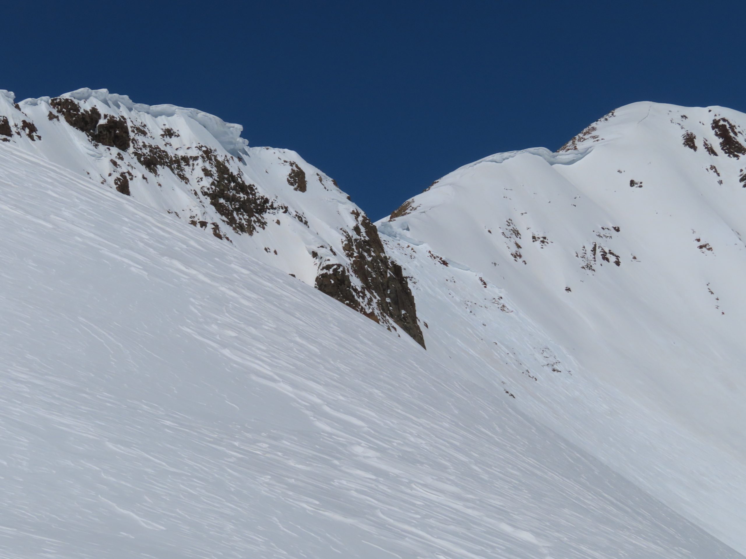
Looming cornices in the fore and background with the previous large, cornice triggered avalanche in the middle.
-
-
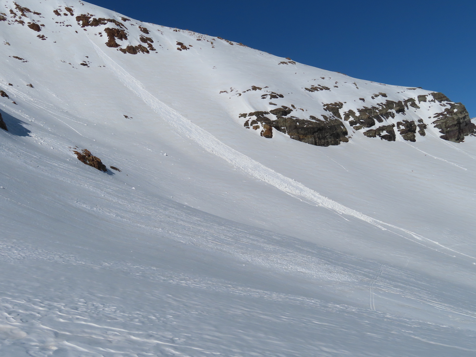
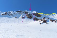
Mt Owen SE. Large Cornice Avalanche. First observed 3/31. Photo Dave Kozlowski
[/gravityforms]