
Another weak wave of moisture has passed over the Crested Butte area leaving us with a dusting of fresh snow and not much of an increase in our avalanche danger. As a cold front chases this storm out we could see winds whip the new snow into very shallow wind slabs on Northeast through Southeast leeward slopes, though these are likely to be thin and less hazardous.
Our early season snowpack has been weakening through the faceting process promoted by our warm and sunny days followed by clear and cold nights. This has allowed the current avalanche danger to diminish with signs of instability tapering off. The sun has created some crusts out there, and the temperature swings have created a thin layer of facets on top of this crust. All of this points toward more dangerous avalanche problems once we do receive more snow.
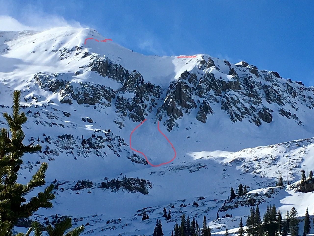
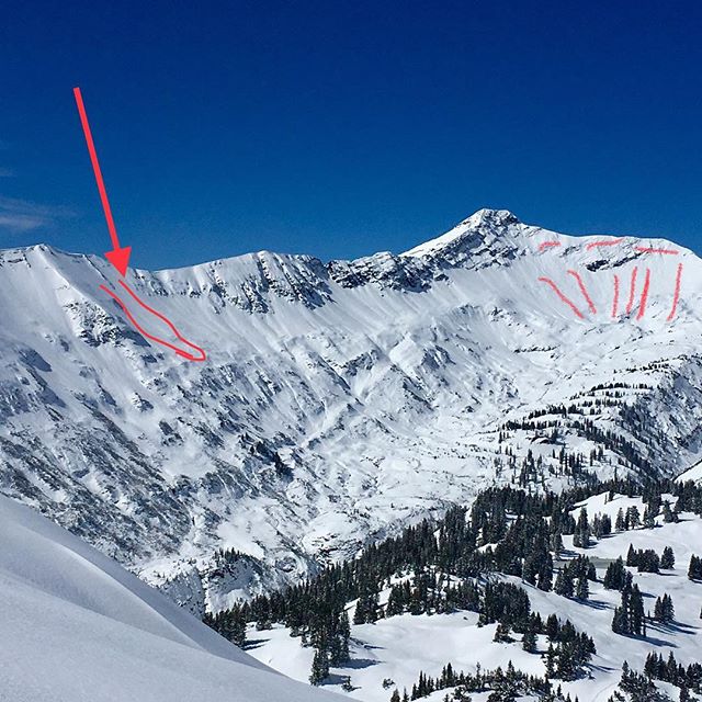
For now, there are still some lingering areas to be heads up in. North through Northeast slopes, above treeline (where the snow is the deepest and therefore the riding will be the best), are still holding onto strong over weak layering and slab type conditions. These slabs are pretty tired right now and have reached a point where they are unlikely to be triggered, however it is still possible and we should still be prepared.
Continue to carry and know how to use all appropriate avalanche rescue tools. Bust out your probe to check for snow depths along your journey and feel what the snow layers are like. When you detect strong over weak layering, get out your shovel and do some tests to see how reactive that slab might be. Shadier leeward slopes steeper than 35 degrees where previous snow has drifted in and where the snow transitions from deeper to shallower will be the most suspect area to be aware of.
Looking ahead, the forecast models are showing another storm headed our way on Thanksgiving and perhaps a more prolonged stormy period after that. If you are out in the backcountry this week, take note of the current snow cover and structure and think what it will be like if/when we do receive another foot of snow or more.
The CBAC will begin daily forecast operations on Thanksgiving Day. Please continue to send us your backcountry observations!

1-2 mm facets found near treeline on a SW aspect