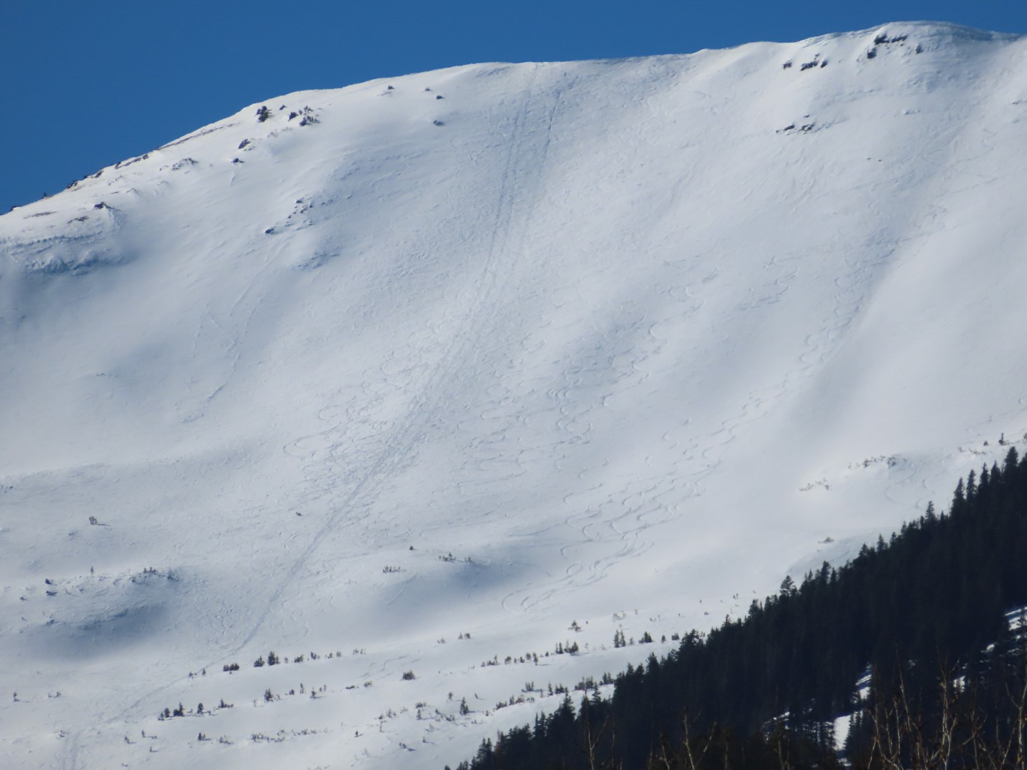
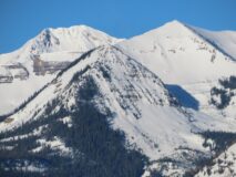
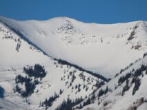
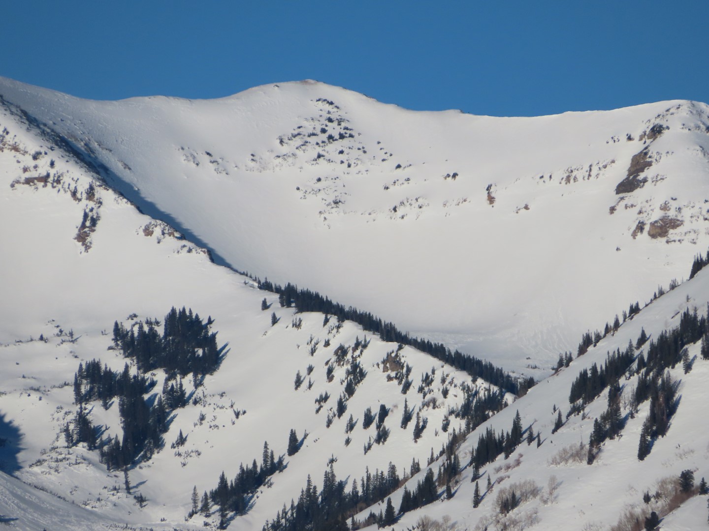
Zone: Northwest and Southeast Mountains Route Description: AM and PM driving binocular tours in the CB/ Mt CB area looking for recent avalanche activity and documenting drifting patterns.
Observed avalanche activity: No Snowpack: Alpine start zones continue to look beaten and generally eroded by winds. Widespread erosional features on W, N, NE, and E aspects. There are some smooth surfaces on SE aspects ATL. Hard to tell if the smooth surfaces are loaded or just pressed smooth from my vantage. I can still see my ski tracks from lines on Peeler, Gothic, Scarp Ridge, and Schuykill Peak from several weeks ago. Raised tracks in some cases.
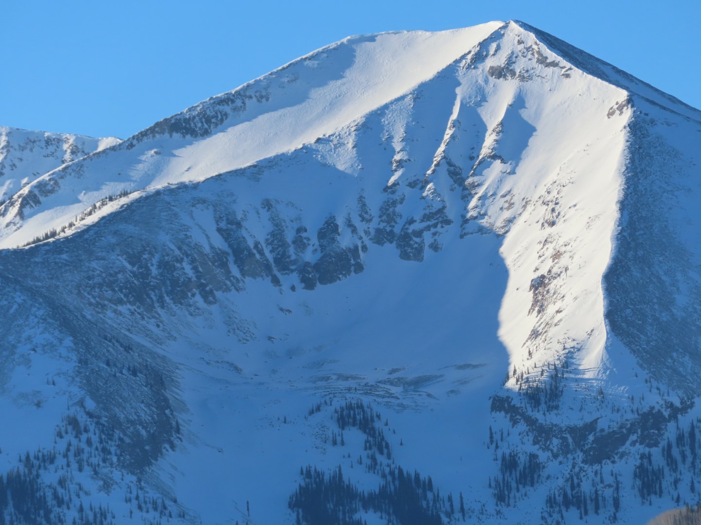
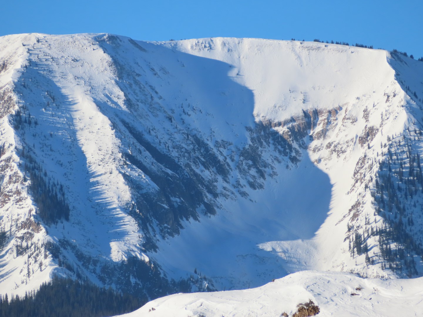
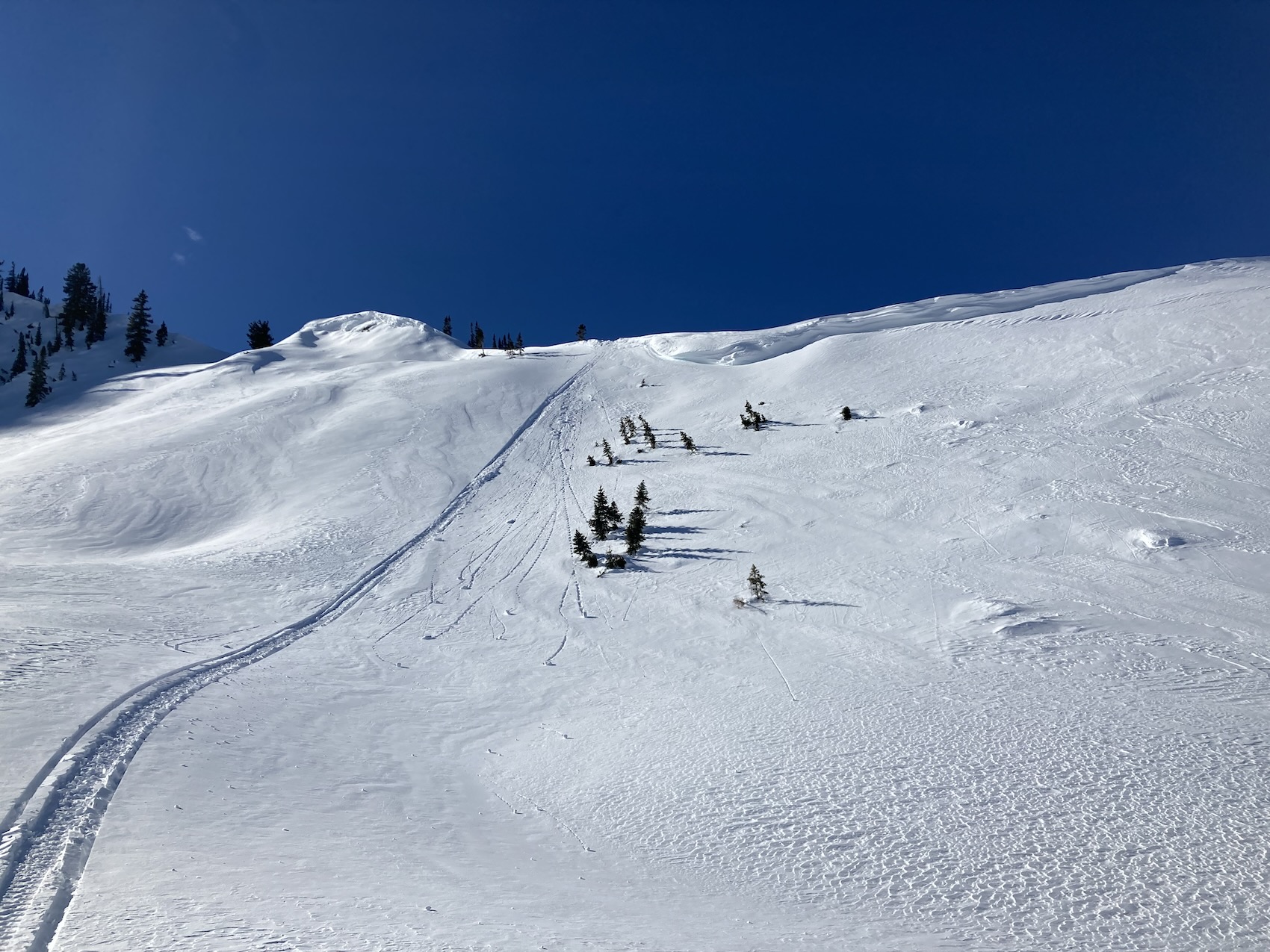
Observed avalanche activity: Yes Avalanches: A slide ran off Gothic a few days ago, probably triggered by wind loaded snow sliding off the straight face area and then fracturing below it, with a decent run-out given how little snow we have been getting. Photo attached. Snowpack: This winter snowfall amount has dropped to 25% below average but the water content of that snow is only 7% below average. Half of the total snow this winter came during the end of December storm. Snowpack is actually holding on pretty well given the dryness but is still 22% below average. –Since there is no snow to report i thought i would give you a ‘no-snow’ report.
Estimated avalanche date: 02/11/2022 Number of Avalanches: 1
Location
Location: Gothic Mountain Location Specific: Start Zone Elevation: NTL: Near Tree Line Aspect: E
Characteristics
Trigger: Natural Trigger modifier: Type: Hard Slab Failure Plane: Old snow
Size
Relative Size: R1 very small Destructive Size: D2 – could bury, injure, or kill a person Avg. crown height (inches): Avg. width (feet): Avg. vertical run (feet):
Involvements
# of people caught: # of partial burials: # of full burials:
Conditions have changed significantly in the past week due to steady northwest winds. This video is a must-watch if you are riding in the backcountry right now.
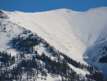
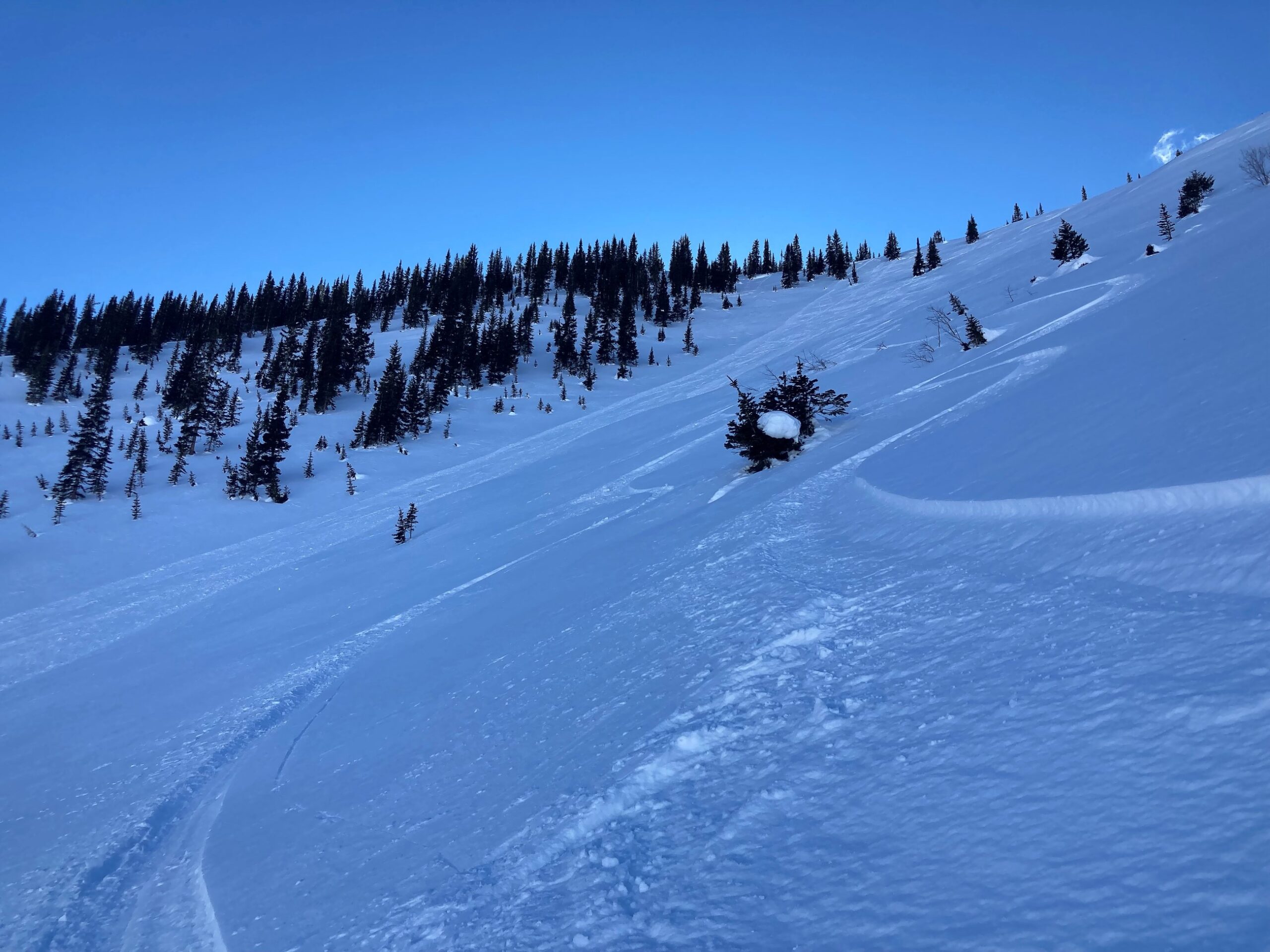
Zone: Southeast Mountains Route Description: Snowmobiled on various aspects near and below treeline in Cement Creek drainage. I rode along the Double Top ridgeline for a while, and then to the headwaters of the Upper Cement to Tilton Pass.
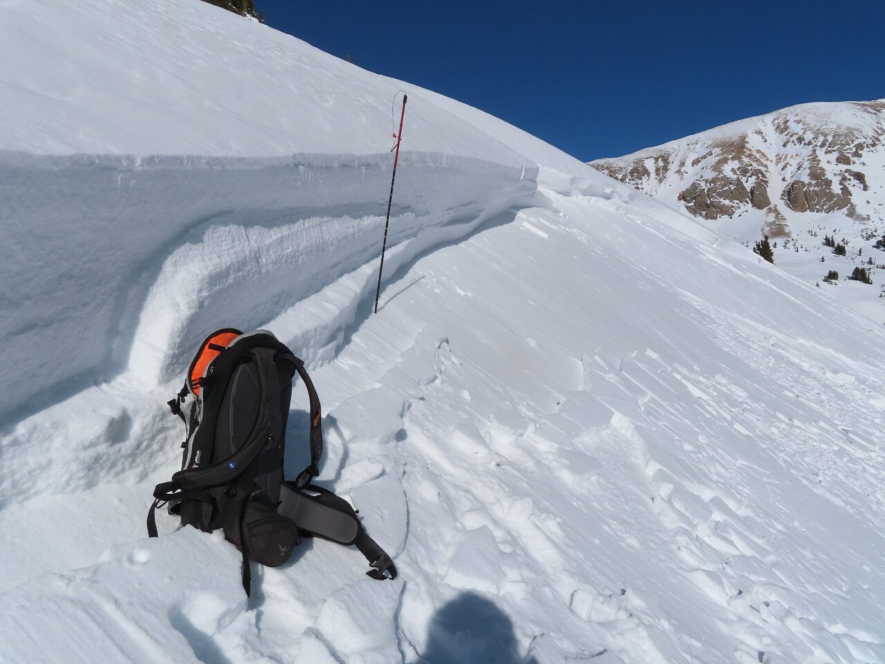
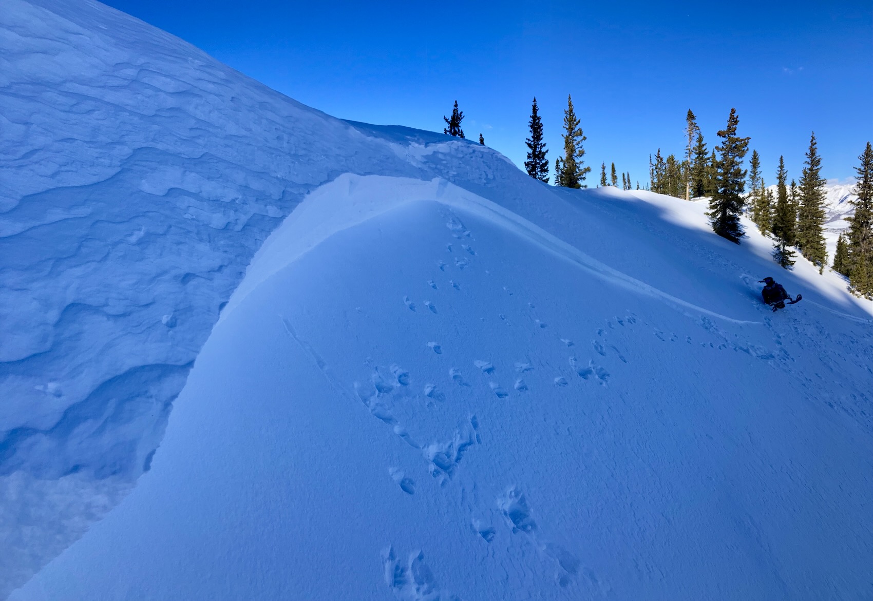
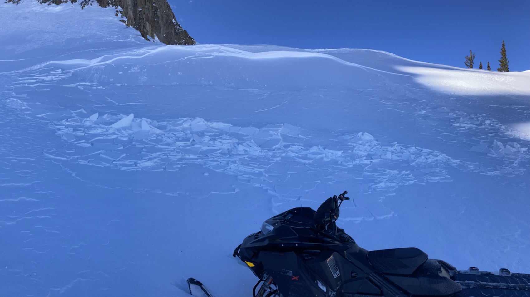
Observed avalanche activity: Yes Avalanches: Near Crystal Peak, I intentionally triggered a surprisingly large, hard wind slab from low on the slope on my second pass across the apron. The crown was 2 to 3 feet thick, composed of several iterations of wind drifted snow in the past week or two, and it failed on the January facets layer. The slide was on a SE aspect near treeline. The crown released on a typical slope angle for avalanches (~35 degrees), but it pulled into an unusually low angle terrain feature that was 26 to 27 degrees steep.
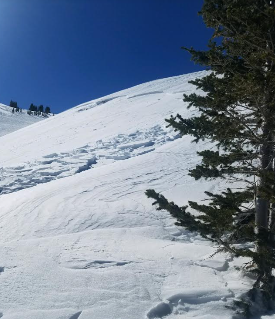
Another group of 3 that was skiing/boarding in the same area remotely triggered another large wind slab. They reported that this one was only 7″ thick, but it entrained enough snow to easily bury someone. This was on an east aspect near treeline. Both slides snapped a few small trees and had large debris piles: D2 in size.
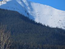
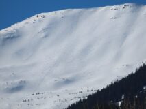
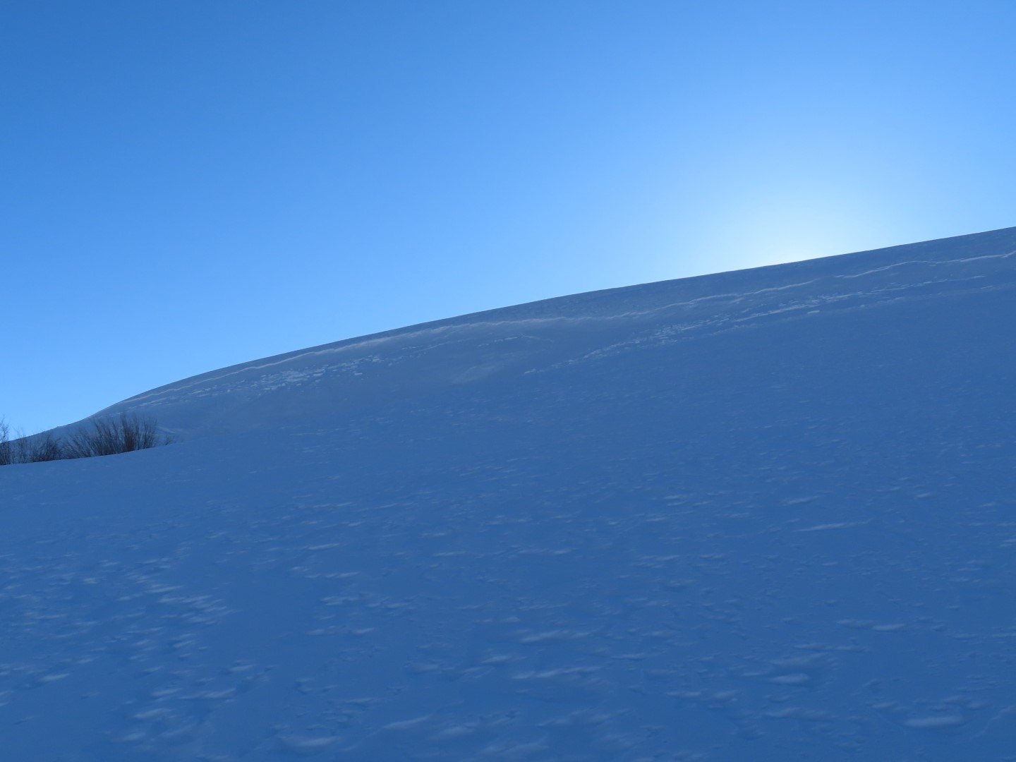
I also spotted a handful of D1 to D1.5 natural hard slabs that ran in the past few days on a variety of aspects near and above treeline. Weather: Mostly clear. Light northwest winds with moderate gusts with a few periods of light drifting. Snowpack: 1″ of new snow. Along Double Top Ridge, wind slabs were small and isolated to just below ridgeline, about 4″ to 6″ thick. I got some localized cracking about 6 feet wide, but couldn’t produce any shooting cracks while riding across a number of drifts. As I got further up the drainage close to the headwaters, previous wind effects were far more pronounced, with huge sastrugi features and wind drifting in a specific distribution from northerly (down valley) winds. I got good views of a lot of alpine terrain in the Southeast Mountains. Ravaged by winds sums it up. Wind erosion is evident on all aspects, with some isolated areas where you could find drifted slabs, mostly at the bottom of the elevation band. Judging from textures, the most widespread wind slab formation is near treeline in this area.
Photos:
Triggered this slide from the bottom of the slope on my second pass. You can see the snowmobile tracks roughly pointed to the trigger location.
Crown was up to 100 cm thick
Small tree in the debris
The slide pulled into an unusually low slope angle, as low as 26 degrees.
This slide was remotely triggered today by a group of skiers while they were ascending adjacent to the path. See snowmobiles for scale
Looking towards the crown of the skier triggered slide, taken near where it was remotely triggered from.
Fresh looking natural hard slab on a SW/W aspect of Twin Lakes.
Recent hard slab on a SE aspect near Teo
Recent hard slab on a westerly aspect of Italian
Recent hard slab on a westerly aspect of Italian
Some cracking on drifted terrain along Double Top ridgeline.
Estimated avalanche date: 02/12/2022 Number of Avalanches: 1
Location
Location: Cement Creek Location Specific: Start Zone Elevation: NTL: Near Tree Line Aspect: SE
Characteristics
Trigger: Snowmobiler Trigger modifier: Remote Type: Hard Slab Failure Plane: Old snow
Size
Relative Size: R2 small Destructive Size: D2 – could bury, injure, or kill a person Avg. crown height (inches): 30 Avg. width (feet): Avg. vertical run (feet):
Involvements
# of people caught: # of partial burials: # of full burials:
Additional comments: Intentionally triggered from the bottom of the slope on my second pass.
Estimated avalanche date: 02/12/2022 Number of Avalanches: 1
Location
Location: Cement Creek Location Specific: Start Zone Elevation: NTL: Near Tree Line Aspect: E
Characteristics
Trigger: Skier Trigger modifier: Remote Type: Hard Slab Failure Plane:
Size
Relative Size: R2 small Destructive Size: D2 – could bury, injure, or kill a person Avg. crown height (inches): Avg. width (feet): Avg. vertical run (feet):
Involvements
# of people caught: # of partial burials: # of full burials:
Estimated avalanche date: 02/10/2022 Number of Avalanches: 2
Location
Location: Cement Creek Location Specific: Start Zone Elevation: NTL: Near Tree Line Aspect: W
Characteristics
Trigger: Natural Trigger modifier: Type: Hard Slab Failure Plane:
Size
Relative Size: R1 very small Destructive Size: D1- Relatively harmless to people Avg. crown height (inches): Avg. width (feet): Avg. vertical run (feet):
Involvements
# of people caught: # of partial burials: # of full burials:
Additional comments: Italian Mountain. Date estimated. One was NTL, one was lower ATL
# of people caught: # of partial burials: # of full burials:
Additional comments: Twin Lakes basin. Could not see crown, but could see hard slab debris that looked fresh. Date estimated. Aspect estimated, either SW or W
Zone: Northwest Mountains Route Description: East Beckwith. Traveled to 11,600 ft on SE, E, and NE aspects, with the focus of our observations at or just below treeline.
Observed avalanche activity: Yes Avalanches: Skier triggered a small loose dry avalanche on a northeast aspect that ran about 800 ft. The sluff did not entrain as much snow as I’ve observed earlier this week because much of the track was stiffened by recent winds. Weather: Mostly clear, light winds where we traveled. Could see a few periods of blowing snow off of the Anthracite Range this afternoon, more of the sublimating type. Snowpack: Recent winds have done a good job of reducing the distribution of loose snow avalanches here. Most terrain that we traveled on was textured from the wind enough to keep the faceted snow from sluffing unless you were on a very steep slope (mid 40’s).
We encountered a handful of hard drifted slabs up to 6″ thick mostly near treeline and a few below treeline. On east facing terrain NTL, they produced a few alarming collapses and shooting cracks up to 20 feet wide. On southeast facing terrain, I couldn’t produce any signs of instability with drifts, but we skirted around them nevertheless. While these drifts were generally easy to identify and avoid, there was one terrain feature that appeared to collapse on an older generation drift and surface clues weren’t as helpful. We turned away from a steeper terrain feature that we had planned to climb due to our uneasiness with the problem after that.
Photos:
We got several shooting cracks and collapses on shallow hard wind slabs.
This sluff didn’t entrain as much snow as I’ve seen in previous fieldwork days because the track was firmed up by recent winds.
One indicator that you’re in wind slab territory is when your partner face plants in grabby wind board.
Lots of very small natural sluffs on a W to NW aspect, likely triggered by solar warming recently.
Reminiscing about the good old days when it used to snow around here… Carnage from 12/31 cycle.
Relative Size: R1 very small Destructive Size: D1- Relatively harmless to people Avg. crown height (inches): Avg. width (feet): Avg. vertical run (feet):
Involvements
# of people caught: # of partial burials: # of full burials:
Zone: Southeast Mountains Route Description: Brush Creek 9,900-11,400ft. E-NE.
Observed avalanche activity: Yes Avalanches: Skier triggered a few small sluffs. Below Treeline, ENE.
Weather: Clouds built up in the morning and alternated between partly and mostly cloudy. Snow flakes did fall from the sky but they didn’t stack up to anything.
Snowpack: More of the same. Felt like L1 avalanche danger with no avalanche problems until you found a slope with all the ingredients for the loose snow avalanche problem. #1 Northerly facing. #2 Protected from the wind. #3 Steep, near or above 40 degrees. If you check all those boxes, then loose snow avalanches are basically guaranteed to be human triggered. Any triggered sluff was small, predictable, and manageable. The terrain was the magnifier for increased hazard or consequence, not the avalanche problem itself.
Due east facing slopes had surface crusts capping the facets that eliminated the loose snow avalanche problem. If you get slightly north of east than the crusts faded away, or of course any terrain influenced shading also eliminated those surface crusts.
Photos:
Small skier triggered sluffs
Easy initiation on this 40-degree slope. Just uphill where the slope angle was 35 degrees sluffs were not initiating.
Date of Observation: 02/08/2022 Name: Zach Guy and Eric Murrow
Zone: Southeast Mountains Route Description: Snowmobiled to West Brush Creek wilderness boundary, and toured into a couple of the upper basins, up to 13000 ft on various aspects.
Observed avalanche activity: Yes Avalanches: Came across a pair of small but hard wind slabs that likely ran during the last wind event along with a few recent natural sluffs. Also intentionally triggered a very thin wind slab BTL that was a couple inches thick, but was about 100 feet wide. It was harmless to anything bigger than a mouse, but it highlights how tender the current surfaces will be once they get buried by real snowfall. Weather: Clear skies. Light to moderate northwesterly winds. Minimal transport. If you timed your ski turns with a gust, you could get sprayed by granular facets in the face, which isn’t as sweet as it sounds, but still nice to get a faceshot during these dire times. Snowpack: We traveled primarily in steep alpine terrain with no signs of instability. Near valley bottoms, we got a few localized collapses or cracks that were a few inches thick, caused by recent drifting over the widespread faceted weak layer.
Winds have beat up the snow surface above treeline terrain and loose dry avalanches were not a concern here. We skirted around one firm-looking drift that looked like it could knock you down. On the same note, there were relatively fewer concerns for sluffs near treeline here compared to some of the more wind-protected slopes where I’ve traveled recently in the Slate or OBJ drainages.
Photos:
A recent natural sluff
A pair of thin, hard wind slabs that likely ran a few days ago
Alpine snow surfaces are beat up by the wind with no concerns for sluffs here. Red circles indicate locations where you might find a thin wind slab, identified by smooth drifted texture.
A shooting crack a few inches deep caused by wind drifting over facets.
Triggered this very tiny wind slab, but its noteworthy because it propagated almost a 100 feet wide, hinting at how problematic our current snow surface will become if it ever gets buried by significant snowfall.
Estimated avalanche date: 02/05/2022 Number of Avalanches: 2
Location
Location: West Brush Creek Location Specific: Start Zone Elevation: NTL: Near Tree Line Aspect: SE
Characteristics
Trigger: Natural Trigger modifier: Type: Hard Slab Failure Plane:
Size
Relative Size: R1 very small Destructive Size: D1- Relatively harmless to people Avg. crown height (inches): Avg. width (feet): Avg. vertical run (feet):
Involvements
# of people caught: # of partial burials: # of full burials:
Additional comments: Upper West Brush below Peak 13010
Zone: Southeast Mountains Route Description: Traveled on E and NE aspects to 11,300 ft.
Observed avalanche activity: Yes Avalanches: Ski cut a few long-running loose dry avalanches in Climax Chutes entraining the top 6″ or so of weak facets with no gouging observed. A few of the sluffs ran past the chokes to the top of the aprons, up to 2000 vertical feet, D1 to D1.5 in size. Another group behind us had similar results in the same chute. Weather: Mostly clear this afternoon. Calm winds where we traveled. Snowpack: The January snowfall is easily to sluff, roughly 6″ of fist hard facets. The December slab remains intact enough to prevent gouging, about 4F and faceting at the top of the slab.
Photos:
A little nudge from the skis got this one going to its apron
Skier triggered sluffs in Climax Chutes managed with off fall line skiing
Red lines indicate start and terminus of triggered sluffs today
Relative Size: R1 very small Destructive Size: D1- Relatively harmless to people Avg. crown height (inches): Avg. width (feet): Avg. vertical run (feet): 1400
Involvements
# of people caught: # of partial burials: # of full burials:
Additional comments: Main chute. Sluffs stopped just short of the choke.
Observed avalanche activity: Yes Avalanches: Triggered 1 small wind slab while traversing into the slope. East 10,960. The crown ranged from 2 feet down to 2 inches. D1 in size and harmless. This slope has a good fetch and in the crown there were three hard wind slabs, all stacked on top of each other. Each thin hard slab sandwiched a layer of weak faceted snow. The crown did propagate fairly wide into some lower angled terrain that didn’t release. I later put one track on a similar slope in the same area without a result.
Photos:
3 layers of hard wind slabs, each sandwiched with a layer of weak faceted snow.
Join us March 2nd at 7:15pm for a panel discussion featuring top local avalanche professionals from across the avalanche spectrum including John Mortimer, Snow Safety Director for Crested Butte Mountain Resort, Ben Pritchett Lead Forecaster for the Colorado Avalanche Information Center, Megan Paden Lead Forecaster for Elk Mountain Grand Traverse and Evan Ross Crested Butte Avalanche Center Forecaster. Should be a great evening of open discussion and sharing of snow wisdom.