Date of Observation: 02/19/2022
Name: Evan Ross
Zone: Northwest Mountains
Route Description: Upper Washington Gulch. Mostly observing between 11,400-12,700ft on E-SE-S aspects.
Observed avalanche activity: Yes
Avalanches: 2 notable slab avalanches that looked to be a day or two old.
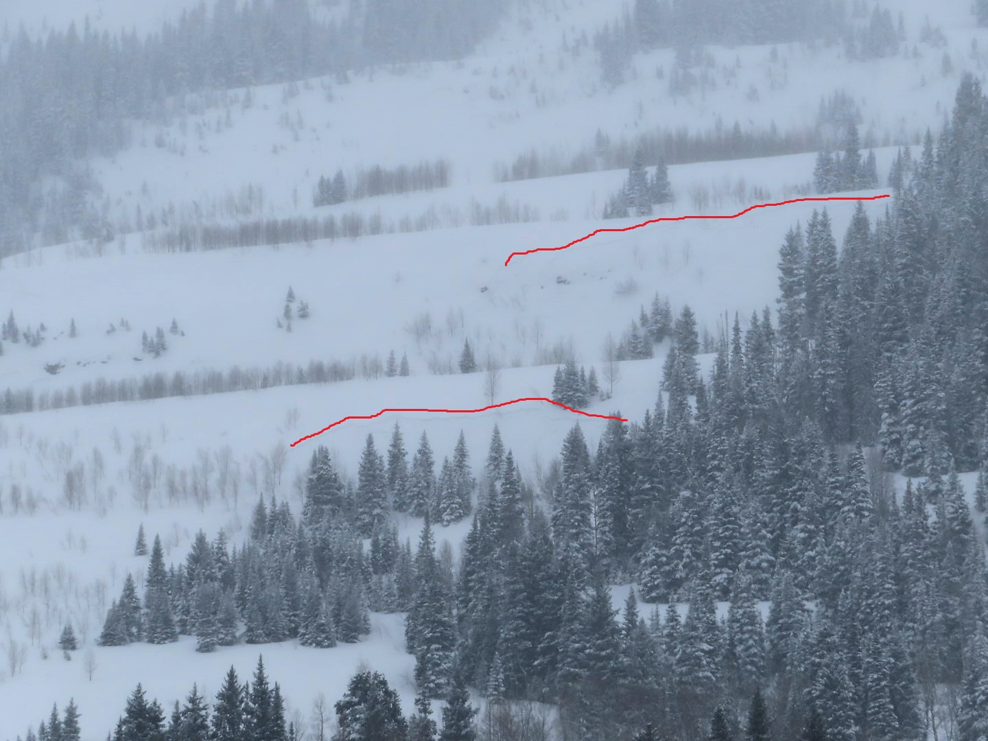
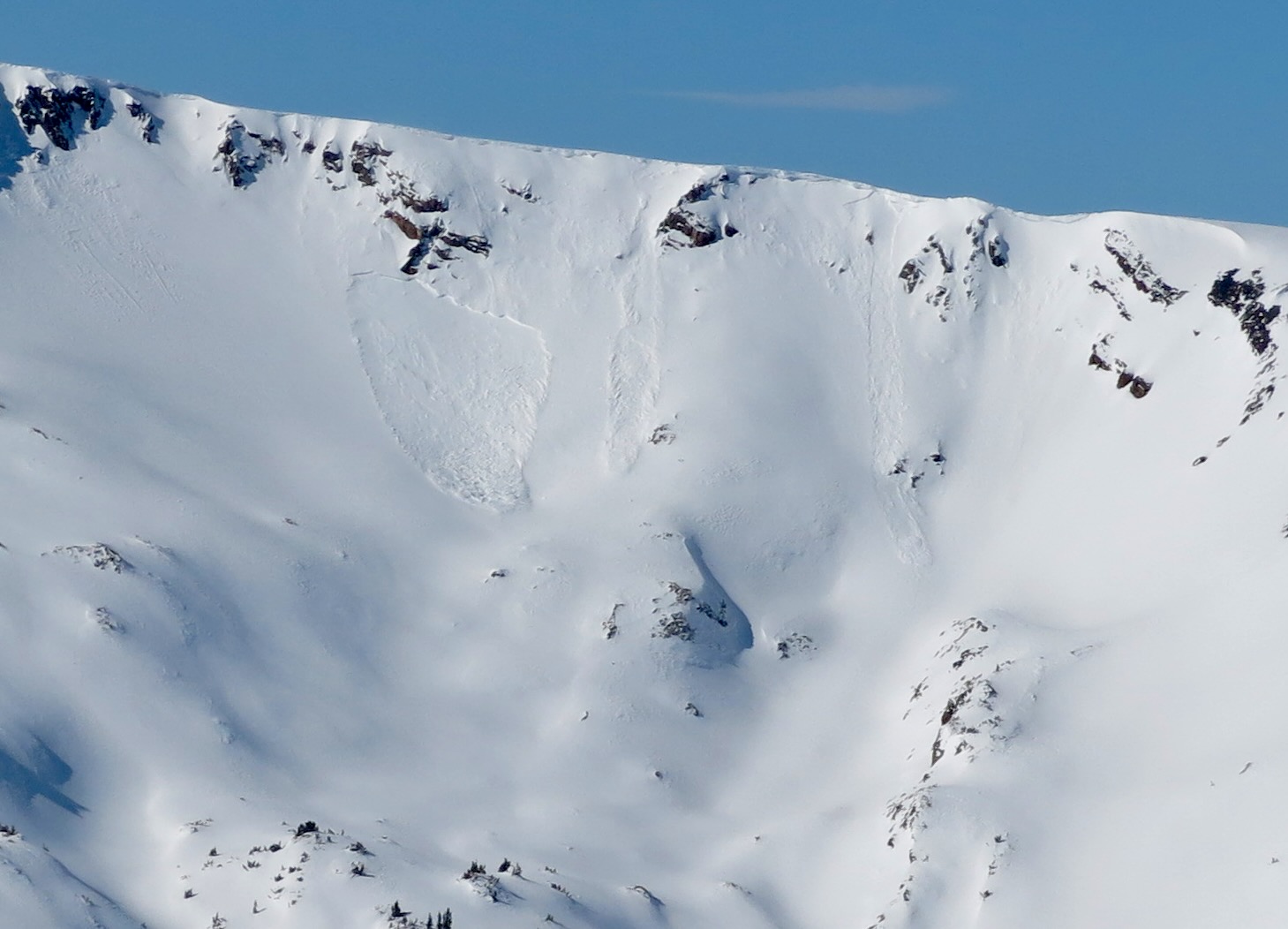
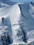
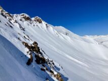
Purple Ridge, NE, 11,000t NTL. Heavly crossloaded terrain featuer. Best guess is that the crown averaged in the 6 to 12″ range, and maybe a bit deeper where it broke into the wind wale. D2 in size.
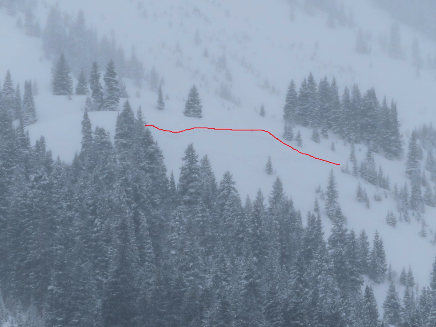
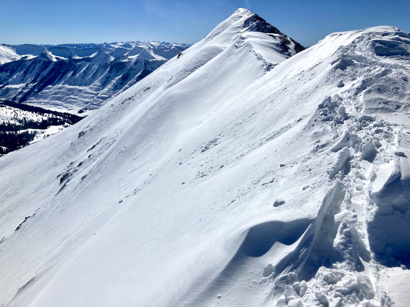
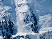
Rock Creek, SE, 12,500ft ATL. 1 D1.5 wind slab breaking near the ridge line. 1 D1.5 slab breaking below a cliff band that was likely triggered by some form of sluff off the ridge.
Weather: Clear, fairly consistent wind NTL blowing in the teens, moderate winds in the alpine continuing to drift snow at times.
Snowpack: Fresh wind-loading was isolated in the terrain and not common across the same specific terrain features. I still encountered a few fresh wind-slabs that I chose to avoid throughout the day. Avalanche problems in general on this tour felt fairly isolated as much of the terrain was simply blown back to firmer old layers.
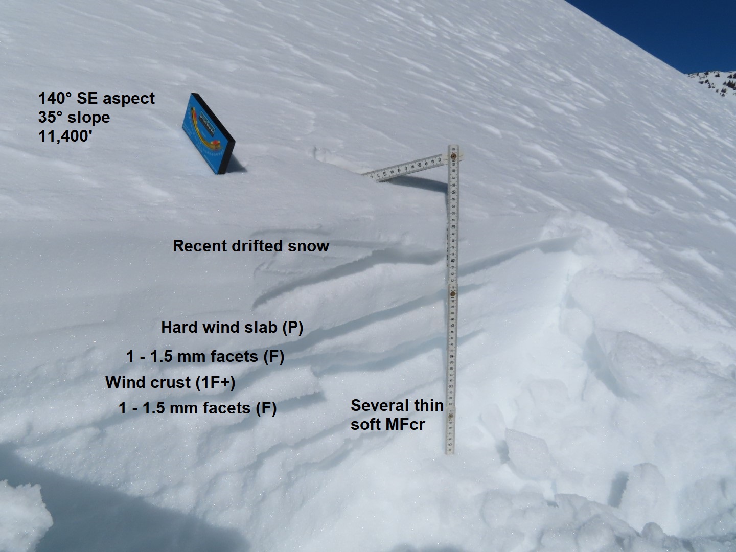
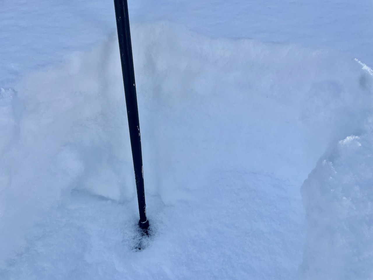
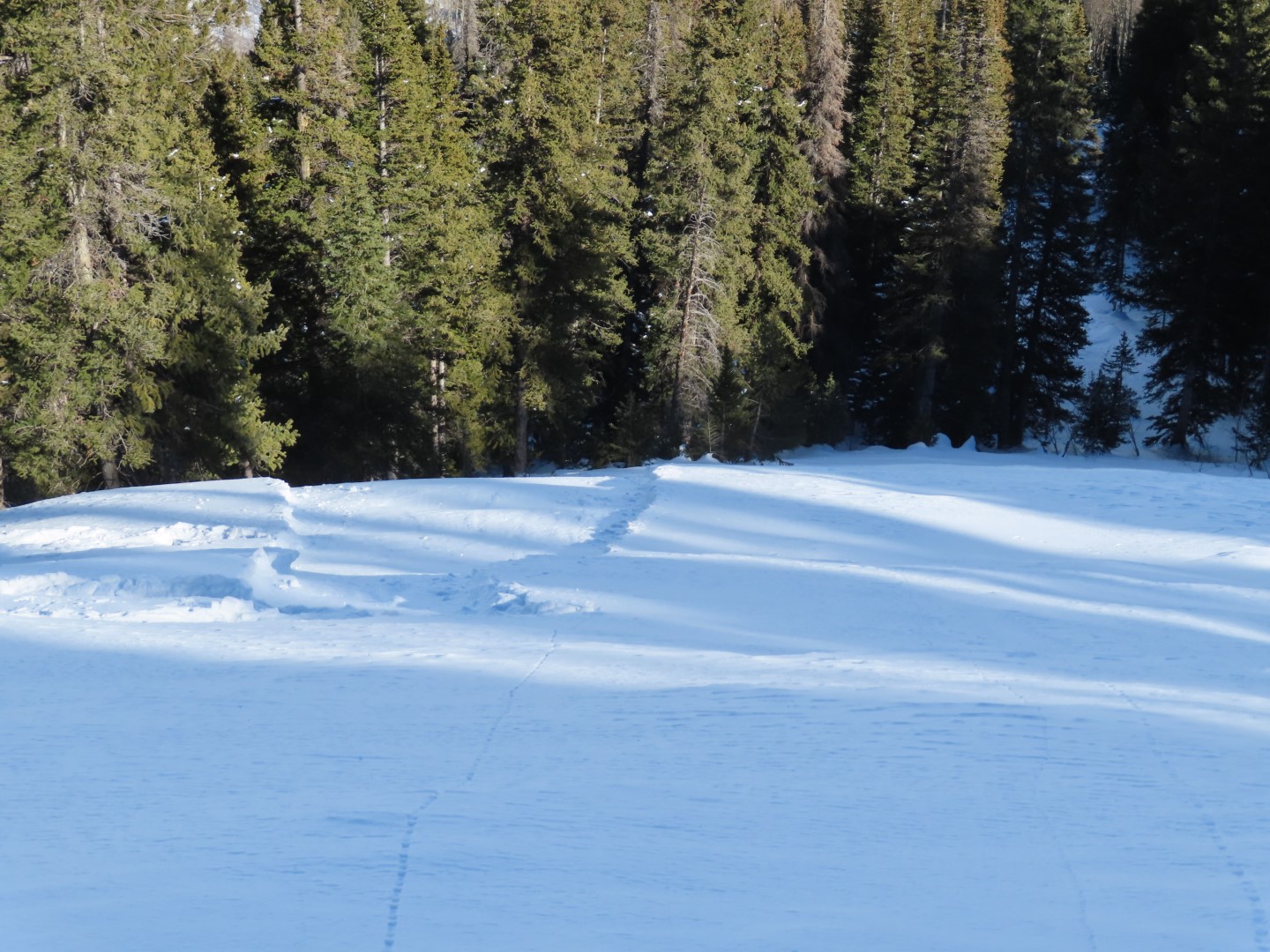
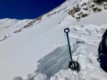
The most concerning thing I encountered was one area where I found multiple stacks of wind boards sandwiching layers of weak facets. This was a south-facing slope at 12,000ft that had seen multiple wind-loading events. I could only observe snowpack structure in the low-angle sections of the slope, somewhere in the 25-degree range. In one area near the bottom of the slope, and in another area near the top of the slope. It would have been interesting to see how much different the structure would have been on the actual steeper section of the slope. The snowpack structure was similar to what I found earlier in the week on low-angle SE to SW slopes near Paradise Divide.
Photos:
-
-
-
The recent slab avalanche on Purple Ridge
-

-
The recent avalanche activity above Rock Creek.
-
-
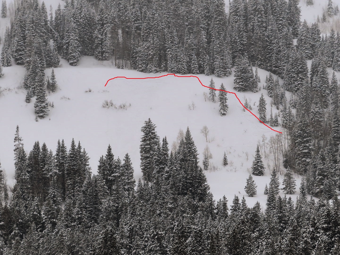
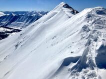
An area with fresh wind-loading isolated to just below the ridgeline on Mt Baldy.
-
-
Wind-boards sandwiching layers of weak facets.
-
-
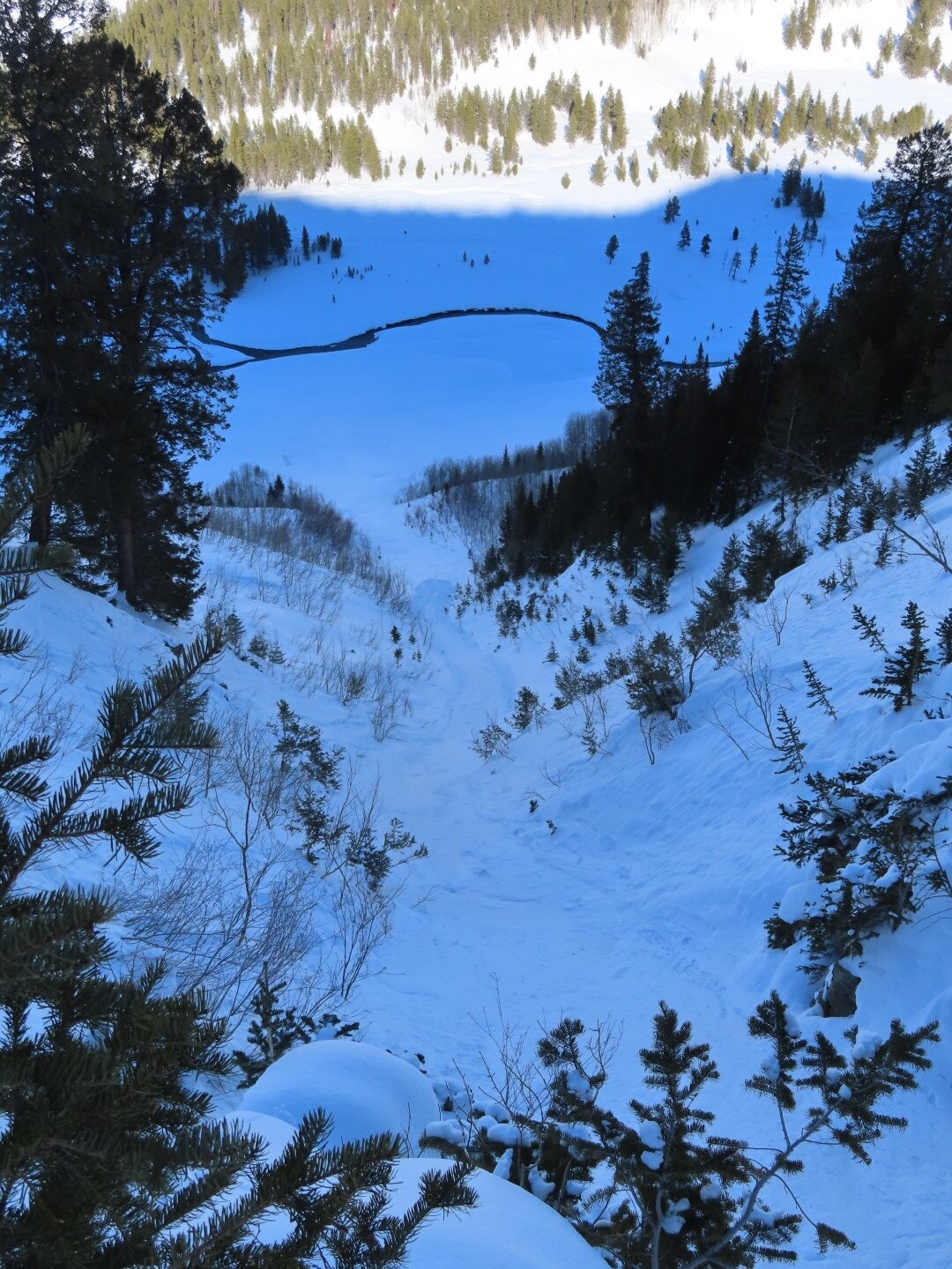
A small avalanche on an eastern aspect of Mt Baldy.
Estimated avalanche date: 02/18/2022
Number of Avalanches: 1
Location
Location: Upper Slate (Purple, Yule Pass, Paradise Divide)
Location Specific:
Start Zone Elevation: NTL: Near Tree Line
Aspect: NE
Characteristics
Trigger: Natural
Trigger modifier:
Type: Soft Slab
Failure Plane: New/Old interface
Size
Relative Size: R1 very small
Destructive Size: D2 – could bury, injure, or kill a person
Avg. crown height (inches): 10
Avg. width (feet):
Avg. vertical run (feet):
Involvements
# of people caught:
# of partial burials:
# of full burials:
Additional comments: Purple Ridge, NE, 11,000t NTL. Heavly crossloaded terrain featuer. Best guess is that the crown averaged in the 6 to 12″ range, and maybe a bit deeper where it broke into the wind wale. D2 in size.
Estimated avalanche date: 02/18/2022
Number of Avalanches: 1
Location
Location: Other: Add text
Location Specific:
Start Zone Elevation: ATL: Above Tree Line
Aspect: SE
Characteristics
Trigger: Natural
Trigger modifier:
Type: Hard Slab
Failure Plane: Old snow
Size
Relative Size: R1 very small
Destructive Size: D1.5
Avg. crown height (inches):
Avg. width (feet):
Avg. vertical run (feet):
Involvements
# of people caught:
# of partial burials:
# of full burials:
Additional comments: Rock Creek, SE, 12,500ft ATL. 1 D1.5 wind slab breaking near the ridge line. 1 D1.5 slab breaking below a cliff band that was likely triggered by some form of sluff off the ridge.
Estimated avalanche date:
Number of Avalanches:
Location
Location:
Location Specific:
Start Zone Elevation:
Aspect:
Characteristics
Trigger:
Trigger modifier:
Type:
Failure Plane:
Size
Relative Size:
Destructive Size:
Avg. crown height (inches):
Avg. width (feet):
Avg. vertical run (feet):
Involvements
# of people caught:
# of partial burials:
# of full burials:
Additional comments:
5357