Date of Observation: 03/02/2023
Name: Evan Ross
Zone: Southeast Mountains
Route Description: Brush Creek. 9,000ft to 11,600ft. NE-E.
Observed avalanche activity: Yes
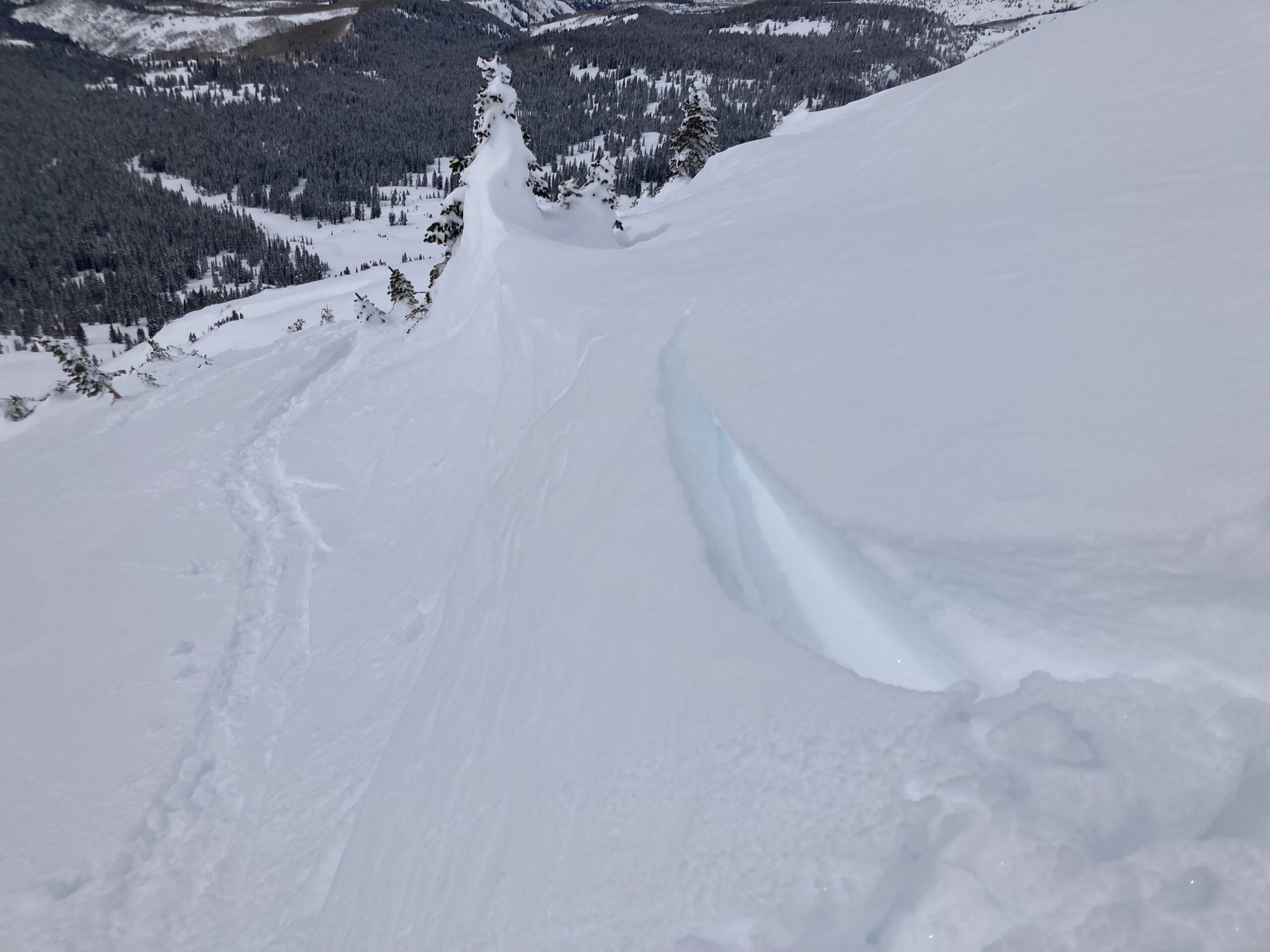
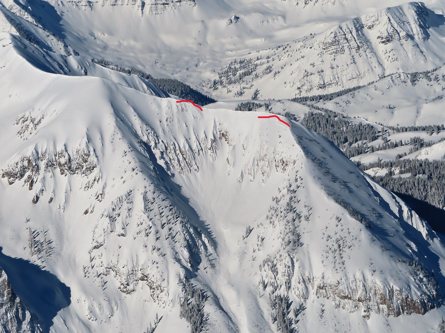
Avalanches: The most recent-looking avalanche failed in the last couple of days. 11,800ft, NE slope, some cornice chunks popped a slab avalanche that become large in size. Best guess is that this slab broke within the recent storm snow around 30 to 45cm deep below a wind-loaded ridgeline.
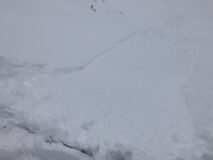
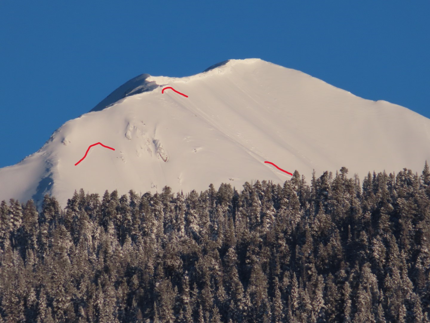
A couple of other large avalanches failed on an East facing slope near the Union Chutes and the south face of Teo. These each had around 25 to 30cm of snow on the debris so I’d estimate they ran during the extreme wind event around 2/22.
Weather: The clear sky became partly cloudy in the afternoon. I saw a couple of snow plumes off the high peaks before mid-day, otherwise nothing notable and calm winds while I was out.
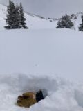
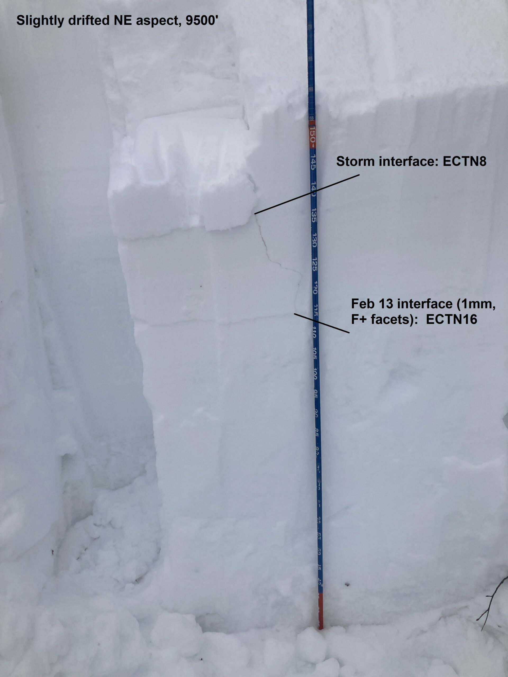
Snowpack: Targeted the late January to February portion of the snowpack. In some areas around 9,300ft, the interface that was buried in early February still consisted of well-developed near-surface facets. However, on an east-facing slope at 9,300ft, I only got ECTN results and no results on test slopes. HS in these areas was 140cm or less and the 20 to 30cm of snow on top of that interface was perhaps just not enough of a slab.
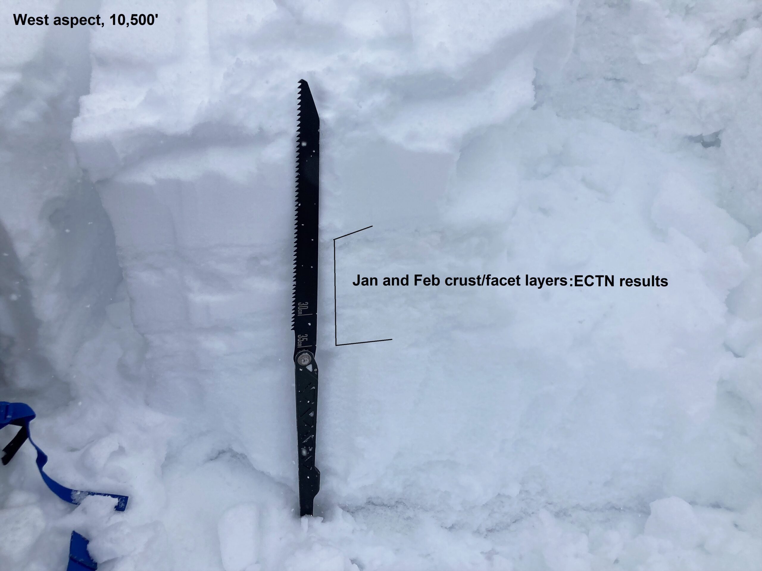
Further up Brush Creek at 10,300ft the HS had climbed to 185cm and the same interface was buried by about 50cm’s of snow. The interface was notably less weak and didn’t produce in ECT or CT tests.
I spend some time trying to find the goldilocks slope between those to data points that would produce an unstable result or show signs of instability but never found it. There were some other suspect areas that would have been nice to look at.
Great skiing on NE-facing slopes, while East-facing slopes were developing a new crust. Steep south-facing slopes ATL had a few roller balls and loose snow avalanches.
Photos:
-
-
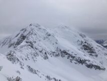
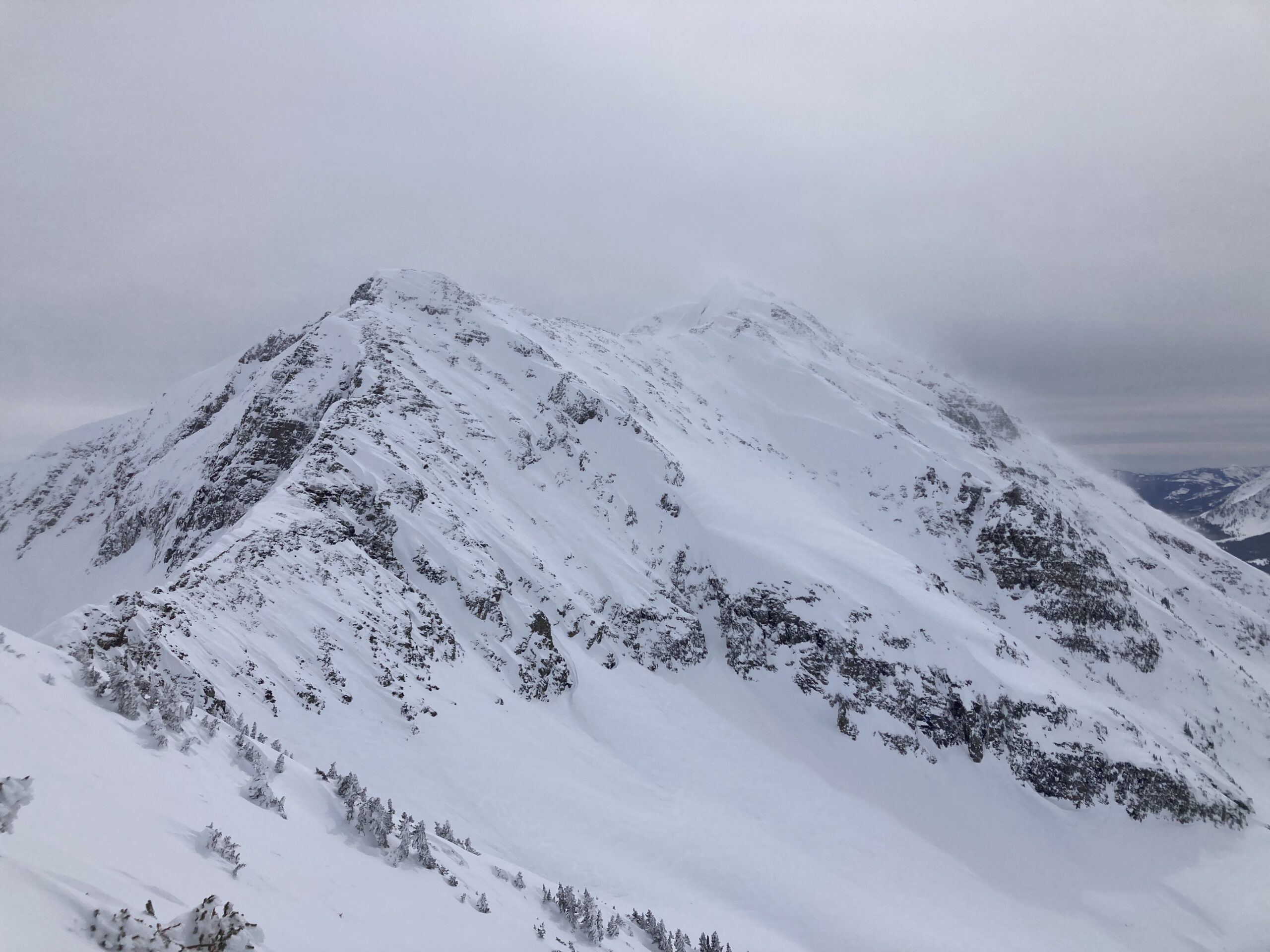
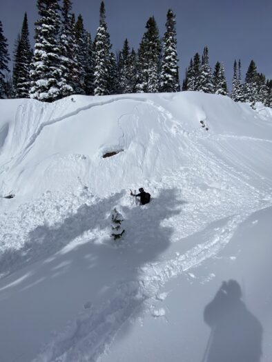
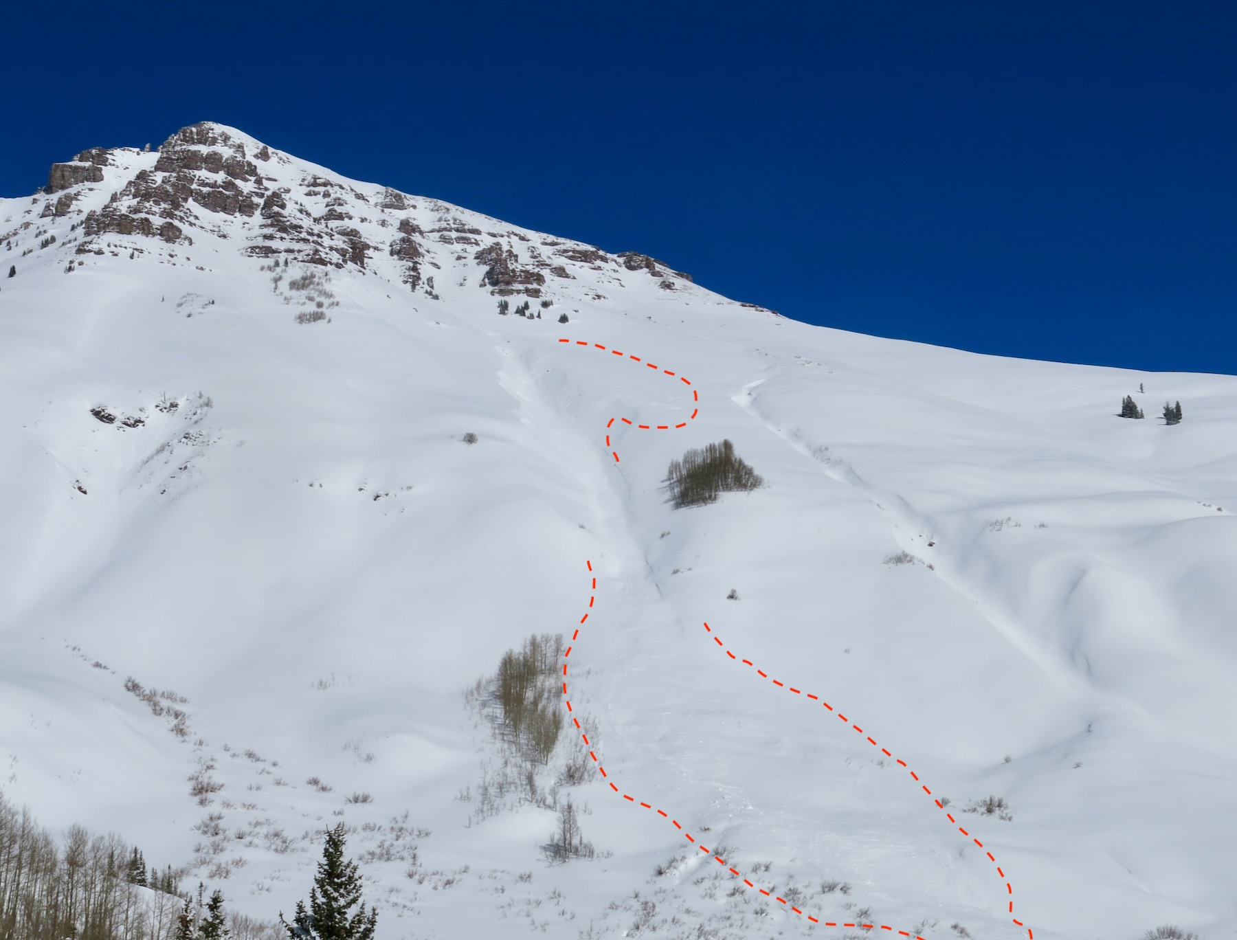
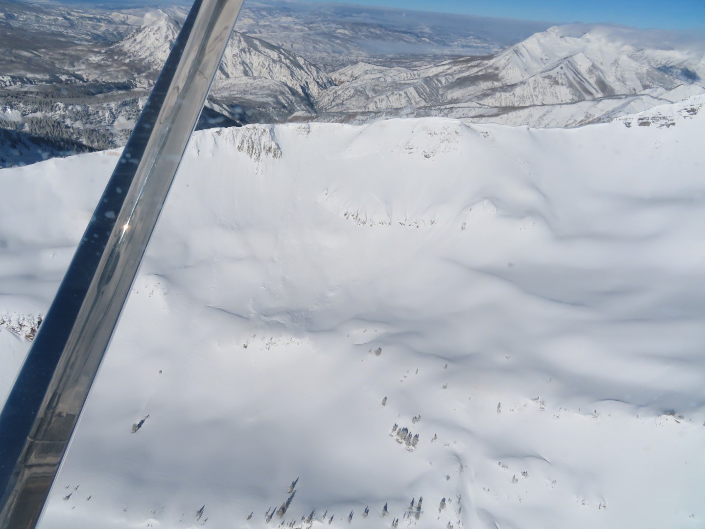
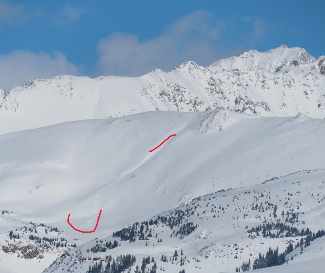
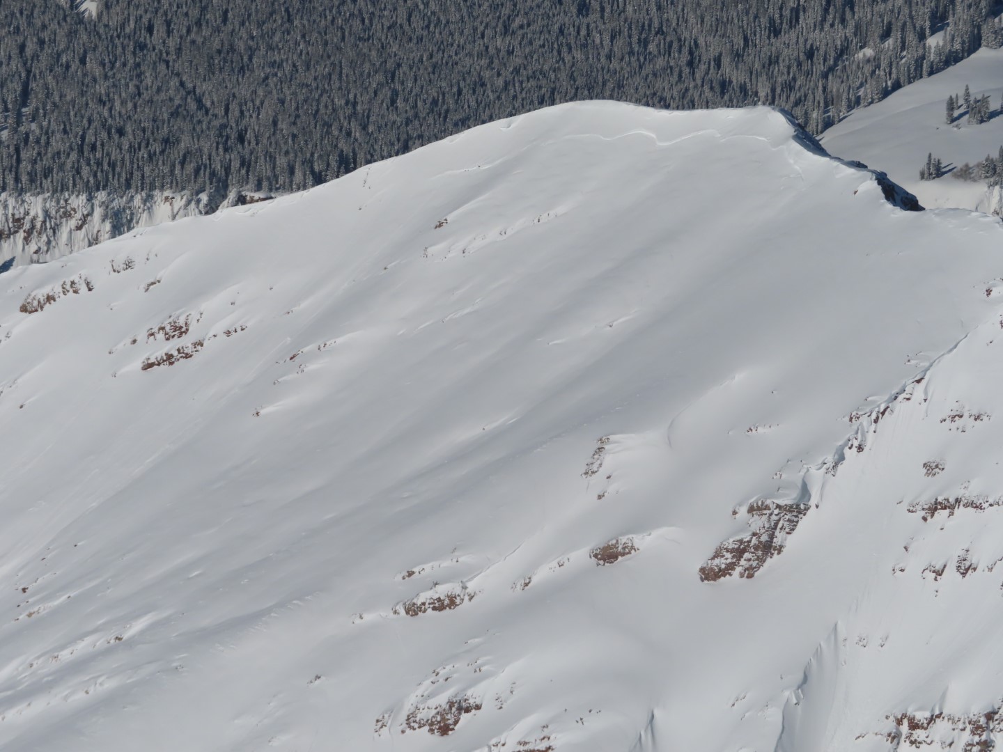
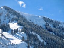
2/28. Estimated Date. 11,800ft, NE slope, some cornice chunks popped a slab avalanche that become large in size. Best guess is that this slab broke within the recent storm snow around 30 to 45cm deep below a wind-loaded ridgeline.
-

-
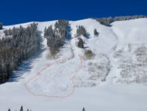
2/28. Estimated Date. 11,800ft, NE slope, some cornice chunks popped a slab avalanche that become large in size. Best guess is that this slab broke within the recent storm snow around 30 to 45cm deep below a wind-loaded ridgeline.
-
-
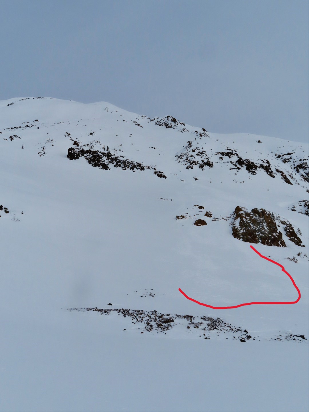
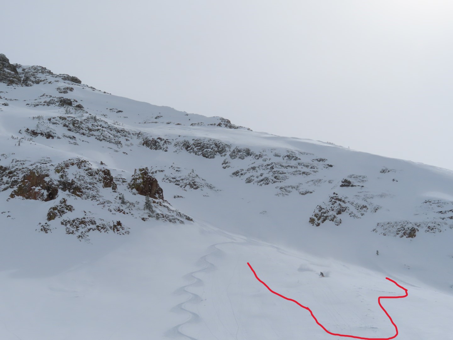
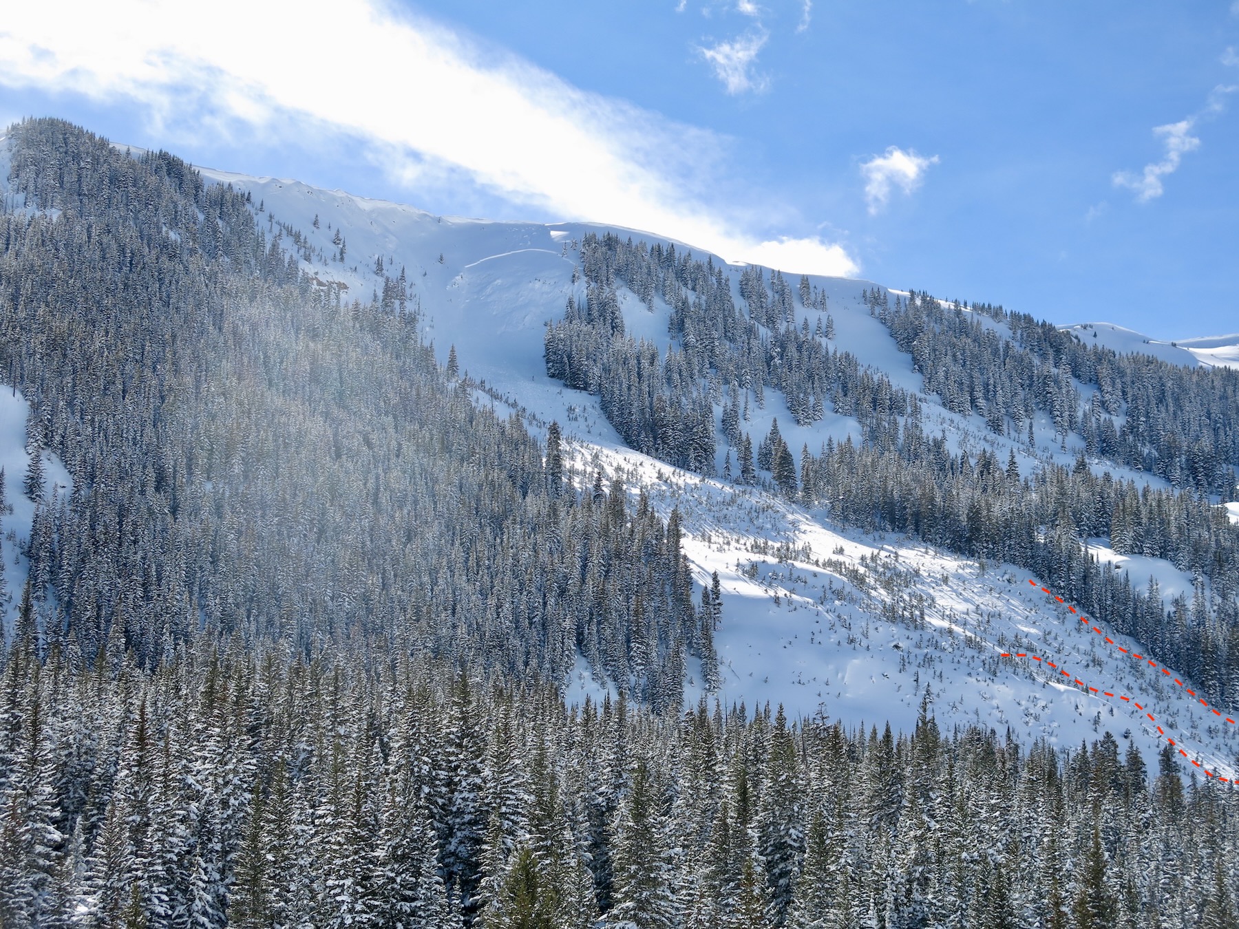
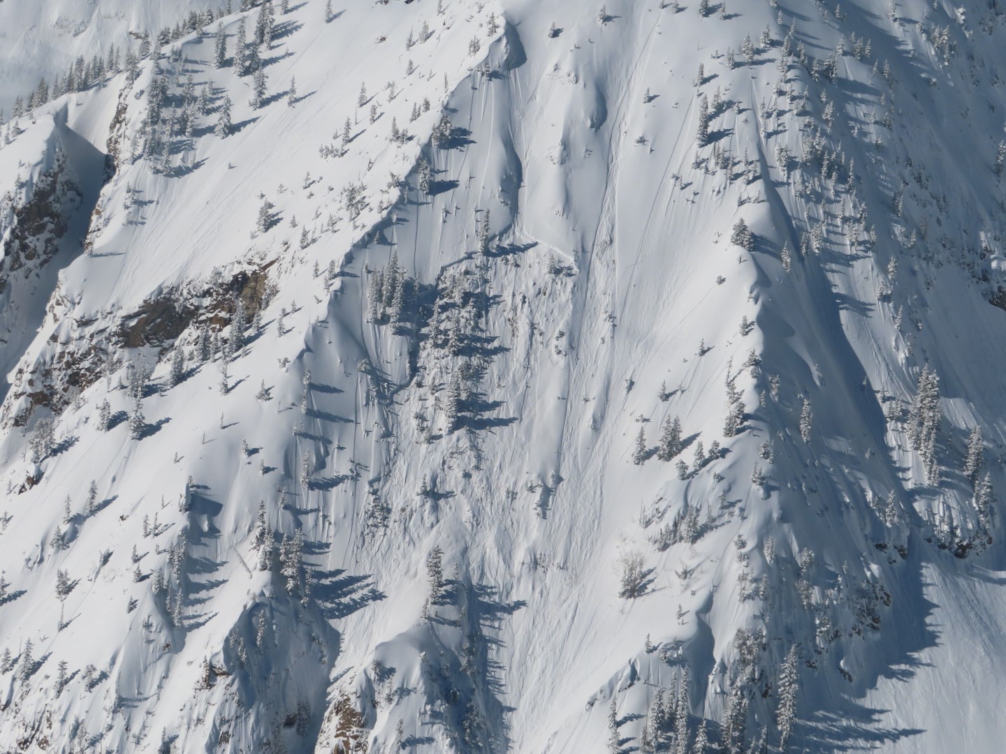
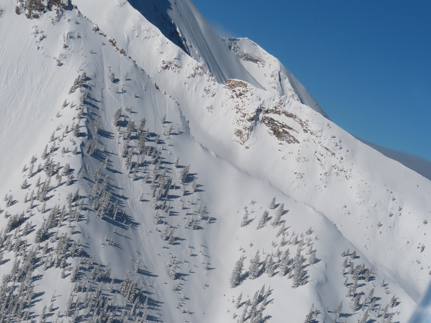
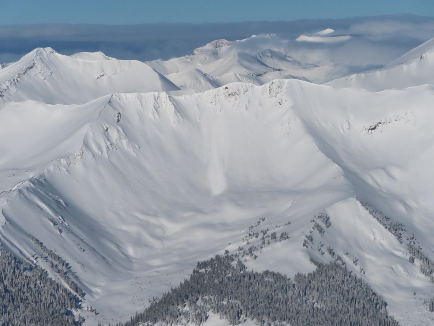
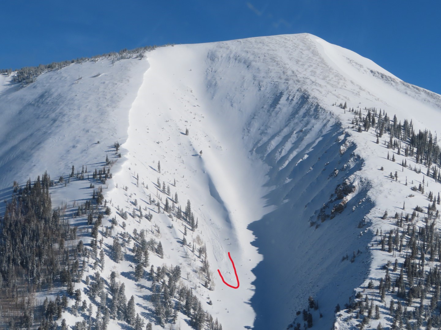
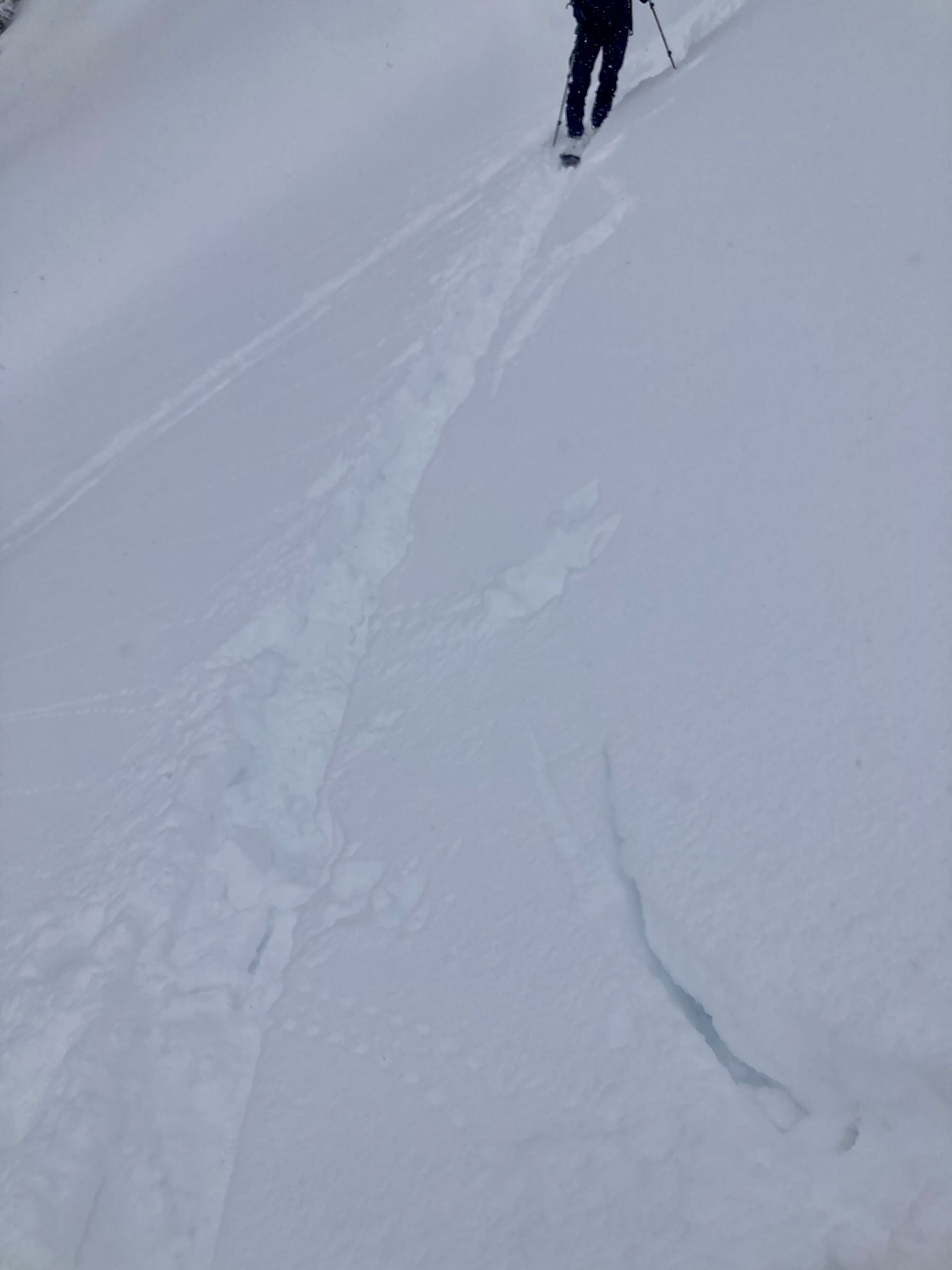
This avalanche had about 25 to 30cm of snow on the debris and likely ran around 2/22
-

-
This avalanche had about 25 to 30cm of snow on the debris and likely ran around 2/22
Estimated avalanche date: 02/28/2023
Number of Avalanches: 1
Location
Location: West Brush Creek
Location Specific:
Start Zone Elevation: NTL: Near Tree Line
Aspect: NE
Characteristics
Trigger: Natural
Trigger modifier:
Type: Soft Slab
Failure Plane: Unknown
Size
Relative Size: R2 small
Destructive Size: D2 – could bury, injure, or kill a person
Avg. crown height (inches):
Avg. width (feet):
Avg. vertical run (feet):
Involvements
# of people caught:
# of partial burials:
# of full burials:
Additional comments: Estimated Date. 11,800ft, NE slope, some cornice chunks popped a slab avalanche that become large in size. Best guess is that this slab broke within the recent storm snow around 30 to 45cm deep below a wind-loaded ridgeline.
Estimated avalanche date: 02/22/2023
Number of Avalanches: 1
Location
Location: West Brush Creek
Location Specific:
Start Zone Elevation:
Aspect: E
Characteristics
Trigger: Natural
Trigger modifier:
Type: Soft Slab
Failure Plane: Unknown
Size
Relative Size: R2 small
Destructive Size: D2 – could bury, injure, or kill a person
Avg. crown height (inches):
Avg. width (feet):
Avg. vertical run (feet):
Involvements
# of people caught:
# of partial burials:
# of full burials:
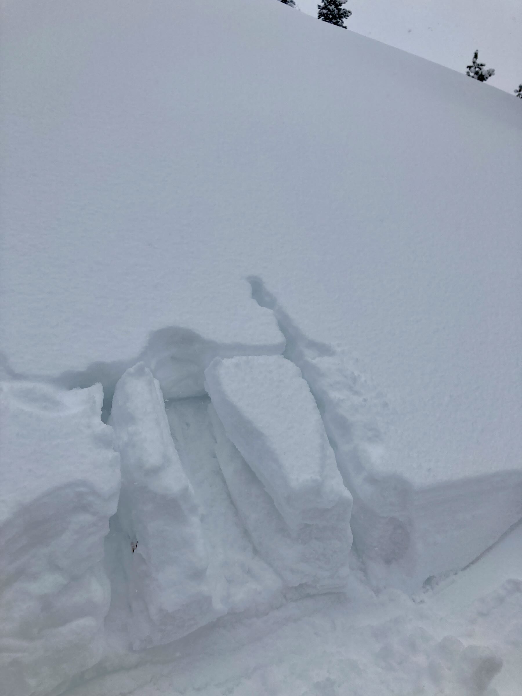
Additional comments: Difficult to see the crown. Notable debris in the runout.
Estimated avalanche date: 02/22/2023
Number of Avalanches: 1
Location
Location: West Brush Creek
Location Specific:
Start Zone Elevation: ATL: Above Tree Line
Aspect: SE
Characteristics
Trigger: Natural
Trigger modifier:
Type: Soft Slab
Failure Plane: Unknown
Size
Relative Size: R2 small
Destructive Size: D2 – could bury, injure, or kill a person
Avg. crown height (inches):
Avg. width (feet):
Avg. vertical run (feet):
Involvements
# of people caught:
# of partial burials:
# of full burials:
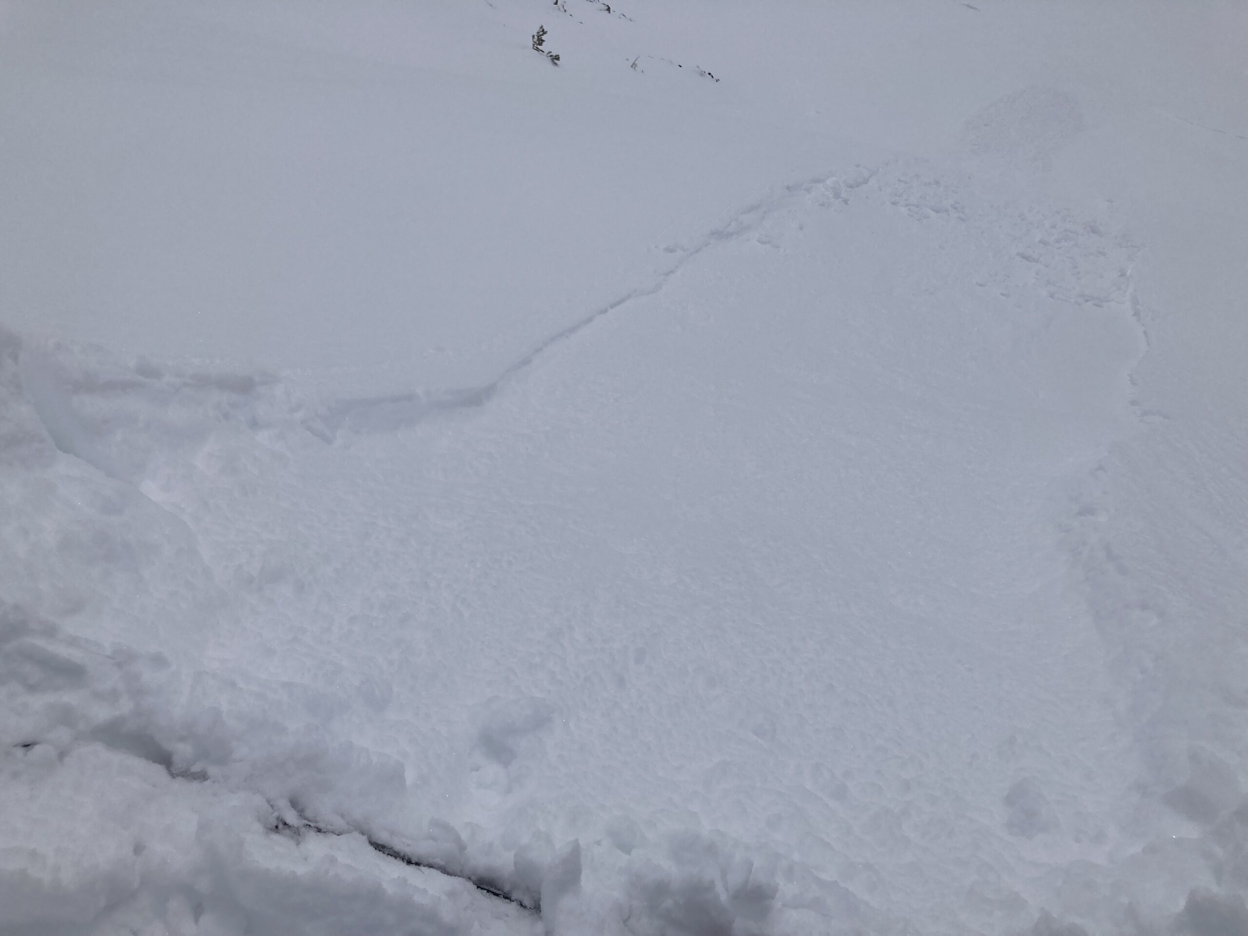
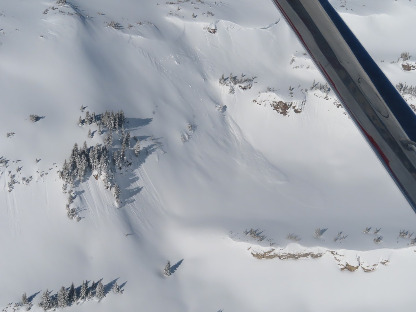
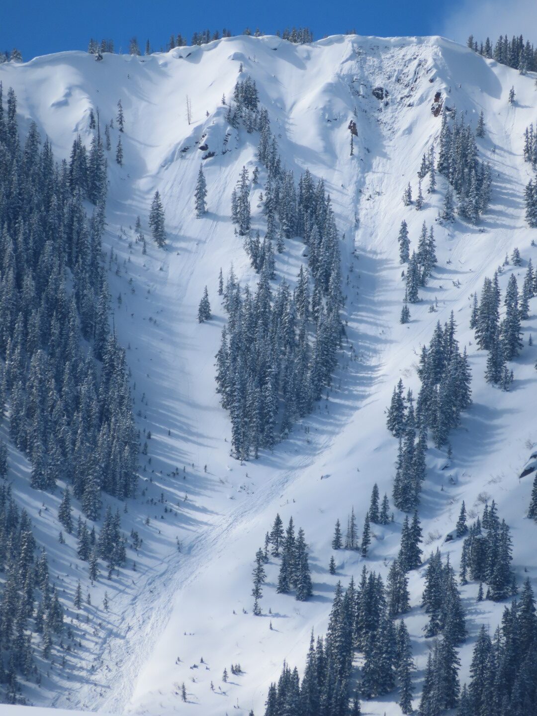
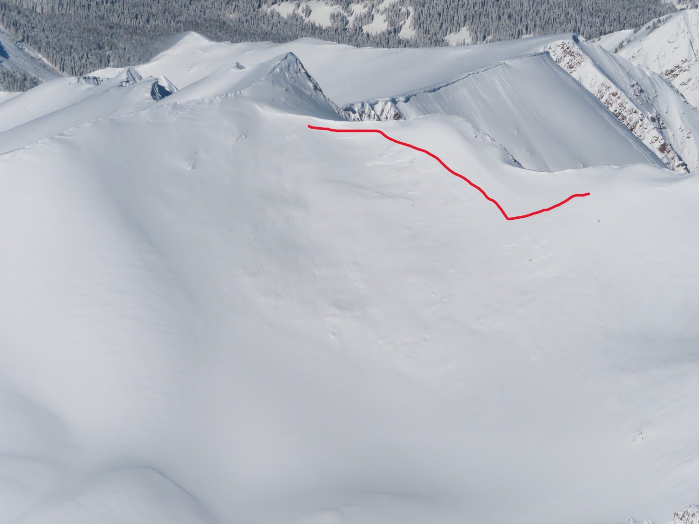
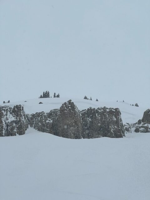
Additional comments: The crown was barely visible and looked to be around 12,500ft on a SE facing slope. The avalanche debris had enough power to blow out of a turning gully mid-track and put notable debris in the runout.
6064