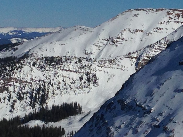
Washington Gulch

CBAC2014-15 Observations

NAME: JSJ, KRISTA

DATE: 2015.03.07

LOCATION: Wash Gulch

ELEV: 9,100-10,500′

ASPECT: N-NE

WEATHER:   Clear, sunny, warm, no wind
AVALANCHE / SNOWPACK OBS: Found ~55cms storm snow (F-4F hard) overlying a distinct surface hoar/buried surface layer on top of 100+cms of mostly 4F hard facets. Two large collapses observed on slope of 34* N slope in dark timber with weight of entire group on slope to produce it. Also saw lots of evidence of recent cracking displacing the storm slab on small steep terrain features, but nothing moved despite the slope angle, guessing compressive support on these small slopes was enough to hold it up in shear strength. A test snow profile revealed CTE & CTM on a layer about 25cms above the ground (or 125cms down !). Sudden Planar failure character on both. Also Tilt Test produced very easy failure results with Sudden Planar fracture character results on a layer 10cms below the surface w/i the storm snow, but no evidence of any activity on this layer anywhere in observed recent activity out in the hills.

Mt Emmons

CBAC2014-15 Observations

Name: Evan Ross
DATE: 3/6/15
LOCATION: Mt Emmons
ELEVATION: ATL-BTL 
ASPECT: SE/S
WEATHER: Really blue, really hot and really no wind.
SNOWPACK:
The march toaster oven was in full effect. Snow surfaces at all elevations became moist by mid day. Differently some rapped settlement going on. Didn’t observe any obvious signs to instability while traveling through terrain but the wide spread avalanche cycle speaks to the potential.
AVALANCHE OBS: 
The lookers left side of RLB (Northeast facing) ran at some point. D2.5 with a 3-4 food deep crown and about 3,000ft wide when measured on Google Earth! Otherwise large avalanches can be observed everywhere on all aspects at all elevations.

Photos from recent avalanche cycle

CBAC2014-15 Observations


Photos by Zach Guy

Snow cat triggered slides above the Nordic CenterDSCF5669-001

Fresh windslabs that ran yesterday or last night on the SE face of Mt. Owen

DSCF5672-001

Northwest Bowl in the Anthracites, ran wall to wall

DSCF5675-001

Southeast face of Mt. Afley

DSCF5678-001


East to Northeast face of Mt. Owen.  I think the looker’s right half ran yesterday or last night, the looker’s left ran earlier in the storm.  DSCF5680-001

Gothic Update

CBAC2014-15 Observations

Only light to moderate wind Tuesday by mid day with light snow picking up at sunset last night.  The 24 hour totals are 8″ new snow with 0.55″ water as snowpack reached 59½”, now at 59″.  Cloudy  currently with thankfully no wind and cooler at 10ºF.  Flat light and little visibility so nothing new on slides to report but run-out zones show nothing new that i can tell.  billy

Crested Butte Area

CBAC2014-15 Observations

GUIDE: JB 

DATE: 201500304
LOCATION: CB Zone
ELEV: 9,400-10,600
ASPECT: S-SW
WEATHER:   SCT to BKN,  winds moderate gusting to strong  BTL & NTL fom NW
Strong winds kicked up ~1:30 & blew in AM skin track in the open fields.  little drifting in forest.
AVALANCHE / SNOWPACK OBS:
Good views of in-numerable slides on E -NE, around long lake, climax chutes, etc
2 collapses in open meadow (S slope @ 27* & 9,500ft)  where the melt freeze crust from mid storm warm up ~20cm down is 1F (4cm thick) over Fist layer.  HS 45cm
1 collapse SW slope @15* & 10,600ft) Similar structure but crust is thinner ) & only 4F.  HS 70cm
Tests @ 10,400 SW 10* slope angle 30*  HS 55cm   Structure: 50cm storm snow sitting on 5cm mfrc (moist poly crystals)
CTM (11) SC 25cm down on 4F mfcr
ECTN (11)  ”     “
ECTN (11)  ”     “
Ski pen 15-25cm

Mt. Emmons

CBAC2014-15 Observations

GUIDE(S): JSJ

DATE: 3.3.15

ACTIVITY: BC Skiing
LOCATION: Emmons
ELEVATION: 9,100 – 11,600′ 
ASPECT: NE / E / SE / S
WEATHER: All over the place. Ski was anywhere from obscured and snowing S2 to sunny broken spells. Mod-strong winds at treeline transporting snow from the West. 
SNOWPACK / AVALANCHE OBS: 65cms of settled storm snow from past 2 weeks resting on the old MF crust on sunny solar aspects. Overall storm snow is F-4F hard and near and above treeline is drifted into thick, dense, heavy windslabs. Lots of evidence of recent avalanche activity in past 24-48 hours, with many paths now filling back in with current strong WSW winds. Recent natural avalanches observed on steep lee East terrain of Emmons (D1-D2) and filling back in. Recent crowns and slides were also noted in Coon basin on steep S and E aspects exposed to wind loading (D2). Ran full track to basin bottom and already filling back in and forming new cornices in start zones. Many fresh slab avalanches noted on steep rocky shallow slopes below Whetstone on drive into town on HWY 135 this am also.

Gothic Updates

CBAC2014-15 Observations

Tuesday A.M.

Not a lot of new snow but terrible wind going strong most the night but letting up a bit after midnight though still at it.  Gusts reached 50 mph during the night.  Only 4″ new snow with 0.46″ water but substantial snow transport such that breaking trail this morning was easy as the snowpack has already set up.  Water content of snow the past 3 days has gone from 6% to 9% to 11%.  Visibility still flat but i have seen slide debris on lower portions of Snodgrass (though not as much as i had hoped).  Wind continues but with gusts only in the 20 mph area now.  Not a nice day, oh no, not at all.  billy

Mid-day Tuesday

Light to moderate snow through the morning but more significantly the wind has stopped.  Visibility better though cloudy all morning.  I have seen about 6 slab releases on Snodgrass, all small though maybe one you could call almost moderate as it crept into it’s tun-out zone, starting at all elevations.  Prominent feature is steep fracture areas, 1 to 2 feet deep running through multiple snow layers.  The one very large run  off the high point just as one comes out of the trees heading into Gothic did not run and has not all winter, which is a problem.

Gothic mountain is still in the clouds so no defined fractures visible, but some light run out debris is.
billy barr