Mountain Weather for 11,000ft

CB Avalanche CenterWeather

Date: 12/23/2019

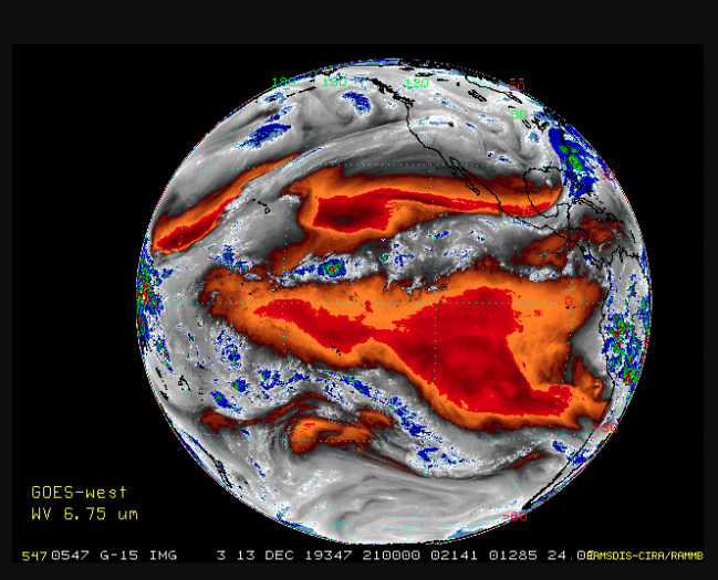
Clouds and mild air will continue to push into the area today in front of a trough centered off the coast of California. This next system will slowly slide eastward towards Colorado today and tomorrow. Cloud cover should thicken and temperatures will likely rise by a few degrees compared to yesterday.
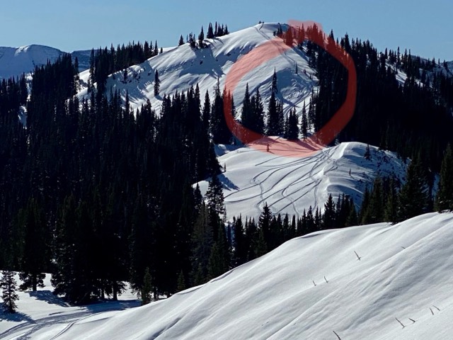
The next system is expected to arrive on Tuesday evening putting Crested Butte under southwest flow. The San Juans, Grand Mesa, and West Elks look to do best with this storm, but Crested Butte will get in on the action as well, but will limited snowfall totals. The best chance of accumulating snowfall will be late Tuesday evening through Christmas morning and taper off after that. Snow totals are not looking impressive but should give our area a little refresh. Look for more detailed snowfall numbers tomorrow.
A closed low-pressure is scheduled to arrive sometime around Thursday but the exact track and timing of this weather producer remain a bit uncertain. The good news is that the pattern looks to remain through the end of the week.

  • Today

    High Temperature: 33 to 37
    Winds/Direction: 5 to 15, S
    Sky Cover: Mostly Cloudy
    Irwin Snow: 0
    Elkton Snow: 0
    Friend’s Hut Snow: 0

  • Tonight

    Low Temperature: 18 to 22
    Winds/Direction: 3 to 13, S
    Sky Cover: Mostly Cloudy
    Irwin Snow: 0
    Elkton Snow: 0
    Friend’s Hut Snow: 0

  • Tomorrow

    High Temperature: 27 to 31
    Winds/Direction: 5 to 15, S
    Sky Cover: Mostly Cloudy
    Irwin Snow: 0 to 1
    Elkton Snow: 0 to 1
    Friend’s Hut Snow: 0 to 1

Snodgrass

CB Avalanche Center2019-20 Observations

Location: Crested Butte Area
Date of Observation: 12/22/2019
Name: Eric Murrow

Subject: Snodgrass

Aspect: North East, East, South East, South

Elevation: 9500′-11100′
Avalanches: Several very small wet loose avalanches on south aspects near and above treeline. I would guess from yesterday, the first warming of sunny slopes since our last storm.

Weather: Mostly cloudy skies with mild temperatures and almost no wind while traveling below treeline.

Snowpack: Southerly slopes below treeline became moist in the top few cms by around noon.

Traveled across the top of snodgrass, peering down into northerly facing, below treeline terrain. Did not see any recent avalanche activity from our last storm. Snow surfaces on shaded terrain had patchy, small surface hoar. HS from 10500′ to 11100′ was around 85cm (see profile). Boot pen was occasionally to ground, but often the slab was strong enough to support my weight. Booted and stomped with skis above the top of several intact start zones without any results. Snowpack was quiet through this terrain with no signs of instability even with obvious strong over weak structure. Riding conditions were supportive and surfy.


Photos:

Mountain Weather for 11,000ft

CB Avalanche CenterWeather

Date: 12/22/2019

That pesky ridge of high pressure will slowly ooze its way to the east today as we will find ourselves on the western side of the ridge axis. This will mean some high-level clouds will spill into the area today with warmer air as well. The clouds and warmer air will help to erode the nasty, frigid inverted temperatures we have been experiencing for the past few days. Temperatures will remain cold, near or below 0, this morning for valley bottoms, but will continue to be downright pleasant at middle and upper elevations. Expect Sunday and Monday to produce similar weather with a change coming late on Monday into Tuesday.
The next opportunity for the area to pick up accumulating snowfall looks to be later in the day on Tuesday and carry into Christmas on Wednesday. A more active pattern will set up for the rest of the week, but models are not pointing towards impressive precipitation totals. The bottom line will be two more days of insignificant weather with warming temperatures and a chance at several modest storms for the rest of the week. Waking up to a power day on Christmas sure would be a great present.

  • Today

    High Temperature: 30 to 34
    Winds/Direction: 2 to 12, SW
    Sky Cover: Mostly Cloudy
    Irwin Snow: 0
    Elkton Snow: 0
    Friend’s Hut Snow: 0

  • Tonight

    Low Temperature: 21 to 25
    Winds/Direction: 3 to 13, SSW
    Sky Cover: Mostly Cloudy
    Irwin Snow: 0
    Elkton Snow: 0
    Friend’s Hut Snow: 0

  • Tomorrow

    High Temperature: 32 to 36
    Winds/Direction: 5 to 15, S
    Sky Cover: Mostly Cloudy
    Irwin Snow: 0
    Elkton Snow: 0
    Friend’s Hut Snow: 0

Coneys

CB Avalanche Center2019-20 Observations

Location: Paradise Divide Area
Date of Observation: 12/22/2019
Name: Emma Vosburg

Subject: Coneys

Aspect: East

Elevation: 10,900

Weather: 18 and sunny no wind

Snowpack: Dug a pit at the top of coneys. Did an extended column test and no fractures at all. Snow was soft and no crust developed yet

Mountain Weather for 11,000ft

CB Avalanche CenterWeather

Date: 12/21/2019

Sub-zero temperatures might slow your motivation this morning, but push through and get out above the stubborn valley inversions to above-average temperatures at higher elevations today. This week’s long-lived ridge of high pressure will slowly track overhead today, with scattered clouds later in the day. Winds remain calm, and temperatures climbing into the mid-30s above the valley floor. Looking into next week, the ridge gets pushed out and more snow looks possible, however, quite a bit of uncertainty with this storm track at the moment. Rudolph will need his red nose potentially for Christmas.

  • Today

    High Temperature: 32-37
    Winds/Direction: 5-15/WSW
    Sky Cover: Partly Cloudy
    Irwin Snow: 0
    Elkton Snow: 0
    Friend’s Hut Snow: 0

  • Tonight

    Low Temperature: 20-25
    Winds/Direction: 5-15/SW
    Sky Cover: Partly Cloudy
    Irwin Snow: 0
    Elkton Snow: 0
    Friend’s Hut Snow: 0

  • Tomorrow

    High Temperature: 35-40
    Winds/Direction: 5-15/WSW
    Sky Cover: Mostly Clear
    Irwin Snow: 0
    Elkton Snow: 0
    Friend’s Hut Snow: 0

Anthracite Mesa Avalanche

CB Avalanche Center2019-20 Observations

Location: Paradise Divide Area
Date of Observation: 12/20/2019
Name: TS

Subject: Anthracite Mesa Avalanche

Aspect: North East

Elevation: 11,000
Avalanches:

“Don’t think this has been reported and I think it may have happened yesterday afternoon as I was in the area until about 230 and feel like I would have noticed it. Anthracite mesa.”

Confirmed with my ski partner yesterday that it was not there when we left the area at around 230 and I was the first one at the trailhead today. Thanks”

(CBAC Edit: This avalanche was previously observed on 12/18 and estimated to have run naturally towards the end of the last natural avalanche cycle.)

Photos:

RLG

CB Avalanche Center2019-20 Observations

Location: Kebler Pass Area
Date of Observation: 12/16/2019
Name: Kirk

Subject: RLG

Aspect: South West

Elevation: 12000 something
Avalanches:

no recent signs

Weather: Clear cold with light wind from west Snowpack: Cold nights are keeping it holding in there although some aspects are starting to crust.

The skin track was awesome, there is like 14 different ways to get to the top now ! but make sure you choose wisely as someone maybe hosing you.

Quiet And A Faceting Snowpack

CB Avalanche Center2019-20 Observations

Location: Paradise Divide Area
Date of Observation: 12/20/2019
Name: Evan Ross & Zack Kinler
Subject: Quiet And A Faceting Snowpack
Aspect: North East
Elevation: 9,000ft to 11,500ft
Snowpack: Traveling through NE terrain showed no obvious signs to instability. We traveled on slopes in the mid to upper 30 degree range. It’s more difficult to find a pristine snowpack given all the natural avalanche events this year on NE slopes. So the majority of the time we were traveling on a slope that had avalanched at some point earlier this season. Even in some steep old growth forest.

The upper snowpack is loosing strength with the current cold and dry weather. A 1F slab still covered some mid-pack SH in one test profile. This interface was identifiable in the wall of the snow-pit, but difficult to get results on. Another test profile was dug below the crown of an avalanche that ran in early December. The HS here was about half 60cm, of the more average 120-130cm snowpack in that area. No SH was found in that 60cm of snow, and the slab over what was left of the facets at the ground was a poor example of strong over weak. So, also breaking down and faceting as a whole.

Mountain Weather for 11,000ft

CB Avalanche CenterWeather

Date: 12/20/2019

Dry conditions and mostly clear skies with cold valley inversions will continue across our forecast area today and into the weekend. The strong ridge of high pressure will slowly track over the western United States through Monday. Looking ahead to early next week, the potential for snow does creep into the picture, but at this point, the southern mountains look favored. Still a ways out, but the chances for a whiter Christmas still remain good.

  • Today

    High Temperature: 25-30
    Winds/Direction: 5-10/WSW
    Sky Cover: Mostly Clear
    Irwin Snow: 0
    Elkton Snow: 0
    Friend’s Hut Snow: 0

  • Tonight

    Low Temperature: 5-15
    Winds/Direction: 5-10/SW
    Sky Cover:
    Irwin Snow: 0
    Elkton Snow: 0
    Friend’s Hut Snow: 0

  • Tomorrow

    High Temperature: 35-40
    Winds/Direction: 5-10/SW
    Sky Cover: Mostly Clear
    Irwin Snow: 0
    Elkton Snow: 0
    Friend’s Hut Snow: 0