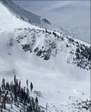
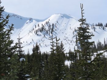
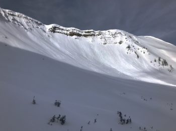
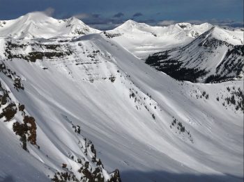
Anthracites obs

CB Avalanche Center2019-20 Observations

Location: Kebler Pass Area
Date of Observation: 03/19/2020
Name: Eric Murrow
Subject: Anthracites obs
Aspect: North, North East, East, South East, South
Elevation: 9,200′ – 11,500′

Avalanches:
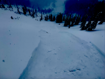
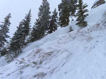
Observed several natural Storm Slabs prior to noon along the Kebler Pass corridor prior to TH, small, steep northerly-facing slopes. around 6 inches deep, below treeline.

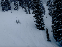
Skier triggered around 5 Storm Slabs in the afternoon 12-18″ deep on north and northeast facing slopes in the Anthracites, D1’s, near treeline.
Intentionally skier triggered two Dry Loose avalanches on steep south/southeast facing slopes. D1 in size but fast-moving on the old crust. No propagation observed while running.

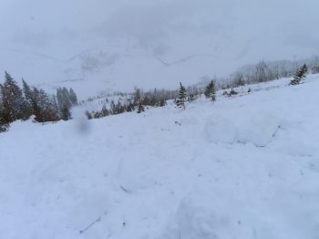
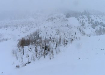
Observed a natural avalanche that ran through the “friendly finish” area of the Anthracites. This failed sometime in the afternoon. Could not see crown due to visibility but presumably failed in the drifted start zone above. Although debris was shallow, it was able to run to the valley floor, east facing.

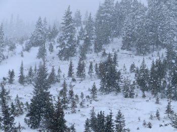
Weather: Obscured skies between 1130am and 430pm out Kebler Pass corridor. Westerly winds transported some snow near ridge top, but less than I would have predicted. Wind speeds at this location generally remained below 20mph at ridgetop. Snowfall was continuous all day with rates between S1 and S3.

Snowpack: New snow accumulations at 11,300′ around 4pm were about 20″ with 1.4″SWE. The new snow was settling to some degree while it was accumulating during the day. New snow was relatively low-density with exceptional ski quality. There was an interface around 2 or 3 inches up in the new snow that was easily identifiable in hasty hand pits that I would suspect was responsible for most of the skier-triggered Storm Slabs in the area (only stuck my mitts into two crowns).

Terrain features that were being pressed or loaded by the wind started to feel top-heavy at the end of the day. Cracks up to a ski length became more common towards later in the day as the snow continued to settle.

Photos:

Climax Storm Slabs

CB Avalanche Center2019-20 Observations

Location: Crested Butte Area
Date of Observation: 03/19/2020
Name: Evan Ross
Subject: Climax Storm Slabs
Aspect: North East, East
Elevation: 9,000-11,300

Weather: Calm wind with a couple strong gusts during our short stay at 11,000ft. We headed out after the peak precipitation in the morning, so S1 throughout our tour.

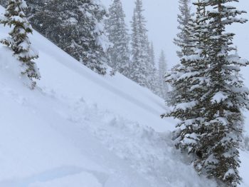
Snowpack: Let’s start small to large. We struggled to get out of easterly tilted slopes in this generally NE facing terrain. Where there was a crust at the old snow surface, the storm slab avalanche problem was reactive on 40+ degree terrain. 30-degree terrain would produce some cracking but wasn’t steep enough to get things moving unless the slope was unsupported. These slabs broke below skis and didn’t propagate very wide. They never pulled down from above. Initiation was at or just above the crust. More northerly facing slopes that didn’t have the crust at the old snow surface were more stubborn to trigger and didn’t run as well on the softer bed surface. HST and crown height was in the 25 to 30cm range. These avalanches were all D1 in size until reaching near treeline start zones. A couple of natural D1’s were also observed.

Getting up to the 11,000ft elevation and into steep NTL start zones, terrain avoidance was obvious given the instabilities found at lower elevations. A simple ski cut produced a wider propagating Storm Slab with a crown in the range of 30 to 40cm range. This crown didn’t propagate horizontally through the terrain, but in a steep downslope frown that was difficult to see how far across the slope it went. Debris from that avalanche were later observed 2,000ft below. This is perfect terrain for producing long-running avalanches.

We worked our way down on ribs in the terrain where you could shred pow above where the small Storm Slabs would initiate. Given the consisted and steep slope angels of this terrain features, the small slabs accumulated mass and kept running to near valley bottom. This terrain is also one of those places to find some of the worst-case avalanche problems in the CBAC FX Area. We found just that when a small Storm Slab stepped down and triggered a larger Persistent Slab failing at the ground in a shallow weak snowpack. That avalanche stepped down on the 3 rollers in the terrain it passed through. Each added mass and produced a D2.5 avalanche by the time it got close to the valley bottom. I don’t think we could have human triggered one of these deeper Persistent Slab Avalanches, and the bigger mass of an avalanche was needed to start gouging things out.

Sluffs and Small Storm Slabs

CB Avalanche Center2019-20 Observations

Location: Crested Butte Area
Date of Observation: 03/19/2020
Name: BA
Subject: Sluffs and Small Storm Slabs
Aspect: North, North East, East, South, South West, West
Elevation: 9,400′-11,000′

Avalanches: 3rd bowl Snodgrass – Multiple D1 storm slabs and small, slow moving dry loose triggered on NE, mostly small terrain features steeper than 35 degrees. Storm slabs were 4F/4F- and breaking on the new interface or within the storm snow. Dry loose were all within storm snow. We avoided any large terrain features that would have held potential for larger storm slabs.

Weather: Snowing all day with lots of variation in snow types and density throughout the day. Winds increased around 2pm, but not enough to transport significant amounts of snow in our sheltered areas.

Snowpack: Variable amounts of new snow and significant accumulations throughout the day, up to 30cm in places by afternoon. No signs of instability anywhere besides 3rd bowl. Skiing was excellent.

Snodgrass Storm Slab

CB Avalanche Center2019-20 Observations

Location: Crested Butte Area
Date of Observation: 03/19/2020
Subject: Snodgrass Storm Slab
Aspect: North East
Elevation: 10,500

Avalanches: Skier triggered a couple storm slabs on 3rd bowl crown was 6 to 8” deep

Weather: Moderate snow and low visibility most of the day

Snowpack: New snow wasn’t bonding very well with the crust below

Mountain Weather For 11,000FT. Thursday 3/19

CB Avalanche CenterWeather

Date: 03/19/2020

Here it comes….winters back baby! A moist and energetic storm started to impact the area very early this morning. Several inches of snow has already accumulated as of 5am and weather models are forecasting consistent snow through sunset and lighter showers until Friday morning. Wind directions have been from the east this morning but will transition to a more westerly direction as the storm moves eastward. Temperatures look to stay near or below the freezing mark today. Winds look modest with this system but strong enough to transport the new snow at upper elevations.

Snow showers are expected to linger on Friday and Saturday, but accumulations look relatively light but this may add a few additional inches into the weekend. Sunday and Monday are looking like drier days before another low-pressure system swings into the area. The storm for early next week looks much like that storms of the past few weeks by tracking towards the Four Corners region.

  • Today

    High Temperature: 25 to 29
    Winds/Direction: 10 to 20/WSW
    Sky Cover: Overcast
    Irwin Snow: 9 to 13″
    Elkton Snow: 9 to 13″
    Friend’s Hut Snow: 6 to 10″

  • Tonight

    Low Temperature: 13 to 17
    Winds/Direction: 6 to 16/SW
    Sky Cover: Mostly Cloudy
    Irwin Snow: 3 to 5″
    Elkton Snow: 3 to 5″
    Friend’s Hut Snow: 2 to 4″

  • Tomorrow

    High Temperature: 24 to 28
    Winds/Direction: 5 to 15/WSW
    Sky Cover: Mostly Cloudy
    Irwin Snow: 1 to 3″
    Elkton Snow: 1 to 3″
    Friend’s Hut Snow: 1 to 3″

Mountain Weather for 11,000ft. Wednesday 3/18

CB Avalanche CenterWeather

Date: 03/18/2020

A dynamic spring storm is making its way through the Great Basin towards Colorado today. Energy will split with the stronger northern Low “slinging” the southern Low into our area. Timing and track of these types of storms are crucial to snowfall amounts and there remains a bit of uncertainty regarding both of those factors. One thing is certain and that is large amounts of moisture will be available. Clouds will thicken today with accumulating snow holding off until this evening.

Snowfall ramps up tonight and into tomorrow as the flow will shift from south to west with colder air filtering in. The heaviest snow for our area will most likely occur after the winds switch, allowing orographics to lift available moisture. Plan on overcast skies, gusty winds and snowfall throughout the day tomorrow with below-average temperatures.

  • Today

    High Temperature: 37 to 41
    Winds/Direction: 8 to 18/ SSW
    Sky Cover: Increasing clouds
    Irwin Snow: 0 to 1″
    Elkton Snow: 0 to 1″
    Friend’s Hut Snow: 0 to 1″

  • Tonight

    Low Temperature: 20 to 24
    Winds/Direction: 5 to 10/ S switching to W
    Sky Cover: Overcast
    Irwin Snow: 3 to 7″
    Elkton Snow: 3 to 7″
    Friend’s Hut Snow: 2 to 5″

  • Tomorrow

    High Temperature: 26 to 30
    Winds/Direction: 10 to 20/ W G30
    Sky Cover: Overcast
    Irwin Snow: 5 to 10″
    Elkton Snow: 5 to 10″
    Friend’s Hut Snow: 3 to 7″

Mountain Weather for 11,000ft. Tuesday 3/17

CB Avalanche CenterWeather

Date: 03/17/2020

A broad area of Low pressure off the coast of California has cut off from the main flow and will be slowly drifting south today before energy splits and stalls over the Great Basin. Under moist southerly flow, we will see another mild day with above-average temperatures and passing clouds. Winds will increase as the pressure gradient tightens and the jet stream moves closer.

Expect clouds to increase tomorrow as the splitting shortwave moves closer drawing in even more moisture in SSW flow. Temperatures will cool a bit tomorrow with cloud cover and increasing winds. Significant precipitation looks to hold off until late tomorrow into Thursday when the shortwave finally moves through with unsettled weather hanging around the Western US through the weekend.

  • Today

    High Temperature: 42 to 46
    Winds/Direction: 5 to 15, SSW
    Sky Cover: Partly Cloudy
    Irwin Snow: 0 to 1″
    Elkton Snow: 0 to 1″
    Friend’s Hut Snow: 0 to 1″

  • Tonight

    Low Temperature: 20 to 25
    Winds/Direction: 5 to 15, SSW
    Sky Cover: Partly Cloudy
    Irwin Snow: 0″
    Elkton Snow: 0″
    Friend’s Hut Snow: 0″

  • Tomorrow

    High Temperature: 37 to 41
    Winds/Direction: 5 to 15, SSW G25
    Sky Cover: Increasing clouds
    Irwin Snow: 0 to 1″
    Elkton Snow: 0 to 1″
    Friend’s Hut Snow: 1 to 2″

Wet snow and dry pow

CB Avalanche Center2019-20 Observations

Location: Crested Butte Area
Date of Observation: 03/16/2020
Name: Eric Murrow
Subject: wet snow and dry pow
Aspect: North, North East, East, South East
Elevation: 8700′ – 12500′

Avalanches: observed a couple of recent small Wet Loose avalanches on steep rocky east-facing near treeline feature.

Weather: Warm day, with light winds, and increasing high-clouds.

Snowpack: Shaded slopes below about 10,000 feet had thin soft crusts at the surface in the morning that softened by late afternoon but I did not find any concerns for loose activity on shady low elevation slopes.

While ascending east-southeast near treeline terrain at 1pm, found 4 to 5 inches of wet snow sitting on an old crust. The old crust was often supportive to boots except for shallowest spots or around vegetation. Felt like you could trigger small loose slides in this terrain by afternoon, but the intact crust would have limited the amount of entrainment. Beneath the old curst, the snowpack was uniform, soft and very moist. Snow depths through this terrain were 65-85cm.

Descended northerly-facing terrain at all elevation bands without signs of instability.  Surfaces were generally soft, well-settled snow.

Photos:

Near and Below tree line surface conditions

CB Avalanche Center2019-20 Observations

Location: Crested Butte Area
Date of Observation: 03/16/2020
Name: Zach Kinler
Subject: Near and Below tree line surface conditions
Aspect: North, North East, East, South East, South, South West, West, North West
Elevation: 9000-11,000′
Avalanches:
A few very small Wet Loose releases from steep southerly slopes which remained in the surface snow.

Weather: Increasing high-level clouds for this afternoon tour. Temps were above freezing at 11K. Calm winds even near ridgeline.

Snowpack: North aspects above 10K are dry while below 10K there are surface crusts and a crust from the previous warming cycle just over a week ago. These get thicker as you descend below 9K where they will soon be welded together. There were no wet loose concerns on this aspect. NW and NE aspects above 10.5K were dry while below, crusts were similar to N aspects getting thicker as you descended or moved towards S. Minimal Wet Loose concerns were seen here.

Moving towards the sunny side of the compass, the upper few inches of recent snow have been wetted down to the previous crusts which are still supportive. With strong overnight freezes and gradual warming trends, these aspects have transitioned very well. Most concerning areas are the steep, shallow areas near rocks, cliffs and dark timber. Cornices have grown large on certain easterly slopes and are starting to see warming…


A few small wet releases on a SE aspect with some overhanging cornices catching some sun.

Redwell Cornice Release

CB Avalanche Center2019-20 Observations

Location: Crested Butte Area
Date of Observation: 03/15/2020
Subject: Redwell Cornice Release
Aspect: East
Elevation: 12,000ft

Avalanches: Estimated 3/14. A large cornice released above Redwell Basin on an easterly facing slope. That cornice gouged into a thin snowpack over rocky cliffs.