Mountain Weather February 9, 2015

CB Avalanche CenterWeather

Date: 02/09/2015

The blocking ridge of high pressure that is responsible for the dry weather pattern we’ve been in is under attack by two small weather systems that will bring a change in weather for us mid week. This evening a weak trough will work its way into northern Colorado and bring us light accumulations on Tuesday. Then another system will dig further south into Colorado Tuesday evening or Wednesday. This 2nd system looks a little better but will be strongest to our east along the Continental Divide. Later in the weak the blocking ridge looks to rebuild, putting us back under dry northwest flow.

Washington Gulch

CB Avalanche Center2014-15 Observations

LOCATION: Crested Butte Area
DATE OF OBSERVATION: 02/08/2015
NAME: Zach Guy
SUBJECT: Washington Gulch
ASPECT: North East
ELEVATION: 9,900 ft

AVALANCHES: None.

WEATHER: Warm, clear, no wind.

SNOWPACK: Low angle south aspects held wet grains/ wet facets to the ground. Isothermal snowpack, 50 cm deep or less. Ski pen was nearly to the ground.
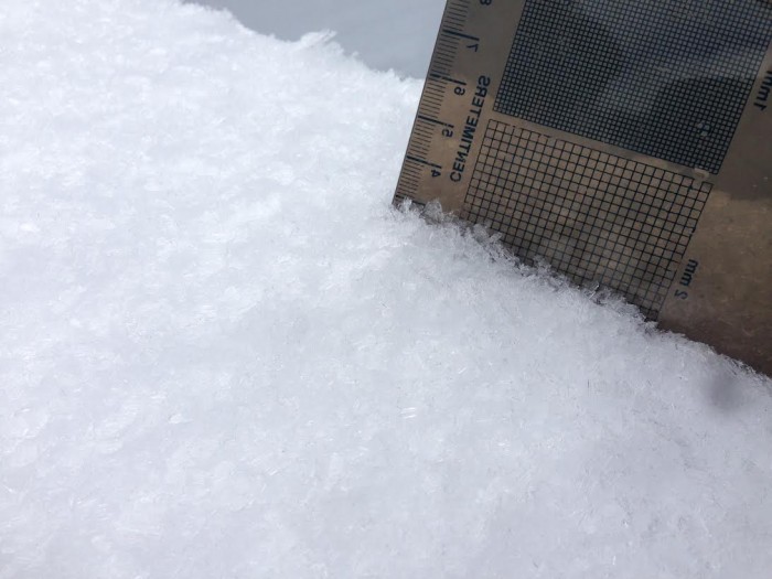
North and northeast aspects held entirely faceted snowpack, with about 2-4″ of DF at the surface. Boot pen to the ground, ski pen nearly to the ground. Melt-freeze crusts formed as far as 70* ENE aspect on steep slopes. Further north still dry.
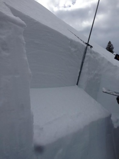
I dug a pit below a heavily windloaded ridgeline, NTL type of snowpack. The new persistent slab over Jan 30th facet layer is 20 cm thick, and was unreactive in the pit, but produced localized cracking about 5 feet wide. The December 13th facet layer was 40 cm deep under a 1F slab, still propagating under moderate loading steps (ECTP15), and the depth hoar failed while isolating the column but this wasn’t a repeatable result, about 100 cm deep. This structure was isolated to just below ridgeline. About 20 yards downslope, it abruptly changed to fully faceted snowpack, with now persistent slab concerns.

UPLOADS:

Presentation1
profile

Mountain Weather February 8, 2015

CB Avalanche CenterWeather

Date: 02/08/2015

The blocking ridge of high pressure appears to continue through this week. Keeping the storm track to our north and leaving most of Colorado dry. There will be a few small disturbances that move through during this period, bringing increased cloudiness and a chance for small accumulations of snow. We’d like to say 0-14” of snow during these shortwaves, but unfortunately our confidences is highest at the 0” level. This morning clouds should be clearing with continued mild temperatures. These shorwaves will arrive Monday morning and again on Tuesday afternoon through Wednesday.

Copper Creek obs

CB Avalanche Center2014-15 Observations

LOCATION: Crested butte  area
DATE OF OBSERVATION: 02/07/2015
NAME: Irwin guides level 1
SUBJECT: Copper Creek obs
ASPECT: North, North East, South, West
ELEVATION: 9000-10500

AVALANCHES: None observed.

WEATHER: Increasing clouds in the pm, light variable winds, intense solar

SNOWPACK: Wet snow surfaces on west and even northerly terrain in trees. Numerous profiles on north to northeast facing slopes revealed two persistent slabs, one 20-40cm deep resting on 10-16mm preserved surface hoar, widespread in areas we dug. The older December 13th slab definitely has lost cohesiveness and no results were observed with compression tests or ECT.

Note able results: 2 x ECTP (17 and 23 taps respectively). SC on the surface hoar on 42 degree wind loaded rollover feature, northeast facing. Other tests preformed found surface but did not produce propagating results.

12mm Surface observed 2.8.15 buried 40cm deep.

12mm Surface observed 2.8.15 buried 40cm deep.

ECTPM x2  40cm deep, NE ASPECT, 10,200ft

ECTPM x2 40cm deep, NE ASPECT, 10,200ft

Mountain weather forecast for Saturday, February 7th, 2015

CB Avalanche CenterWeather

Date: 02/07/2015

Another warm one in store today, with in increase of high cloudiness this afternoon as a weakening disturbance crosses extreme northern Colorado tonight. The northernmost portion of our forecast area may sneak a few flurries, but any snow shouldn’t amount to much. Our depressing pattern of high pressure looks to reinforce itself once again after a weakening midweek storm clips the central mountains…

Skier Triggered Avalanche on Snodgrass

CB Avalanche Center2014-15 Observations

LOCATION: Crested Butte Area
DATE OF OBSERVATION: 02/06/2015
SUBJECT: Skier triggered avalanche on Snodgrass
NAME: Havlick
ASPECT: North East
ELEVATION: 10000


AVALANCHES: Observed fresh slab avalanche on a convex roll on snodgrass. Possibly surface hoar as culprit? 12″-18″ deep, 60-8oft wide, running 100ft or so.

WEATHER: warm, slight down valley breeze

SNOWPACK:  significant collapsing on flats, shooting cracks 80′

UPLOADS:

Snodgrass

Snodgrass


Schuykill Ridge

CB Avalanche Center2014-15 Observations

LOCATION: Crested Butte Area
DATE OF OBSERVATION: 02/06/2015
NAME: Than
SUBJECT: skooks
ASPECT: North
ELEVATION: treeline and below

AVALANCHES: Saw avalanches of a variety of sizes all on east facing aspects

WEATHER: sunny, warm and still

SNOWPACK: east and south already sloppy by 10 a.m.
Skied first bowl on skooks, first 10 turns good then turned slabby, punchy until it turned into bottomless for the final third of the pitch.

UPLOADS:

Mountain Weather for Friday, February 6th, 2015

CB Avalanche CenterWeather

Date: 02/06/2015

Now this is getting weird…another day of near record warmth for most of Colorado, and the normally frigid Gunnison valley is no exception. High temperatures today will soar into the 50s today with light westerly winds and thin cirrus will enhance that solar intensity. Temperatures will cool tomorrow a bit ahead of a weakening push of Pacific moisture that may spur a few orographic snow showers late Saturday afternoon and evening. Otherwise…our next chance for significant snow is next week.

Natural in Redwell Basin

CB Avalanche Center2014-15 Observations

LOCATION: Crested Butte Area
DATE OF OBSERVATION: 02/05/2015
NAME: Jafar Tabaian
SUBJECT: Natural in Redwell Basin
ASPECT: South East
ELEVATION: Above Tree Line

AVALANCHES: Natural slide off SE (ish) face of Redwell observed from Coneys ridge. Assume this is a windslab but it could have been a wet loose slide.

WEATHER: Strong N-NW winds at start of tour, winds ceased in afternoon. Clear skies and very warm.

SNOWPACK: 3-5 inches of dense, wind affected snow over crust. Variable skiing. No signs of instability observed.

UPLOADS:

IMG_20150205_132418250_HDR

Natural slides around the Ruby Range and Anthracites

CB Avalanche Center2014-15 Observations

SUBJECT: Natural Slides – Ruby Range and Anthracites
DATE OF OBSERVATION: 02/05/2015
NAME: Zach Guy and Evan Ross
LOCATION: Kebler Pass Area
ASPECT: North East, East, South East
ELEVATION: Near/ Above treeline


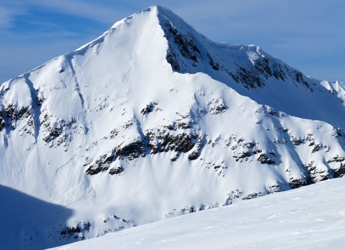
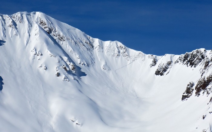
AVALANCHES: Observed 11 fresh natural soft slab avalanches on E, SE, and NE aspects above treeline, mostly D1.5, and one D2. Averaged an estimated 1 to 2 feet deep, ranging from 30 feet to 600 feet wide, averaging about 50-150 feet wide, presumably on or above the Jan 30th interface. Ran in the last 36 hours. Also about 10 very small wet loose avalanches on south aspects near/above treeline from steep, rocky slopes.

  • 2x SS-N-R1-D1.5-U on Mt Owen’s E/NE face
  • 1xSS-N-R1-D1-U on Mt. Owen’s NE face
  • 1xSS-N-R1-D1.5-U on Mt. Afley’s SE face
  • 2x SS-N-R1-D1.5-U on Mt Richmond’s E and SE faces
  • 1x SS-N-R1-D1.5-U on Hancock Peak’s SE face
  • 2x SS-N-R2-D2/1.5-U in the Anthracite Range E aspect ATL (wide propagation, 600 feet?, happened today)
  • 2xSS-N-R1-D1.5-U off of Scarp Ridge, NE aspect ATL.
  • 10x WL-N-R1-D1-S various south aspects N/ATL
  • We skier triggered a fresh windslab on a SE aspect ATL. Up to 18″ deep, 30 feet wide, failing on mid-storm DF’s. SS-ASc-R1-D1-S

WEATHER: Moderate winds with strong gusts began to ease midday, with moderate snow transport in the morning. A high of 39 at 10k feet. Thin clouds, few to scattered.

SNOWPACK: Surfaces became moist on SE to SW aspects N/BTL in wind sheltered areas.

IMG_9106

1xSS-N-R1-D1.5-U on Mt. Afley’s SE face

IMG_9104

2x SS-N-R1-D1.5-U on Mt Owen’s E/NE face

IMG_9102

2x SS-N-R2-D2/1.5-U in the Anthracite Range E aspect ATL (wide propagation, 600 feet?

IMG_9098

skier triggered a fresh windslab on a SE aspect ATL. Up to 18″ deep, 30 feet wide, failing on mid-storm DF’s. SS-ASc-R1-D1-S

Windslab on east aspect of Red Coon that likely failed naturally on 2/2/15

Windslab on east aspect of Red Coon that likely failed naturally on 2/2/15