Mt. Emmons Snowpack

CB Avalanche Center2015-16 Observations

Location: Kebler Pass Area
Date of Observation: 01/27/2016
Name: Zach Guy
Subject: Mt. Emmons Snowpack
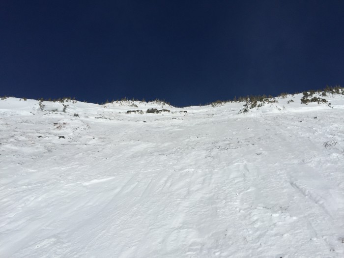
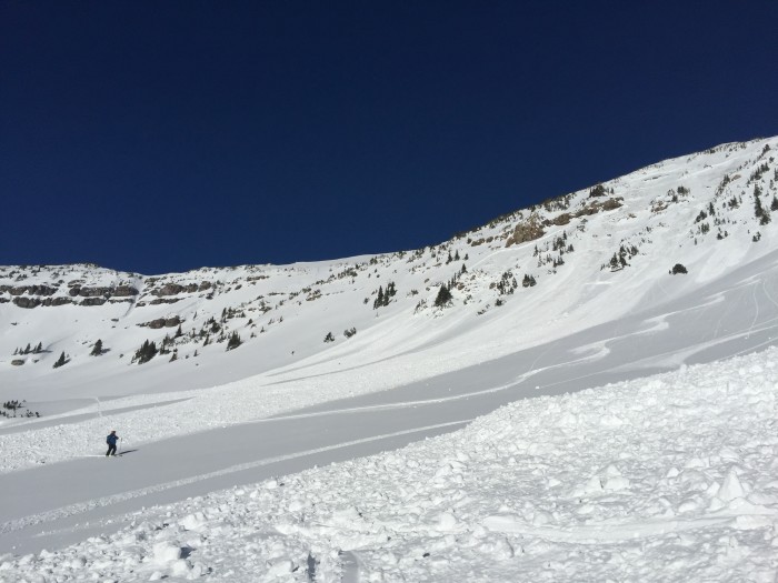
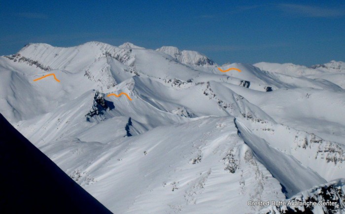
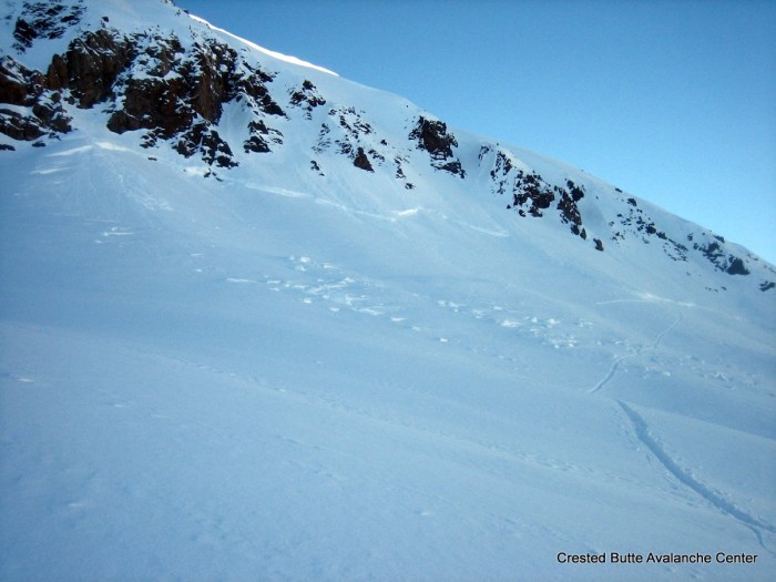
Aspect: North East, South East
Elevation: 9,000- 12,000 ft.
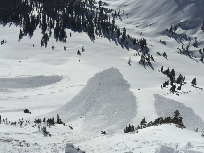
Avalanches: None
Weather: Clear, calm winds, warm temps at higher elevations
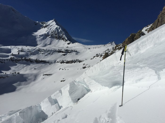
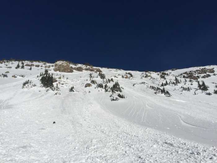
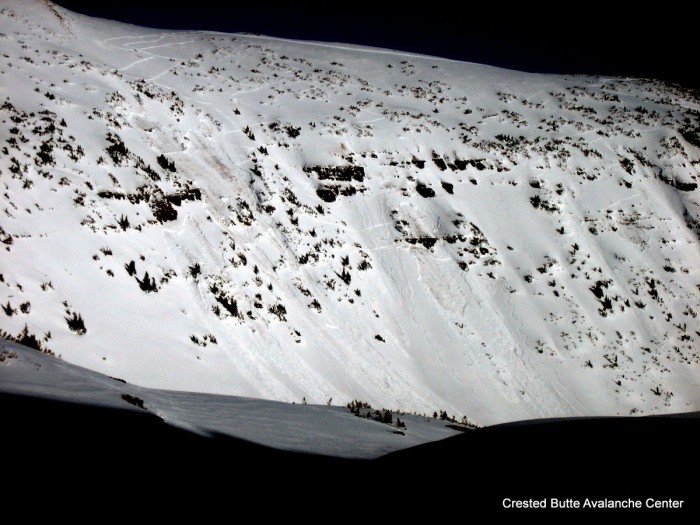
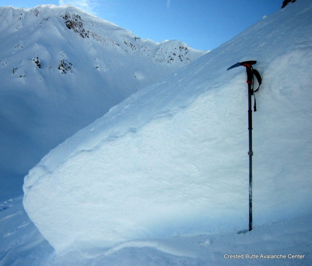
Snowpack: See video.  In general, the Jan 14th layer is pronounced and weak (F+ hard, 1 to 1.5mm facets) on southeast and northeast aspects, but this area hasn’t seen the snow load yet to test it, except perhaps on heavily drifted areas. Fist hard soft slabs above the layer were <30cm deep and not reactive in pits and showing no signs of instability, except in a drifted area on a SE aspect NTL, which showed propagating results above the Jan 14th crust. There are multiple new crusts forming above the Jan 14th layer on sunny aspects. NE aspects look like they will be the first to shed if we see a big load.
The rest of the snowpack was faceted out below that layer. Most of these paths appeared to have run during December. Surface hoar/near surface facets forming on shaded aspects.

Explosive triggered persistent slabs at Irwin

CB Avalanche Center2015-16 Observations

Location: Kebler Pass Area
Date of Observation: 01/27/2016
Name: Irwin Guides
Subject: Explosive triggered persistent slabs
Aspect: South West, West
Elevation: Near/ Above treeline

Avalanches: Significant explosive results (hand shots to larger 9£ AB) F to 1F+ (40-125cm slab) resting above large, moist 4-8mm striated depth hoar on Upper Upper West Wall (SW and West aspects)
Weather:
Snowpack: Beautiful low density powder from yesterday’s storm, minimal wind effect. Afternoon temperatures remained below 20ºF, helped keep surfaces cold on higher terrain, no crust formation on westwall.

1/26. Explosive triggered persistent slabs at Irwin.

1/26. Explosive triggered persistent slabs at Irwin.

1/26. Explosive triggered persistent slabs at Irwin.

1/26. Explosive triggered persistent slabs at Irwin.

1/26. Explosive triggered persistent slabs at Irwin.

1/26. Explosive triggered persistent slabs at Irwin.

IMG_3141 IMG_3143

Mountain Weather 1/27/2016

CB Avalanche CenterWeather

Date: 01/27/2016

Strong inversions are in place this morning, with Crested Butte pooling in cold air in the negative double digits. Warm air is advecting into the mountains and temps have risen to near 20 degrees at most stations. High pressure will continue to bring calm winds, mostly clear skies, and a warming trend to our mountains today. The ridge flattens by Thursday night, issuing in moisture and a weak embedded disturbance under zonal flow on Friday. This will bring increased clouds but little in the way of snowfall. A significant Pacific trough will develop over the weekend into early next week, bringing a good chance for serious snowfall. Details to come.

Red Lady Bowl

CB Avalanche Center2015-16 Observations

Location: Crested Butte Area
Date of Observation: 01/25/2016
Name: J Banks
Subject: Red Lady Bowl
Aspect: East, South East, South
Elevation: 9,200-12,200

Avalanches:
Weather: Calm to Moderate N/NW, light winds starting ATL & Moderate on ridge top
Snowpack: No signs of instability
light drifting had moved small amounts of snow in Alpine (small intermittent drifting onto old skin track)

Gothic

CB Avalanche Center2015-16 Observations

Location: Crested Butte Area
Date of Observation: 01/26/2016
Name: JSJ
Subject: Gothic
Aspect: North East
Elevation: 9,500-11,100

Avalanches:
Weather: clear, calm, and cold. High temp of 17F.
Snowpack: SNOWPACK/AVALANCHE OBS: small surface hoar growth in valley on top of a few inches of fresh, new low density snow that is decomposing and faceting. Overall average HS was 125cms and mostly all F and 4F snow with 1F mid pack on slopes w/o previous Avalanche activity.

Ruby Range Obs

CB Avalanche Center2015-16 Observations

Location: Kebler Pass Area
Date of Observation: 01/26/2016
Name: Zach Guy
Subject: Ruby Range Obs
Aspect: North East, East, South East
Elevation: 10,800-12,800 ft

Avalanches: Several natural D2 soft slabs that likely failed on or before 1/21/16 on SE and S aspects above treeline. (Galena Peak, Richmond Peak, and the ridge between Mt. Justice and Purple Mountain). One faint crown, D1.5, on a West aspect ATL on Garfield Peak.
Took quick look at the crown of the SS-N-R2-D2.5-O crown on the S/SE face of Purple that was first observed 1/21/16. The crown was roughly 70 to 120 cm deep. It appeared to fail on 4F-, 1mm facets below the Jan 14th crust, which was 4 cm thick, 1F. There were no noticeable facets above the crust at my pit location, just 1F rounds.
Weather: Clear, calm winds, cold in the shade, warm in the sun.
Snowpack: ~10″ of storm snow, largely unaffected by winds. Isolated soft drifts up to 18″ deep and some isolated cracking in the top few inches of snow. No other signs of storm instability except very small sluffs in steep terrain.
On a 30 degree ENE aspect at 12,000 ft: Total snow depth was 220 cm. The Jan 14th facet layer is 80 cm deep, 4F hard, 0.5mm in size and rounding. The slab above it is 1F hard at this interface, .3mm rounds. No propagating results in ECTs or PSTs. DT 22, Q2, SC.
On SE aspects N/ATL, the Jan 24th melt-freeze crust is ~2cm thick, supporting skis but boot pen easily breaks through. A thin new crust formed today on steep S/SE slopes.

Older crown lines visible looking north towards Snowmass Peak.  Crowns on Richmond (foreground), Galena, and Justice Ridge.  S and SE aspects ATL. Probably failed 1/20 or 1/21.

Older crown lines visible looking north towards Snowmass Peak. Crowns on Richmond (foreground), Galena, and Justice Ridge. S and SE aspects ATL. Probably failed 1/20 or 1/21.

Explosive triggered slides today at Irwin. SW and W aspects in Robinson Basin.

Explosive triggered slides today at Irwin. SW and W aspects in Robinson Basin.

IMG_5630-001

Old crown on Purple Peak, S/SE aspect above treeline. The slide appeared to break below the January 14th meltfreeze crust on 4F-, 1mm facets, about a meter deep on average. Likely failed 1/20 or 1/21.

IMG_5634-001

Mountain Weather

CB Avalanche CenterWeather

Date: 01/26/2016

Our quick hitting, slightly disappointing storm has since moved into New Mexico and West Texas as tranquil weather under a strengthening ridge of high pressure builds over the western states. Light winds and stubborn mid-winter inversions take hold through the rest of the week, before stormier weather returns for the weekend and beyond.

Pittsburg Area

CB Avalanche Center2015-16 Observations

Location: Paradise Divide Area
Date of Observation: 01/25/2016
Name: 2nd Hand Observation
Subject: Pittsburg Area
Aspect: North East, East, South East, South
Elevation: 10000-12000

Avalanches: did observe one older 4-5 days old slide, west facing, off Baldy. Crossed Paradise Divide switchbacks, D2.5.

One fresh windslab 10-18″ deep, east facing, didnt see whole slide but potentially size 2 in steep terrain.
Weather: partly cloudy, light west winds, valley inversion
Snowpack: 6″ new snow, good skiing. Winds transporting snow lightly.

20160125_Windslab

Gothic Obs 7am

CB Avalanche Center2015-16 Observations

Location: Crested Butte Area
Date of Observation: 01/25/2016
Name: billy barr
Subject: Gothic Obs 7am
Aspect:
Elevation:

Avalanches:
Weather: There was 3″ new snow in the past 24 hours with 0.18″ of water. Not overly significant. Snow pack at 40½” and it has been hovering between 38-42″ most days of late. Cleared and cooling at sunrise today.
Snowpack: South facing slopes have developed a crust and steep south slopes were sloughing over the weekend- just point releases but picking up some snow on the way down so could be a problem again later in the week if it warms (highs were 36 and 37ºF Friday and Saturday). billy