Red Lady Glades

CB Avalanche Center2015-16 Observations

Location: Crested Butte Area
Date of Observation: 03/10/2016
Name: Will
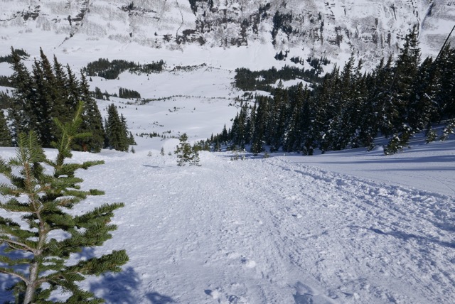
Subject: Red Lady Glades
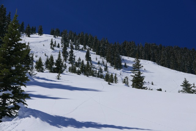
Aspect: South East, South
Elevation: 9,300-12,392

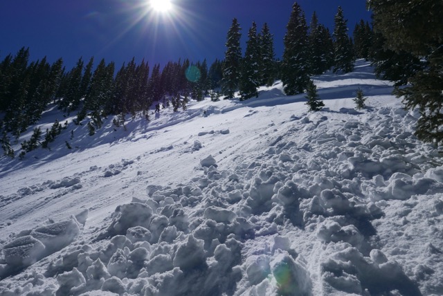
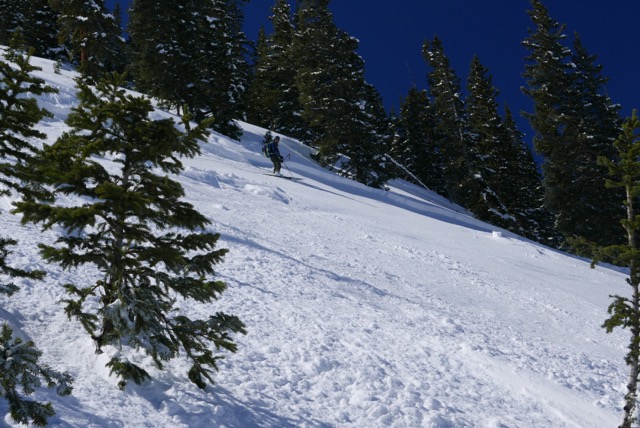
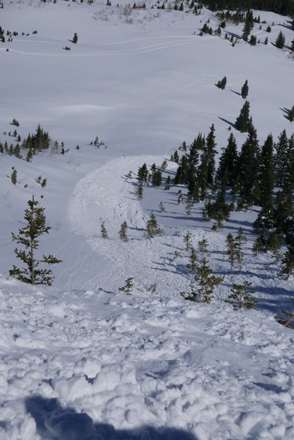
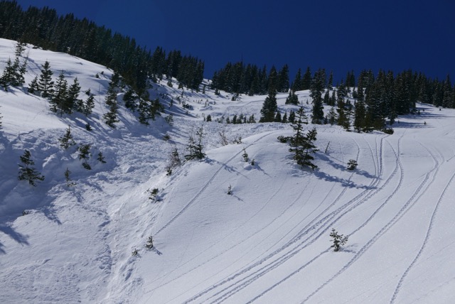
Avalanches: New snow from Mondays storm has had a chances to warm up on S-SE with the high temps creating wet loose slides running on the dust crust at Elv 11,000. In the photo if you look closely you can see crown of a wet loose slide running diagonally down the picture frame triggered from the ridge line.
Weather: Clear skies, warm calm winds at 11,000 Elv T20= 0°C Surf 1*C Air=7°C
Snowpack:

Wet-Loose

Skier triggered slides on Schuylkill Ridge

CB Avalanche Center2015-16 Observations

Location: Paradise Divide Area
Date of Observation: 03/10/2016
Name: Dan Loftus
Subject: Skier triggered slides on Schuylkill Ridge
Aspect: North East
Elevation: Near treeline

Avalanches: See photos. First skier triggered the slide on an old bed surface that had run early season. I then triggered another skiing down to him. Both crowns were 8-10″ or so. Both fractured at our feet and we were both able to stay on our feet and ski out. Snow moved on the slow side for the pitch we were on.
Weather:
Snowpack:

P1050810 P1050815 P1050823 P1050825 P1050832 P1050837

schuykill avalanche activity

CB Avalanche Center2015-16 Observations

Location: Paradise Divide Area
Date of Observation: 03/10/2016
Name: MR
Subject: Schuykill avalanche activity
Aspect: North East
Elevation: 11400-9200

Avalanches: Pair before us remote triggered a R2D2 slab avalanche on thanksgiving bowl, maybe they’ll give their own report. We triggered some hang fire above the main slide, R1D2, ran slowly but enough to take you off your feet and into trees that would ruin your day. 8 inch slab. As we skied down any convexities popped loose that hadn’t already but ran with little to no energy. Down lower, maybe around 10,200?, we tried to trigger at some convexities but the slab seemed to be bonding better to the sun crust lower down.
Weather: very warm, calm winds, clear
Snowpack: storm snow settling into creamy pow. The warming slab is resting on facets up high, sun crust down low

IMG_1495
IMG_1504
IMG_1493
IMG_1492

Poverty Gulch

CB Avalanche Center2015-16 Observations

Location: Paradise Divide Area
Date of Observation: 03/10/2016
Subject: Poverty Gulch
Aspect: East, South East, South
Elevation: ATL

Avalanches: After over night freeze, surface snow gained solar very quickly. Especially in absence of cooling wind.Snowballs rolling out of heating rockbands would fan out and pick up volume in track. By noon many areas were seeing surface, new snow, sluffs. Some ran long track. Didn’t observe any stepping down into old pack. Above 11,500 or so much evidence of wind transport and shallow surface wind slabs. On way out saw couple skier triggered new snow sluffs that ran long distances in confined features facing NE along Skuklyll ridge.
Weather: Blue Bird, barely a breeze on Richmond ridge. Enormous solar gain today.
Snowpack: 4-7″ new snow on frozen old surfaces. Most elevations seemed to have a good bond with the old surface. Till the sun got to it on steeper aspects.

Mountain Weather

CB Avalanche CenterWeather

Date: 03/10/2016

The big story of the day will be soaring high temperatures as the ridge of high pressure builds today and tomorrow. Light winds and clear skies will allow that strengthening mid-March sun the bring high temperatures into the 40s at most locations. Looking ahead, Saturday looks like next chance for a few inches of snow, before a larger trough of low pressure churns out of the Pacific and ushers in stormy and snowy weather for early next week.

Coney’s

CB Avalanche Center2015-16 Observations

Location: Crested Butte Area
Date of Observation: 03/09/2016
Name: DB
Subject: Coney’s
Aspect: North East, East, South, West
Elevation: 9.5- 11K

Avalanches:
Weather: Overcast skies nearly all day till 1500 when the sun poked out, Winds Light, had a 2hr period of S 1 snow. Did not amount to much, but it felt like winter again. Morning temp was -1 c, afternoon cooled down as the from moved in temp went down to -4.5c. There was not much solar effect to today.
Snowpack: No signs of instability on tour. ski pen was 10cm & boot ben was 25cm. The skiing was good. You could still feel the old layers of snow in steeper areas but we got some good powder skiing in.

Coney’s

CB Avalanche Center2015-16 Observations

Location: Crested Butte Area
Date of Observation: 03/08/2016
Name: JB
Subject: Coney’s
Aspect: North East, East, South, West
Elevation: 9.5- 11K

Avalanches:
Weather: Clear skies nearly all day, Winds Light- Moderate NW, Intense Solar,
Snowpack: No signs of instability on tour
~4” of snow had drifted in along skin track overnight, 1/2 way up on open slope and less drifting closer to ridge top
Steep 40-50* road cuts on S-W were moist but new snow was well bonded to old snirt layer (rough broken shears)

Snodgrass

CB Avalanche Center2015-16 Observations

Location: Crested Butte Area
Date of Observation: 03/08/2016
Name: Will
Subject: Snodgrass
Aspect: North East, East
Elevation: 9,600-9,200

Avalanches:
Weather: Spring Break 2016 wheres the beach…sunny, warm, calm wind
Snowpack: 0°CT20cm Surf 1.6°C, 4″ of new snow with settlement around tree wells. Strong solar warmed up the top layer, but the light breeze kept the snow dry. No signs of instability.

Obs Snodgrass

CB Avalanche Center2015-16 Observations

Location: Crested Butte Area
Date of Observation: 03/08/2016
Name: Dave
Subject: Obs Snodgrass
Aspect: North, North East
Elevation: 9,600 – 10,8000

Avalanches:
Weather: AFRICA HOT! Felt like 40F, Clear skies and sunny, clouds did not build throughout the day. Should have put another round of sun screen on!
Snowpack: HS ranges from 85-100 cm. So nice to have a new blanket of snow. You still could fell the old crust layers underneath the new snow. Skiing was ok but challenging for folks being heavy & pushy. No signs of instability! When you changed to a slightly different aspect you found a thin crust, that was not that bad to ski.

Mountain Weather

CB Avalanche CenterWeather

Date: 03/09/2016

A weakening upper level trough pokes into northwestern Colorado this afternoon, increasing clouds and potentially a flurry, but accumulating snow looks like a long shot. Expect warming temperatures and light southwest winds to finish out the work week as a ridge builds. This weekend, the once promising piece of energy looks to have weakened, and only a few inches seem possible. It seems like a broken record now…but next week…the pattern changes….this time, it is looking better for a significant storm Monday, Tuesday and beyond.