Washington Gulch

CB Avalanche Center2016-17 Observations

Location: Crested Butte Area
Date of Observation: 12/26/2016
Name: Donny Roth
Subject: Washington Gulch
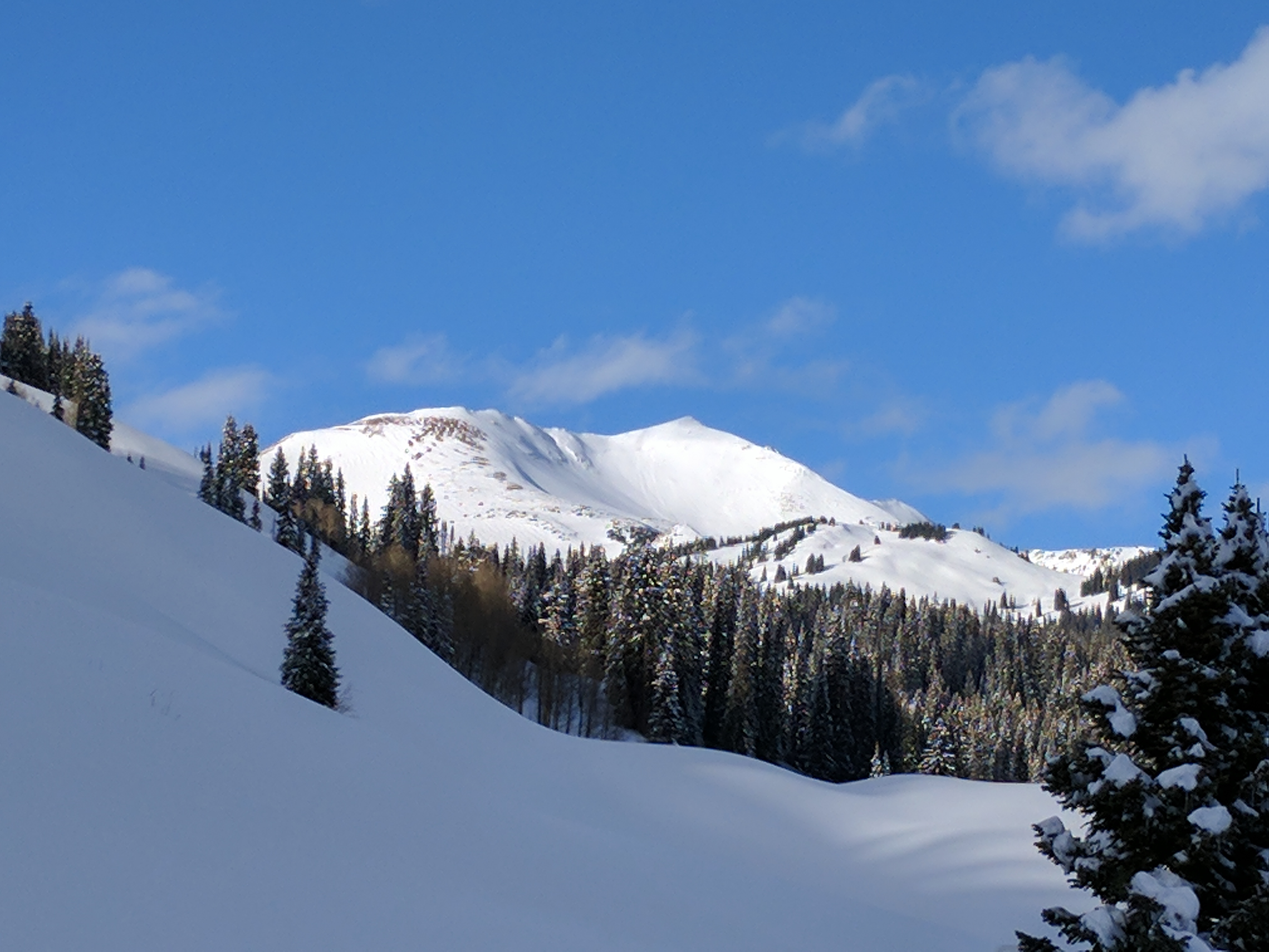
Aspect: North East, East
Elevation: 9800-10,900

Avalanches:
Weather: Overcast in AM to clear skies in PM, no new precip; light to moderate down valley wind in morning, calm in PM; cold, high recorded temp of -11ºC @ 10,000’ @ 13:00.
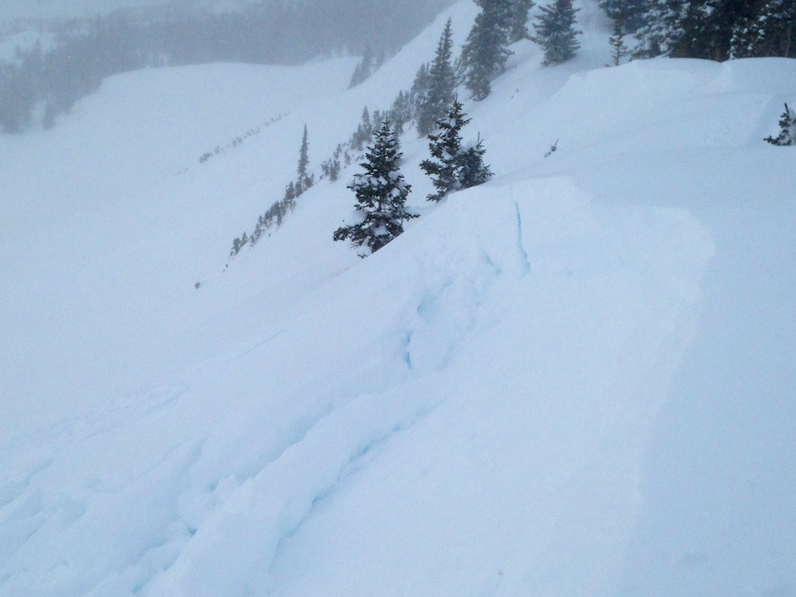
Snowpack: Ski pen of 10cm to 20cm for most of the day; upper 20cm to 40cm of the snowpack was a 4F wind slab. Compression tests and hand shears produced easy results, but an ECT didn’t propagate across the column. The upper part of the pack felt great under foot while touring, but you could feel the inconsistencies on the descent. We got one, short, shooting crack on a 32º slope, but otherwise so no obvious signs of instabilities. The interface between the new wind slab and the buried near surface facets was clear. With the cold temps, the surface of the snow appeared to be faceting in the late afternoon. I think this will heal this week, but it needs a couple days. (IMO).

Irwin

CB Avalanche Center2016-17 Observations

Location: Kebler Pass Area
Date of Observation: 12/25/2016
Name: Irwin Guides
Subject: Irwin
Aspect: East, South, West
Elevation: NTL/ATL

Avalanches: D1’s with ski cuts on everything steeper than 35 degrees failing 10-20cm’s deep on a storm instability, a couple small remote triggers. Paperboy route produced numerous size 1 storm slabs.
Weather: Obscured skies, Snowing S1, strong winds w/ extreme gusts from the WSW, High Gust 74mph. High temp 11F in the study plot 3F at Ridge Top. HST 12″ with 1.2″ SWE at 4pm. H2D’s at 20″ total at 4pm.
Snowpack: Cracking everywhere on the storm instability. I think the instability is when the storm increased in intensity early this morning but seemed to go away in the pm as ski cuts were not producing any cracks.

Mountain Weather 12/26/16

CB Avalanche CenterWeather

Date: 12/26/2016

Yesterday’s arrival of a cold front and westerly orographics really kicked off high snow accumulations in favored areas like the Ruby Range. While Crested Butte still did well, this was the first storm this season that delivered a large difference in snow accumulation like this as many of the previous storms have been on the southern track. This morning we remain in westerly flow with enough moisture upstream and a weak disturbance to our north, to continue seeing some light snow showers and clouds mostly in the mountains west of Crested Butte. Clouds should start decreasing by mid-day as we head into clear and dry weather for Tuesday. Winds will also ease today. The next storm will just brush northern Colorado starting Tuesday night. We’ll see increased winds and clouds and now snow accumulations this far south.

Fresh Windslabs

CB Avalanche Center2016-17 Observations

Location: Crested Butte Area, Mt Emmons
Date of Observation: 12/25/2016
Name: Evan Ross
Subject: Fresh Windslabs
Aspect: South East, South
Elevation: 9,200-11,800. BTL/NTL

Avalanches: Skier triggered a few small windslabs from ridgeline at NTL elevation. These slabs were about 8″ to 12″ thick at 3pm and continuing to build.
Weather: Oooo blustery. Strong down valley winds in the Kebler Pass corridor and strong to extreme westerly winds at higher elevations. Snowing, but couldn’t make a call on hourly rates with all the wind.
Snowpack: Late afternoon tour. Cross loaded slopes BTL, and would have managed them for potential windslabs up to 12″ thick. At NTL elevations recent wind loading was obvious with observed slabs also in the 12″ range on the few easterly slopes I traveled above. Quick observations didn’t reveal any persistent weak layers and avalanche obs didn’t show much for propagation in this area.

Small skier triggered windslab at NTL elevation on easterly aspect.

Small skier triggered windslab at NTL elevation on easterly aspect.

Wind loading at 9,500ft

Gothic 7 a.m. report

CB Avalanche Center2016-17 Observations

Location: Crested Butte Area
Date of Observation: 12/25/2016
Name: billy barr
Subject: Gothic 7 a.m. report
Aspect:
Elevation:

Avalanches: At 3:45 was skiing up valley when a saw a slide run out of the furthest north bowl on the east side of Gothic (my slide path 001 in case anyone kept that info). Ran down to near the river (an old size 3) but stopped as soon as terrain flattened out. Light was flat and I had no binoculars (or even my glasses) but I would assume a fracture out of the top of the bowl as it was windy up there much of the afternoon. Ran about 2600 feet. billy
Weather: Steady moderate to strong wind all night but with only light off and on blowing snow with a weak 1″ new and water 0.06″. Currently cloudy with very light snow and wind 5-10 gusting to 20. Snowpack at 43″.

12/24 Natural avalanche on northeastern aspect of Gothic Mountain

Mountain Weather 12/25/16

CB Avalanche CenterWeather

Date: 12/25/2016

There will be no reason to blow dry your hair after a shower this morning, as those strong winds will slick things back, dry you out and give you a nice Albert Einstein hairdo. A cold front is moving through our area early this morning bringing snow and strong winds. The surface cold front will move through our area today with cooler temperatures, as winds become westerly and fuel orographic snow showers in the mountains to our west today. A low pressure to our northeast will wrap moister back into Colorado and bring us continued snow showers this evening and into early Monday. Wind speeds will also stay elevated during this period. Skys will begin clearing Monday as drier air moves in on westerly flow. For the most part we’ll see relatively dry conditions next week, other than a disturbance that looks to impact Northern Colorado mid-week.

Italian Mountain Ridgeline

CB Avalanche Center2016-17 Observations, Snow Profiles

Location: Cement Creek Area
Date of Observation: 12/24/2016
Name: Ian Havlick
Subject: Italian Mountain Ridgeline
Aspect: North, South West, West, North West
Elevation: 9000-12200

Avalanches: Did not observe any fresh avalanche activity in Cement, Spring Creek, or visible surrounding peaks.
Weather: Beautiful sun, intense solar, temps 18-25ºF. SW winds increased to strong early afternoon, died a bit, but increasing again around 1600.
Snowpack: Much different story between below treeline and above TL. Relatively deep (100cm) snowpack near and below treeline, but with ascent into more wind prone areas, snow cover became much more variable and weak. A few booming collapses on 20º, SW facing slope ~11800ft.

Profile BTL, west facing did not produce any results for propagation (PST60/100end, basal facets, ECTX), but profile above treeline, SW facing slope held 1F slab over 4mm depth hoar, ECTP12 SC. Significant wind transport and sensitive windslabs up to 12″ deep forming on NE-E facing slopes and ridgelines.

**One concern for future is widespread 4-5mm surface hoar which developed overnight above delicate suncrust/temperature crust on E-S-W facing slopes. Was destroyed by sun and SW winds on southerly slopes, but east and west facing slopes should be monitored…Could be referred to as XMAS surface hoar event.

Slide19
Slide18
Slide17
IMG_0384

2 fresh slabs

CB Avalanche Center2016-17 Observations

Location: Kebler Pass Area
Date of Observation: 12/24/2016
Name: Zach Guy
Subject: 2 fresh slabs
Aspect: North, South, West
Elevation: 10,000-12,000 ft

Avalanches: A pair of 2-3 foot soft slabs ran naturally today on the north face of Ruby Peak, failing on old snow at the ground. SS-N-R1-D2-O/G. These paths had been wind scoured close to the ground during the 12/16 storm, so I would expect similar instabilities could be found on reloading bed surfaces above treeline. No other activity observed.
Weather: Mild temps, scattered clouds. Light to moderate SW winds at ridge top with minimal transport, but moderate to strong wind transport observed off of the peaks in the Ruby Range and Beckwiths. Minimal transport on Axtell and Carbon Peak.
Snowpack: On low angle southerly aspects below treeline, the snow surface was 2-4 mm surface hoar over a thin, soft crust mid day. On westerly aspects, 1 mm near surface facets. Snow surface snow surface was becoming moist on these aspects by the afternoon, and it appears that these PWL’s got cooked into a crust by the end of the day (with very small facets above) at lower elevations, and got raked by winds at higher elevations.

2-4 mm surface hoar, low angle southerly aspects.
Fresh slides to the ground

Mountain Weather

CB Avalanche CenterWeather

Date: 12/24/2016

A white Christmas is in store for Crested Butte! Today, winds and clouds increase ahead of a low-pressure trough that is currently deepening over the California coast. Good dynamics on the front end of the trough will spark relatively warm snowfall beginning around sunset today. A clatter will arise late tonight, but you’ll have decide for yourself whether that is the cold front and associated powerful winds slamming into your house or something else… Snowfall continues through Christmas Day, with cold air filling in behind the front. We should see 6-8″ in town and twice that in the favored western parts of the zone by Sunday evening.

Natural activity on Baldy and Gothic

CB Avalanche Center2016-17 Observations

Location: Crested Butte Area
Date of Observation: 12/23/2016
Name: Jafar Tabaian
Subject: Natural activity on Baldy and Gothic
Aspect:
Elevation:

Avalanches: Activity on baldy and gothic. Natural, maybe wet loose?
Weather:
Snowpack:

IMG_20161223_143858
Burst_Cover_GIF_Action_20161223143900
IMG_20161223_143913