Florida of the Rockies

CB Avalanche CenterCBAC Observations

Date of Observation: 12/03/2021
Name: billy barr

Zone: Southeast Mountains
Route Description: Gothic

Observed avalanche activity: Yes
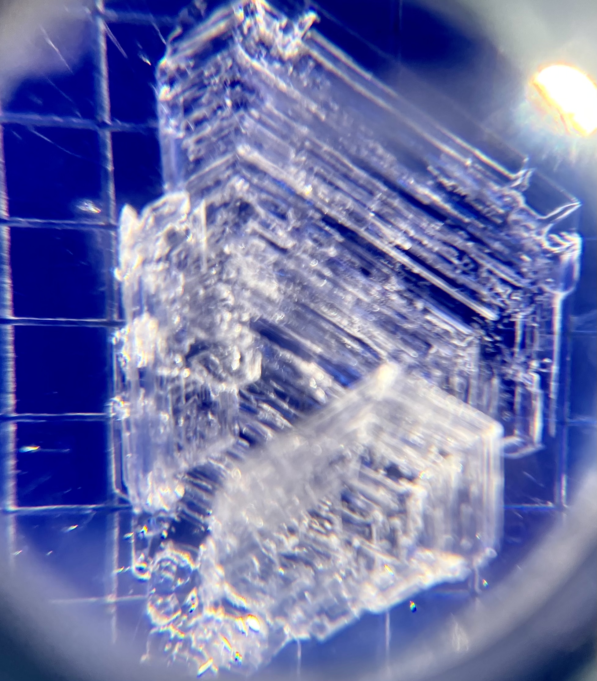
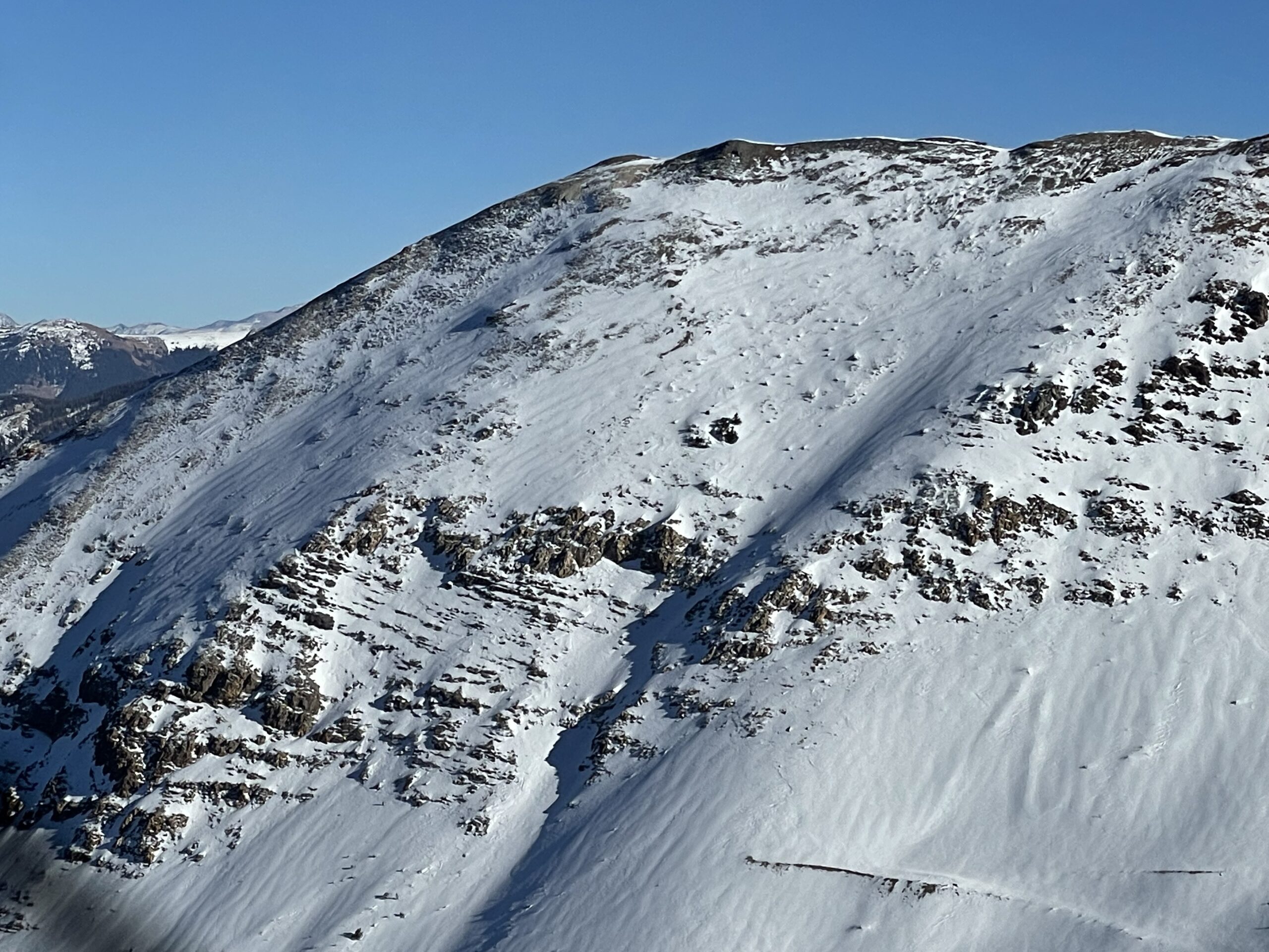
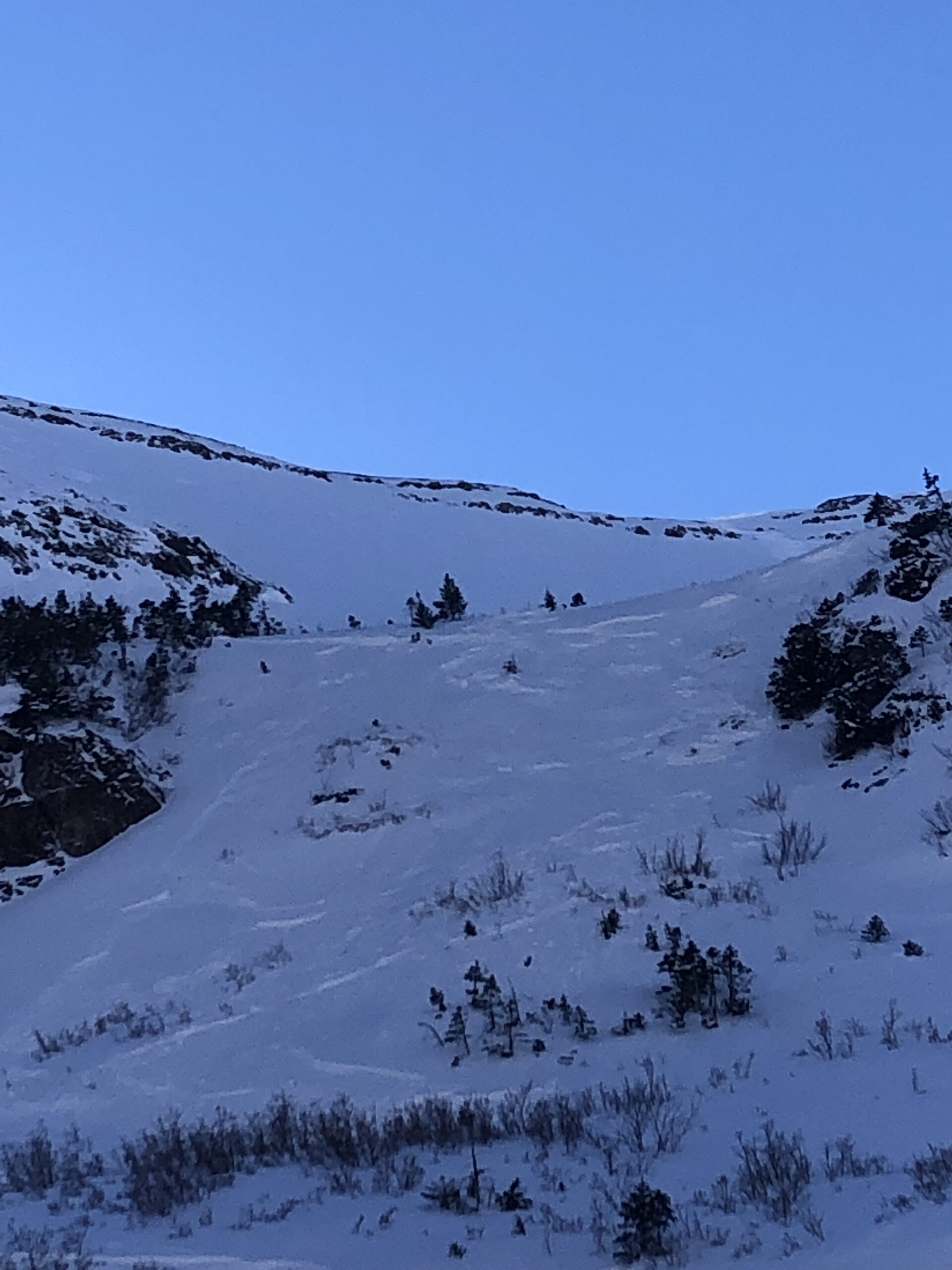
Avalanches: There was a slab release, looks like a 1 foot fracture that went nowhere, on the ESE facing end of Gothic Mountain a few days back but too small to get any photo of and only visible in the early morning sun.
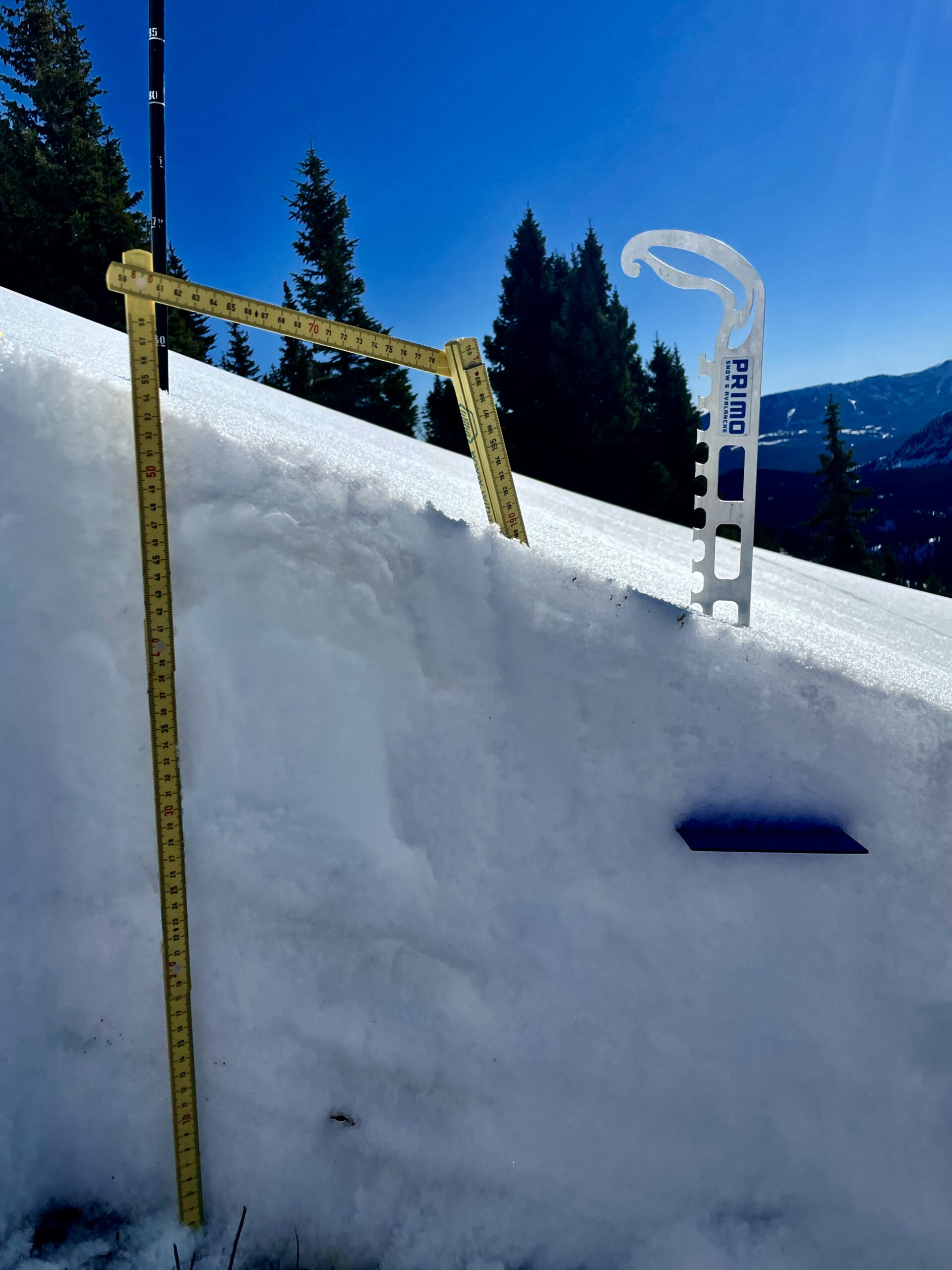
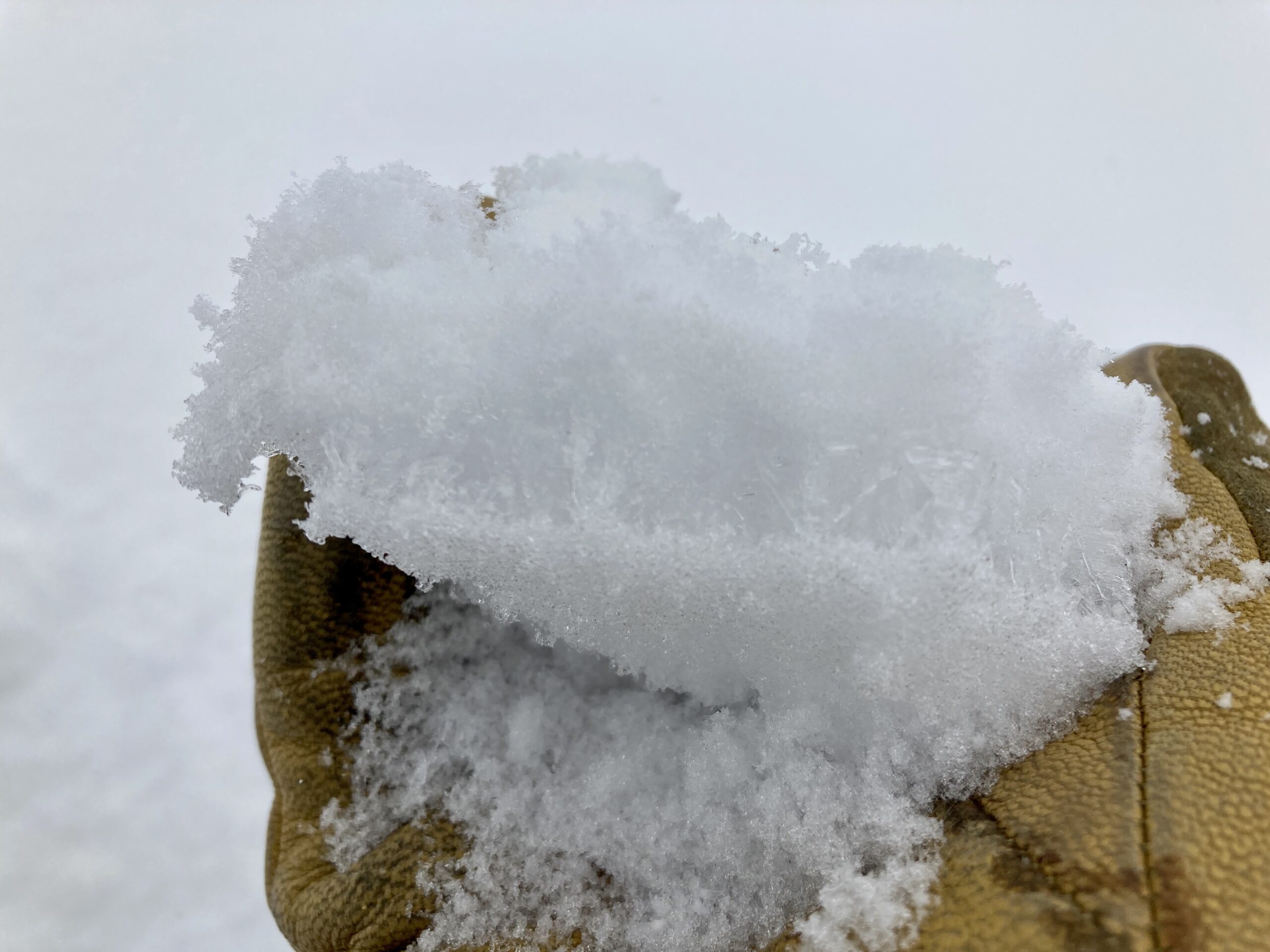
Weather: In 4 of the past 5 days there has been a record high temperature, including beating the old record yesterday by a whopping 3½ºC. Everyday since November 28 has set a record for the shallowest snowpack for those dates and this will continue until we get a few inches of snow. Currently there is 1″ on the ground (with this little snow that amount is an average of the snow depth in a given area around the snow pole, though actually this is what is at the pole right now). Yesterday’s high was 55ºF and it has been at 50º or warmer the past 4 days and 47ºF or warmer for the past week. (note that these temperatures may seem too high but i have multiple temperature devices to make certain these numbers are accurate). This winter now has the least amount of snowfall to date of any winter of the past 48 years- not, however, the least amount of SWE given the high density of snowfall.

5044

Elk Basin

CB Avalanche CenterCBAC Observations

Date of Observation: 12/02/2021
Name: Eric Roberts

Zone: Northwest Mountains
Route Description: 11:00-15:45
Toured Elk Creek towards Scarp Ridgeline to assess snow instability and coverage before potential storm pulse moves in next week.
Descended same route with spring-like surface conditions back to Kebler Rd.
Sunny, warm day with no alarming results.

Observed avalanche activity: No
Avalanches:
Weather: CLR
Calm winds BTL-NTL, with light W wind near ridgeline 12,000’+.
36F @ 9,400’ (11:00)
42°F @ 11,850’ (13:30)
No Precipitation
No riming observed
Snowpack: Snow Surface: 2-12mm surface hoar feathers 9,800’-10,800 in sheltered terrain.
Roller balls present at 11:30 on Southerly aspects
Widespread moist surfaces with a 2-3cm thick MFcr above unsupportive wind stiffened snow and/or NSFs @ 11,000+ in non-shaded areas.

Ski/boot pen: 15cm/ 5-30cm

Overall, the snowpack is sporadic and terrain/aspect dependent, specifically NW-NE aspects harboring 10-65cm with an upside-down structure.
Test results showed poor structure, moderate, strength and low propagation propensity due to inconsistent slab layering and continuity.
Most wind sheltered areas do not have a slab component, mainly unsupportive and cohesionless facets making up the bulk of the pack. Areas where a slab recipe is found are wind-packed slopes, leeward slopes and ridge lines where assessing for overhead hazard could mitigate exposure.

Photos:

5042

Grimsby on southwest aspects

CB Avalanche CenterCBAC Observations

Date of Observation: 11/30/2021
Name: Than Acuff and Zach Guy

Zone: Southeast Mountains
Route Description: Traveled on southwest aspects below treeline near Mt. Crested Butte

Observed avalanche activity: No
Snowpack: Skied in steep avalanche terrain and saw no signs of instability. Mostly just dirt and sagebrush.

5040

Gothic 7am Weather Report

CB Avalanche CenterCBAC Observations

Date of Observation: 11/24/2021
Name: billy barr

Zone: Southeast Mountains

Weather: Overcast and mild all night with a steady but light snowfall. There is 3″ new snow ( (just slightly under at 7 cm) with 0.25″ of water and no wind. Snowpack is that 3″. Snow let up for a bit but seems to be starting again. Yesterday’s high was 44ºF and today’s low, and current, 25ºF.

Elk Basin Pre-storm

CB Avalanche CenterCBAC Observations

Date of Observation: 11/23/2021
Name: Eric Roberts

Zone: Northwest Mountains
Route Description: 11:00-14:20
Toured up Elk Creek to ridgeline of Elk Basin to assess coverage and instability before storm moves in.Sky cover deteriorated and winds picked up around 12:30 with light precipitation moving in from the NW. No test pits were done, and I skied back on the skin track with some fresh turns.

Observed avalanche activity: No
Avalanches:
Weather: SCT->BKN->OVC by 12:30pm
Light to Moderate NNW winds increasing to consistent moderate SW winds with sporadic strong gusts.
36°F @ 9,400′
31°F @ 11,000′
S-1@13:00, S1 @13:30 (12,000′)
No riming observed
Snowpack: Overall, the snowpack is inconsistent and terrain/aspect dependent which has been the trend. No tests were conducted but snowpack in sheltered and exposed terrain shows poor structure.
Most wind sheltered areas do not have a slab component with unsupportive and cohesionless facets making up the bulk of the snowpack.
As the winds picked up, active transport was visible with plenty of low-density snow available for this storm to throw around.
The surface hoar observed from 9,800′-11,500′ will be tomorrows potential weak layer if there is enough accumulation from this pulse.
Where surface hoar isn’t present, 1-4″ of fresh or wind stiffened snow exists over a 1-2cm MFcr 10,000′ and up.

Photos:

5023

Mount Baldy East Basin

CB Avalanche CenterCBAC Observations

Date of Observation: 11/22/2021
Name: Eric Roberts, J. Caprio, W. Gilliam

Zone: Northwest Mountains
Route Description: 08:45-15:00
Our group of three toured from Schofield Pass Road near Friends Lake to our high point of 12, 400 in the East Basin of Mount Baldy.
We conducted test pits above treeline with results showing poor stability overall and false stable conditions. Great skiing conditions overall on North-East aspects as we descended near our skin track with no incidents. Beautiful day!

Observed avalanche activity: No
Avalanches:
Weather: Clear
Calm
31°F @ 11,375′ (10:30)
No Precipitation
Snowpack: Snow Surface:
10,500′-11,500′ :20-40cm with wind kissed surface with NSF up to 10cm below surface. Wind slabs are present 10-15cm below surface in exposed terrain. There is a Melt-freeze crust/facet combo on ENE aspects approximately 15cm below surface.
11,500′-12,400′: 1-4″ of Fresh low density snow in sheltered areas ranging to unsupportive wind stiffened surfaces with HS 40-120cm.

Overall, our focus was to assess the SE zone and look for slab formation above treeline.
Instability tests at 11,375′ showed results of low-moderate strength with propagation potential, but there is evidence of false stable conditions.
Compression tests showed sudden results, at the base (120cm), despite the moderate results.
ECT’s varied in propagation potential, but more alarming is once again the fracture character of a sudden collapse at the base, despite the high results.
The upper snowpack in this location is complex and variable and the 1F-4F wind slab(20cm down) is potentially bridging the deeper, weaker snow. Time, warmer temps, shallow terrain and additional loads will potentially allow one to penetrate these layers.
A temperature gradient is present in the upper snowpack. 0-20cm below surface.
Surface hoar feathers 1-3mm were observed in the north facing treeline between 10,000′-10,600′.

Photos:

5019

Small windslsb

CB Avalanche CenterCBAC Observations

Date of Observation: 11/21/2021
Name: Sam Lesnikoski

Zone: Northwest Mountains
Route Description: Near purple palace

Observed avalanche activity: Yes
Avalanches: Skier triggered small wind slab that ran predominantly in storm snow on easterly facing crust on our exit. Had we been above more serious terrain consequences would have been heightened.
Weather: Sunny and warm
Snowpack: Around five inches new on top of a pile of facets and and a variably distributed sun crust on solar aspects.

Photos:

5018

4”!

CB Avalanche CenterCBAC Observations

Date of Observation: 11/20/2021
Name: Jack Caprio

Zone: Northwest Mountains
Route Description: Purple Ridge

Observed avalanche activity: Yes
Avalanches: Small D .5 dry loose sluffing in steep north aspects.
Weather: Overcast all day. Intermittent periods of S-1 snowfall. Around 3 pm, precipitation rate increased to consistent S1.
Snowpack: About an inch of new snow this morning at the valley bottom. Above 12,000’ there was about 3-4 inches of fresh snow. New snow was reactive on steep slopes producing sluff on every turn. The sluffs ran the length of the slope but did not gouge into the rest of the snowpack. The snowpack on north facing terrain was very weak top to bottom, without a slab. East facing terrain in this area had a thin breaker crust below the new snow, making for punchy conditions.

5016

Ruby Range buried SH

CB Avalanche CenterCBAC Observations

Date of Observation: 11/19/2021
Name: Evan Ross

Zone: Northwest Mountains
Route Description: Mt Owen

Observed avalanche activity: No
Avalanches: No recent avalanche, just the old stuff from a week ago.
Weather: Overcast sky. Trace of new snow, maybe a 1/4 inch! We mostly encountered calm winds, but there were some strong looking gusts blowing through the wind tunnels like near Green Lake.
Snowpack: The most notable observation was finding buried surface hoar from today’s snow. First happened to notice at about 12,500ft on a steep NE facing slope. The SH at that spot was 1cm tall under the trace of new snow. Continued to find the SH up to the ridgeline, and didn’t check on the decent. The SH was sitting on top of NSF, junk on junk.

Nothing notable to talk about below about 11,500ft. At those lower elevations the snowpack was shallow, but thankfully still supportable to keep the skis off the ground.

Above that elevation the snowpack continued to grow in depth and provided some surprisingly nice and soft ski turns. The best travel advice was keeping an eye out for those old thicker snow drifts, on northerly and easterly facing slopes, where maybe you could collapse a slab into weak snow below as you transitioned from the fatter snowpack to a thinner snowpack. In the end we didn’t find something that we chose to avoid. Feeling snow structure with a ski pole through the terrain didn’t show a consistent strong over week layering or significant, abrupt changes in hardness between those layers. Any thin interfaces would have been missed. Boot pen was around 35cm and ski pen averaging around 10 to 15cm.

Photos:

5014