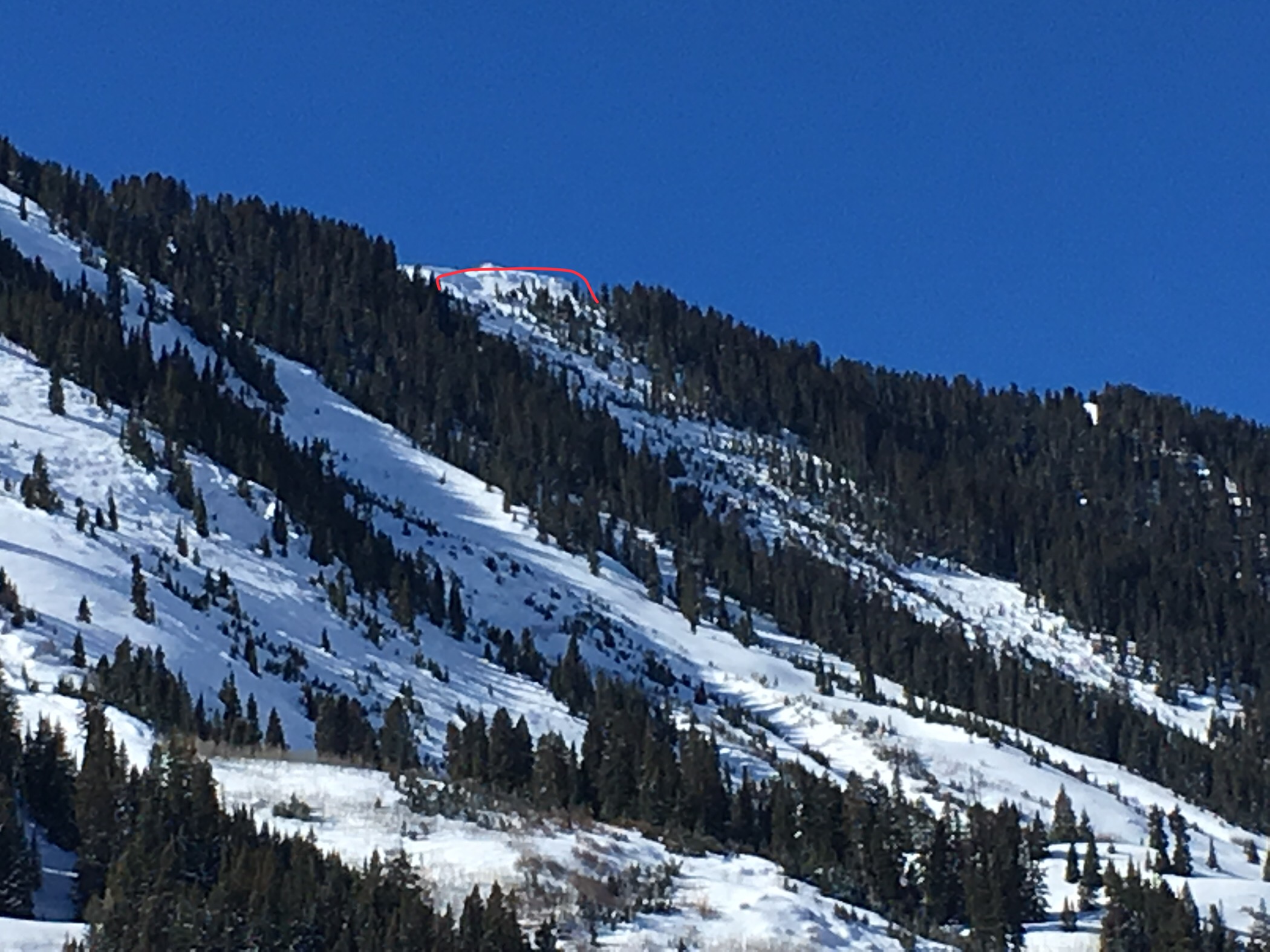
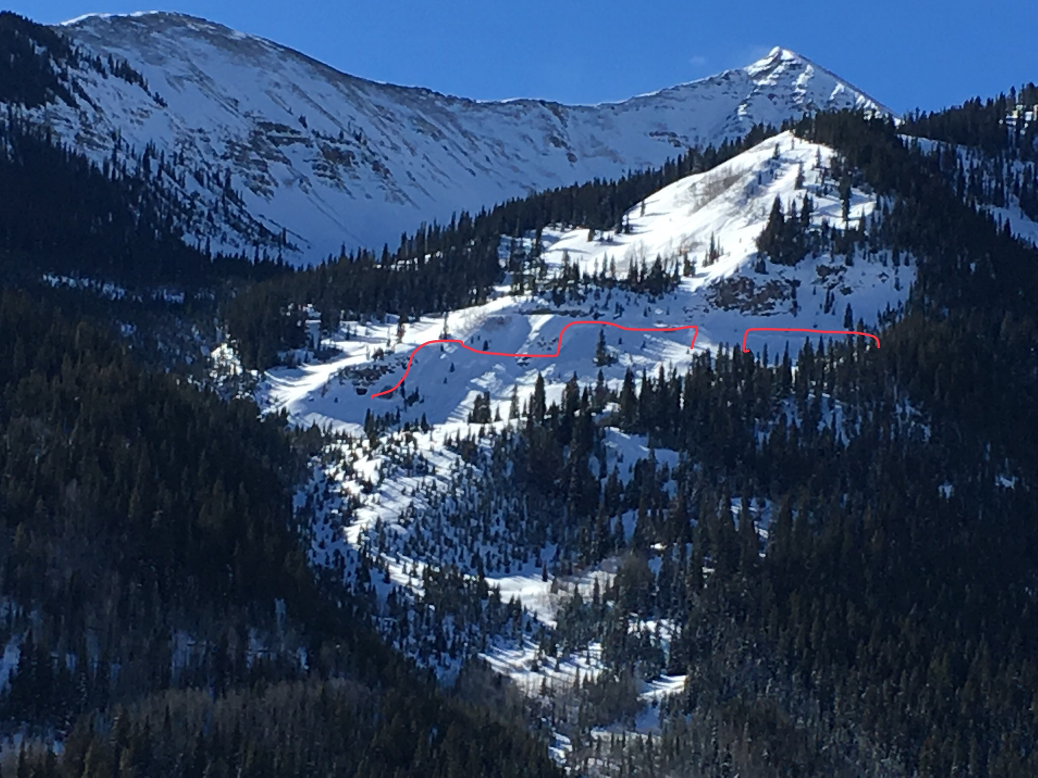
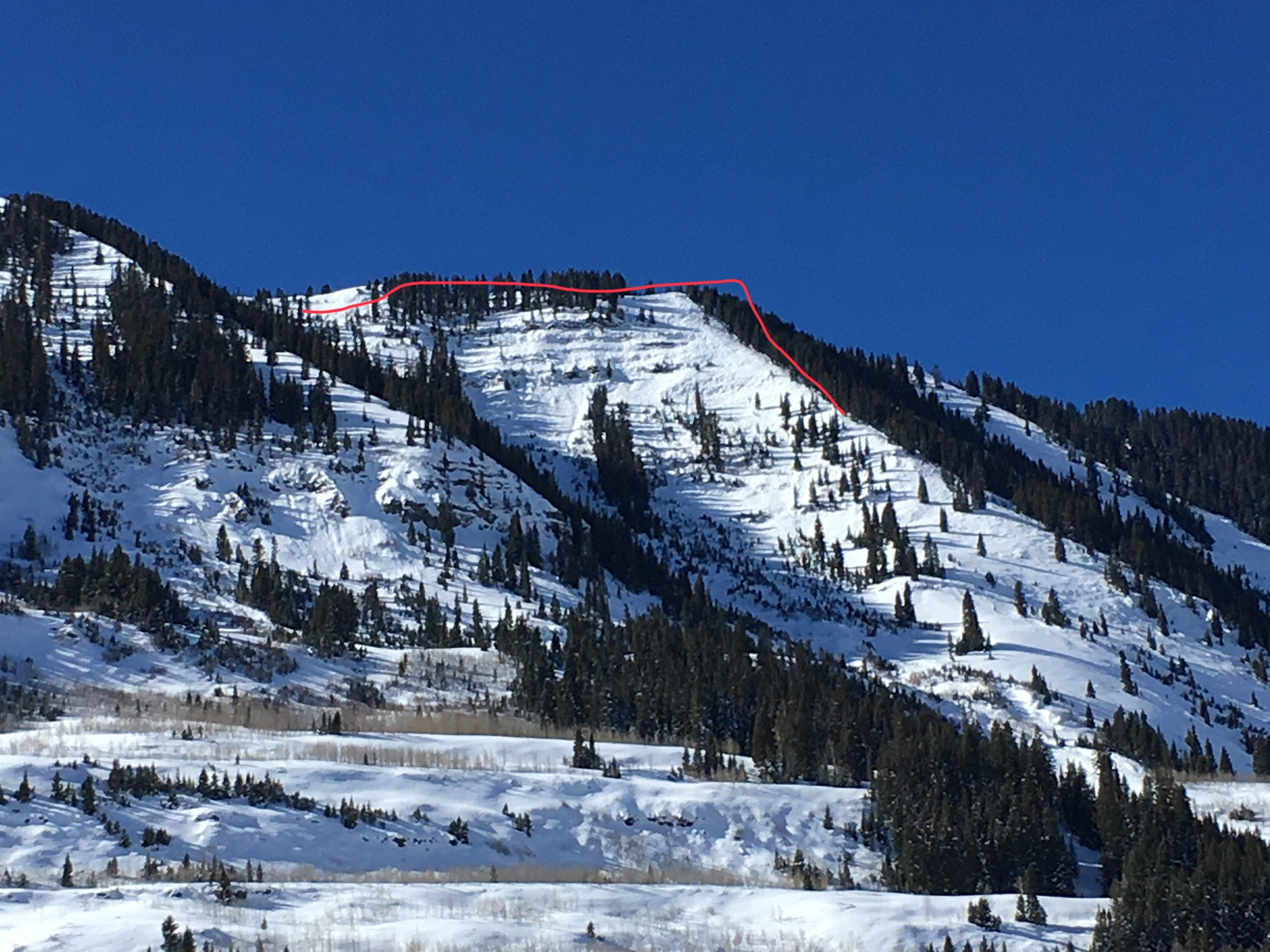
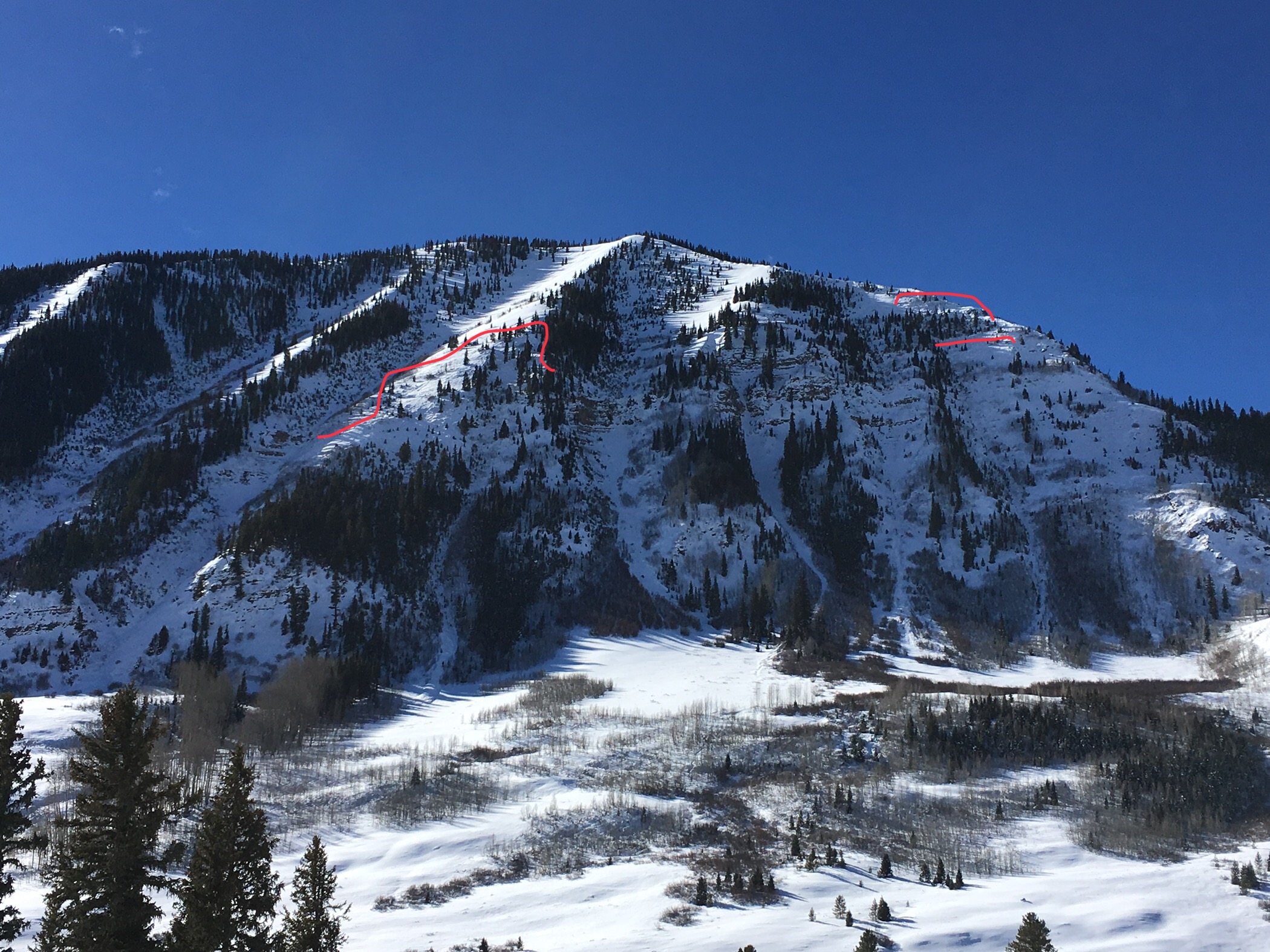
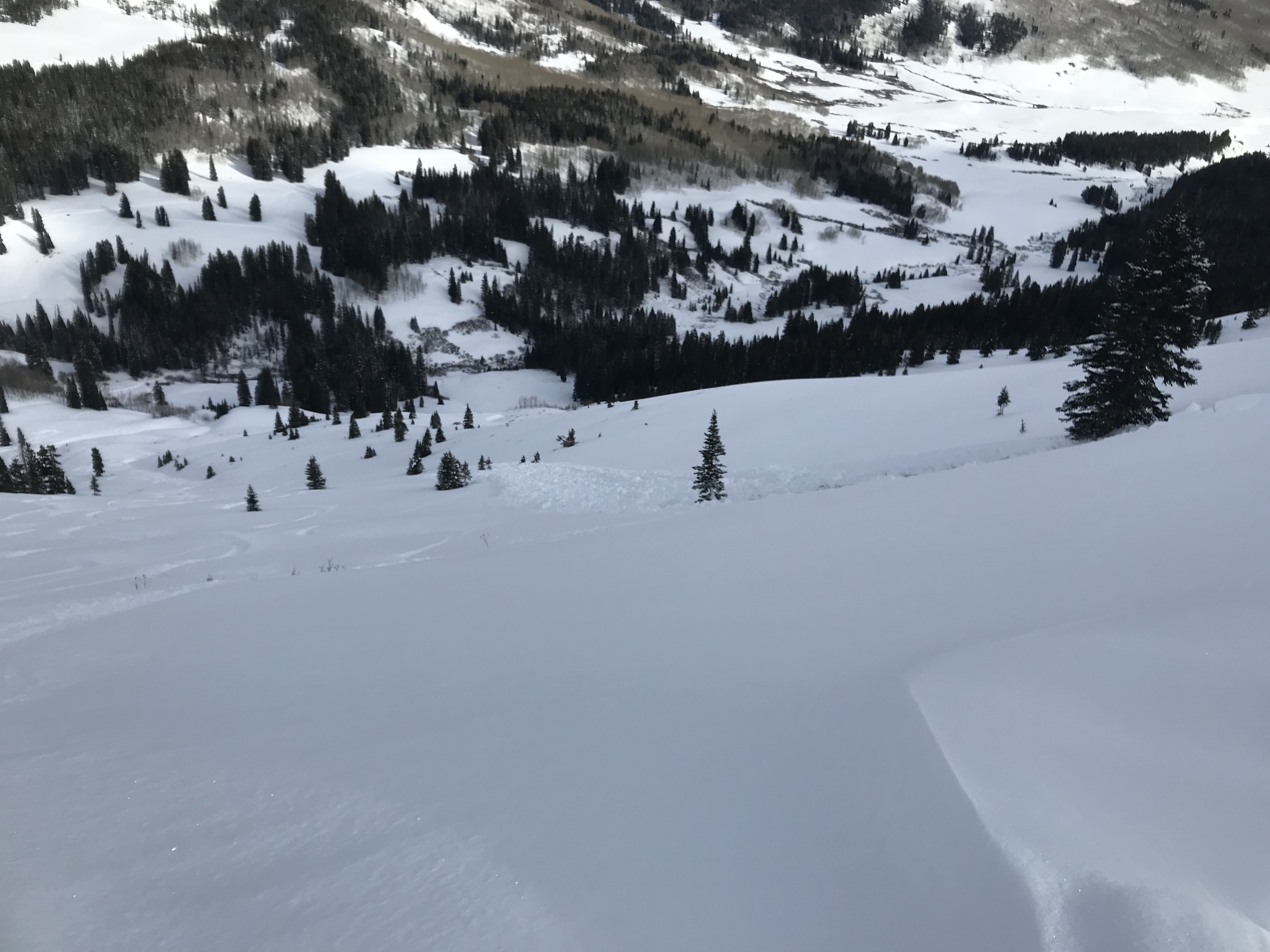
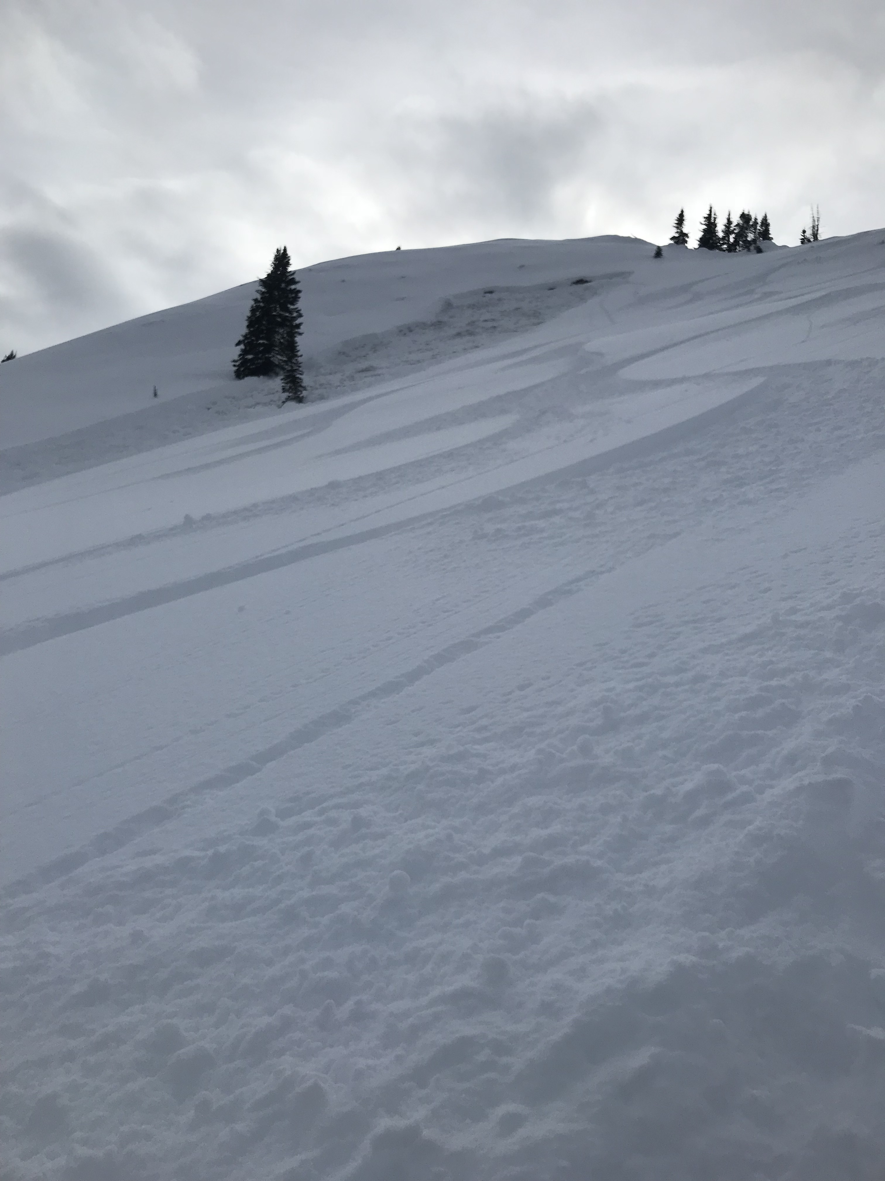
Location: Crested Butte Area
Date of Observation: 01/15/2018
Name: Eric Murrow
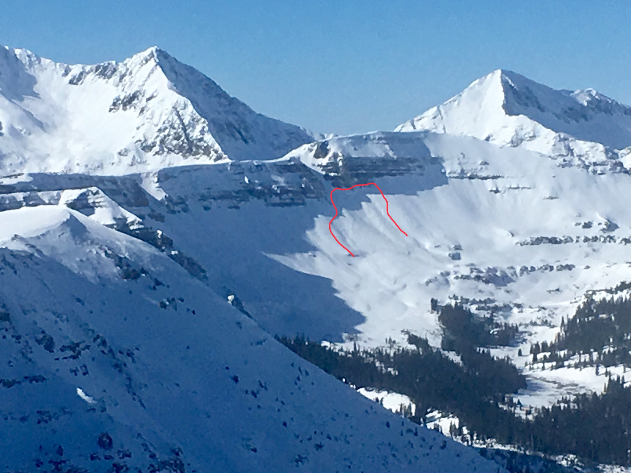
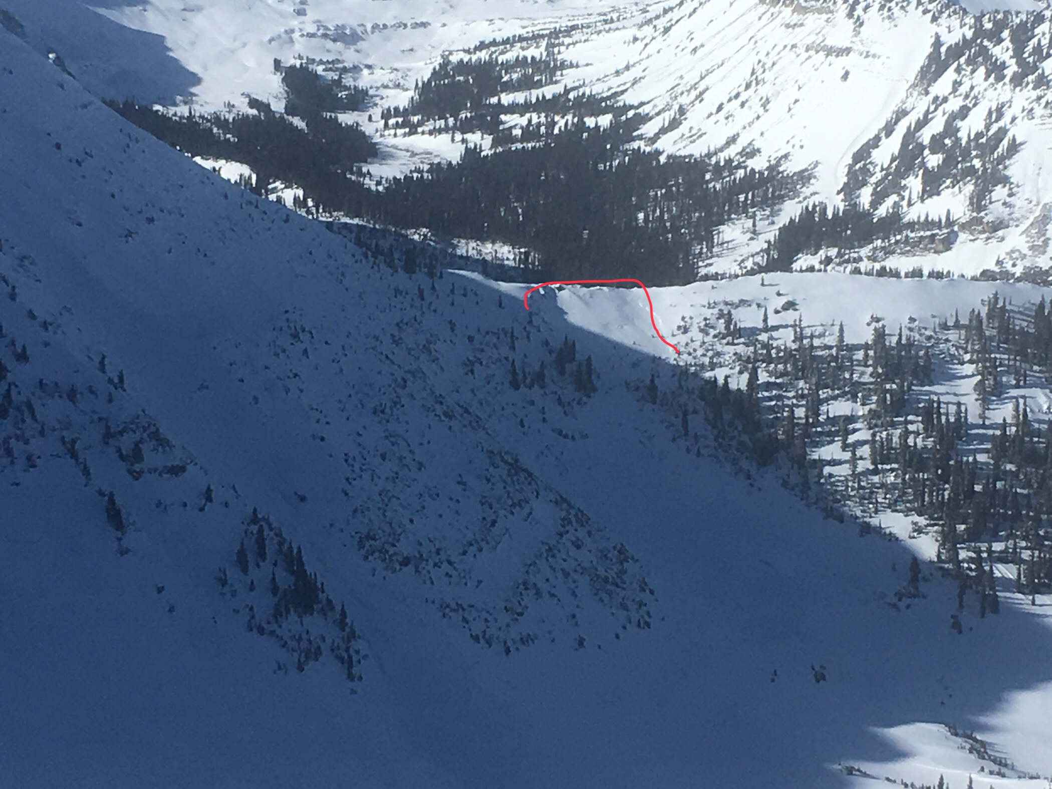
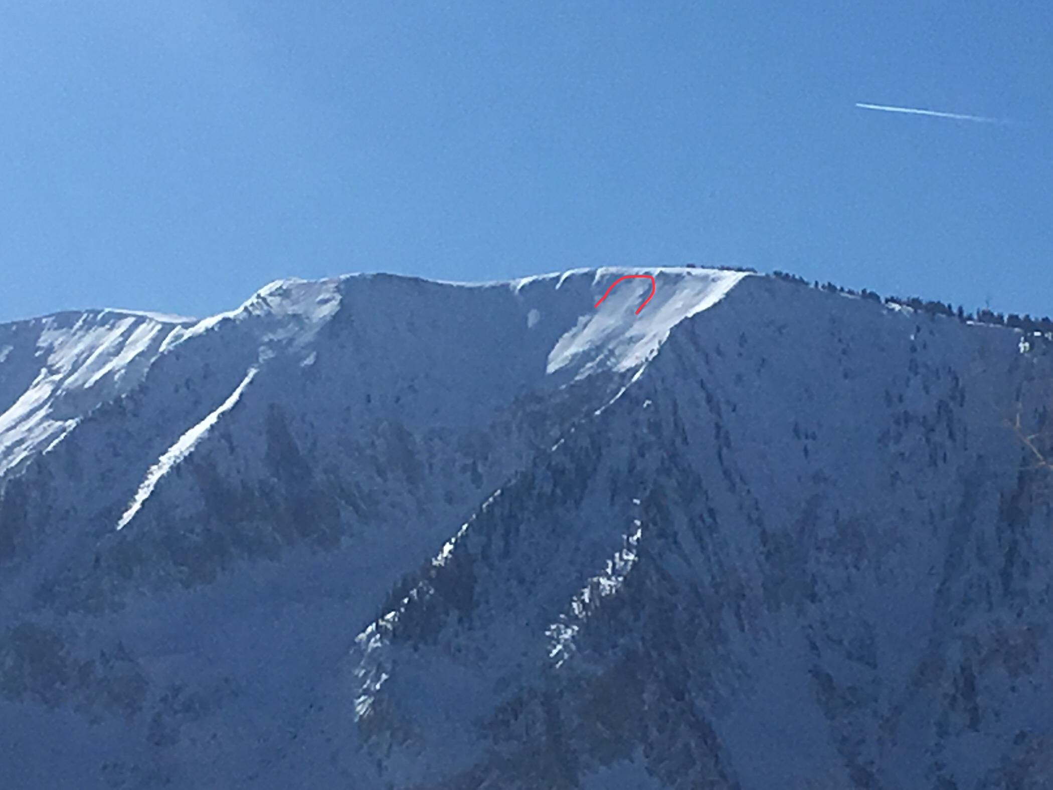
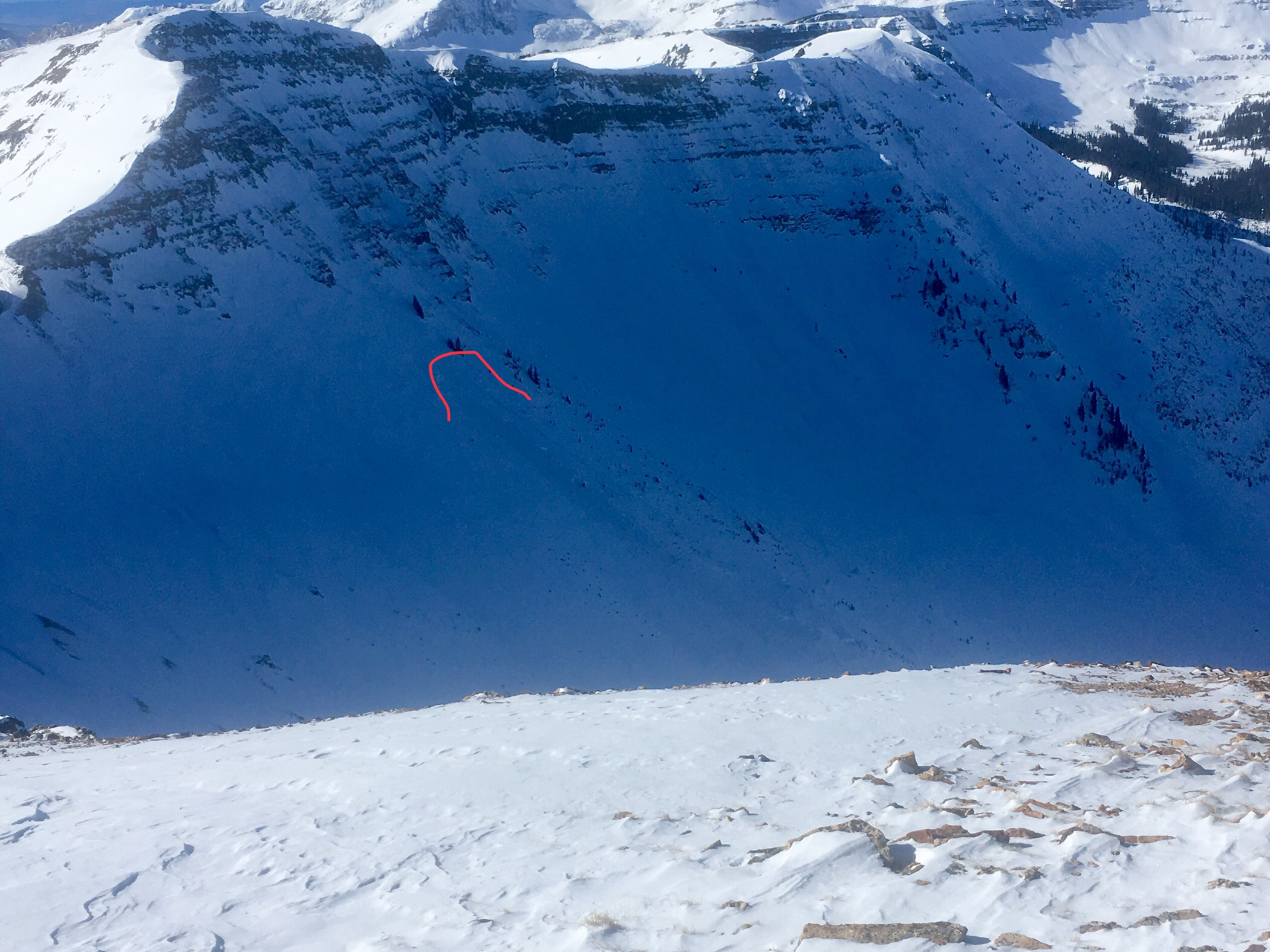
Subject: Lower Slate River avalanche photos
Aspect: North, North East, East
Elevation: Views from valley bottom
Avalanches:
Went out slate to take stock of avalanches from last cycle. There were numerous slides present on Climax, lower Wolverine Basin road cuts, and Schuylkill Ridge. I travelled through the valley last on Friday around 2pm; visibility was slightly obscured at the time but reasonable. I believe a good chunk of the slides in photos occurred after Friday, 2pm.
Weather: Clear day with what felt like strong radiation. Winds were lightly gusting a valley bottom. Blowing snow was occasionally present at most exposed alpine locations, loading on to south and east aspects.
Snowpack:
Photos: