

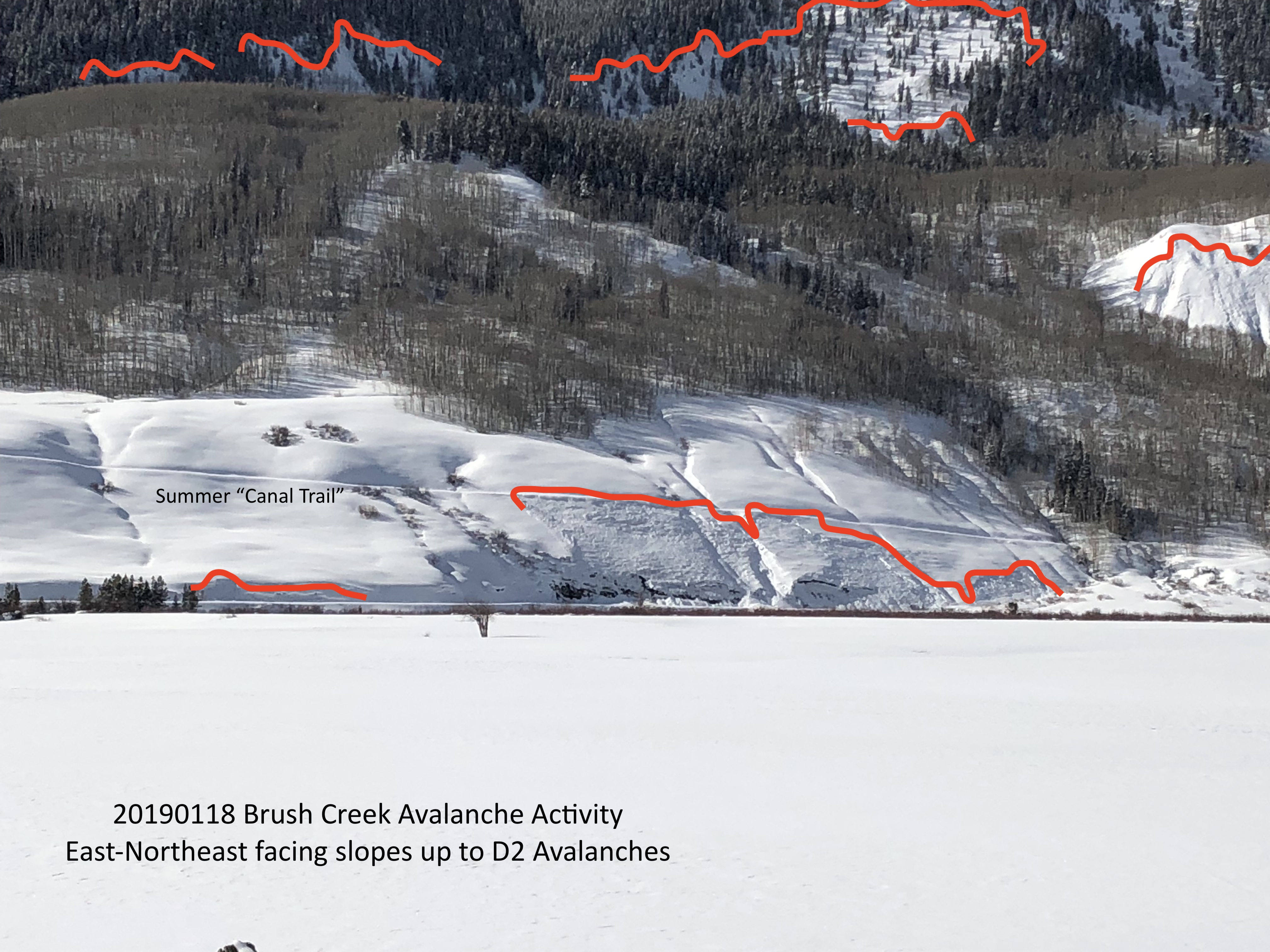
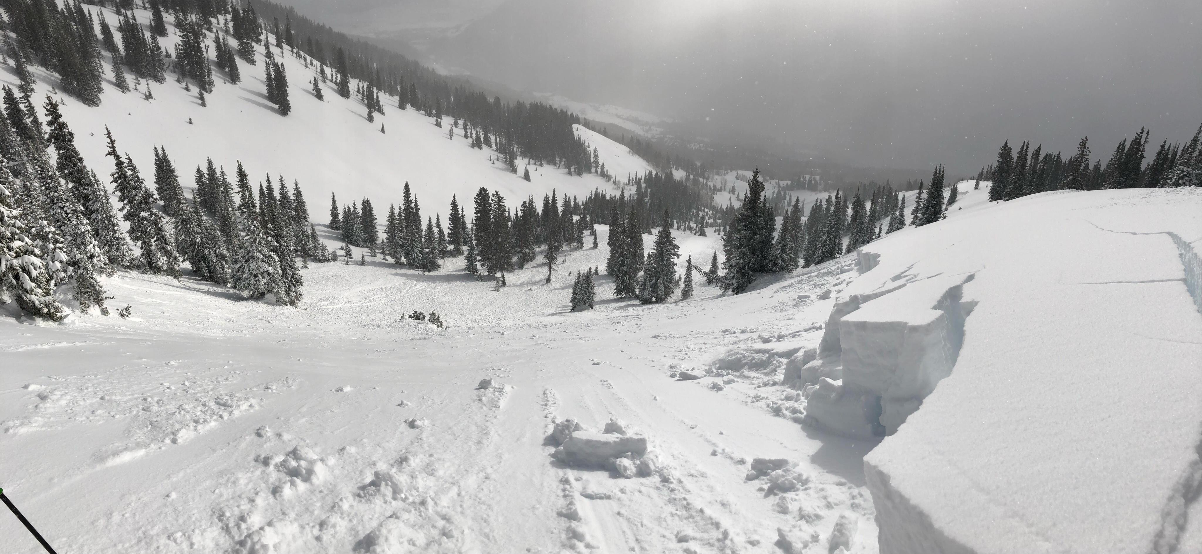
Location: Brush Creek Area
Date of Observation: 01/19/201
Name: Frank
Subject: Brush Creek Avalanches
Aspect: North East, East
Elevation: 9000
Avalanches:
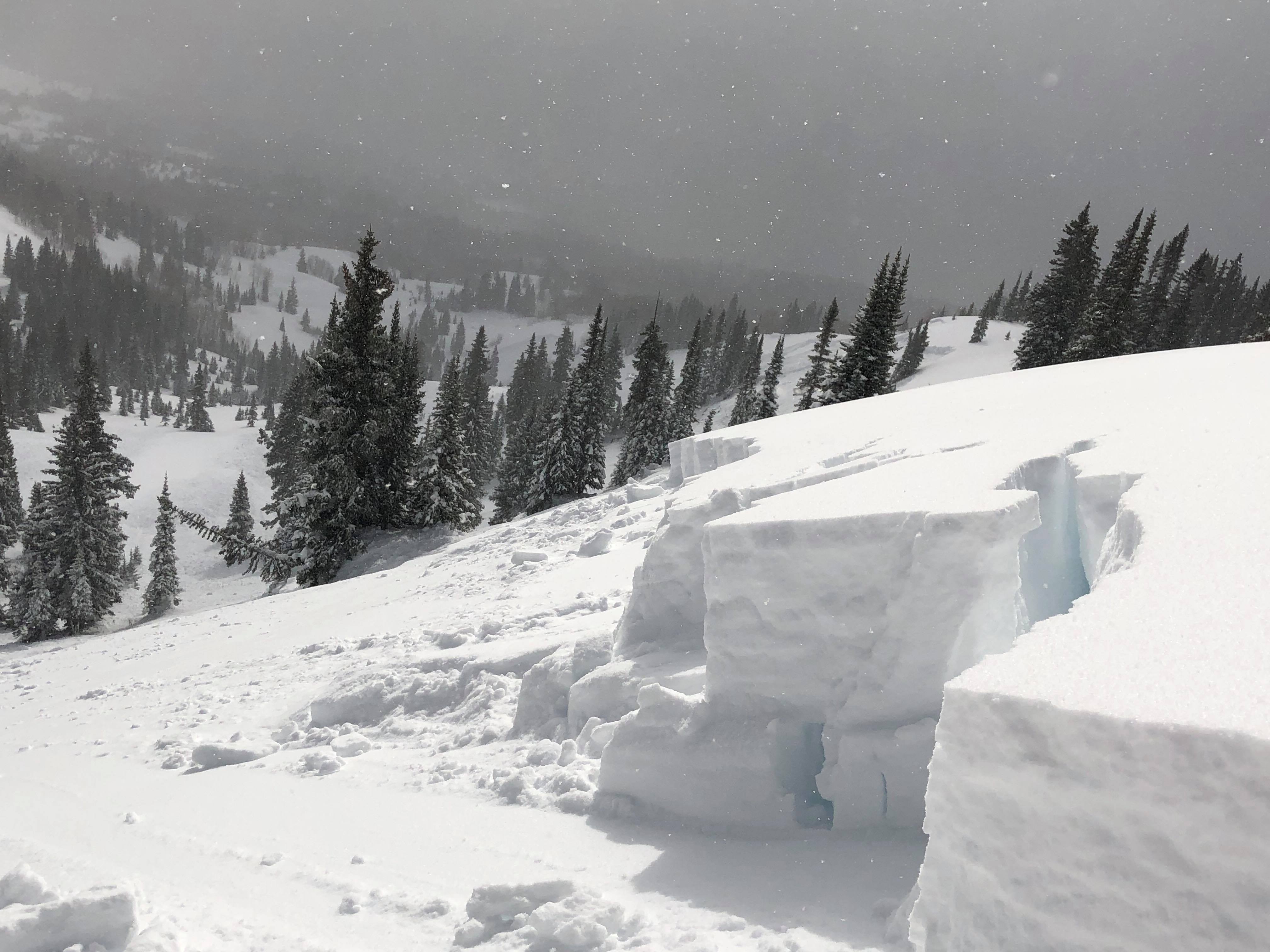
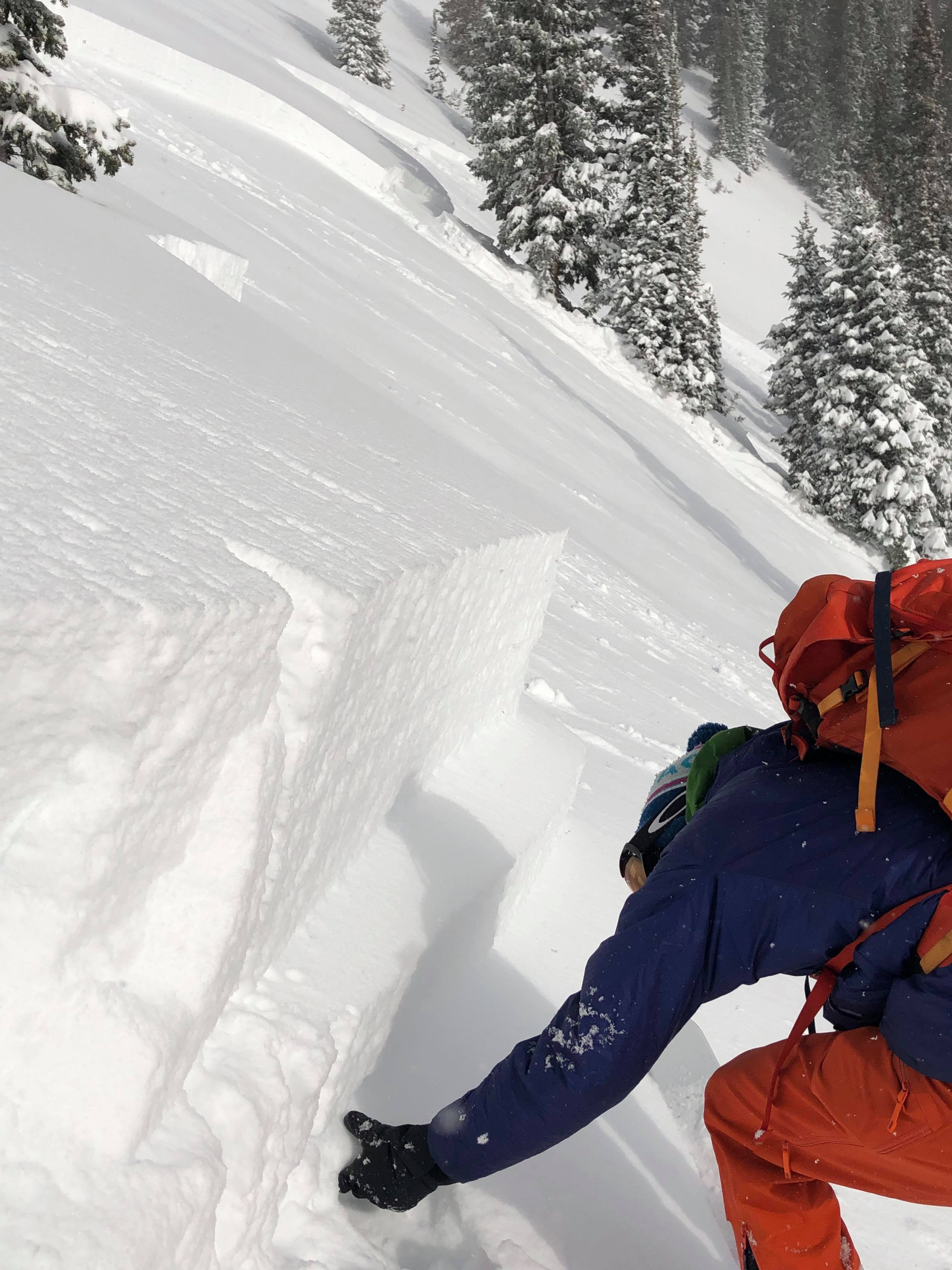
Several avalanche D0.5-1, NE and E aspect.
Weather:
Snowpack:
Photos:
Location: Brush Creek Area
Date of Observation: 01/19/201
Name: Frank
Subject: Brush Creek Avalanches
Aspect: North East, East
Elevation: 9000
Avalanches:
Several avalanche D0.5-1, NE and E aspect.
Weather:
Snowpack:
Photos:
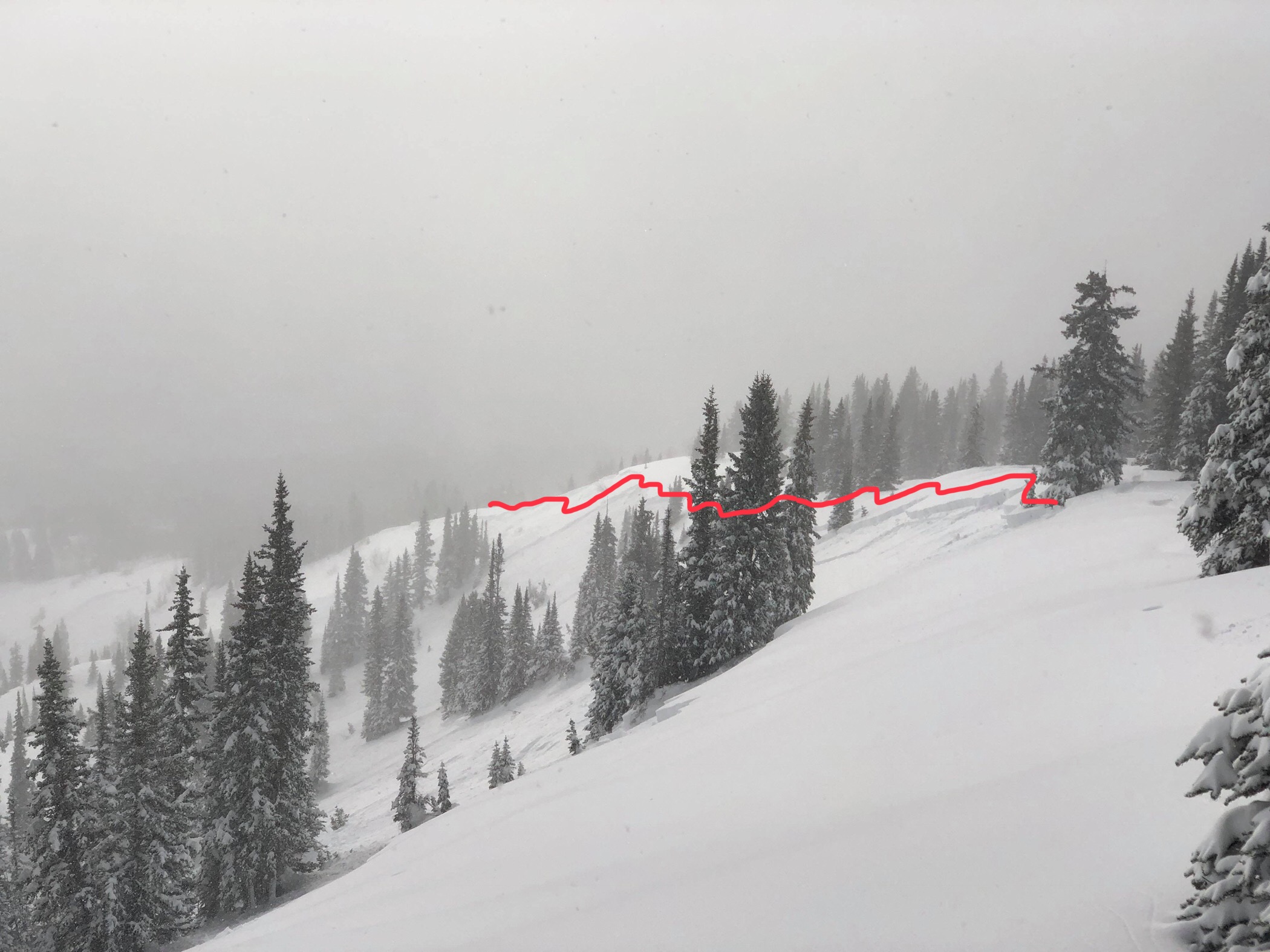
Location: Crested Butte Area
Date of Observation: 01/19/2019
Name: ADB
Subject: Mt. Emmons Red Lady Glades
Aspect: South East, South
Elevation: BTL/NTL/ATL
Avalanches:
Scarp Ridge: SE/E aspect-during the past snow storm, SS-N-R2-D2.
Weather: BTL: Warm temperatures and mostly calm.
ATL/NTL: Cold temperatures with moderate winds blowing snow . Some snow transport into SE aspects of Red lady Bowl. Snow was being blown in different directions. Other surrounding peaks such as Axtell and Whetstone had snow being blown from ridges.
Sky: Few to Scattered clouds.
Snowpack: skin track is well established and remained on the track. no cracking; whumping; or collapsing.
Photos:
Location: Crested Butte Area
Date of Observation: 01/19/2019
Name: Obs from Gothic road
Subject:
Aspect: North East, East, West, North West
Elevation:
Avalanches:
Surprisingly little natural activity on NE aspects of snodgrass. Just 1 small slide on the middle pitch on 3rd bowl. A small slide propagated about 1000’ underneath gothic road about a mile from the gothic trailhead. Some larger natural activity on the other side of the valley on Red Rock and WSC.
Weather:
Snowpack:
Photos:
Location: Crested Butte Area
Date of Observation: 01/19/2019
Name: Cam
Subject: Naturals all over. + still occurring?
Aspect:
Elevation:
Avalanches:
Natural Avalanches in Redwell in steep N facing terrain, and fairly certain one slid on a NE aspect in the morning of the 19th between 8 and 10 a.m. All d1 to 1.5 appearing to fail in storm snow. Also several slides of a similar size on E and SE further down the basin. Large avalanche over on the Ruby/Owen saddle.
Weather: Clear and relatively calm up high. Winds felt 15-20 mph at most, leading to some transport. It looked like winds were howling on a few nearby peaks.
Snowpack: No signs of instability noticed while skiing some nice low angle pow
Photos:
Location: Crested Butte Area
Date of Observation: 01/18/2019
Name: Alfred P.
Subject: Washington Gulch
Aspect: East
Elevation: 9400
Avalanches:
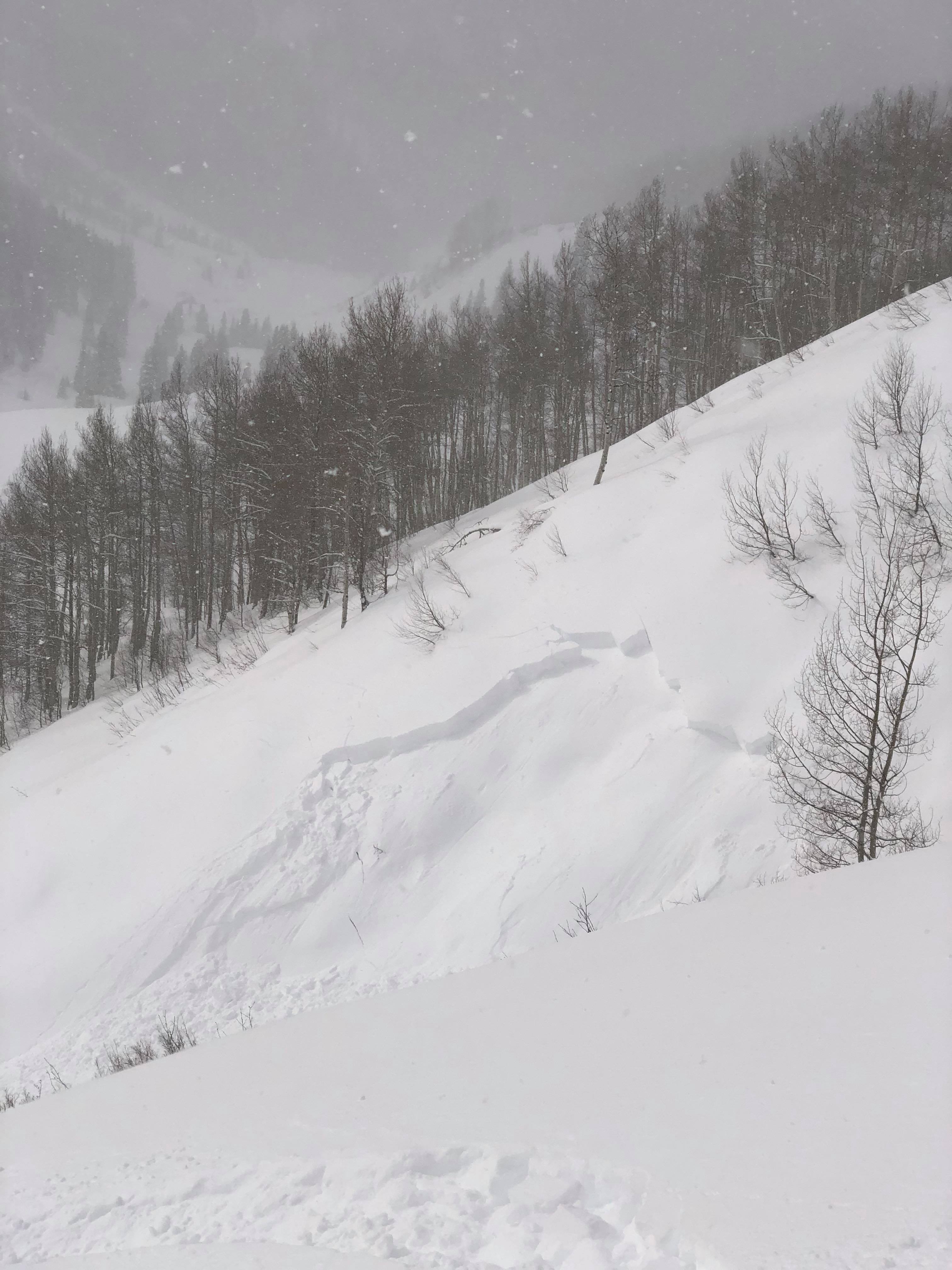
Avalanche 01/18/2019; Washington Gulch, Pristine Point; naturally triggered
Weather:
Snowpack:
Photos:
Location: Paradise Divide Area
Date of Observation: 01/19/2019
Name: Zach Kinler
Subject: Weekly Weather/Snowpack Summary
Date: 01/19/2019
Cold, dry northwest flow kept stubborn orographic flurries into the night, but dawn is breaking clear and we should be treated to a perfect mid January day in the high Rockies. Light northwest winds should be on the decline, and temperatures should rise into the mid 20s. Enjoy the dry weather this weekend, as we look to have another system rolling into the Elk Mountains on Monday afternoon. Nothing as big as our last few storms, but the area mountains should squeeze some more measurable precipitation out by Tuesday.
High Temperature: 25-30
Winds/Direction: 10-20/NW G40
Sky Cover: Mostly Clear
Irwin Snow: 0
Elkton Snow: 0
Friend’s Hut Snow: 0
Low Temperature: 10
Winds/Direction: 5-15/NW
Sky Cover: Mostly Clear
Irwin Snow: 0
Elkton Snow: 0
Friend’s Hut Snow: 0
High Temperature: 30-35
Winds/Direction: 5-15/N
Sky Cover: Partly Cloudy
Irwin Snow: 0
Elkton Snow: 0
Friend’s Hut Snow: 0
Location: Crested Butte Area
Date of Observation: 01/18/2019
Name: 2nd Hand from Aaron Carlson
Subject: Remotely Triggered Avalanche Red Lady and Red Lady Glades Avalanches
Aspect: South East, South, South West, West
Elevation: 9000-12000
Avalanches:
Watched Party remotely trigger large avalanche in Red Lady Bowl on Mount Emmons from ridgetop before planned descent of bowl. Party then aborted plans and skied Red Lady glades, subsequently triggering other 1-3ft deep pockets where terrain steepened, convexities.
Weather:
Snowpack:
Photos:
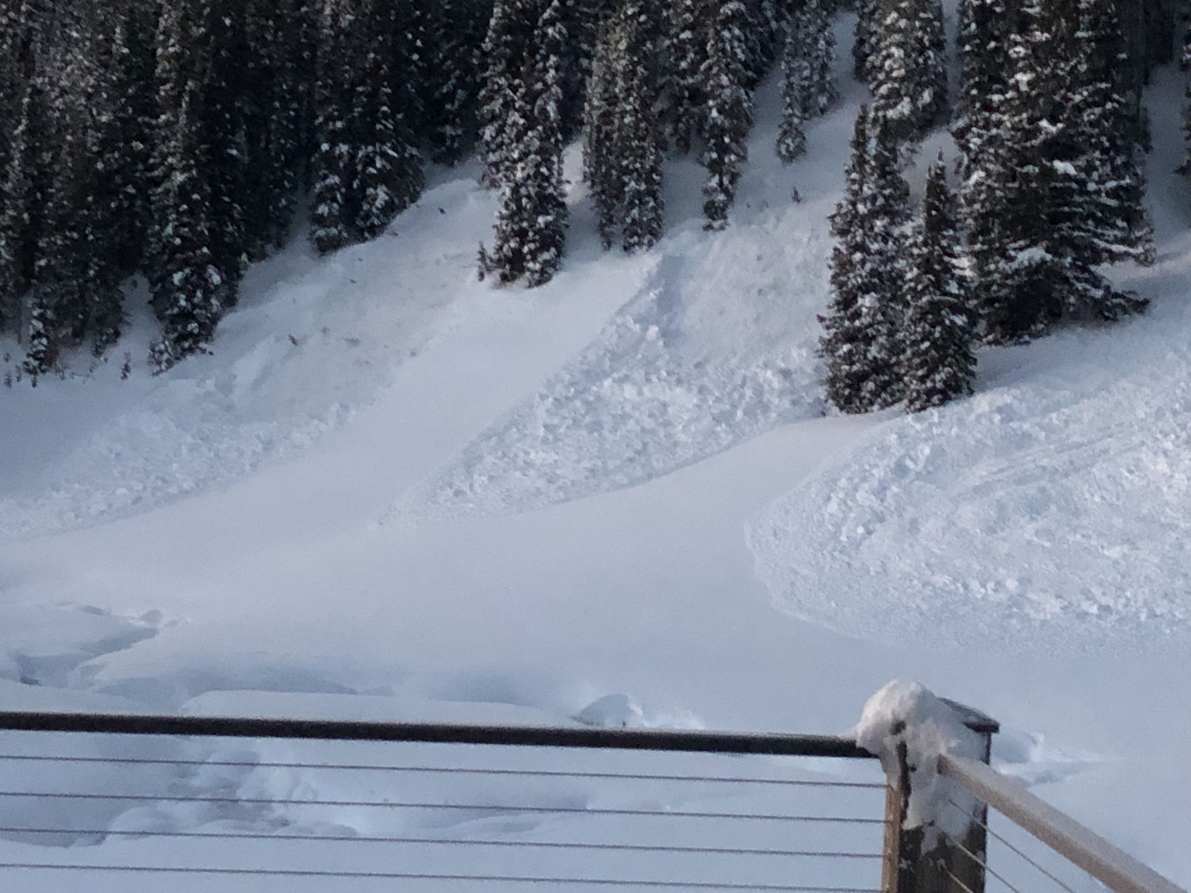
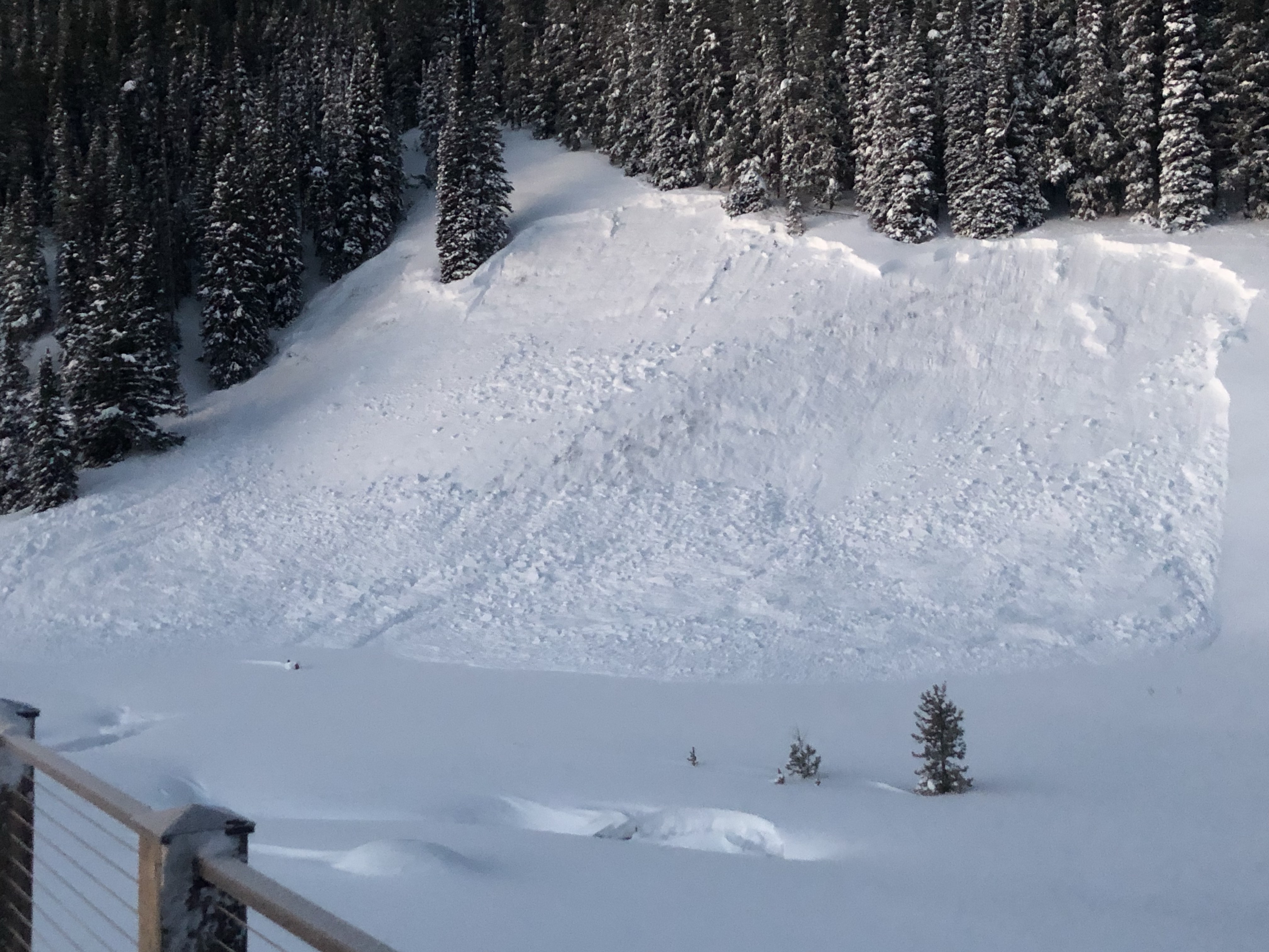
Location: Cement Creek Area
Date of Observation: 01/18/2019
Name: Eric Murrow
Subject: Walrod banger
Aspect: North East, East
Elevation: 9,400 – 10,500
Avalanches:
Went for a stroll out lower Cement Creek and heard that there was a significant avalanche up Walrod Gulch and so I took a look. Check out the photos below. Good example of terrain that you may walk your dog on or nordic ski underneath that under HIGH avalanche danger and an Avalanche Warning could prove to be very dangerous. Debris is estimated to be 10 plus feet deep in places and covers around 700 linear feet of the road. The path has about 1,000 vertical feet and pushed debris up the opposing hillside a good bit and then likely triggered an avalanche on the opposing hillside.
Weather: Mostly cloudy skies with light winds at valley bottom.
Snowpack: shallow, weak, and tender.
Photos:


Location: Crested Butte Area
Date of Observation: 01/18/2019
Name: ADB
Subject: Anthracite Mesa-Coneys: WIND
Aspect: East
Elevation: BTL
Avalanches:
Road leading to Trailhead, observed two areas with storm slabs.
East aspect below trees above Meridian Lakes: Two slides: SS-N-R1-D1 on a slope at least 30 degrees on a linear
West/SW aspects between lower two cattle guards: SS-N-R1-D1 on slope less than 30 degrees but below a convexity in a shallow snowpack evidenced by grasses and shrubs on slope.
Weather: Cold and blustery.
Moderate winds in the valley bottom and on the ridge. Obscured skies. Periods of S1 and S-1 snowfall.
Moderate winds on ridge didn’t transport snow onto the leeward sides. Winds in the valley bottom with no trees or vegetative cover transported snow, filling in skin track with 6 inches of snow.
Snowpack: Between 6 and 8 inches of new snow within 24 hours with a few areas favored by wind deposition of 10 inches.
All about the wind.
No collapses or cracking. Tested a few convex slopes in the valley bottom on east and west aspects with no failures or shooting cracks.
Supportive snow.
Photos: