


Location: Paradise Divide Area
Date of Observation: 01/25/2019
Name: Zach Kinler
Subject: Weekly Weather/Snowpack Summary
Location: Paradise Divide Area
Date of Observation: 01/25/2019
Name: Zach Kinler
Subject: Weekly Weather/Snowpack Summary
Location: Crested Butte Area
Date of Observation: 01/25/2019
Name: Petar Dopchev
Subject: Natural Avalanches?
Aspect: South East, South
Elevation:
Avalanches:
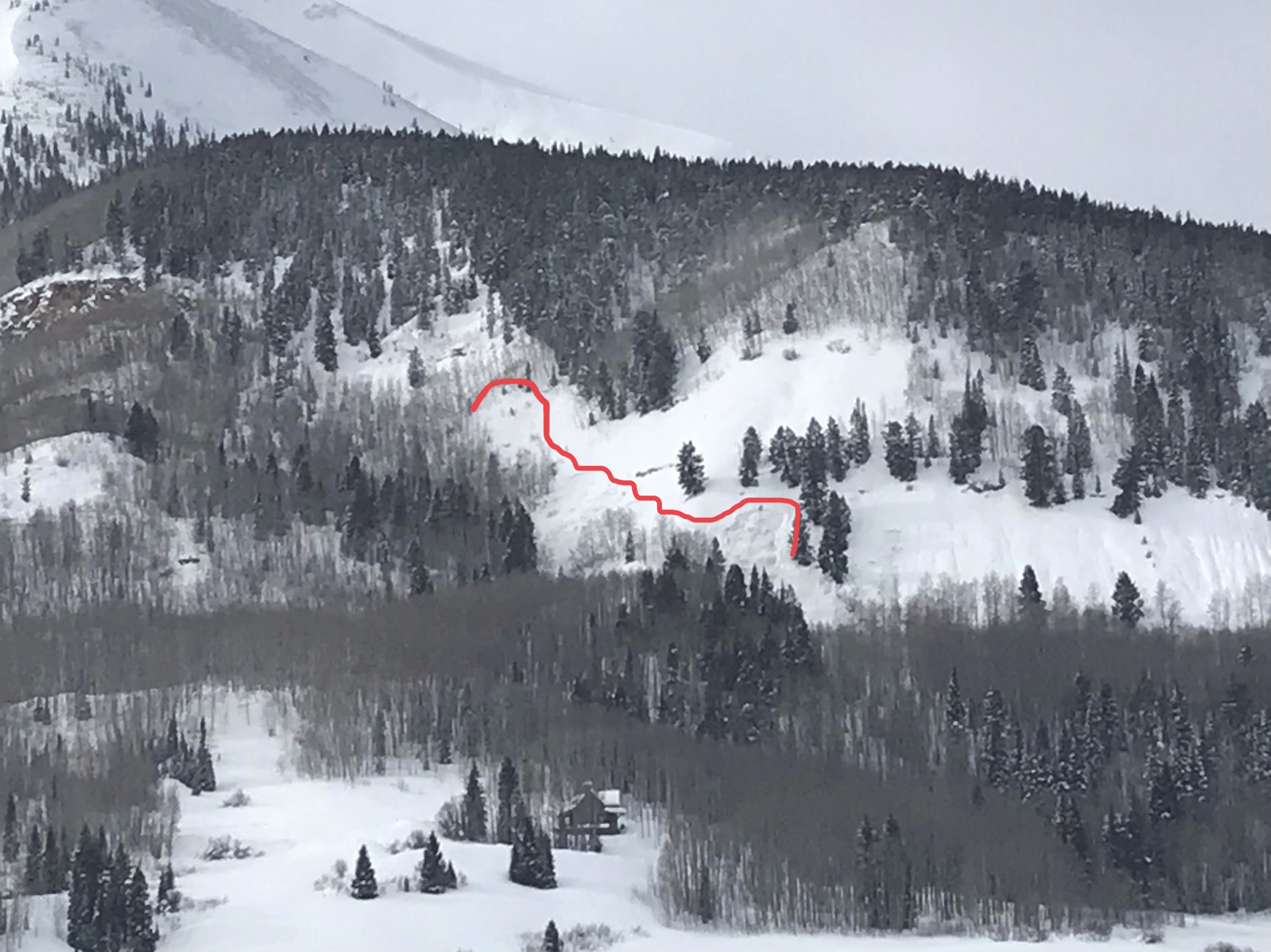
Not sure, if you guys had noticed those already, but went to fly my drone and saw these two north of the Snodgrass/Gothic trailhead – above the stables. Not certain what the name of that mountain is – No Name Mountain? (Forecaster note: White Mountain) Anyway, wanted to get close and get a video of it, but it turned out to be way further than I thought and ran out of battery. The two adjacent faces went down. Was there right at sunset…
(Forecaster note: These avalanches were first observed the morning of 1/23, but we really appreciate the observation and new photo angle of these avalanches!)
Weather: It was nuking (really windy) on those ridges in the morning. I can see those from my balcony, and usually check to see, if it is windy up high.
Snowpack:
Photos:
Location: Crested Butte Area
Date of Observation: 01/24/2019
Name: Than
Subject: Mint Sack
Aspect: North East
Elevation: BTL
Avalanches:
None seen
Weather: spotty snow and plenty of wind transporting snow onto the N/NE aspects
Snowpack: Deeper than before, I know because the stick in the picture below used to poke me in the head while skinning, today it poked me in the shoulder.
Photos:

Date: 01/25/2019
Cold, and moist northwest flow continued to produce cold smoke into the evening in favored mountains west of Crested Butte. Cold temperatures and moderate northwesterly winds will drop windchills into the -30ºF range as last night’s weak system slowly departs. We are squeezing any potential moisture out by the skin of our teeth with favorable orographics. A big, dreaded ridge of high pressure sits to our west, and the large scale trough lingers across the eastern half of the nation. Looking ahead, that westerly ridge slides overhead, bringing mostly dry conditions this weekend, with the next potential storm later next week.
High Temperature: 10-15
Winds/Direction: 15-25/NW G 40s
Sky Cover: Mostly Cloudy
Irwin Snow: 1-3″
Elkton Snow: 1-3″
Friend’s Hut Snow: 0-2″
Low Temperature: 0-5
Winds/Direction: 10-20/NW G40s
Sky Cover: Decreasing clouds
Irwin Snow: 0-1″
Elkton Snow: 0-1″
Friend’s Hut Snow: 0-1″
High Temperature: 18-23
Winds/Direction: 5-15/NW
Sky Cover: Partly Cloudy
Irwin Snow: 0
Elkton Snow: 0
Friend’s Hut Snow: 0
Location: Crested Butte Area
Date of Observation: 01/24/2019
Name: Ian Havlick
Subject: Fresh Whetstone Avalanche
Aspect: East, South East
Elevation: 8600
Avalanches:
new pocket lookers left of previous crowns on the same feature that ran in Jan 7/8 cycle. Avalanche looked 2ft deep, failing on facets near the ground and propagating widely up gully feature.
Weather: light snow, light NW wind, cold temperatures aroudn 10ºF
Snowpack:
Photos:
Location: Kebler Pass Area
Date of Observation: 01/25/2019
Name: Eleven Cat Ski Guides
Subject: Skier Triggered Avalanche Near Miss
Aspect: South
Elevation: 11,000, NTL
Avalanches:
We had a near miss when a guest, unintentionally, skier triggered an avalanche on a South facing aspect around 14:00. It failed on the 1/15 interface on small grained facets. There had been explosive testing on the slope in the morning with no results. 14th skier pushed right-hand boundary into untracked snow and the slab released when he was mid-slope. He skied out left at the bottom and was unaware of the slope had released above him. See attached pics and profile. PM report has details
Weather: S1/S2 snowfall throughout the day. HST 10″.
Snowpack:
Photos:


Location: Cement Creek Area
Date of Observation: 01/24/2019
Name: Cosmo Langsfeld
Subject: Cement/Double Top Slides
Aspect: North East, West
Elevation: 9400-10600 ft
Avalanches:
Noticed these slides on my way back to the trailhead around 3pm. One small slide on E-NE facing slope on Doubletop. Not sure when this slid. Looked fairly fresh. Also two small slides low on Cement, West aspect,~9500ft. I think these slid sometime between 930am and 3pm on 1/24.
Weather: Snowing and low clouds early in the day. Clearing as the day went on. Wind blowing hard enough to transport snow in the valley bottom in the morning. Wind died down and it was calm by mid-morning. Very cold down low. Pleasant off the valley bottom.
Snowpack: Supportive. No obvious signs of instability on the way out. Dug down on low angled NE facing meadow BTL (~10600′). Snow depth 140cm. Top 30 unconsolidated. 110-95 Fist. Crusts at 95 and 85 cm above ground level with a distinct layer of sugar above the 85cm crust. Between the two crusts, 2 layers 1f-4f with softer snow between those two layers at 90cm above ground level. Below 85cm, snow was 4f to Fist, softening with depth until it turned to sugar somewhere around 35cm above ground level, grain size increasing with depth. Leaving the pit, when I got about 6 feet away, the snowpack settled audibly.
Photos:


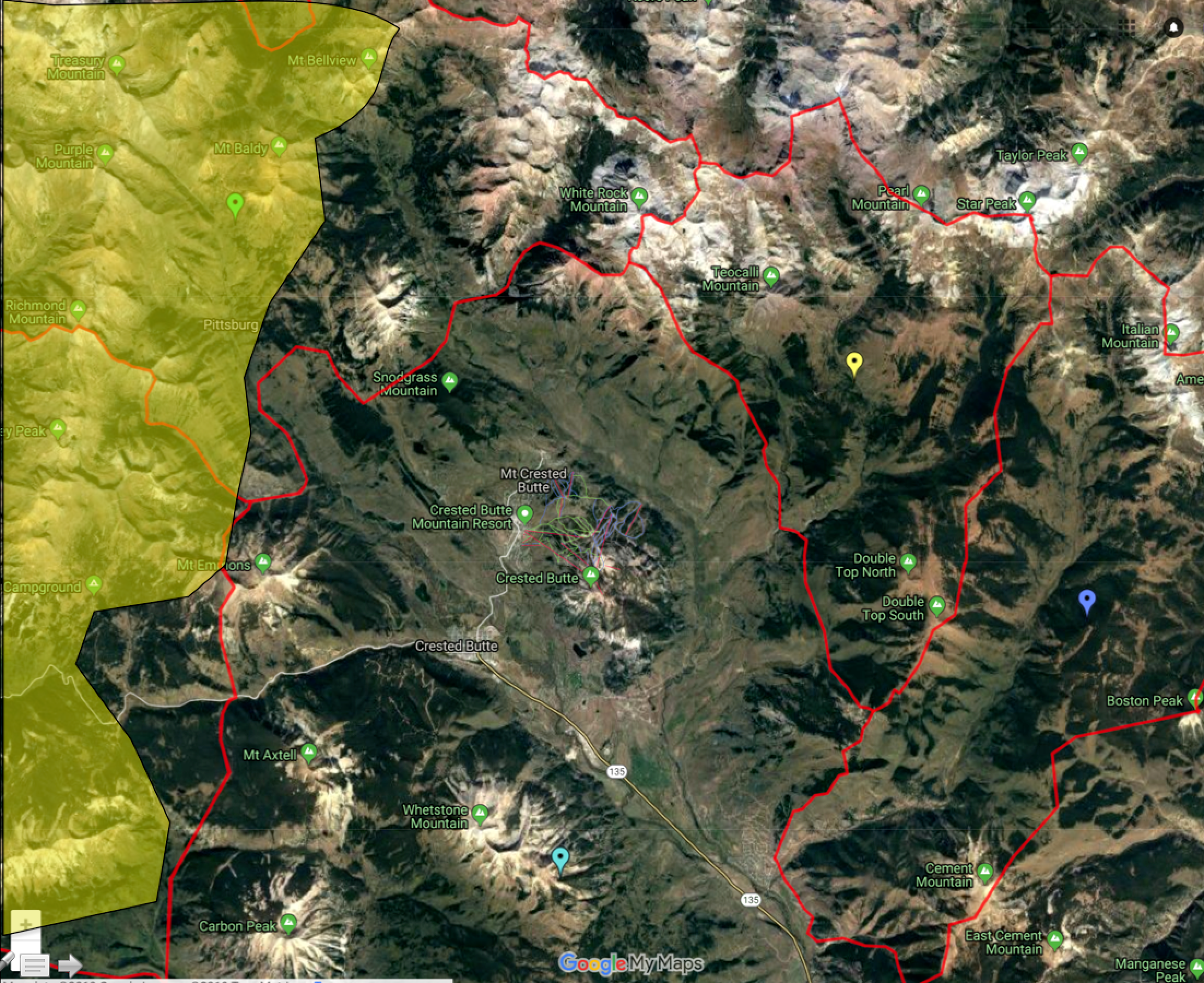
Location: Crested Butte Area
Date of Observation: 01/24/2019
Name: Ian Havlick
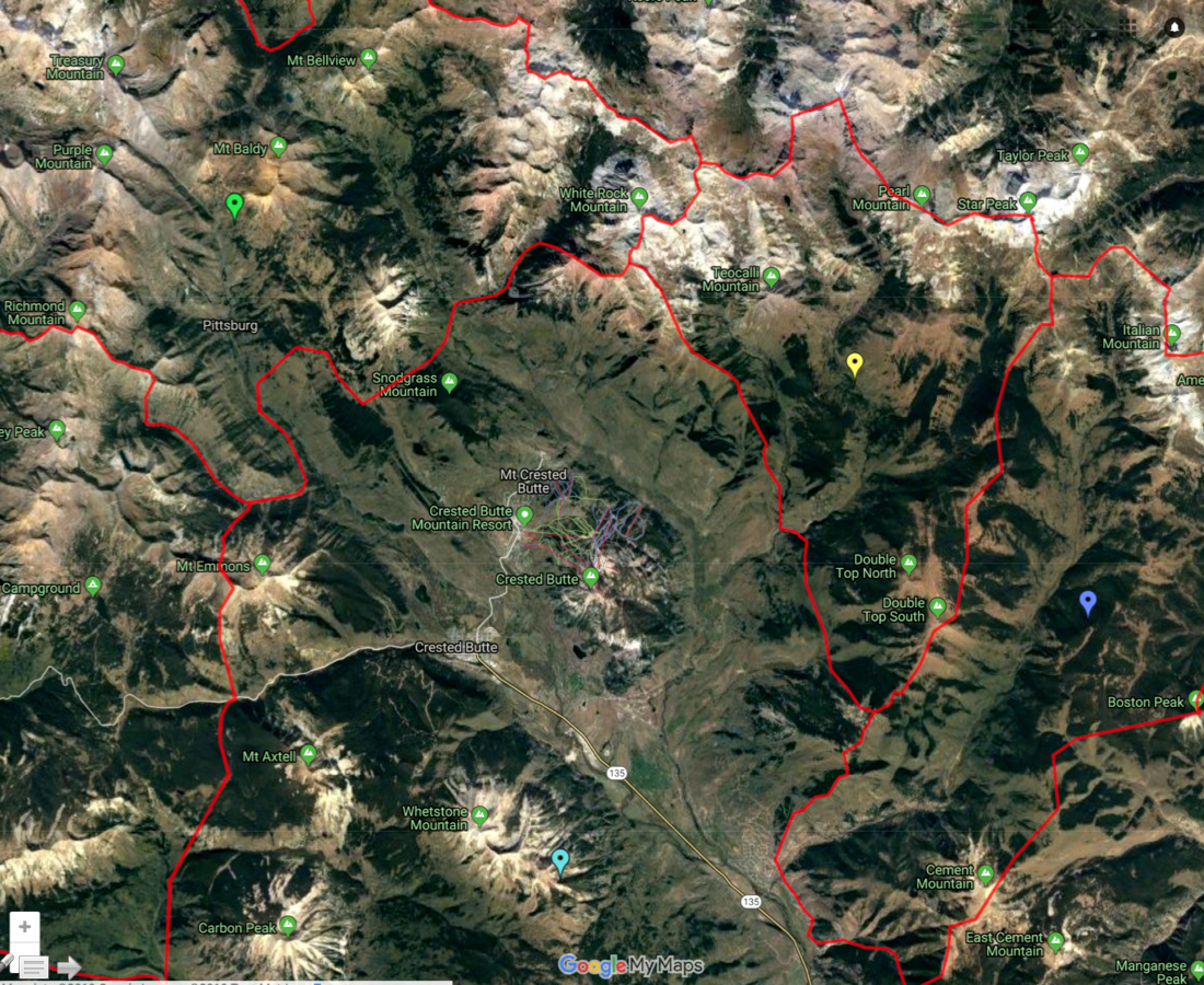
Subject: Rough Overall Danger Analysis of CBAC Forecast Area
Aspect:
Elevation:
Avalanches:
Rough Analysis of Avalanche danger across forecast area with colors corresponding (yellow=moderate danger, yellow-ish orange = trending from considerable to Moderate, and dark orange = lingering more widespread considerable danger). Additionally, red stars symbolize observed avalanches size D2.5 or larger since 1/18/2019.
As communicated in daily avalanche forecasts, the threat of greater (larger and more widespread) avalanche activity (both persistent slab and wind slabs) in the shallower snow-covered areas near and east of Crested Butte is symbolized in this visual interpretation.
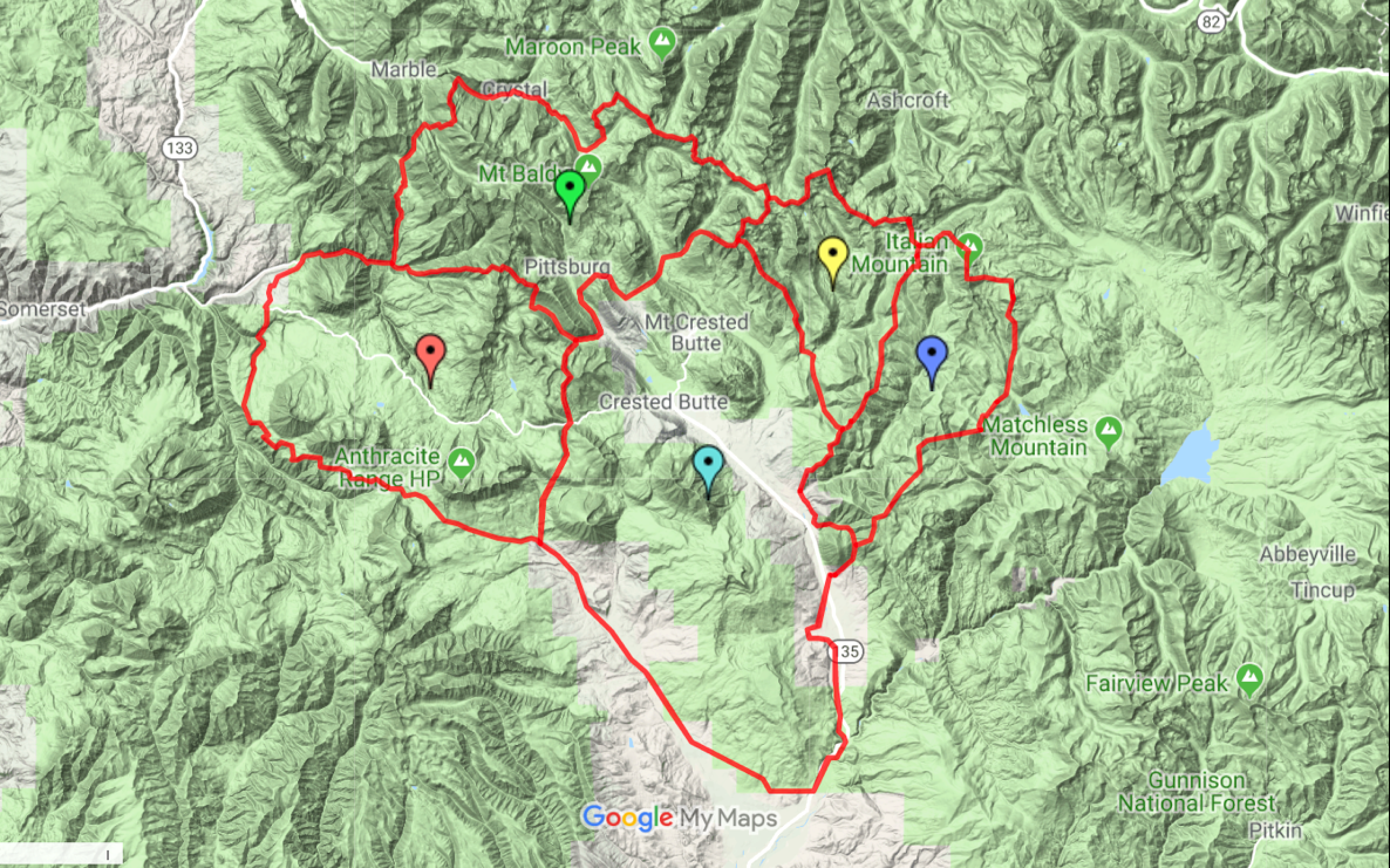
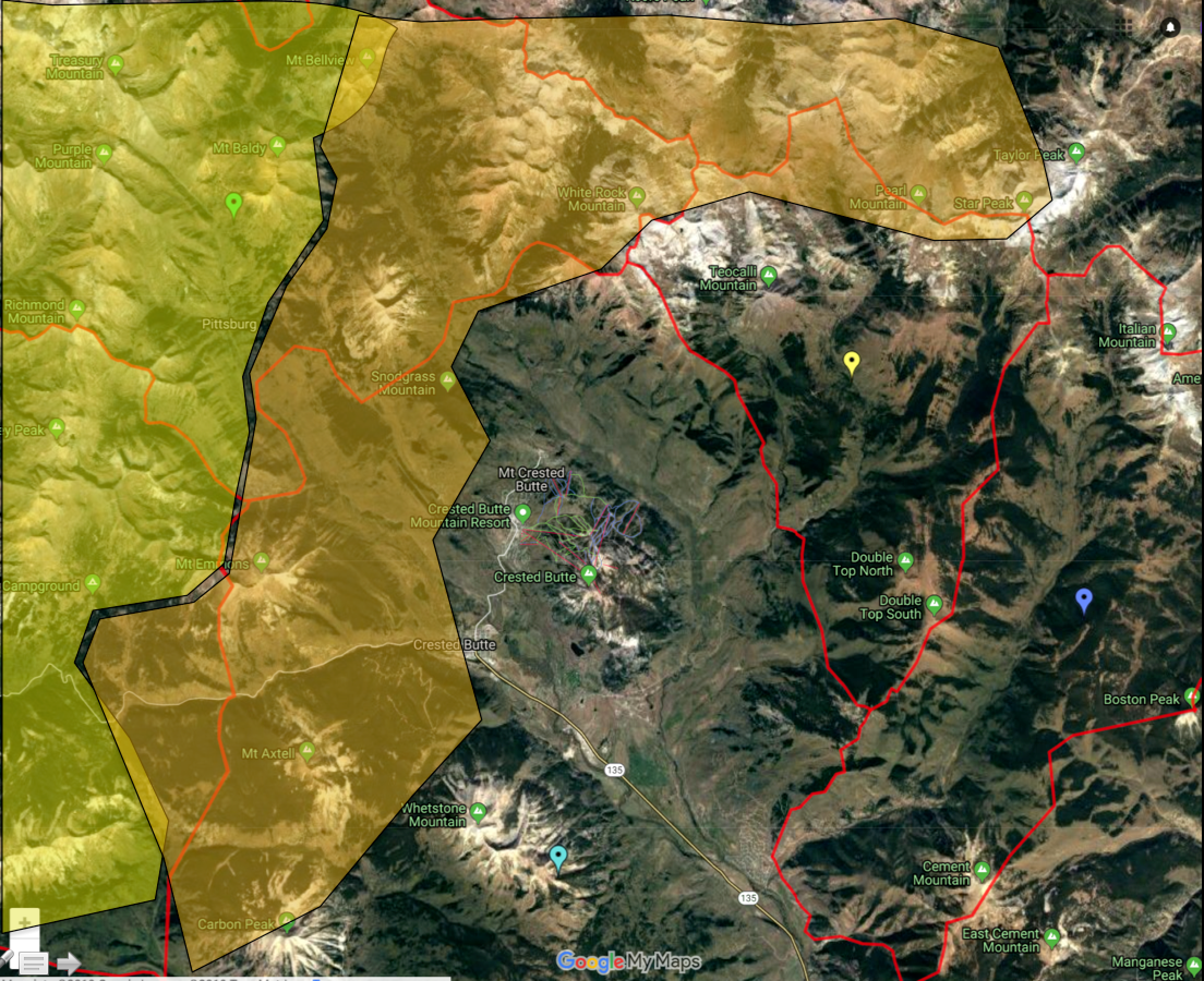
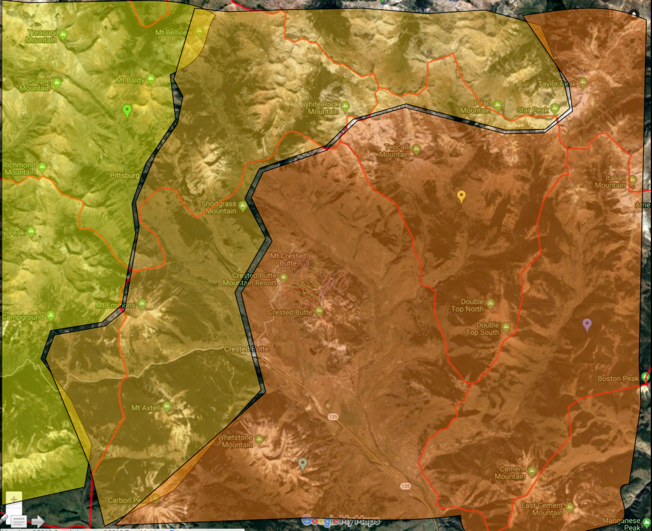
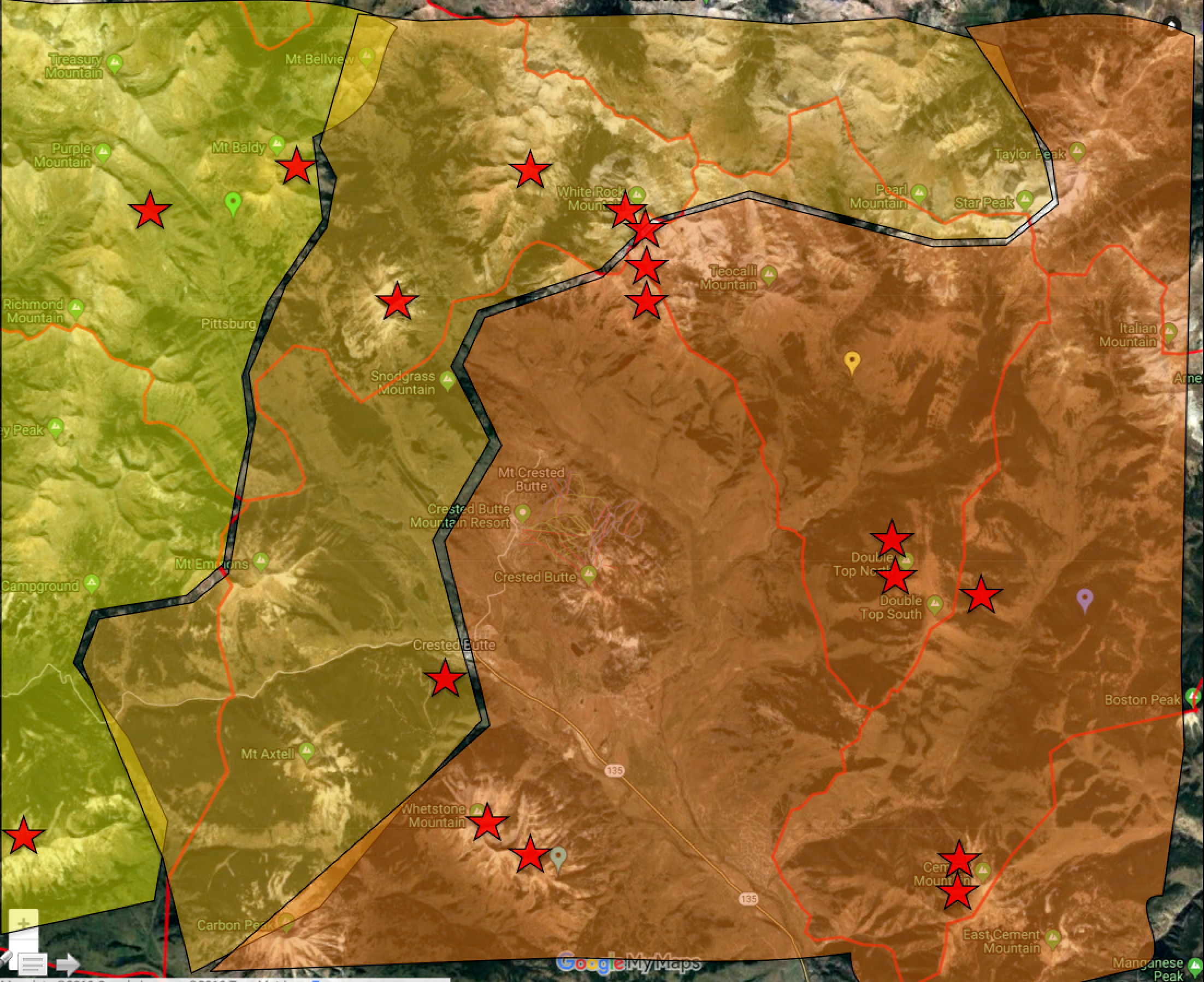
As illustrated by the red stars, there have been many more large to very large avalanches in the eastern portion of our forecast area. The greatest uncertainty lies in these transition areas in a band from Gothic, to Washington Gulch to Mount Emmons, to Mount Axtell.
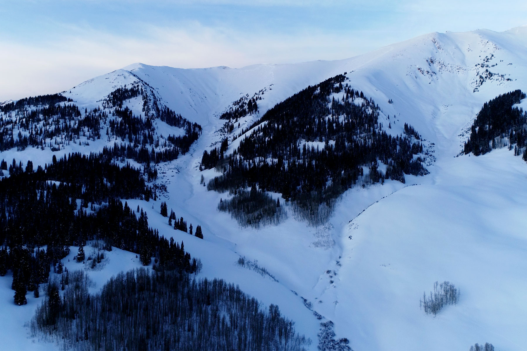
Location: Crested Butte Area
Date of Observation: 01/23/2019
Name: Avalanche
Subject: Two very large natural avalanches on the White Mountain massif
Avalanches: Two very large avalanche that ran early on 1/23. The sunny avalanche faces southwest, the shady one faces due west. These avalanches are located on the White Mountain massif to the north of Crested Butte.

Date: 01/24/2019
The old “Clipper Storms”. That’s what it is going to be all about over the next few days. Small storms are dropping down the old Rocky Mountains on NW to SE flow and having various impacts to Colorado as they pass on by. Last nights clipper storm will start drying out early today. Looks like we should see clearing sky today, but moisture hangs out at lower elevations which makes me wonder if we’ll see some low valley clouds persist longer through the day. Orographics should keep snowfall and clouds around longer in the Paradise Divide and Irwin areas.
After a brief break today, we’ll see another small storm clip Colorado Thursday Night. Not much is expected out of this one. The next clipper rolls across Colorado Friday Night and this one looks better and should bring a few more inches of snow. Looks like drier weather for the weekend.
High Temperature: 17 to 22
Winds/Direction: 12 to 22 NW
Sky Cover: Partly Cloudy
Irwin Snow: 1 to 3 AM
Elkton Snow: 1 to 3 AM
Friend’s Hut Snow: 1 to 3 AM
Low Temperature: 0 to 5
Winds/Direction: 10 to 20 NW
Sky Cover: Mostly Clear
Irwin Snow: 1 to 2
Elkton Snow: 1 to 2
Friend’s Hut Snow: 1 to 2
High Temperature: 20 to 25
Winds/Direction: 10 to 20 WNW
Sky Cover: Mostly Cloudy
Irwin Snow: 0 to 1
Elkton Snow: 0 to 1
Friend’s Hut Snow: 0 to 1