Coastal Feeling Pow

CB Avalanche Center2018-19 Observations

Location: Crested Butte Area
Date of Observation: 02/21/2019
Name: Evan Ross

Subject: Felt Coastal
Aspect: North, North East
Elevation: 9,400-11,400ft

Weather: Partly to mostly cloudy through the day. Didn’t notice any snow plumes on the peaks but the light wasn’t there to really see that well. Noticed valley tracks getting drifted back over. Otherwise traveled in areas protected from the wind. About  1″ of new snow in 24hr

Snowpack: Feels like coastal pow. No signs to instability and skiing north to northeast NTL/BTL terrain. The Valentine Storm really stuck well to rocks and steep terrain features. We didn’t encounter any thin snowpack areas that may have been more concerning.

Mountain Weather for 11,000ft

CB Avalanche CenterWeather

Date: 02/21/2019

Last night produced just a trace of new snow across the forecast area, but the low-pressure system, that has been producing small amounts of snow the past few days, is now in Nevada and is continuing its slow march towards Colorado. This morning the satellite imagery shows a healthy stream of moisture flowing into Colorado from the SW. It is currently snowing in our area, and it looks like we will see generally light snow for today with accumulations of a couple of inches with increasing wind speeds during the day. The San Juans are going to take the brunt of the snowfall today. Thursday night and Friday ought to be the best chance for substantial accumulations for the Gunnison Country. Models currently are showing close to a foot of snow by the end of Friday for the higher elevations; keep your fingers crossed.

  • Today

    High Temperature: 14 to 19
    Winds/Direction: 7 to 17, S
    Sky Cover: Overcast
    Irwin Snow: 2 to 4″
    Elkton Snow: 2 to 4″
    Friend’s Hut Snow: 1 to 3″

  • Tonight

    Low Temperature: 6 to 12
    Winds/Direction: 6 to 16, SSE
    Sky Cover: Overcast
    Irwin Snow: 4 to 7″
    Elkton Snow: 4 to 7″
    Friend’s Hut Snow: 3 to 5″

  • Tomorrow

    High Temperature: 21 to 26
    Winds/Direction: 6 to 16, SE
    Sky Cover: Overcast
    Irwin Snow: 2 to 4″
    Elkton Snow: 2 to 4″
    Friend’s Hut Snow: 3 to 5″

Shooting Cracks WNW. Otherwise Quiet Pow.

CB Avalanche Center2018-19 Observations

Location: Crested Butte Area
Date of Observation: 02/20/2019
Name: Evan Ross

Subject: Shooting Cracks WNW. Otherwise Quite Pow.
Aspect: North, South, North West
Elevation: 8,900ft to 12,300ft

Avalanches:

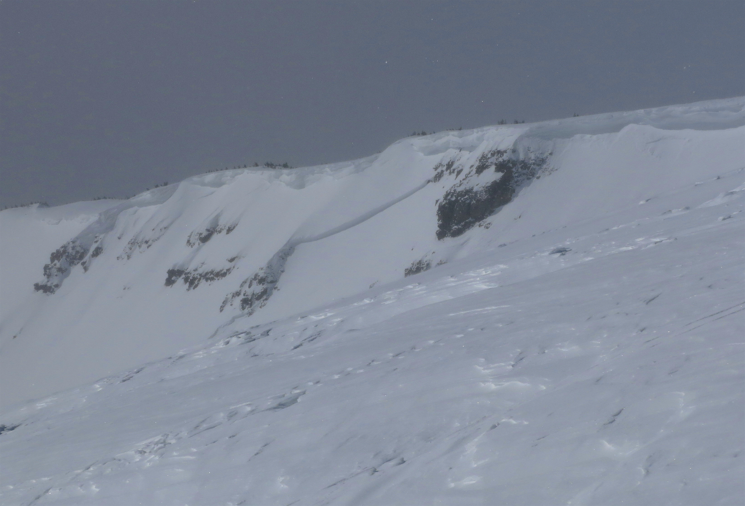
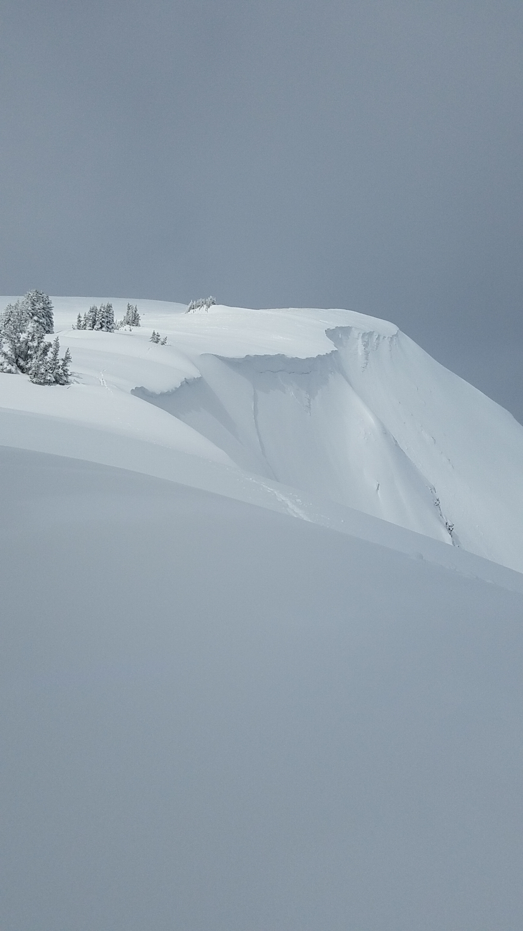
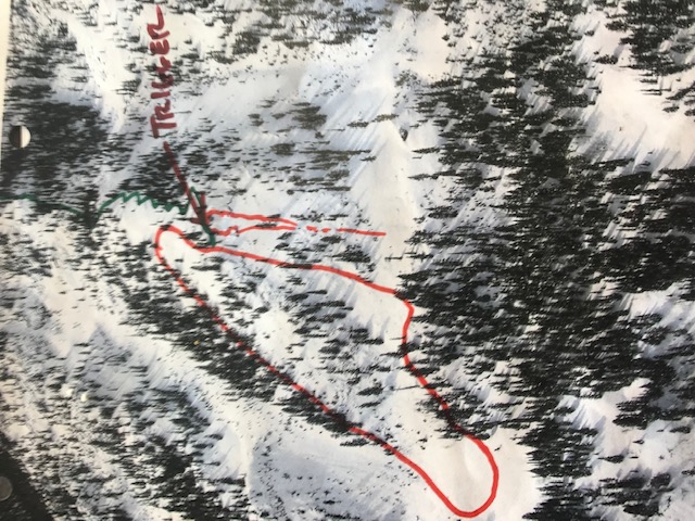
Several D1 and D1.5 windslabs in the alpine on wind-loaded terrain. One fresh D2 windslab into Redwell Basin.

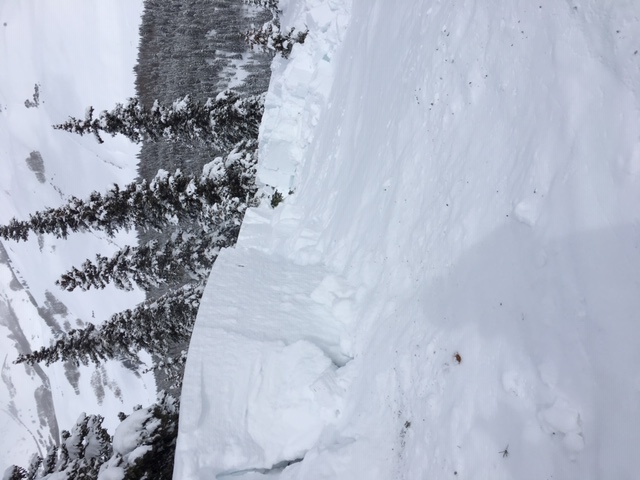
All other avalanches were old, from around the Valentine Storm. Many D2’s from N to NW to E at ATL and NTL elevations in Redwell Basin.

Weather: Mostly Cloudy sky with some breaks to let the sun through. Moderate westerly rigeline winds in the alpine transporting snow.

Snowpack: For the current moderate wind speed in the alpine, most of the snow has already been blown around and transported. That snow looked to have mostly transported last night and yesterday. Still there was snow blowing around today and there is plenty more in the fetches as the wind speeds pick up.

Generally a quiet day with the snowpack feeling strong. We continued to manage slopes with windslabs and trigger points in mind.

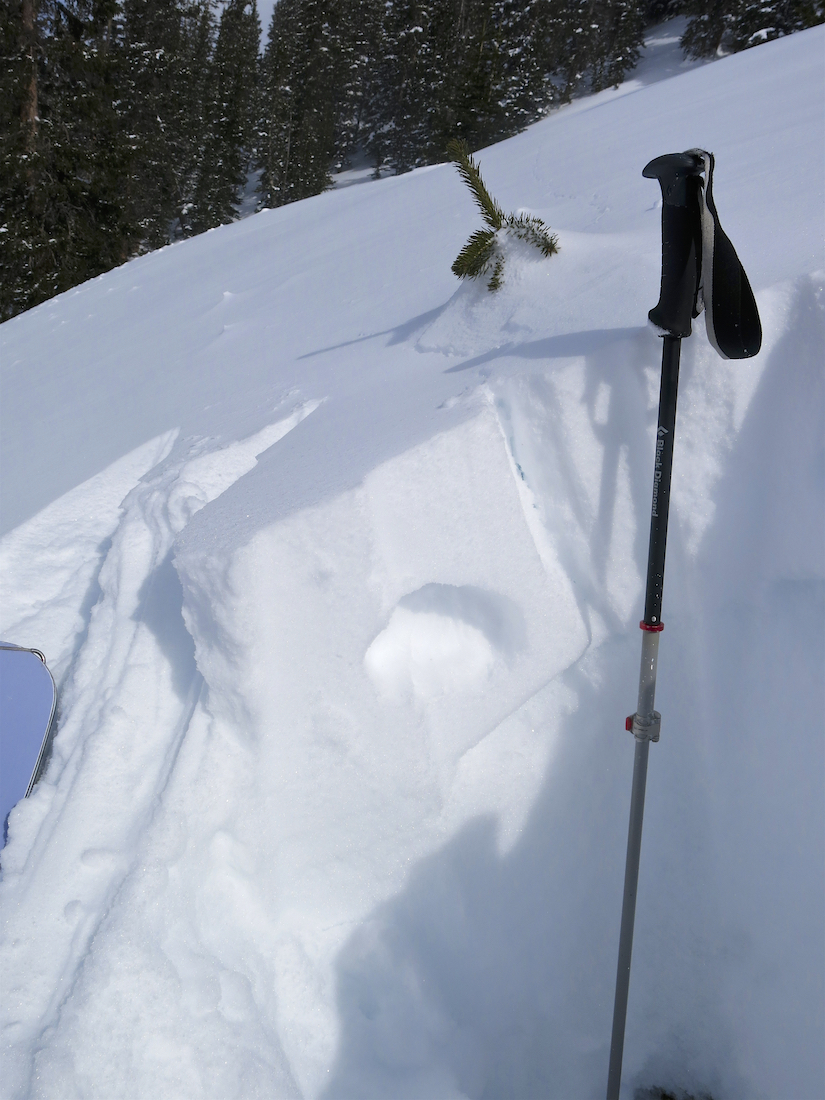
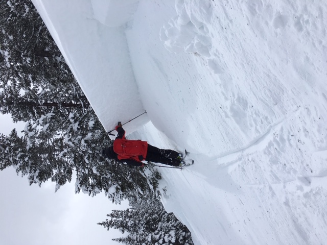
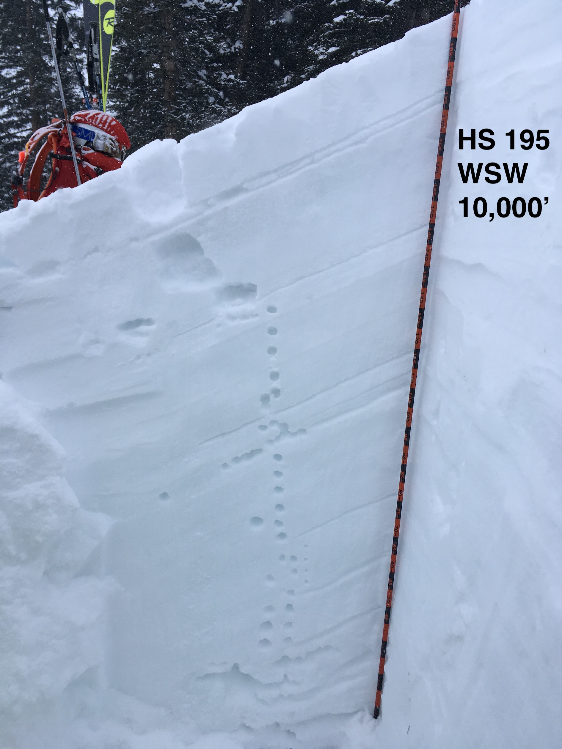
Shooting cracks were observed and a week snowpack was found on west northwest terrain at a near treeline elevation. HS was much shallower then average here, around 120-130cm. There were several large avalanches in this terrain from the Valentine Storm, and it didn’t take long in that terrain to realize the snow wasn’t something we wanted to travel on.

Photos:

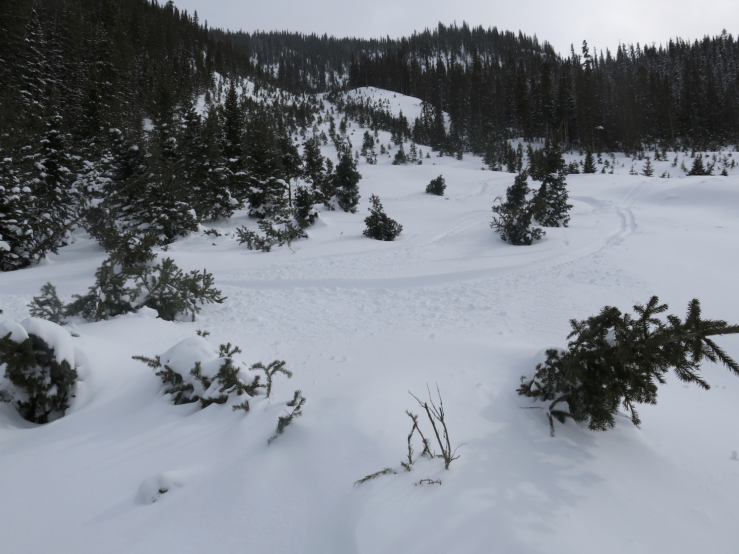
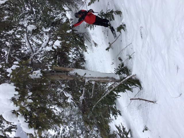
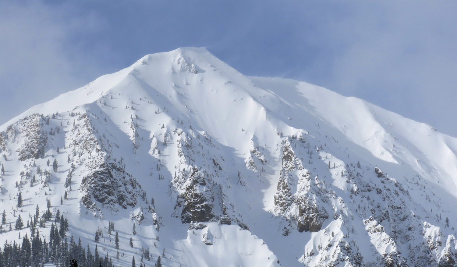
Mowed down trees in Right Chute or Wrong Chute. Start zone NW at 11,000’ish feet

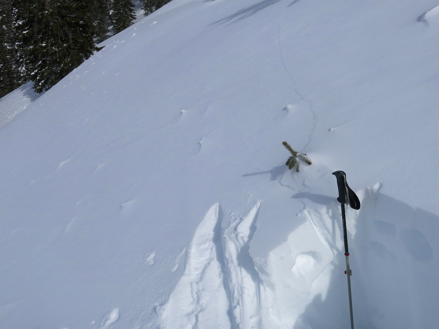
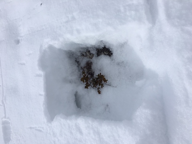
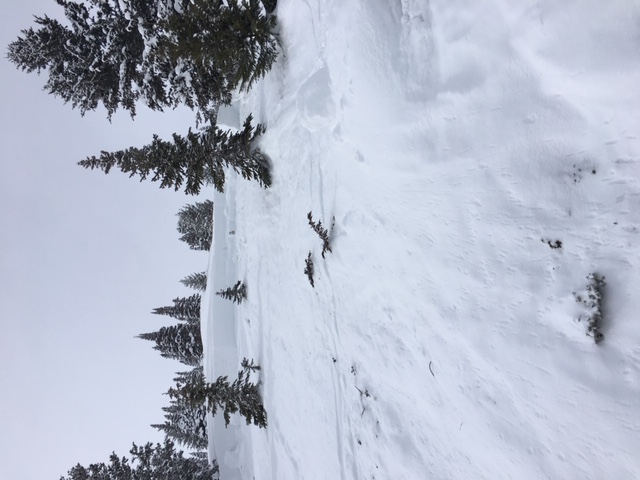
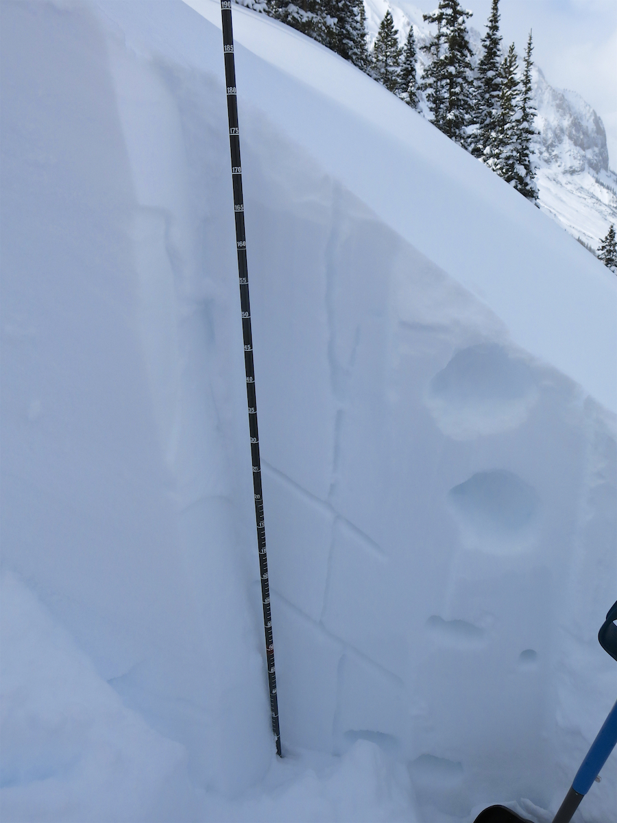
Weak snowpack and shooting cracks WNW aspect.

Axtell Walkabout

CB Avalanche Center2018-19 Observations

Location: Kebler Pass Area
Date of Observation: 02/20/2019
Name: TC

Subject: Axtell Walkabout
Aspect: North, North East, South, South West
Elevation: 9,800-12,000

Avalanches:

One small wind slab in 4th Bowl (picture attached), but very little recent activity. Only minor sloughing in Corner Pocket on the decent back into the Coal Creek drainage.

Weather: Cold. Back and forth between clouds and sun. Surprisingly light SW winds on the ridge early, increasing to 10-15 mph by the afternoon.

Snowpack: Informal probing with my poles throughout the tour. Seems to be setting up nicely on N and NE. South (girlfriend glades) was about 20 cm of new snow on top of a supportable, but potentially collapsible sandwich of old sun crusts.
Photos:

Mountain Weather for 11,000ft

CB Avalanche CenterWeather

Date: 02/20/2019

The latest round of moisture produced just a couple inches around the forecast area; light orographic snow showers continue around the Ruby Range this morning. Yesterday’s trough has moved eastward with the next system looking to arrive late this evening. This next system looks to be very similar to the last; a low-pressure system is pushing down from the northwest and will slide towards the Four Corners region putting the area under a southwest flow. This system looks to produce snow from Wednesday night through Friday afternoon. Winds are already on the increase overnight and will likely stay elevated throughout the day. Expect significant drifting with ample soft snow for transport.

  • Today

    High Temperature: 9 to 14
    Winds/Direction: 13 to 23, WSW
    Sky Cover: Mostly Cloudy
    Irwin Snow: 0 to 2″
    Elkton Snow: 0 to 2″
    Friend’s Hut Snow: 0 to 2″

  • Tonight

    Low Temperature: -3 to 2
    Winds/Direction: 8 to 18, SW
    Sky Cover: Overcast
    Irwin Snow: 3 to 5″
    Elkton Snow: 3 to 5″
    Friend’s Hut Snow: 2 to 4″

  • Tomorrow

    High Temperature: 15 to 20
    Winds/Direction: 8 to 18, S
    Sky Cover: Mostly Cloudy
    Irwin Snow: 1 to 3″
    Elkton Snow: 1 to 3″
    Friend’s Hut Snow: 1 to 3″

CBMR stepping out into new terrain

CB Avalanche Center2018-19 Observations

Location: Crested Butte Area
Date of Observation: 02/19/2019
Name: Tom Schaefer

Subject: CBMR stepping out into new terrain
Aspect: East, West
Elevation: 10,000′

Avalanches:

#1 SS-ASur-R2-D2.5-O (skier #1 triggered a small slide on a ski cut below on a N aspect and simultaneously remotely triggered this slide from above on the E facing aspect around a rounded shoulder). E aspect 34 deg. slope Elevation 10,284′ 150′ X 400′ Failed above MFC on T-Day interface.
#2 SS-AE-R2-D2-O (SIingle 2# hand charge in Terminator 1 propagated up the ridge aprox. 400′ through sparse trees releasing across Terminator 2 and down through the apron’s towards the aspens below).

Weather: Cold, Calm, with light snow fall 3″ low density snow last night.

Snowpack: Snowpack was only observed on N aspect at 10,200′ in 4th bowl in previously untraveled terrain. Reported as supportive snow pack on N aspects with approximately 150-20cm HS. E aspect was not observed where remote avalanche occurred.
Photos:

Questionably quiet at Coneys

CB Avalanche Center2018-19 Observations

Location: Kebler Pass Area
Date of Observation: 02/19/2019
Name: Will Nunez

Subject: Questionably quiet at Coneys
Aspect: North East, East
Elevation: 9,000-11,000

Avalanches:

No signs of instabilities, shooting cracks or whomping. Large piles of sluff at the base of gothic west face was observed.

Weather: COLD, NW winds light/mod, Overcast-Few with light moments of orographic of snow fall.

Snowpack: Today’s snowpack observation where questionably quiet. Snow heights ranged from 190-220cm with a variety of snow surfaces from wind scaled in the open exposed slopes to decomposing snow flakes as .5-1mm facets in protected treed areas. Finding no instabilities while traveling we decided to dig a pit on a east aspect near tree line. The pit reveled a hand hardness from fist 190-160cm four finger 160-140cm one finger 140-60cm fist+ 60-0cm down. This confirmed that the persistent slab structure still exists with with two layers of concern. One resting on the 2/2 interface 40cm down resting on 1mm facets and easily pulled off with hand shears, not active with CT tests. The other layer of concern is still the 1/15 facet interface with +/- 3.5 inches of liquid water resting on it. The layer was unreactive to CT test but when pried off after it fell out planer with 1mm facet on both under and below the slab. Perhaps the questionably quiet snowpack structure could wake up in the right spot. The persistent slab structure still exists.
Photos:

Snowpack Feeling Strong and Managing Consequence With Terrain

CB Avalanche Center2018-19 Observations

Location: Crested Butte Area
Date of Observation: 02/19/2019
Name: Evan Ross

Subject: Snowpack Feeling Strong and Managing Consequence With Terrain
Aspect: North East
Elevation: 11,800-9,400

Weather: Trace of new snow today, mostly cloudy, clam winds with snow blowing off Gothic Mountain.

Snowpack: Boot Pen in the 35-40cm range as the upper snowpack has set up. Surprisingly little sluffing and no obvious signs to instability observed. Stepping out mindset in the terrain, but still managing exposure and avoiding higher consequence terrain features. Dug into one start zone that has previously avalanched earlier this season. NE aspect at about 10,700ft and around 35 degrees steep. HS 180. CTH SP result on a thin layer of 1cm NSF down 60cm. The possibility was there with faceted grains in the snowpack, but no particular layer was screaming that it was the layer of concern.

Photos:

Mountain Weather for 11,000ft

CB Avalanche CenterWeather

Date: 02/19/2019

Yesterday afternoon and last night brought a couple inches of snow with light SW winds from a trough over the Great Basin. Today the trough will move eastward over Colorado and pass by this evening. Today we can expect continued light snowfall with accumulations around 3 to 5 inches across the forecast area. Winds are expected to remain light throughout the day. Wednesday there will be a short break in snowfall as the area will be between two troughs. Snowfall looks to pick back up on Wednesday evening as the next trough begins to impact the area. Winds are expected to be on the increase on Wednesday on the front end of the next system. It appears like we will see a steady trickle of snowfall Wednesday, Thursday, and Friday. No individual day looks to offer dramatic accumulations but snow totals will add up to around a foot by the end of the work week on Friday.

  • Today

    High Temperature: 9 to 14
    Winds/Direction: 7 to 17, SW
    Sky Cover: Overcast
    Irwin Snow: 3 to 5″
    Elkton Snow: 3 to 5″
    Friend’s Hut Snow: 3 to 5″

  • Tonight

    Low Temperature: -9 to -4
    Winds/Direction: 4 to 14, WNW
    Sky Cover: Mostly Cloudy
    Irwin Snow: 0 to 2″
    Elkton Snow: 0 to 2″
    Friend’s Hut Snow: 0 to 2″

  • Tomorrow

    High Temperature: 11 to 16
    Winds/Direction: 12 to 22, W
    Sky Cover: Mostly Cloudy
    Irwin Snow: 0 to 1″
    Elkton Snow: 0 to 1″
    Friend’s Hut Snow: 0 to 1″

Westerly terrain BTL and more natural activity from the past few days

CB Avalanche Center2018-19 Observations

Location: Paradise Divide Area
Date of Observation: 02/19/2019
Name: Eric Murrow

Subject: Westerly terrain BTL and more natural activity from the past few days
Aspect:
Elevation: 9,000 – 10,000

Avalanches:

Observed a few unreported naturals that looked to have failed on Friday and Saturday. Mostly below treeline shaded slopes with the exception of one WSW slopes off of Anthracite Mesa. This slide put some debris across Slate River Rd and a deep pile just above it – suspect this failed on 2/15 early AM, ran ~1,600 vertical feet.

Weather: Mostly cloudy skies with S-1 snowfall during the afternoon. Winds were very light, no transport below treeline observed.

Snowpack: Climbed up through westerly terrain below treeline. In this snow favored part of the range, the average HS was ~190cm. The 1/15 and 1/21 interfaces were rounding and gaining strength; no concerning test results on these layers. Two graupel layers from 2/2 storm and 2/15 still clearly visible but no test results. Of note was a soft 2cm melt/freeze crust that formed during the afternoon on Friday, 2/15 – it was buried by about 18cm of snow from Saturday. ECTN test results on 2/15 and 1/21.
Photos: