Avi obs and snowpack obs from Kebler

CB Avalanche Center2018-19 Observations

Location: Kebler Pass Area & avi obs from all over fx area
Date of Observation: 03/04/2019
Name: Eric Murrow and Zach Kinler

Subject:
Aspect: North East, South East
Elevation: 9,000-10,000

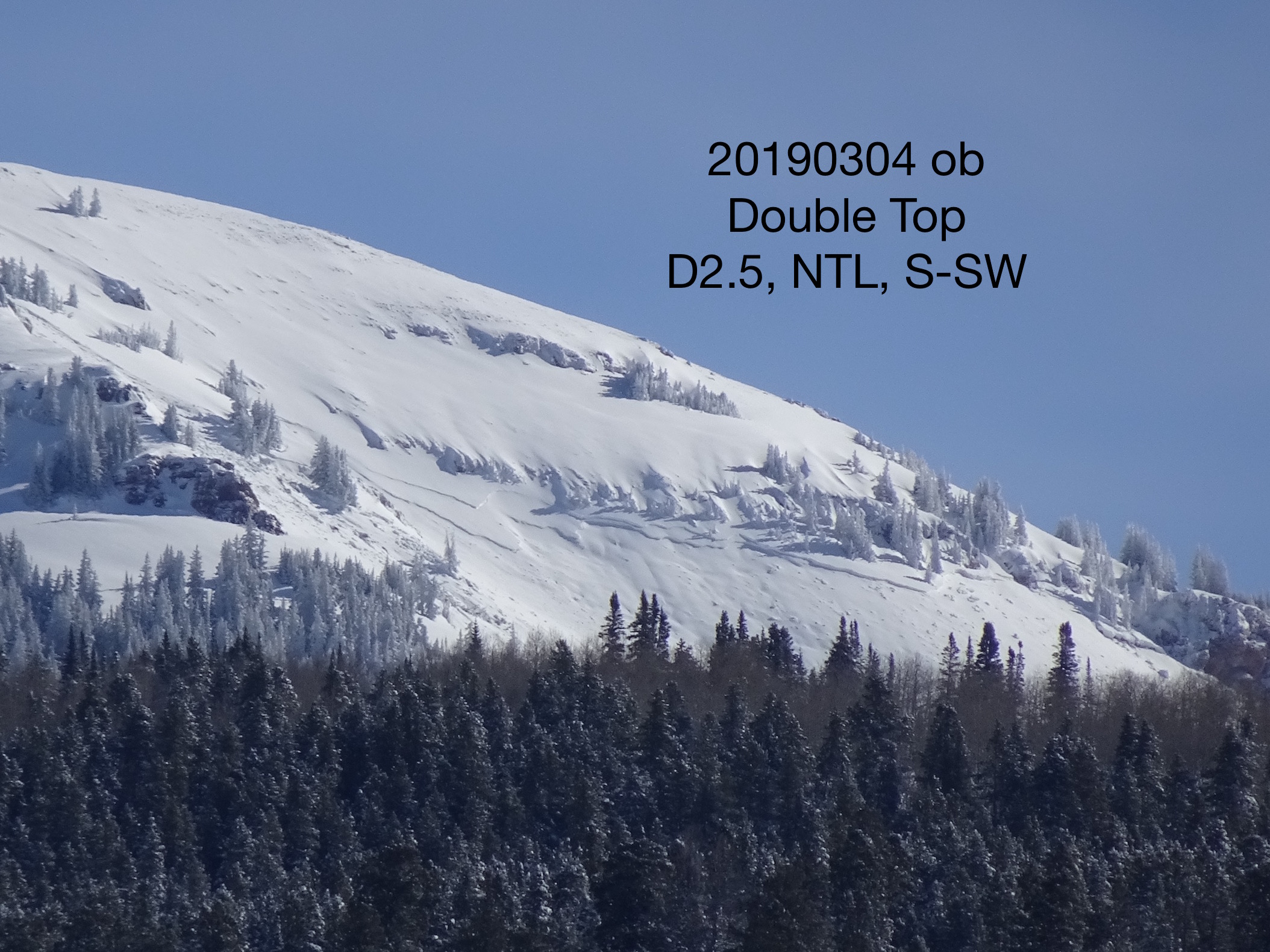
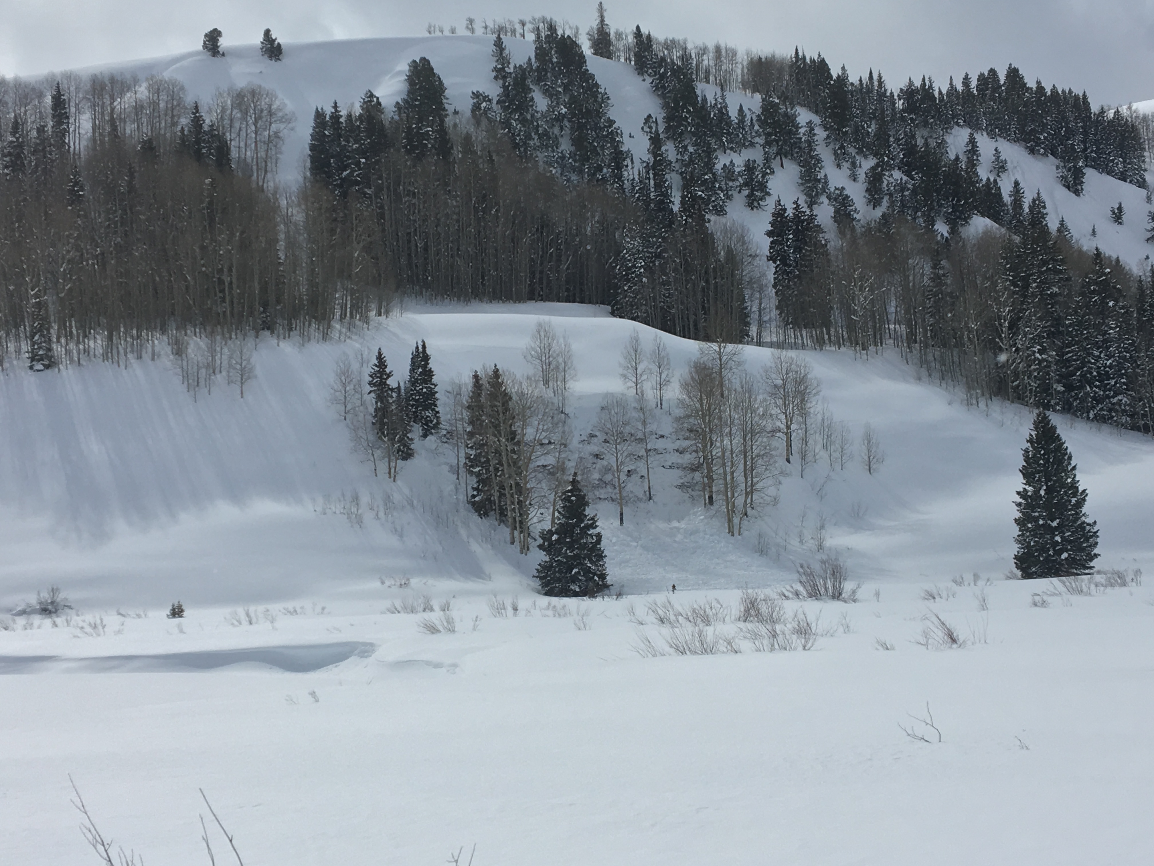
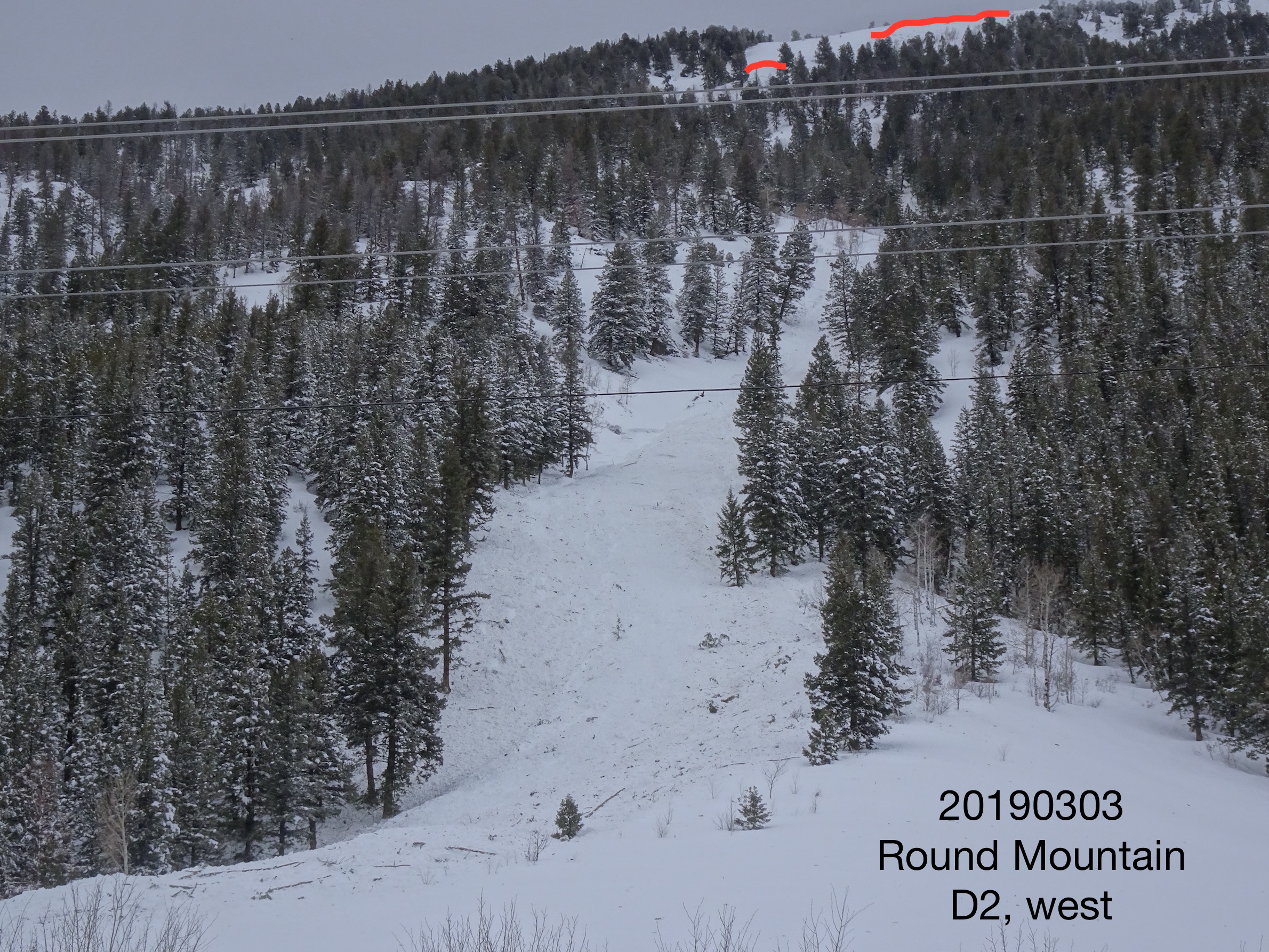
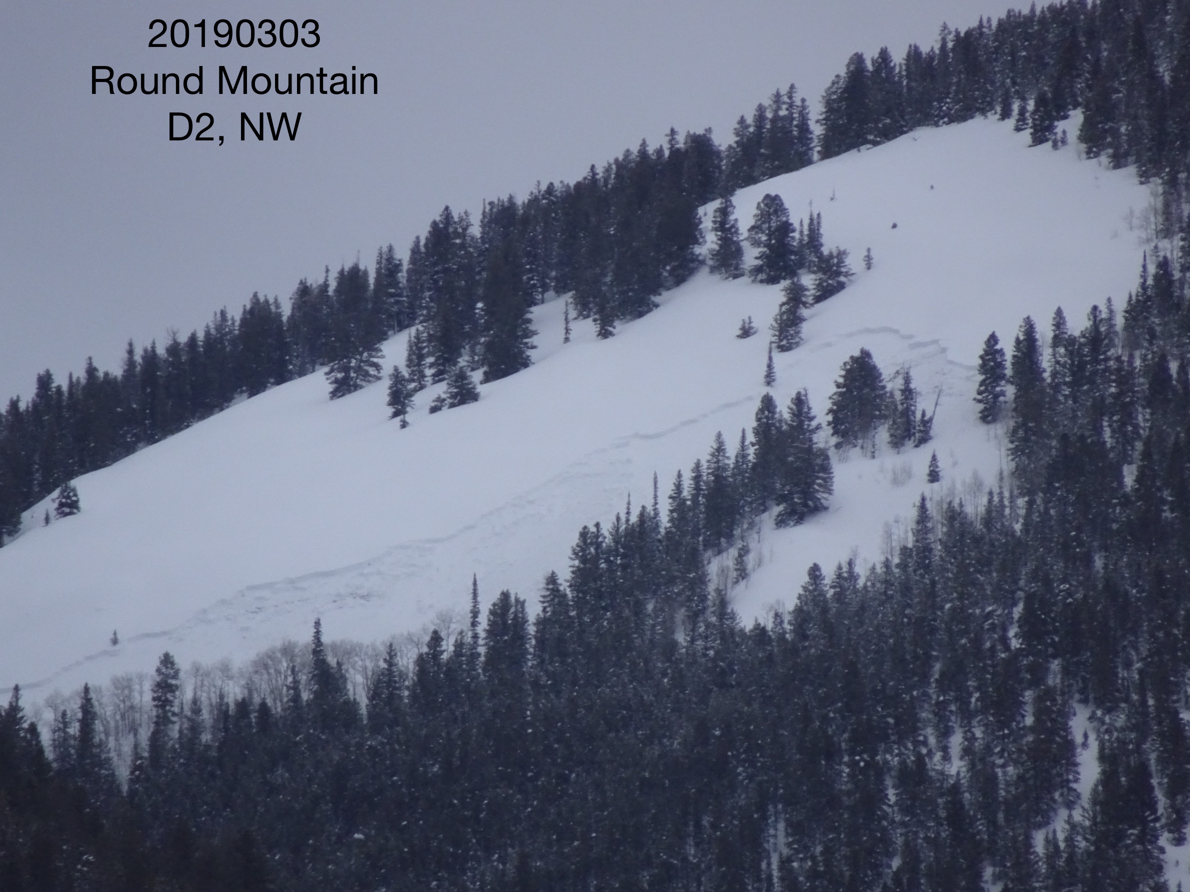
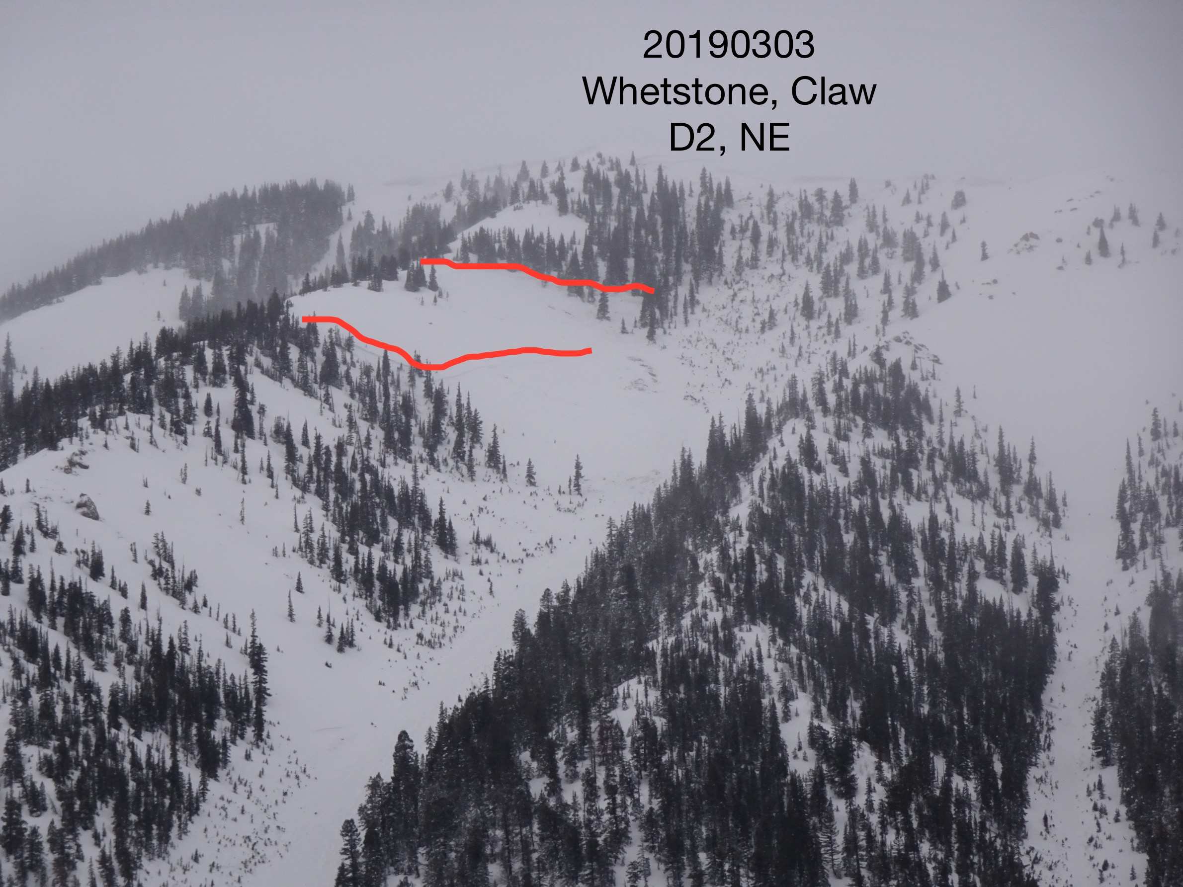
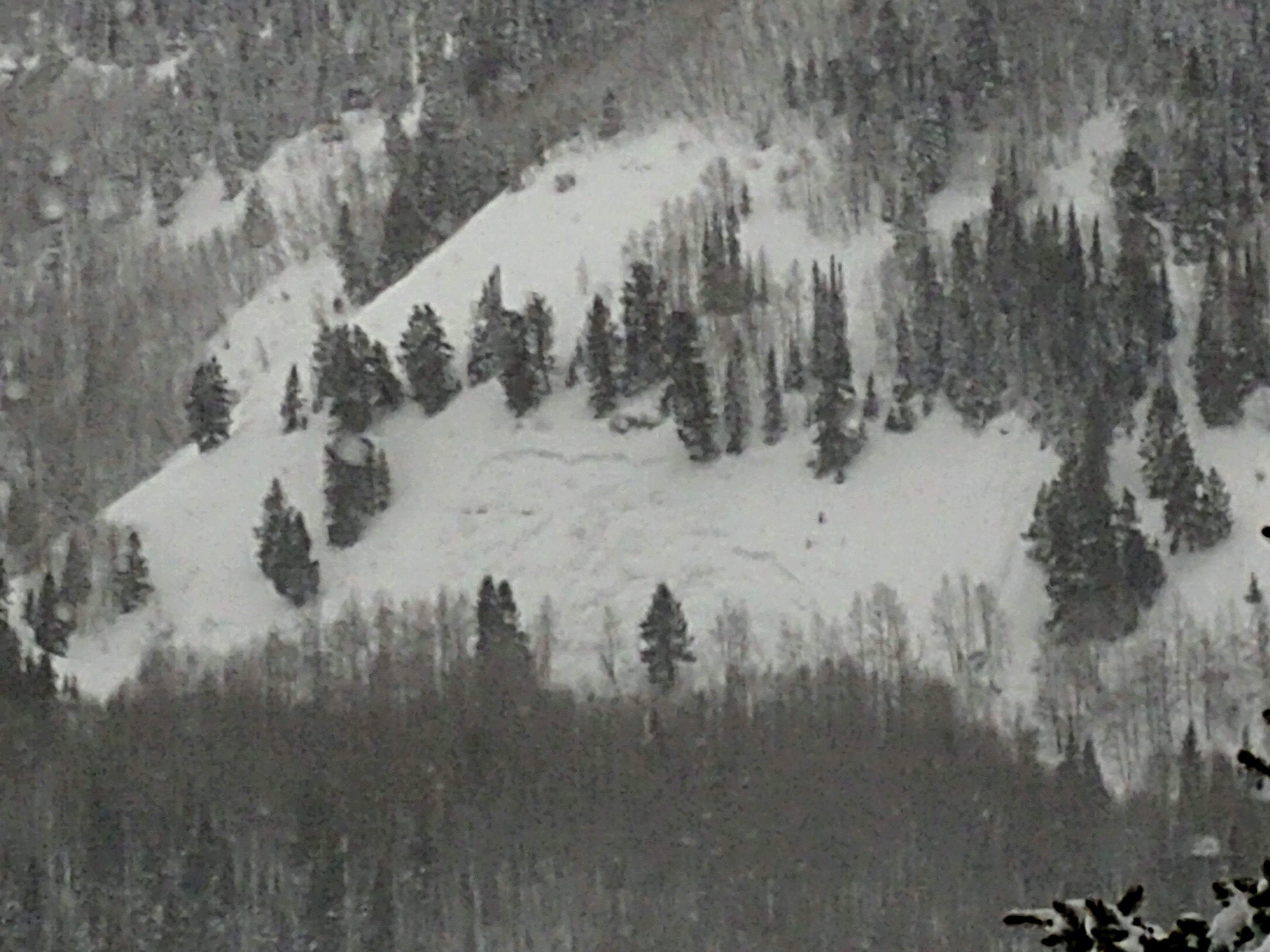
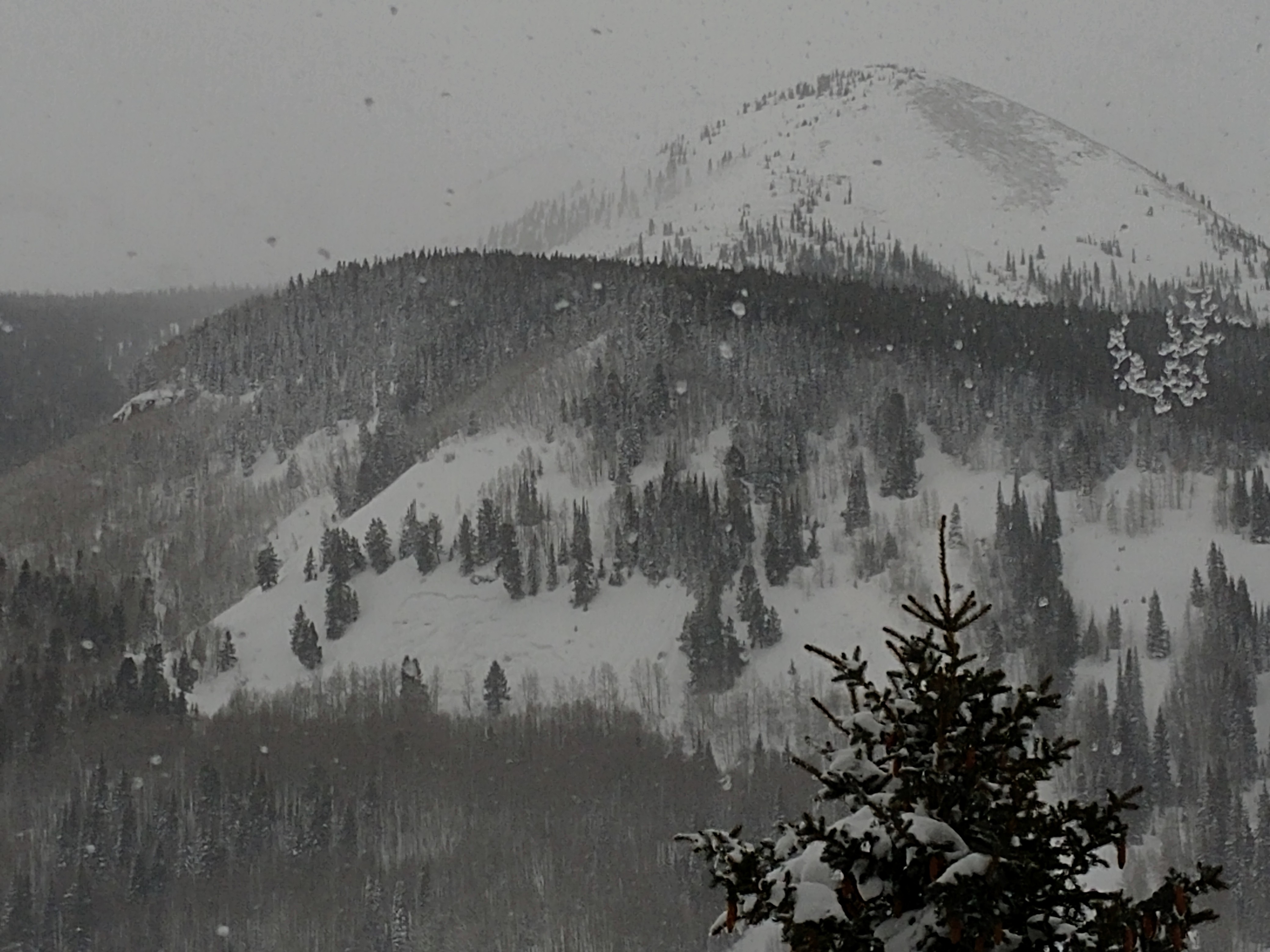
Avalanches: Numerous avalanches around the fx area.  Reasonable viewing in the AM.  Roughly 10 D2.5-D3 slides around the area; dozens of D2.  Avalanches observed on many aspects and elevations but most activity was near and above treeline (drifting) on N-E-S.  See pictures below for sampling.

Weather: Partly Cloudy skies at trailhead to Overcast skies and low clouds near the pass. Temps in the mid to upper 20s, light westerly winds below tree line with moderate winds and blowing snow near and above treeline.

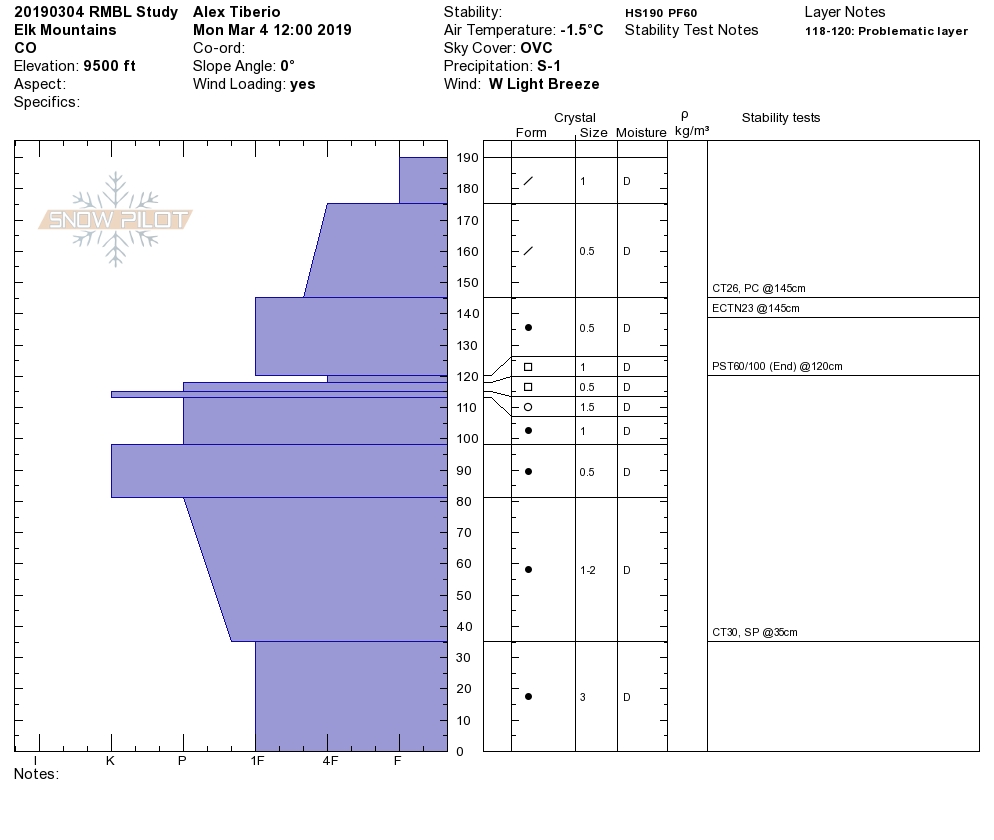
Snowpack: Digging on the sunny side and shady side in the lower Elk Creek area we found 60 cm-75 cm recent storm snow since 2/28. This thick dense snow was moistened and forming a crust on southerly slopes > 20 deg., while staying dry and right side up, with several storm density changes, on a North East aspect. Ski pen ~15-20 cm with boot pen ~55 cm. ECTN results in storm snow density changes, and ECTX at all other deeper interfaces in both profiles. No major cracking or collapsing. Percolation columns were observed under the 2/28 crust on South.

Photos:

Gothic Valley Obs

CB Avalanche Center2018-19 Observations

Location: Crested Butte Area
Date of Observation: 03/04/2019
Name: Steve Banks

Subject: Gothic Valley Obs
Aspect: North East, East, South East, South
Elevation: 9,400

Avalanches:

Several avalanche observations from D1 persistent slabs to D4 wind slabs in the Gothic Valley:
Numberous D1s on steep banks of East River. These ran on or near the ground. It did appear as though these areas had little snow previously, so perhaps repeat offenders? North and NE aspects

Large crowns noted on Easterly aspects of Mt. Belleview and Avery Peak. Steep wind loaded terrain with wide propagation, likely D3 or greater in size.

2 slabs noted on lower flanks of WSC Peak, S-SW aspects, D2. Notably, these seemed to have failed at the new snow/old snow interface as the bed surface appeared to be the old crust (2/28)

We observed the debris from previously reported East Face of Gothic slides. Whoa. Big time debris with lost of mature timber knocked down and water pushed out of the river. Heard the North Bowl of Gothic also ran today around 1 pm and hit the Judd Falls TH toilets again.

Weather: Sunny morning with increasing clouds and strong orographic snow showers and winds in the afternoon. Temps got warm with strong solar. Afternoon winds picked up from the West and transporting snow in the peaks was noted all day. Surprisingly heavy snowfall began around 3 pm and continued to 6 pm. 2” accumulate quickly.

Snowpack: The new snow is settle in quickly with ski pen half of yesterday, around 15 cms today. Snow surface became moist on SE-S facing slopes and will have a crust tomorrow. Storm totals in the 100 cm range and fairly evenly distributed. Total HS 140-208 cms. Digging to the ground in a flat location at 9,400 showed a very dense slab resting over sugary facets at the bottom.
Photos:

Mountains to the West of CB obs

CB Avalanche Center2018-19 Observations

Location: Crested Butte Area
Date of Observation: 03/04/2019
Name: Evan Ross

Subject: Mountains to the West of CB obs
Aspect: North, East, South, South West
Elevation: BTL/NTL

Avalanches:

During this 3 day period. No avalanches where observed BTL in the Kebler, CB Town, and Washington Cultch areas (not all slopes viewed of course). While the weather was clear on the morning of 3/4, a very large crown could be seen on the Spork of Mt Gothic (observed in other observations). A large avalanche within the new snow was observed above treeline on a south aspect of Mt Baldy. Poor visibility of something on a southerly ATL slope of the White Massive, and poor visibility of something on a NE aspect NTL in the Skyukill area, all failing during 3/3 loading.

Weather: 3/4: Partly cloudy in the morning becoming mostly cloudy in the afternoon. Afternoon weather seemed convective wish short bursts of S2. Maybe 2″ of new snow by the late afternoon. Generally light winds, certainly some drifting at times and probably more at higher elevations.

Snowpack:

3/4: Washington Cultch. No signs to instability. Mostly traveling on slopes up to 200 feet in vertical or smaller and up to the mid 30 degree range with a snowmobile. No shooting cracks or signs to a Storm Slab avalanche problem on shelter terrain and winded loaded terrain. Cut across several larger and steeper slopes with more vertical and no remote triggering or collapses felt. Bomb holed off plenty of cornices. Many different aspects traveld. 2 avalanches Observed above treeline from yesterday, otherwise no avalanches observed at NTL/BTL elevations from this last storm. Visibility cut out in the afternoon and limited alpine observations. HST on a SSW aspect at 11,200ft was 90-95cm.

3/3: Kebler Pass area. Again traveling on smaller terrain with slopes up to 200 feet in vertical and in the mid 30 degree range. All terrain was BTL and in the Kebler Pass or Irwin Area. No Storm Slab or Persistent Slab issues observed in this lower elevation and smaller terrain.

3/2: Snodgrass to Gothic Rd. Large group of skiers traveling on slopes in the mid-30 degree range. Thick heavy new snow. No collapses observed and no storm slab issues found.

RMBL Study Plot

CB Avalanche Center2018-19 Observations

Location: Crested Butte Area
Date of Observation: 03/04/2019
Name: Alex Tiberio

Subject: RMBL Study Plot
Aspect:
Elevation: 9500

Avalanches:

Weather: Clear skies in AM, light snow moving in around 1PM

Snowpack:
Photos:

Mountain Weather for 11,000ft

CB Avalanche CenterWeather

Date: 03/04/2019

Pheww…the past few days produced some pretty nice snowfall and water numbers. Today you can expect the snowfall to taper off and end sometime during the middle of the day as a weak ridge tries to build into the area. This weak ridge will be short-lived as the flow turns SW’erly on Tuesday ahead of the next approaching storm. Monday PM and Tuesday appear to be dry days. The next system looks to impact the area starting on Wednesday with impressive moisture! Models are already putting out some big numbers for Wednesday and show light snowfall continuing into the weekend. I hope your backs are feeling good because it looks like your going to need to do a lot more shoveling during the second half of the week.

  • Today

    High Temperature: 22 to 27
    Winds/Direction: 10 to 20, WNW
    Sky Cover: Decreasing clouds
    Irwin Snow: 1 to 2″
    Elkton Snow: 1 to 2″
    Friend’s Hut Snow: tr to 1″

  • Tonight

    Low Temperature: 6 to 11
    Winds/Direction: 6 to 16, WNW
    Sky Cover: Partly Cloudy
    Irwin Snow: 0
    Elkton Snow: 0
    Friend’s Hut Snow: 0

  • Tomorrow

    High Temperature: 26 to 31
    Winds/Direction: 5 to 15, W
    Sky Cover: Partly Cloudy
    Irwin Snow: 0
    Elkton Snow: 0
    Friend’s Hut Snow: 0

Irwin Cat Ski Obs

CB Avalanche Center2018-19 Observations

Location: Kebler Pass Area
Date of Observation: 03/03/2019
Name: Irwin Guides

Subject: Irwin Cat Ski Obs
Aspect:
Elevation:

Avalanches:

Thorton’s and Glade: SS-ASc-R1-D1-S. 10-15cm’s Deep, 100′ wide, ran full track.
2-Chutes: SS-AE-R1-D1-S. 10-15cm’s Deep, 50′ wide, ran full track.
Moonrise Right SS-ASc-R2-D1.5-I DF-02/28 (30cm x 20m x 100m) Triggered by a ski cut
Booth SS-ASc-R2-D1.5-S PP (60cm x 15m x 50m) Ski cut in booth bed surface was still 30 cm’s above the 2/28
crust

Weather: PM Weather Sky Sfc MxTp MnTp Temp WDir WSpd Gust Time H2D/W/DEN HN24 HST/W HS
Study Plot OVC PP 26 20 25 177 14 35 0800 14.0/1.60 11.4 17.0 29.0/3.55 98.0
Scarp Ridge Solar: 0 18 14 18 238 29 59 1600 5.0/0.30 6.0 5.0 32.0/3.85 99.0

Weather summary: SNOWING S2 most of the day picking up to S4 around 15:00. Winds Moderate to Strong from WSW
w/ extreme gusts, especially picking up around 15:00. Large Grauppel noted at 16:00

Snowpack: Lower Westwall minimal signs of instability with minor shooting cracks mostly under skis to 10′ in front of skis, some slow to medium speed Loose Dry. Mid Westwall- Thorton’s and Glade, Way Long- shooting cracks up to 100′ and shallow storm Slabs. Long shot SS-AS-I 22″ crown, entire slope and debris ran down to photographers tree island.Collapse in the bottom
of Lean. Upper Westwall, reactive windslabs in Moonrise right on ski cut. Shallow storm slabs in 2-Chutes w/ Double handshots. Deeper Storm slab in Booth and Strike 3 convexity. South Barkmarker Zone, Whiskey/Vodka Shots had minimal to no sign of instability, minor cracking up high in storm snow and a collapse in Vodka. Most of cracking and avalanches were in the new snow at a couple different depths (storm slabs). The Soft Slab in Moonrise was the only activity the 2/28 interface.
Photos:

Lower Cement Creek and down valley avi obs

CB Avalanche Center2018-19 Observations

Location: Cement Creek Area
Date of Observation: 03/03/2019
Name: Eric Murrow

Subject: Lower Cement Creek and down valley avi obs
Aspect: North, North East, East, West, North West
Elevation: 8750′ – 10200′

Avalanches:

Round Mountain D2 W, D2 NW
Whetstone – Claw, D2 NE

Gothic – reports of East facing running in multiple spots with one slide crossing river and hitting a cabin.

Weather: Snowfall S-1 to S2 between 1030 am to 400pm. Accumulations during the day amounted to just over an inch. Winds were light until about 3pm when they picked up and started stripping snow out of the trees. Visibility was obscured most of the day so ID’ing natural avalanches was limited.

Snowpack: Average HS through this NW – N facing terrain was 130cm. HST since 2/28 was 40cm. Bottom 50cm of snowpack is 2-3mm facets F+ hard. The middle of the snowpack was 4f+ hard with 40cm F hard storm snow at the top. Experienced only one moderate-sized collapsed during the day. Two layers of concern are basal facets and a thin layer of facets in the midpack that were 1-1.5mm. Stability test did not produce propagating results but I sure wouldn’t want to be on steep terrain with this structure. Very little cracking within the storm snow.

Photos:

South east of town

CB Avalanche Center2018-19 Observations

Location: Cement Creek Area
Date of Observation: 03/03/2019
Name: Bryan

Subject: South east of town
Aspect: North, North East
Elevation: 10K

Avalanches:

Roadside deep slabs in cliffs, looking wet.
Round Mountain path looks to have slid naturally, R1 D2.

Weather: Snow

Snowpack: +\- 1 meter total depth. 25cm DH, 40cm 2F, remainder is 4F and Fist.
Photos:

Small Whetstone natural

CB Avalanche Center2018-19 Observations

Location: Crested Butte Area
Date of Observation: 03/04/2019
Name: Scott H

Subject: Small Whetstone natural
Aspect: North East, East
Elevation: BTL

Avalanches:

Ran sometime during the night late Saturday or during the day on Sunday. No obvious trigger. Crown estimated at a foot or so. Runnels close to bed surface. Possible warming from rocks nearby combined with load from new accumulation.

Weather: Light snow. 30F @5pm, high of 34F. Gusts measured at 24mph.

Snowpack: Observed from my living room. There are obvious runnels on the skiers right of the flank.
Photos:

Red Lady Glades

CB Avalanche Center2018-19 Observations

Location: Crested Butte Area
Date of Observation: 03/03/2019
Name: Steve Banks

Subject: Red Lady Glades
Aspect: South East, South
Elevation: 9200-10,400

Avalanches:

None observed, but we avoided avalanche terrain and visibility was minimal at best.

Weather: S1 to S5 throughout the day. Obscured skies and moderate but gusty westerly winds. Warm temps near freezing. A fair amount of blowing snow was observed on exposed knoll.

Snowpack: 15 cms new snow with storm totals around 60 cms. Deep trail breaking with knee deep ski penetration and hip deep foot penetration. 2 small localized collapses felt when 2 people came together. Isolated and surprisingly little cracking in the new snow 6-20 cms deep.

ECTN 23 down 42 cms
CTM Sudden Planer failure down 42 cms on mid storm density change. No failure on new snow/old snow interface.
Photos: