Date of Observation: 03/19/2023 Name: Zach Guy and Evan Ross
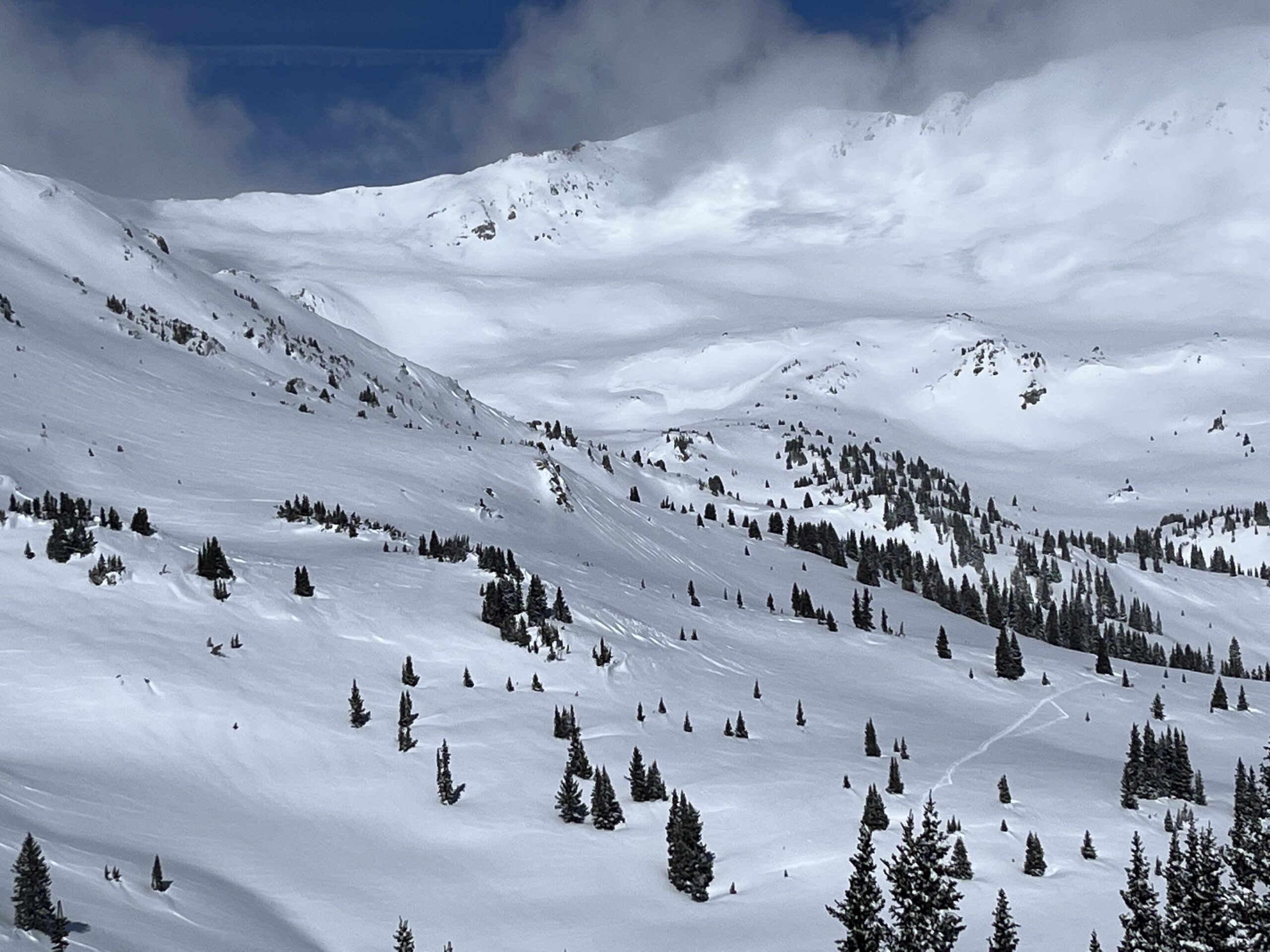
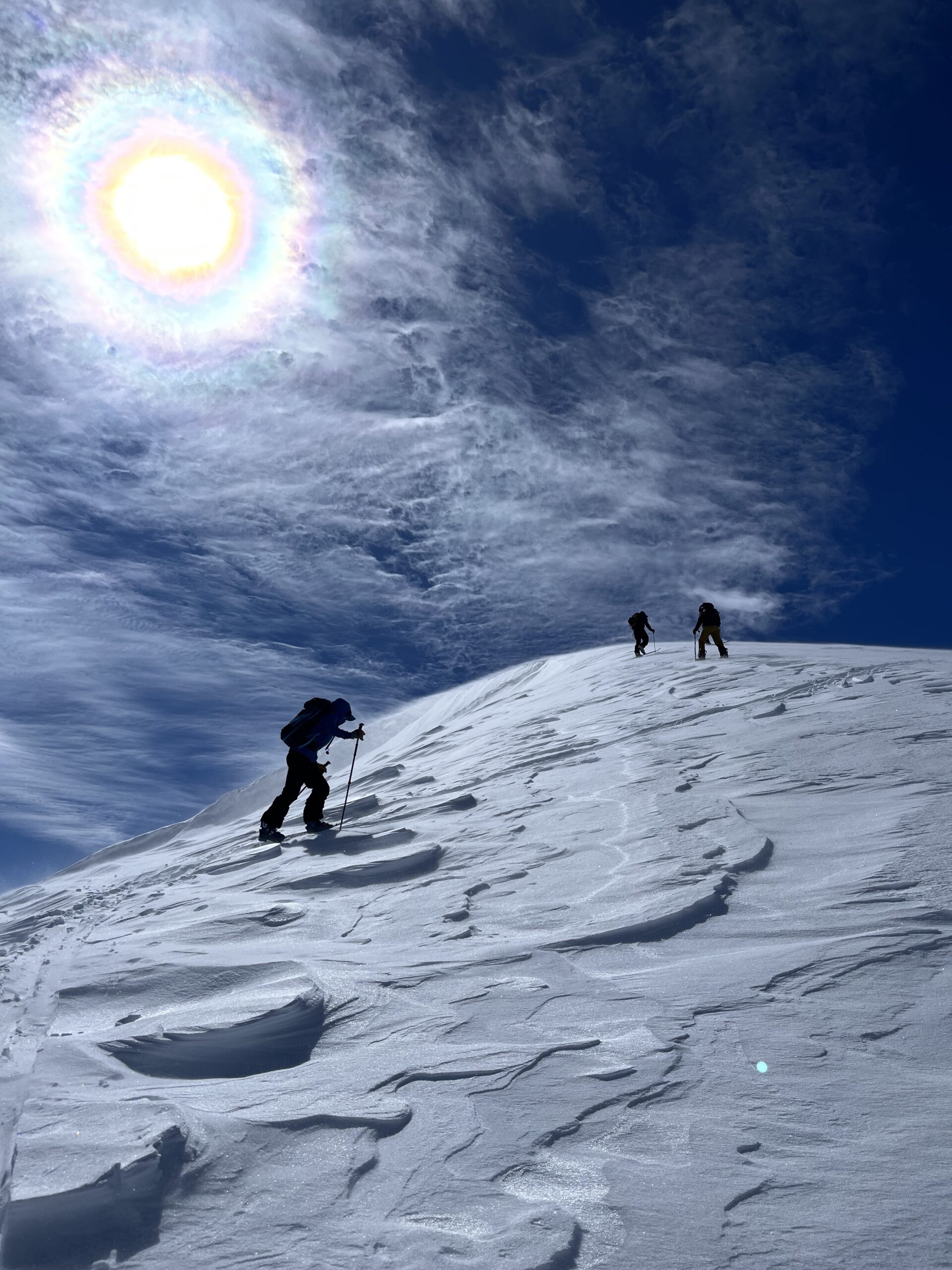
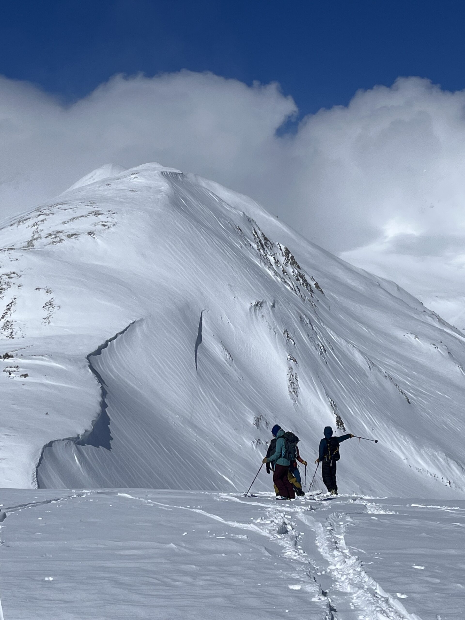
Zone: Northwest Mountains Route Description: Snowmobiled to the south bowl of Baldy to get a closer look at the snowmobile triggered persistent slab from yesterday.
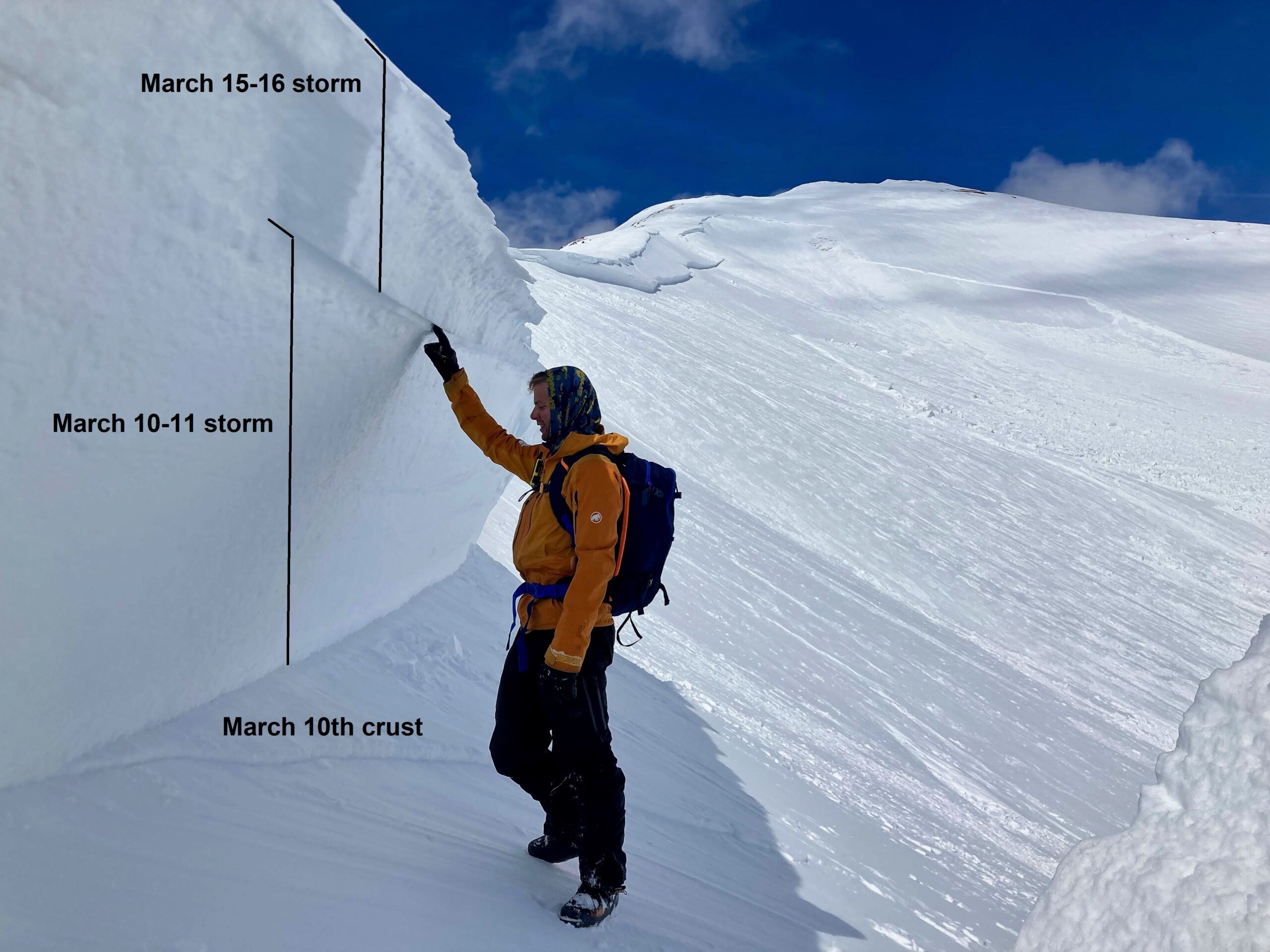
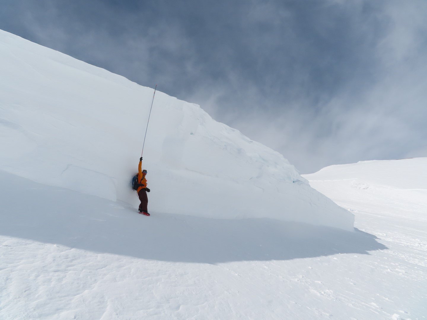
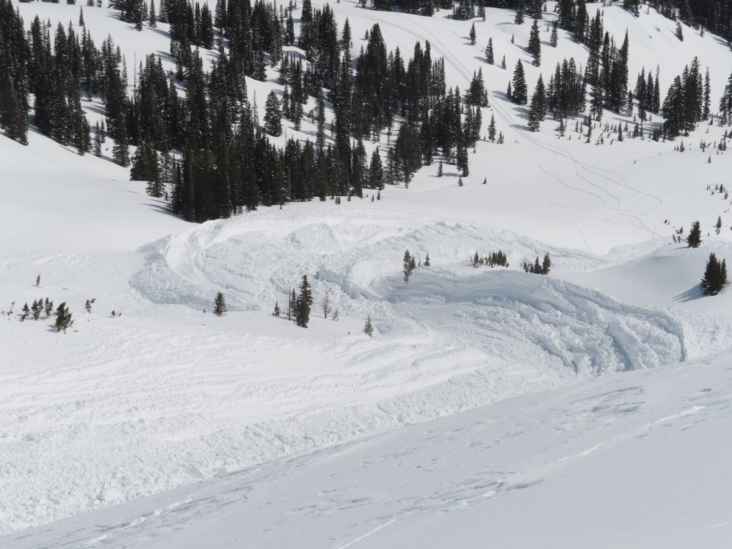
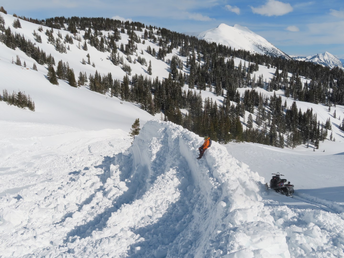
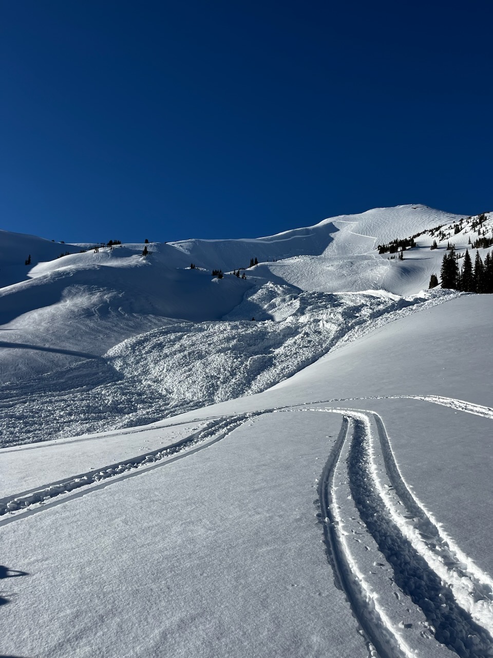
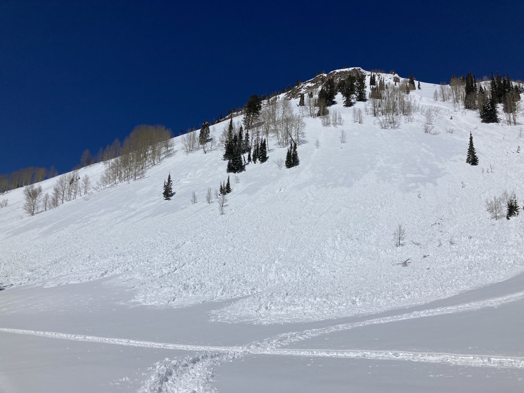
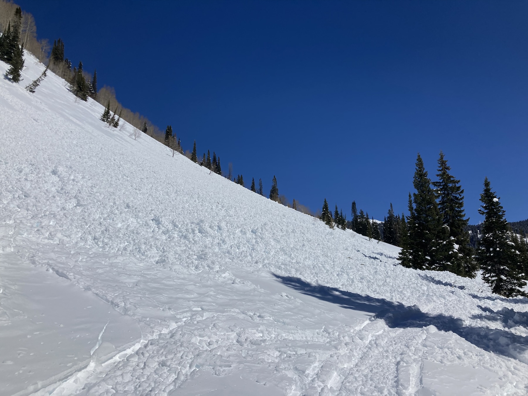
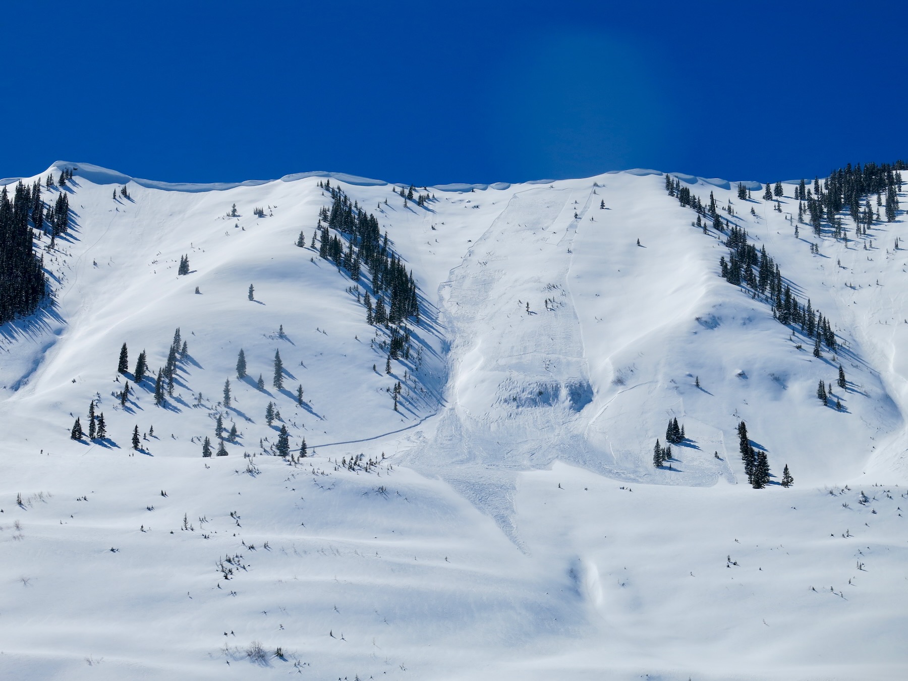
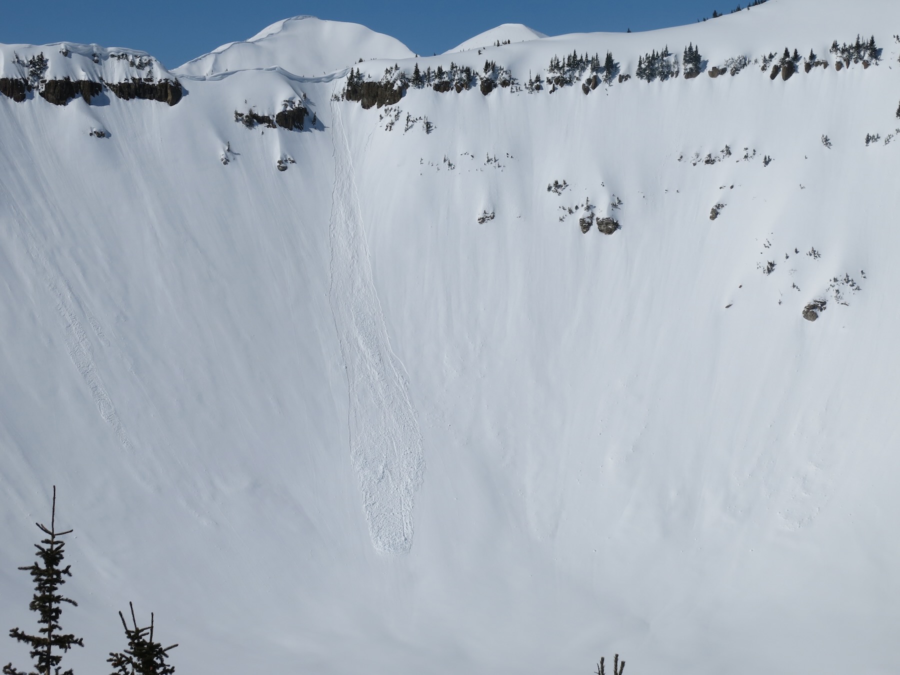
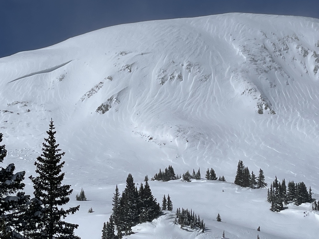
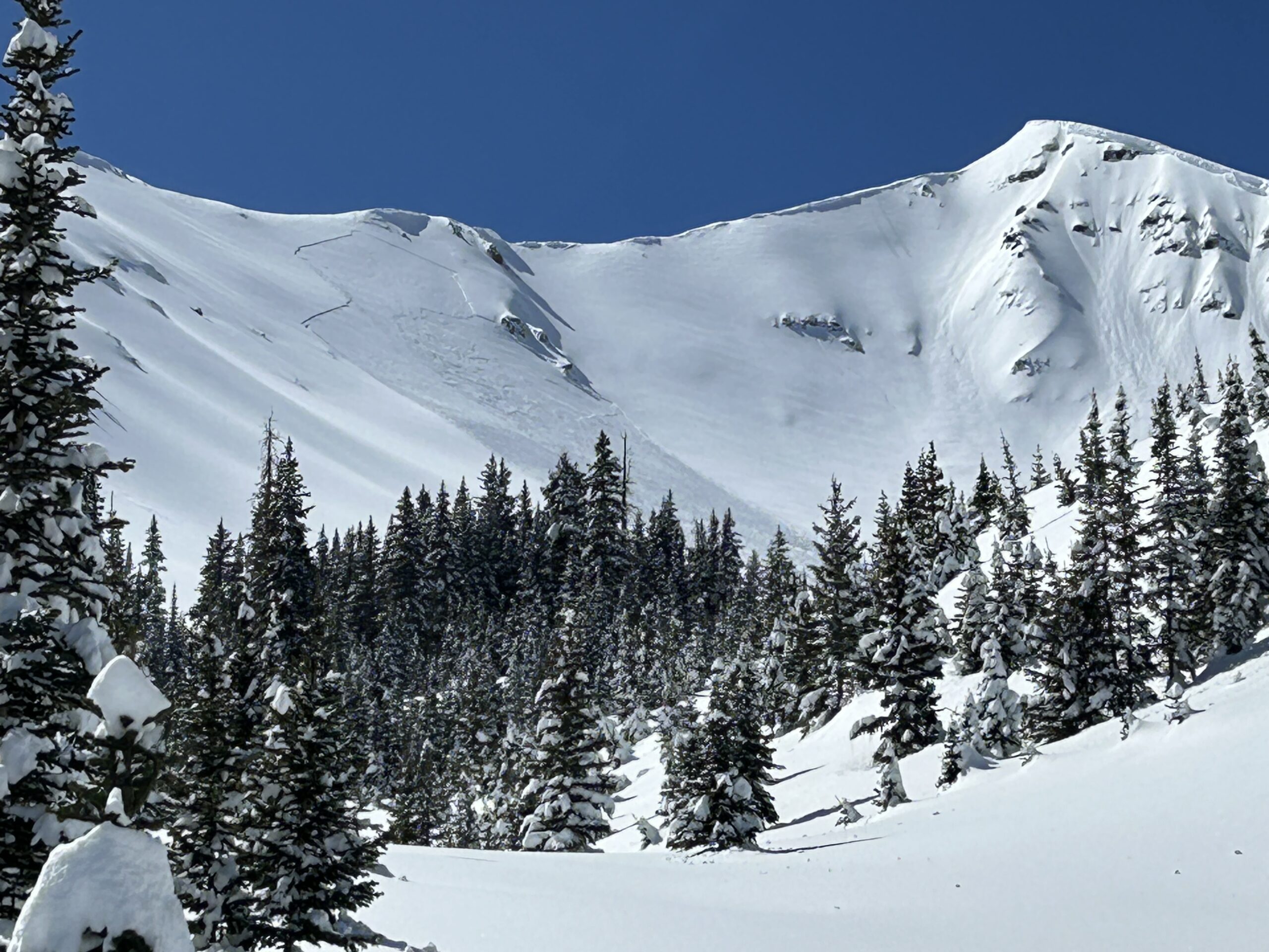
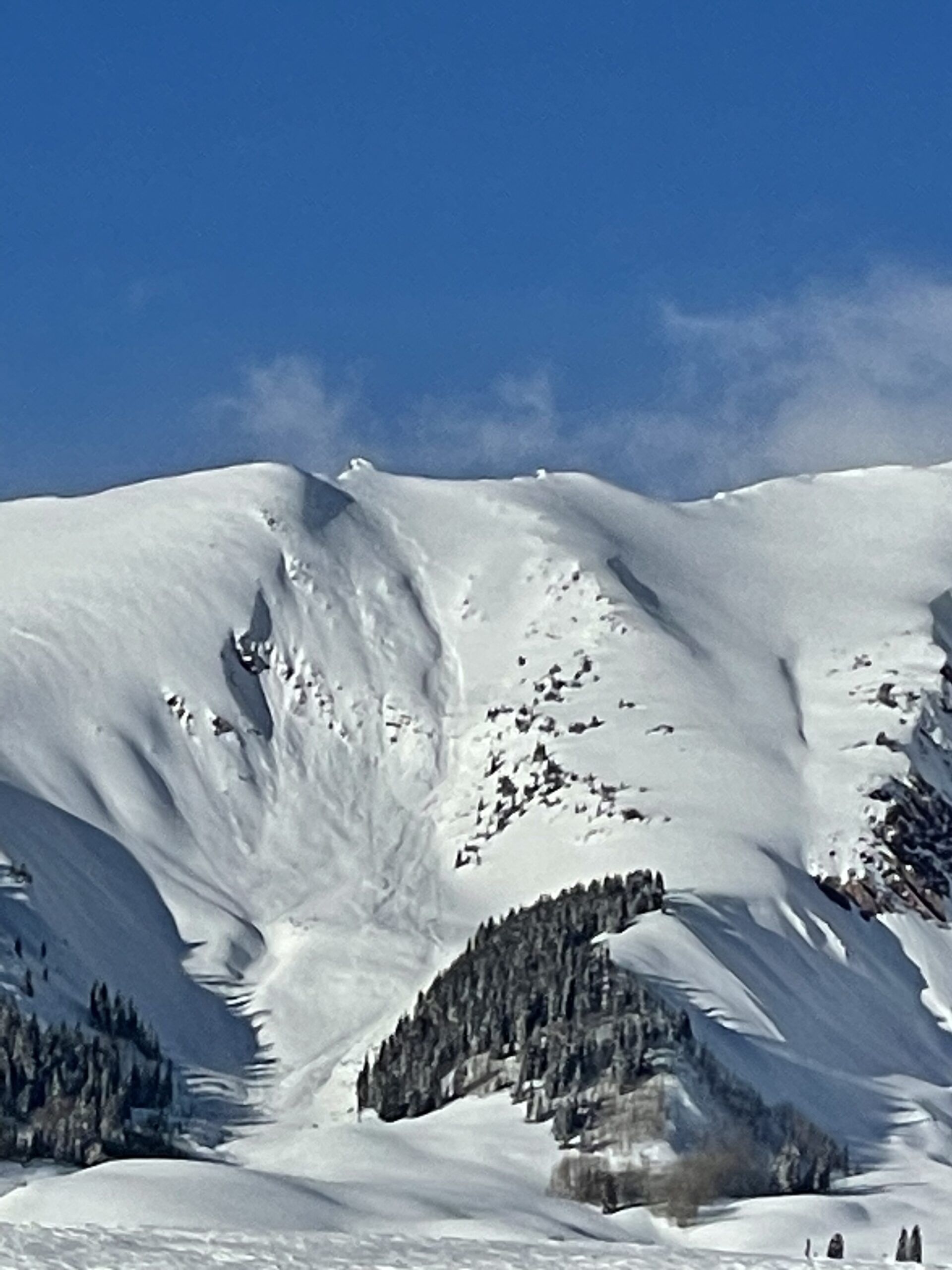
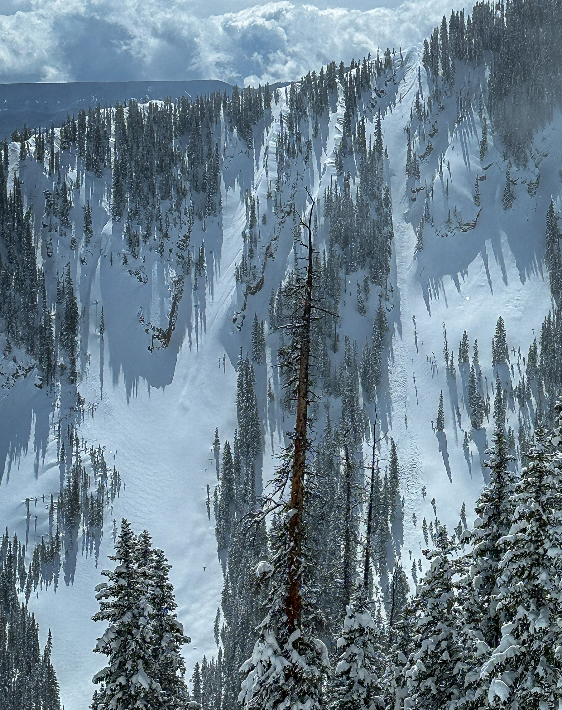
Observed avalanche activity: Yes Avalanches: Huge! This was the biggest human-triggered avalanche that I’ve ever investigated and the most destructive slide we’ve seen this season since the Red Lady ran in early January. The crown was just under 2,000′ wide and ran about 1200′ vert, wrapping from south to southeast aspects near and above treeline. It is a hard slab that averaged about 5 feet thick. Some of the well-drifted areas were over 10 feet with a max crown depth of 15 feet. We estimate the debris pile was up to 30 or 40 feet deep. The snowmobiler remotely triggered the slide while ascending along a safe ridgeline. They weren’t sure exactly where the trigger point was; we estimate it was near a shallower spot near the top of the bowl, about 30 or 40 feet from the avalanche. We classified the avalanche: HS-AMr-R3-D3.5-O
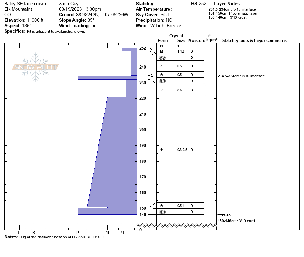
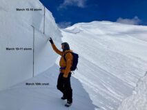
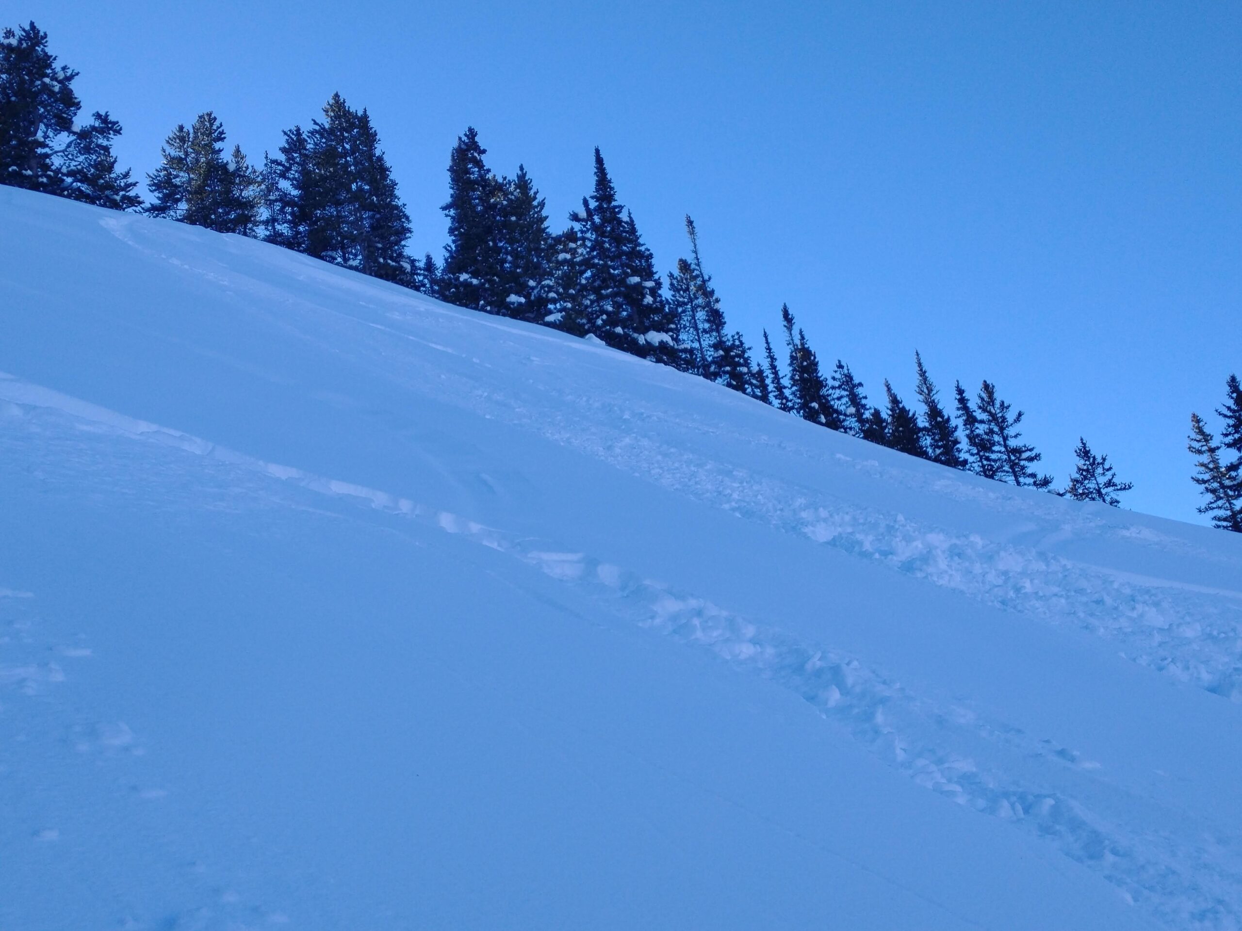
Observed a handful of other small storm slabs and wind slabs that ran or were triggered sometime in the past few days, and one large persistent slab on a south aspect ATL near Avery Peak. See photos and details below. Weather: Partly cloudy, mild temps, light winds with no transport observed. Snowpack: The avalanche failed just above the March 10th crust, and was made up of drifted snow from the March 10th-11th storm and March 15th-16th storm. We dug one snow profile in a shallower part of the crown. See profile below. The weak layer is difficult to discern (~.5 mm rounding facets, 1F) and did not produce results in an extended column test. Grain sizes are slightly larger than the overlying slab, and one level of hardness softer than the overlying slab and underlying crust, both of which are pencil-hard. The snow surface at this location was 1.0 to 1.5 mm near-surface facets over a thin, soft crust.
Photos:
Snow profile from a thin portion of the crown.
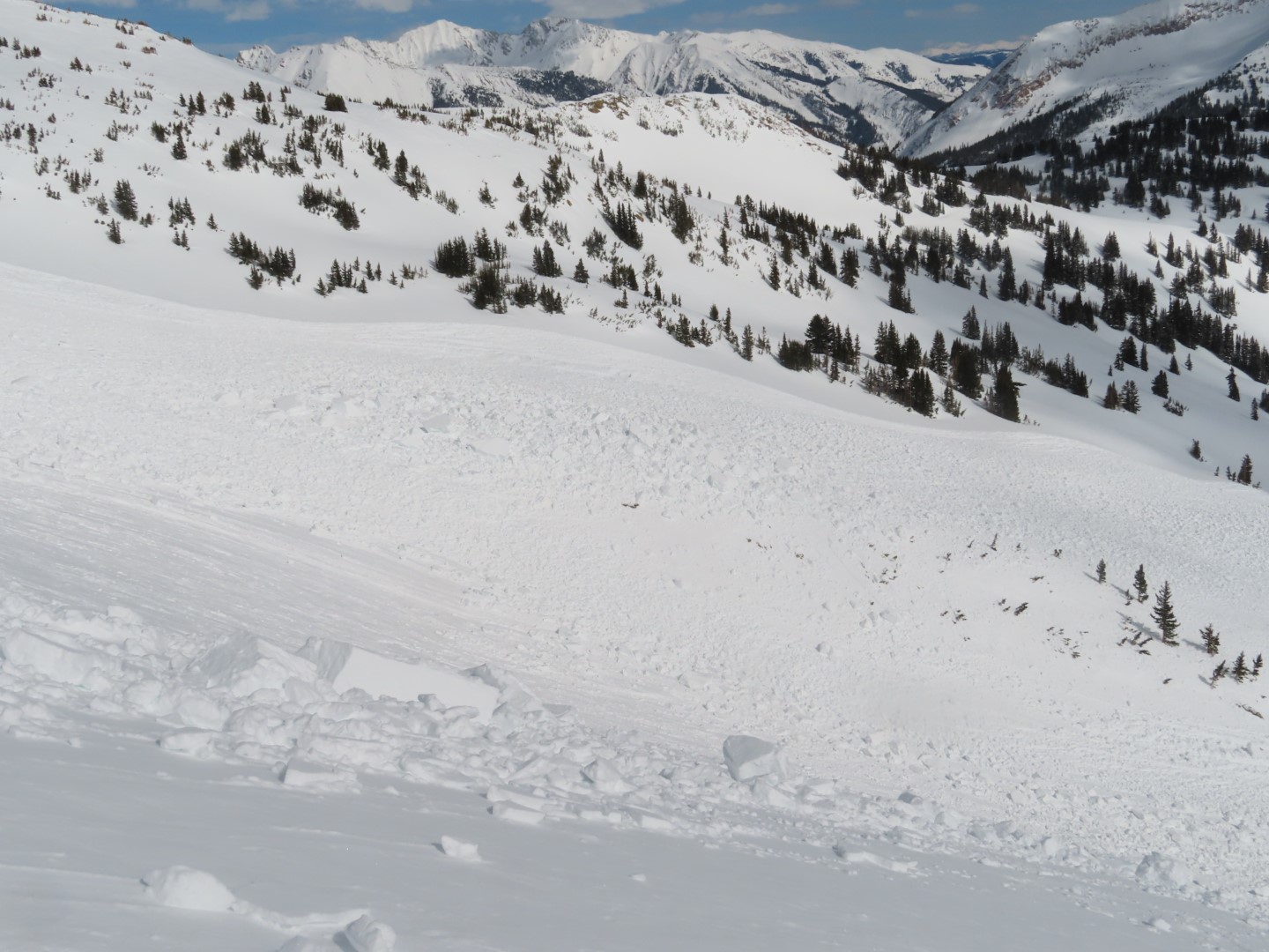
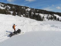
Looking up at the slide. Evan and his sled for scale.
The crown in a drifted area
The crown was up to 15′ at its thickest
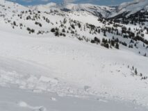
Looking down at the debris
Car-sized debris chunks
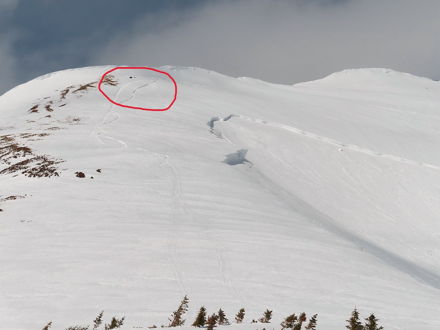
We’re guessing the slide was triggered somewhere near the circled area where the slab is thinner
Evan sunbathing on some debris flow features
Deep debris piles
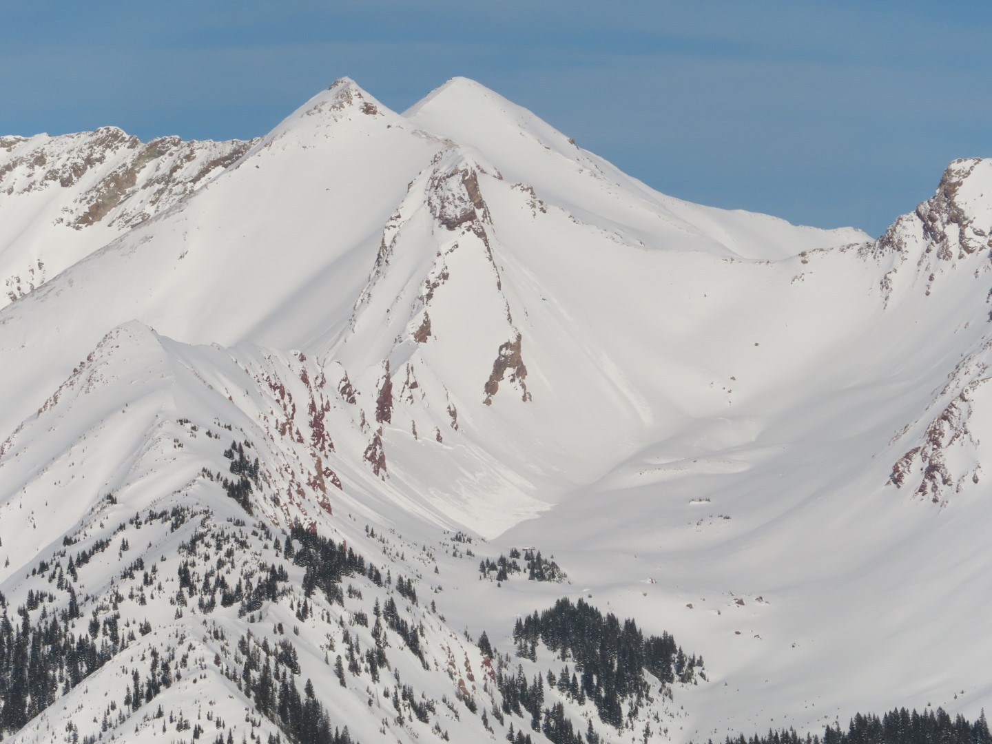
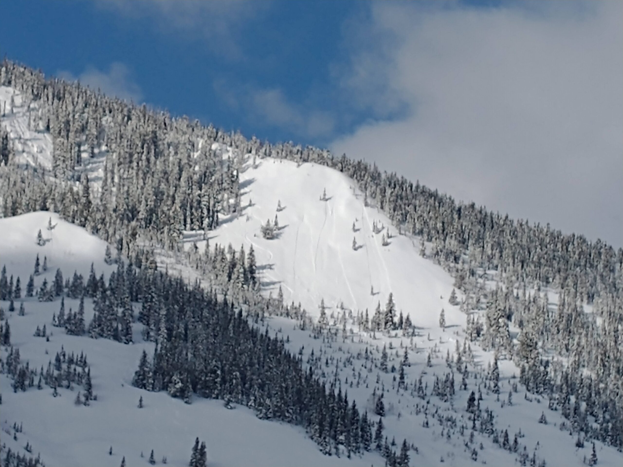
A persistent slab on a south aspect near Avery Peak
Relative Size: R1 very small Destructive Size: D1- Relatively harmless to people Avg. crown height (inches): Avg. width (feet): Avg. vertical run (feet):
Involvements
# of people caught: # of partial burials: # of full burials:
Additional comments: Storm slabs near Elkton Knob. Failure date estimated, could be anytime since 3/16.
Relative Size: R1 very small Destructive Size: D1- Relatively harmless to people Avg. crown height (inches): Avg. width (feet): Avg. vertical run (feet):
Involvements
# of people caught: # of partial burials: # of full burials:
Additional comments: Coney’s skier triggered. Failure date estimated, could be anytime since 3/16.
Relative Size: R2 small Destructive Size: D2 – could bury, injure, or kill a person Avg. crown height (inches): Avg. width (feet): Avg. vertical run (feet):
Involvements
# of people caught: # of partial burials: # of full burials:
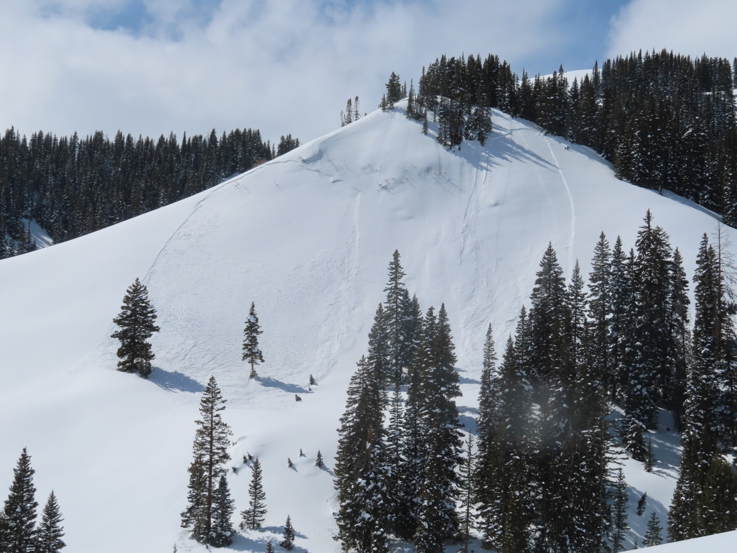
Additional comments: The basin just north of Avery Peak. Looks like it failed on 3/10 crust.
Zone: Southeast Mountains Route Description: Skin track from Gothic Rd (Tuttle Cabin) to 3rd bowl on Snodgrass ridge
Observed avalanche activity: Yes Avalanches: An avalanche on the rollover of 3rd bowl, which appeared to be skier triggered (tracks in) Weather: Sunny but shaded in the bowl. Calm. -7C at Gothic townsite
Relative Size: R2 small Destructive Size: D1- Relatively harmless to people Avg. crown height (inches): Avg. width (feet): 15 ft Avg. vertical run (feet): ~100 ft
Involvements
# of people caught: # of partial burials: # of full burials:
Additional comments: Not 100% sure it was skier triggered, but I saw tracks going into it, but no tracks in the path after it had run
Relative Size: R3 medium Destructive Size: D3 – could destroy a car, wood-frame house, or snap trees Avg. crown height (inches): Avg. width (feet): Avg. vertical run (feet):
Involvements
# of people caught: # of partial burials: # of full burials:
Zone: Northwest Mountains Route Description: Slate River
Observed avalanche activity: Yes
Snowpack: Loose-dry and Loose wet avalanches looked like the primary avalanche problems NTL and BTL. Both natural and skier-triggered. Most of the wet avalanche activity appeared to have occurred yesterday or previously. I didn’t travel on southerly-facing slopes today and don’t know how wet they got, but temperatures did feel cooler than yesterday. The only recent slab avalanche I saw was in the Great Wide Open of Skooks. It looked like it failed after yesterday morning’s 1″ of fairy dust.
Photos:
S to SW loose wet avalanche debris.
S to SW loose wet avalanche debris.
S to SW loose wet avalanche debris.
Another soft slab in the Great Wide Open of Skooks.
Relative Size: R2 small Destructive Size: D2 – could bury, injure, or kill a person Avg. crown height (inches): Avg. width (feet): Avg. vertical run (feet):
Involvements
# of people caught: # of partial burials: # of full burials:
Date of Observation: 03/17/2023 Name: Chris Martin
Zone: Southeast Mountains Route Description: Aspen to CB via Starr Pass. We traveled over the pass via wind scoured ribs and ridges Wednesday morning before the intense precip of another river Wednesday evening.
We awoke thursday evening to the most quality powder skiing i’ve ever experienced in the friends hut zone.
Observed avalanche activity: Yes Avalanches: Carbonate Hill Flank SE – D2 R2 Hard Slab – Natural – failing at the ground, seemingly sometime Wednesday evening
Many various shallow storm slabs failing on solar crusts about 4-12″ in thickness Weather: Heavy precip Wednesday PM along with howling winds
Clear sunny skies Thursday Snowpack:
Zone: Southeast Mountains Route Description: Gothic townsite to Kettle Ponds
Observed avalanche activity: Yes Avalanches: 3 avalanches that had already run on 2nd bowl. Appeared to be natural as I couldn’t make out any tracks Weather: Mostly sunny. -8C, no wind, but signs of drifting overnight Snowpack:
Date of Observation: 03/16/2023 Name: Grant Robbins
Zone: Southeast Mountains Route Description: Skinning up Snodgrass and across the valley appeared to be an avalanche on south aspect of Red Ridge area.
Date of Observation: 03/16/2023 Name: Mark Robbins
Zone: Northwest Mountains Route Description: Amr
Observed avalanche activity: Yes Avalanches: Natural storm sluff in the playground, see photo
Weather: Cool air temps in the morning but the sun was doing its thing on southerlies by midday. Moderate NW winds, some evidence of wind transport in amr tenure, more evidence of cross loading over in the playground, see photo. Winds had stiffened some of the new snow on north facing terrain.