Observations

01/02/21

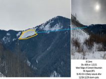
Cement Mountain West Ridge Avalanche ob

Date of Observation: 01/02/2021
Name: Andrew Breibart


Zone: Southeast Mountains
Location: West ridge-Cement Mountain
Aspect: North East
Elevation: BTL

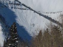
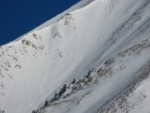
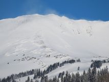
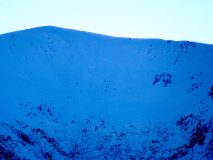
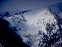
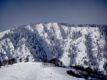
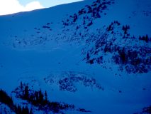
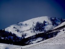
Avalanches: Observed a recent storm slab avalanche with unknown trigger but likely natural due to wind loading from strong SW winds during the night of 12/28-12/29 and additional snowfall with 1 inch of SWE (12/29/20 archive CBAC Weather) on a shallow snowpack in the SE zone. That’s a guess. Figure its in the R2-D2 category but cannot be certain from today’s vantage point across the Cement Creek Valley.
Weather: light winds and overcast.
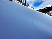
Snowpack: Just skiing the road due to non supportive snow in the area. Surface hoar is widespread and has a length of at least 2mm.


Photos:

Read Full Observation
01/01/21

Upper Cement

Date of Observation: 01/01/2021
Name: Eric Murrow, Zach Kinler, Zach Guy


Zone: Southeast Mountains
Location: Upper Cement Creek
Aspect: North East, East, West
Elevation: Near and below treeline to 11,800′


Avalanches: This area got about 6″ of snow from Monday night’s storm and we saw limited evidence of natural activity from storm. A few D1 to 1.5s on easterly aspects. No avalanches triggered today.
Weather: Increasing clouds, a snowflake or two, light winds.
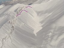
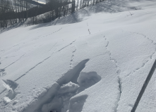
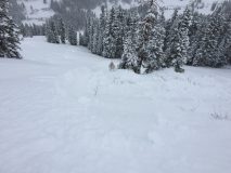
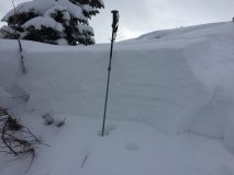
Snowpack: In Lower Cement, the persistent slab structure is poorly developed without enough snow to make a slab. As we gained elevation further up the basin (around 10,000′ near Block and Tackle trail), we started noticing shooting cracks and collapses. The slab is soft and a foot thick over fist hard depth hoar (3-4mm).  The snow surface and slab are faceting.  In less sheltered areas, there is a pencil hard wind crust near the 12/10 layer helping making for a drastic hardness change near the bottom of the slab. We experienced shooting cracks on both westerly and easterly aspects. In more wind affected areas, the collapses were localized to just drifted areas. We traveled adjacent to a few steep slopes and got them to collapse and crack remotely, but not avalanche.  We also got repeatable ECTPV results on the 12/10 layer in a pit on a NE aspect NTL.


Photos:
[/gravityforms]

Read Full Observation
01/01/21

Weekly Summary 1/1/2021

Zone: Crested Butte Backcountry
Date: 1/1/2021
Name: Jack Caprio/ Ian Havlick


Happy New Year! Unfortunately, our snowpack didn’t stay in 2020. Check out the weekly recap to see how the recent storms shook things up.


Read Full Observation
12/31/20

Brush Creek TH area – collapse city and remotely-trigger avalanche

Date of Observation: 12/31/2020
Name: Eric Murrow


Zone: Southeast Mountains
Location: Low elevation east-facing terrain at bottom of Mount Crested Butte above East River
Aspect: North, North East, East
Elevation: 9,000 – 9,800′


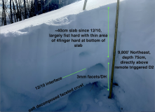
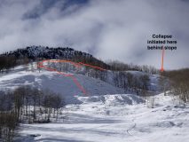
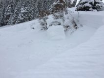
Avalanches: Remotely trigged 3 very small D1’s on east-northeast aspect from a single collapse that propagated around 300-400 feet
Remotely trigger a D2 avalanche from about ~500 feet away that traveled through several terrain features and mature aspen groves
Weather:
Snowpack: Slopes very near valley bottom felt incredibly weak and produced regular collapsing but only traveled 20 or so feet. As I ascended just a few hundred feet above valley bottom on east and northeast terrain, the collapsing started to propagate hundreds of feet to slope scale size. Slab formation since 12/10 is only about 40cm thick and mostly fist hard with a small amount of 4finger. It rests on well-developed facets around 3mm in size. Total depth on east and northeast slopes averaged around 65cm. The snowpack was screaming to avoid all avalanche terrain and so that’s what I did, but managed to be surprised by collapses rolling through low-angled, mature aspen forest and triggering adjacent slopes. The snowpack in this area is incredibly reactive and steep slopes feel like a sure bet for an avalanche.  Small surface hoar observed on northerly slopes.


Photos:
 

Read Full Observation
12/30/20

Bluebird views

Date of Observation: 12/30/2020
Name: Zach Guy


Zone: Southeast Mountains
Location: Coney’s
Aspect: North East
Elevation: N/BTL

Avalanches: Good views of the leeward aspects of the Northwest Mountains. Plenty of evidence of storm slab instabilities that ran throughout the storm, D1 to D2. A few slides looked like they broke into deeper layers, up to D2.5. Attached photos highlight the largest or most interesting activity.
We triggered a small storm slab (1 foot thick) on a rollover.
Weather: Clear, cold, calm winds.
Snowpack: Stepping off the beaten track we got frequent rumbling collapses and shooting cracks on basal weak layers. On shady aspects, we also got cracking at the storm snow interface about a foot down.


Photos:

Read Full Observation
12/30/20

Email ob from Red Lady skin-track

Date of Observation: 12/30/2020


Zone: Southeast Mountains
Location:
Aspect: South East
Elevation:


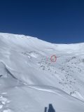
Avalanches: The photo below was taken at approximately 11 am on Wednesday, 12/30. From the skin track on Red Lady above tree line, a party of three of us saw two skiers come down the bowl, stop for a while in the circled spot, and remotely triggered the slide spotted lookers left to them maybe a minute or two after they had stopped there. We weren’t sure if they had stopped there for a particular reason and/or if they had noticed the remote slide. (Submitted by CBAC Forecaster from an email)
Weather:
Snowpack:


Photos:


Read Full Observation
12/30/20

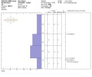
RMBL Study Plot 12/30/20

Date of Observation: 12/30/2020
Name: Alex Tiberio


Zone: Southeast Mountains
Location: Gothic Townsite
Aspect:
Elevation: 9500


Avalanches:
Weather:
Snowpack:


Photos:

Read Full Observation
12/30/20

frequent shooting cracks & collapses RLG

Date of Observation: 12/30/2020
Name: jeff banks


Zone: Southeast Mountains
Location: RLG to Gravel Pit
Aspect: East, South East, South, South West
Elevation: 9,400-12,000


Avalanches: 4 older avalanches from ~10,800-11,200. from tail end of storm around 1-2 inches of snow on the old debris/bed surface in the “W” bowl between standard skin track easy glade line.
Weather:
Snowpack: Barking snowpack. Can’t move without Small to Large collapses skiing in less disturbed areas. Shooting cracks 3-15m NTL & BTL SE-S-SW all the way down to Kebler road. Slopes cracking up to ~38* but not releasing. Seeing some aggressive terrain choices out there for how vocal the snowpack is. Via con dios amigos.


Read Full Observation
12/29/20

Avalanche obs on Whetstone from the highway

Date of Observation: 12/29/2020
Name: Eric Murrow


Zone: Southeast Mountains
Location: Whetstone Mountain
Aspect: North East, East
Elevation: near and above treeline


Avalanches: Observed natural avalanche on Whetstone at 945am.
Several avalanches on far southern end near CB south on east and northeast aspects near treeline, D1-D2
D2 avalanche in Barcelona Bowl NE aspect above treeline
D2 in Lucky Boy Bowl NE aspect near treeline

Several of these avalanches appeared to be shallow storm slabs that “stepped down” into deeper persistent weak layers

Photos:


Read Full Observation
12/29/20

Small Ski/Remote triggered slide at Coney’s

Date of Observation: 12/29/2020
Name: Dave Bumgarner


Zone: Southeast Mountains
Location: Coney’s Nose
Aspect: North East
Elevation: 10,800


Avalanches: Ski triggered/remote small D1 slide in the steeper section near the right of Coney’s nose. Was skiing the lower angle terrain and a small slide broke to my right and ran to the tree line.
No one was caught.
Slide slid on the early season snow 10–20 cm of large facets on the ground, broke around the shrubbery. (see photos)
Weather: Temp: Mid 20’s
Sky: Partly cloudy
Wind: light
Precip: S -1
Snowpack: Had a few collapses in undisturbed areas throughout our skin. Did not see any other avalanche activity beside our isolated slide. Multiple folks slaying Coney’s today skiing the main shots.


Photos:

Read Full Observation
The blog.