Observations

01/26/21

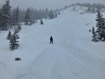
Wash Gulch Wandering

Date of Observation: 01/26/2021
Name: Ben Ammon

Zone: Southeast Mountains
Location: Coney’s and Snodgrass
Aspect: North East, East, South, South West, West
Elevation: B/NTL

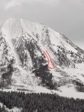
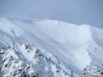
Avalanches: Observed debris below the West Face of Gothic. Looked fairly fresh but visibility was mediocre so hard to say from when, could not see start zones well enough to tell.
Weather: Overcast with periods of broken skies until around 230pm, with on and off S-1 and very light to calm winds. After 230pm winds were moderate from NW and S1 snowfall.
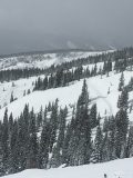
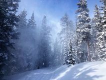
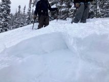
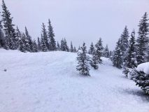
Snowpack: Storm snow much more supportive today, 4F to F+ right above the 1/19 interface. Traveled a few of the same zones Saturday on the tail end of the largest snowfall and could still feel old tracks despite very deep conditions, but today was a different story! Traveled on terrain up to the low 30 degree range facing NE, E, S, SW, and W. Observed no signs of instability, observed generally excellent ski quality.


Photos:

Read Full Observation
01/26/21

Gothic 7 a.m.

Date of Observation: 01/26/2021
Name: billy barr

Zone: Southeast Mountains
Location: Gothic

Weather: This is now the 8th day in a row with measurable snowfall and only one day has recorded more than 2½”. A true sign of a winter in drought. Light snow yesterday, then some clearing after dark as temperature dropped to -09ºF before clouds moved back and pushed it to the current 6F after a high yesterday of 24F. Light snow with 1″ new and water 0.09″. Currently overcast with very light snow, though small and dense crystals without any wind and snowpack sits at 35″. billy


Read Full Observation
01/25/21

Gothic 7 a.m.

Date of Observation: 01/25/2021
Name: billy barr


Zone: Southeast Mountains
Location: Gothic

Weather: Cloudy all day yesterday and overnight with steady very light snow during the Sunday morning – a cold weather, small crystal, dense snowfall but not much of it until a brief last afternoon period of heavier snow. Then dry most of the night until snow started up around 5 a.m. Snow total is 3″ new and 0.29″ of water and the snowpack sits at 36½”. No wind (and none yesterday) and currently overcast and the snow seems to have stopped. The temperature range was a hgh of 27F, low 0F and currently 10F. billy


Read Full Observation
01/24/21

Red Lady Glades

Date of Observation: 01/24/2021
Name: Sasha Legere

Zone: Southeast Mountains
Location: Red Lady Skin Tracks
Aspect: South East
Elevation: 11800

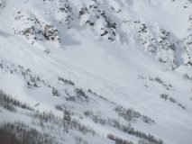
Avalanches: Watched it slide from the Red Lady skin track. No obvious trigger. Possible natural slide but did see some tracks on the ridge above the slide on our descent so possibly remote trigger.
Weather: Low visibility. Light snow. No wind.
Snowpack: Storm Slab


Photos:

Read Full Observation
01/24/21

Thor Himself,

Date of Observation: 01/24/2021
Name: Emilio Alcala

Zone: Southeast Mountains
Location: Reno Divide
Aspect: East, West
Elevation: 11,200

Avalanches: Collapsing and Whumpfing, everywhere, loud as Thor. No visible avalanches.
Weather: Overcast with occasional sun pockets, light west wind, moderate snowfall.
Snowpack: Wind stripped @ ridge.
West aspect-
30-60cm below ridge. Firm sun crust and wind board.
East aspect-
60-105cm below ridge. Firm windslab on top of sun crust supportive to snow machine.
Sheltered on ridge-
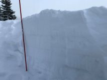
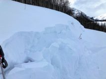
105cm, 10cm storm snow (see photo)


Photos:

Read Full Observation
01/24/21

Cement Creek Snow

Date of Observation: 01/24/2021
Name: Cosmo Langsfeld


Zone: Southeast Mountains
Location: Cement Creek Ranch
Aspect:
Elevation: 9250’


Avalanches:
Weather: Storm total as of Sunday morning is 2”. That includes 1.5” reported yesterday morning.
Snowpack:


Read Full Observation
01/24/21

Gothic 7am Weather Update

Date of Observation: 01/24/2021
Name: billy barr

Zone: Southeast Mountains

Weather: Only light snow after sunset until early in the morning but decent snow Saturday afternoon so the 24 hour total is 3½” new with 0.27″ of water. Snowpack reached 37″ deep but now sits at 35″. Currently cloudy with no wind. Temperature range was from a high 0f 32F to a low of -2F but it has jumped to 10F by sunrise. The recent snow has propelled this winter to 31st of the last 47 winters in snowpack, but that was just the climb from the past few days as snowfall to date has dropped to 45th of the last 47 winters.

Read Full Observation
01/23/21

Not your grandma’s sluffing

Date of Observation: 01/23/2021
Name: Zach Guy

Zone: Southeast Mountains
Location: Snodgrass
Aspect: North East
Elevation: 9400′ – 11000′

Avalanches: D2 natural slab avalanche off of the East face of Gothic along with some smaller slides on Gothic.
On Snodgrass, we noted 3 natural loose snow avalanches and intentionally triggered about 5 others that ran about 400 vertical feet. These were all larger than you might expect because they entrained the 12″ of storm snow along with most of the season’s weak snowpack, generally about D1.5 in size. We probed debris on a low angle bench where several slides had overlapped and it was up to 8 feet deep.
Weather: Moderate snowfall through mid-afternoon (S1 to S3). Moderate southwesterly winds were shaking trees and blowing snow near Snodgrass Summit, but weren’t mixing into the wind protected terrain. We also could see and hear gusts moving snow near valley bottom of the East River.
Snowpack: 4″ of storm snow at the trailhead and 12″ near the summit. The new snow wasn’t quite cohesive enough to form a storm slab except in drifted areas. Very minimal cracking. I felt one collapse on a low angle slope that was on basal weak layers (12/10), about 30″ deep. The storm snow is on a mix of rotten facets and windboard capped facets. The windboard is more common lower in the terrain, facets more common in upper start zones.


Photos:

[/gravityforms]

Read Full Observation
01/23/21

Gothic Weather Update 7am

Date of Observation: 01/23/2021
Name: billy barr

Zone: Southeast Mountains

Weather: Winter is here- i seemed to have forgotten how much more difficult it is to get around when it snows as it has been a while. —Light snow overnight picking up some after midnight with 7½” new and water a lighter 0.45″. The snowpack has reached the winter’s deepest of 35″. Currently obscured cloud cover with moderate snow and thankfully no wind. Yesterday’s high temp was 28F this mornings low and the current is 21F. We had more snow last night than the whole of January up until today.

Read Full Observation
01/23/21

Cement Creek 7am Weather Update

Date of Observation: 01/23/2021
Name: Cosmo Langsfeld

Zone: Southeast Mountains
Location: Cement Creek
Elevation: 9250

Weather: 1.5” @ 6:30aa

Read Full Observation
The blog.