Observations

11/07/22

Like skiing in the Front Range

Date of Observation: 11/07/2022
Name: Zach Guy

Zone: Northwest Mountains
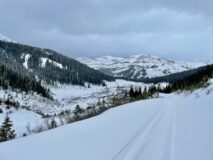
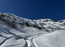
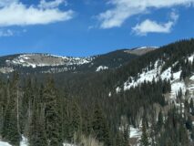
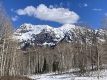
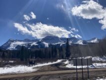
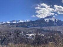
Route Description: Toured into Peeler Basin and upper Oh-Be-Joyful Basin from Lake Irwin, traveling on various aspects up to 12,000′

Observed avalanche activity: No
Avalanches: Just some rollerballs on southerly aspects today.
Weather: Mild, few clouds, light to moderate SW winds.
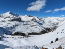
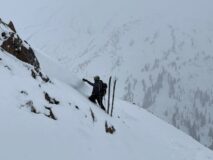
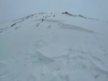
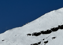
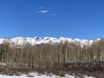
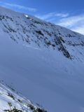
Snowpack: Shallow and wind hammered sums it up. Traveled mostly near and above treeline, where its tough to find snow surfaces softer than 4F, except for random patches of unsupportive facets. Last weekend’s winds did some damage, with lots of erosion from W to NW winds. The snowpack is weakest on N and NW slopes, but generally lacks a slab except for isolated pockets of deeper crossloading. Surfaces on those slopes were stiff wind crusts or softer sastrugi, with faceting through much of the snowpack. The east quadrant held recently drifted snow up 1F hard, highly variable in slab thicknesses up to at least 18″. Kind of spooky to travel on because it wasn’t always obvious if you were on a stiff slab or just a firm wind crust without some digging. Stability tests on east aspects produced moderate propagating results on the 11/3 interface (a faceted crust), though we observed no signs of instability on the slopes that we traveled. I avoided approaching some of the meatiest looking drifts for fear of remote triggering or getting tangled in a stiffer slab. Southerly aspects were getting cooked into what will be a supportive crust tomorrow.
The thin ice crust described in previous obs was also present near the snow surface in some areas; it appeared to be formed by a riming event in this area – generally present only on terrain windward to southwest flow, up to ridgetop. It was on the south side of Scarp Ridge, in a few spots in Peeler, and absent in OBJ.

Photos:

5611
Read Full Observation
11/06/22

Cinnamon Mtn zone

Date of Observation: 11/06/2022
Name: Eric Murrow Ben Pritchett

Zone: Northwest Mountains
Route Description: Snowmobile ride from Washington Gulch to Schofield Pass area. Ski tour on the northern end of Cinnamon Mountain.

Observed avalanche activity: Yes
Avalanches: We triggered one small avalanche on a northeast-facing slope, around 11,900′. The avalanche was triggered on a 25-degree slope just off the ridge and propagated into an adjacent wind-drifted feature over 40 degrees in steepness
Weather: Ridgeline Wind Speed: 5-10 mph
Ridgeline Wind Direction: W
Wind Loading: None
Temperature: 33 F
Sky Cover: Overcast
Depth of New Snow: 2 cm
Depth of Total Snow: 60 cm
Weather Description: Warm (just above freezing), snowing lightly (even misting rain off mid day).
Snowpack: We found the November 5th rain crust throughout our trip. Above 11,000 the crust is too thin to play a long-term role, but it’s worth tracking the evolution of this crust below treeline if it remains near the snow surface with cool weather. It could become a problematic faceted crust in time.
Snow height ranged from 20-30cm deep in lower Washington Gulch up to an average 60-70cm deep in wind-sheltered locations near treeline in the Paradise Divide area.
We found recently drifted slabs mostly above treeline, on northerly and easterly-facing slopes near ridgelines. Only the wind-loaded features with a broad and open fetch on their windward side posed a problem. Fresh slabs from the wind on Saturday were generally in the 40-50cm range, resting on a layer of small (1mm) facets.
Wind-sheltered slopes were right-side-up, with denser supportive snow near the ground and soft snow on top.

Photos:

5609

Read Full Observation
11/05/22

Sensitive wind drifts and a rain crust?

Date of Observation: 11/05/2022
Name: Eric Murrow

Zone: Northwest Mountains
Route Description: Toured from Pittsburg to the bottom of Baxter Basin.

Observed avalanche activity: No
Avalanches: none observed. Visibility was poor.
Weather: Overcast skies, foggy conditions and very light snowfall.
Snowpack: Only toured up to 10,600′ on easterly and northeasterly low-angle terrain. Each drifted test slope we encountered collapsed and cracked (generally east and northeast aspects). The drifted snow failed on small-grained facets buried on Wednesday night. Slabs were up to 4f hard and 16 inches thick. We also encountered a thin (5mm) crust on the surface that appeared to be from a short period of rain Friday night or Saturday morning. It was present up to 10,600′ where we stopped uphill travel.

Photos:

5608

Read Full Observation
11/05/22

Gusty

Date of Observation: 11/05/2022
Name: Zach Guy

Zone: Northwest Mountains
Route Description: Mount Baldy, easterly aspects to 11,200′

Observed avalanche activity: Yes
Avalanches: On wind loaded southeast facing test slopes, we triggered a few slabs up to 18″ thick, 4F hard, failing in the recent storm snow.
Weather: Significant increase in winds since yesterday. Moderate northwest winds with strong gusts, with moderate snow transport where we traveled below treeline. Overcast with very light snowfall.
Snowpack: Total snow depth is generally 18″ to 24″ deep. Isolated wind slabs forming below treeline, with slabs growing thicker and more widespread as we approached treeline. Shooting cracks in drifted slopes, generally on east to south aspects. Significant scouring off of exposed north-facing terrain above treeline.

Photos:

5607

Read Full Observation
11/04/22

fresh snow and wind transport at paradise divide

Date of Observation: 11/04/2022
Name: Mark Robbins

Zone: Northwest Mountains
Route Description: sledded up wash gulch to paradise divide, skinned up looker’s right side of WSC bowl, skied main WSC bowl below the rocky chutes

Observed avalanche activity: No
Avalanches: no new avalanche activity
Weather: cold, in and out of clouds all morning with minimal snowfall, moderate winds out of the north effectively transporting new snow
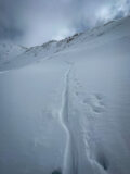
Snowpack: 8-10 inches new snow. See photos for evidence of wind transport – partially covering skin track in between laps, and crossloading of west facing gullies in the bowl

Photos:

5606

Read Full Observation
11/04/22

Good stability in wind sheltered terrain

Date of Observation: 11/04/2022
Name: Zach Guy and Zach Kinler

Zone: Northwest Mountains
Route Description: Mt. Bellview to 12,200′, on east and south aspects.

Observed avalanche activity: Yes
Avalanches: A few harmless (D1) slides that started from above treeline on Gothic and Baldy. Couldn’t discern if they were soft slabs or loose avalanches because of flat light.
Weather: A mix of clouds and sun. Moderate northerly winds were drifting snow at ridgetop onto southerly aspects.
Snowpack: Storm total was about 6″, not enough to cause any real concerns in wind sheltered terrain.  Wind effects were fairly minor as we gained elevation: fresh cornices at ridgetop were sensitive but small, with very small pockets of soft slab releasing below. Total snow depth increased to about 2 feet deep near/above treeline. The storm interface transitions from small facets (on shadier aspects) to a melt-freeze crust (on sunnier aspects) right around due East (90*).

Photos:

5605

Read Full Observation
11/02/22

Ruby Range alpine ob

Date of Observation: 11/02/2022
Name: Eric Murrow

Zone: Northwest Mountains
Route Description: Toured from base of switch back at the head of Slate River up towards Purple Mountain.

Observed avalanche activity: No
Weather: Sunny skies, mild air temperatures, and moderate wind speeds with small amounts of snow transport above treeline.
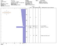
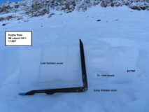
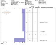
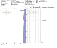
Snowpack: Continuous snow coverage exists on the north half of the compass in this portion of the forecast area ranging from around 10 inches below treeline to a bit more than 2 feet above treeline. Small faceted grains (less than 1mm) comprise much of the snowpack on shaded slopes. Above treeline on northerly slopes, the snow surface was a mix of stiff windboard and soft faceted grains. At the highest elevations, there is a melt/freeze crust resting on the ground from snow early in the fall (see profile image). The few sunny slopes traveled showed a shallow, moist snowpack without any concerning weak layer formation.

Photos:

[/gravityforms]

5604

Read Full Observation
11/02/22

Pre-storm surface obs from Kebler

Date of Observation: 11/2/2022
Name: Zach Guy

Zone: Northwest Mountains
Route Description: Driving Kebler Pass

Observed avalanche activity: No
Weather: Sunny, breezy, mild temps. A few snow plumes off of the high peaks this morning.
Snowpack: The current surface is our most pronounced and widespread weak layer to date. There is continuous snow coverage across most West to North to East aspects at all elevations. The southern quadrant has patchier coverage above treeline and is mostly melted off below treeline. Below treeline, snow depth averages about 10 inches in the shade. The snowpack is .5-.7mm developing facets on steep northerlies, with large surface hoar in open areas below treeline. On southerlies and flat terrain, the snowpack was wet grains throughout, with no obvious weak layer development.

Photos:

5603

Read Full Observation
10/29/22

Halloween bowl natural

Date of Observation: 10/29/2022
Name: Turner Petersen

Zone: Northwest Mountains
Route Description: Toured from Scofield pass with Whitney and Lawson

Observed avalanche activity: Yes
Avalanches: Natural slab avalanche around 11,800ft N face in Halloween bowl. Assuming it ran on Wednesday.
Weather: Sunny, upper 30’s
Snowpack: 35-40cm?

Photos:

5600

Read Full Observation
10/27/22

Gothic Weather 10/27

Date of Observation: 10/27/2022
Name: Billy Barr

Zone: Southeast Mountains
Route Description: Gothic Townsite

Observed avalanche activity: No
Avalanches:
Weather: Steady snow yesterday before a pause near sunset and then scattered light snow during the night before picking up around 4 a.m. and stopping before 6 am.  The 24 hour total is 10″ new with 0.66″ of water.  The snowpack is currently at the winter’s deepest of 14″.  It is overcast and calm and no longer snowing.
Snowpack:

5599

Read Full Observation
The blog.