Observations

11/28/22

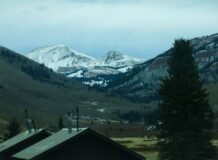
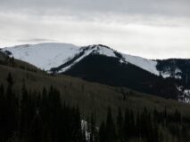
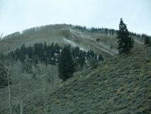
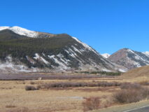
Few more data points for Lower Brush Creek and Cement Creek.

Date of Observation: 11/28/2022
Name: Evan Ross

Zone: Southeast Mountains
Route Description: Lower Brush Creek and lower Cement Creek. Right in the donut hole.

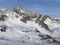
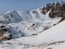
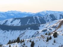
Snowpack: Lower Brush Creek and lower Cement Creek is often characterized as being located within the “donut hole” portion of our greater forecast areas. This donut hole holds the least amount of snow when compared to the surrounding mountains. Anyway, this is of course the case right now.

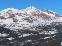
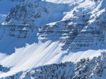
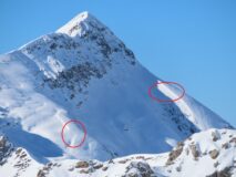
Above treeline, old snow does exist around the compass. Though the southern half of the compass has spotty snow coverage on those slopes located closer to town and not as deep into the mountains.

Near treeline has old snow coverage on NW to NE. While W and E have some coverage but are fairly shallow and rough.

Below treeline, there is really just the northern quadrant to talk about for snow coverage. Even on north, the snow coverage is of course shallow, and often rough.

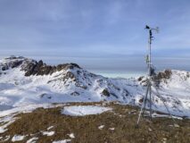
The camera is good a picking up “white” and “dark” colors but not so good at highlighting the finer details from afar. There is also a little bit of fresh snow in these photos and adding some white to non-problematic slopes.

Photos:

5639

Read Full Observation
11/27/22

Significant Wind Loading around Yule Pass

Date of Observation: 11/27/2022

Zone: Northwest Mountains
Route Description: Climbed NTL: S, SE, E, NE; Skied ATL, NTL: NW, N, NE

Observed avalanche activity: Yes
Avalanches: Saw a few D1-sized loose sluffs release naturally on leeward slopes triggered by active wind transport, which entrained top few inches of snow, and ran a few hundred feet in terrain ~35° in steepness.
Weather: Light snow; clear to cloudy; ATL winds from W, NW, N at ~20-30mph consistently
Snowpack: A huge range of snow conditions, depths, and structures. ~4 inches of new very dry snow NTL-ATL. Wind had transported up to ~6 inches of snow in leeward terrain by around noon.

No cracking or collapsing produced when skinning across suspect slopes with weak structure, and kicking cornices produced no results on slopes below.

New/wind transported snow was not stiffened yet and so made for decent skiing.

At lower more Easterly terrain snow was either icy, wind-stiffened, or sun-affected.

5636

Read Full Observation
11/27/22

Gothic weather

Date of Observation: 11/27/2022
Name: billy barr

Zone: Southeast Mountains
Route Description: Gothic townsite

Observed avalanche activity: No
Weather: This was the first measurable snowfall in 17 days so if just to keep in practice, here is the info. Just ½” new snow and water content 0.05″. Snowpack has held at 6″ deep for weeks though dropped to 5½” yesterday but now back at 6″. Total snowfall so far this winter ranks 49th of the past 50 years. That tells you something. Snow on the ground is rotten. Cleared towards sunrise and it is mild with yesterday’s high 43F and currently the morning low of 20F. With all the clear weather the daily lows have been below average but highs above, but overall a cool month.

5634

Read Full Observation
11/26/22

Baxter basin NFace Schuylkill

Date of Observation: 11/26/2022
Name: Turner Petersen

Zone: Northwest Mountains
Route Description: Toured with Owen Berv and Holden Bradford up Baxter basin on the Schuylkill side of the basin. Fully changed our tour plan to avoid crossing a wind loaded gully above exposure that we were concerned about after noticing more sensitive than expected small wind slabs when skinning over lower angle convexities lower in the drainage.

Observed avalanche activity: Yes
Avalanches: While skiing we all got slow moving facet sluffs to run a good 800’. Not concerning in the terrain we skied but could be in more extreme terrain.
Weather: Sunny. Slight Winds from the west.
Snowpack: Thin. 40 Cm’s?

Photos:

5633

Read Full Observation
11/26/22

Snow coverage obs

Date of Observation: 11/26/2022
Name: Zach Guy

Zone: Northwest Mountains and Southeast Mountains
Route Description: Driving tour, Gothic Road, Washington Gulch, Slate River, and Kebler Pass

Observed avalanche activity: No
Snowpack: The northern half of the compass has continuous snow coverage at all elevations. We know the snow there is weak and faceted. Coverage continues around the southern half of the compass above treeline, except for the shallowest areas or wind-eroded slopes on the southwest quadrant. Below treeline, most slopes have melted out on SE, S, SW aspects. The sunnier halves of W and E have some melted-out slopes as well, especially in the shallower parts of the forecast area.  A few example photos below.  All photos are here.

Photos:

5632

Read Full Observation
11/25/22

Weak

Date of Observation: 11/25/2022
Name: Zach Guy

Zone: Northwest Mountains
Route Description: Anthracite Mountain Resort, northerly and east aspects to 11,200′.

Observed avalanche activity: Yes
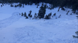
Avalanches: Triggered a few shallow sluffs in East Bowl. They’re still quite small and not gouging through the whole snowpack like we’ve seen in previous seasons this time of year.
Weather: Clear, mild, calm.
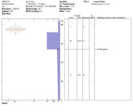
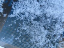
Snowpack: Documenting weak layers on the shady aspects in advance of a pattern change next week. In short, it’s shallow and weak.  See profiles. The snow surface is very weak below treeline (F-) and will struggle to hold any kind of load. It’s faceted throughout, generally 1-1.5mm here. Sluffs are entraining the top 6″ or so, but would probably gouge deeper once they gained enough mass. In more wind-affected terrain NTL, the snowpack is more variable and surfaces are a stronger mix of wind crusts and old wind drifts. However, there’s plenty of weak, faceted snow below these harder layers. In previously wind-eroded areas, those facets are larger and more developed than below treeline.

Photos:

5631

Read Full Observation
11/24/22

The wind wasn’t kind.

Date of Observation: 11/24/2022
Name: Evan Ross

Zone: Northwest Mountains
Route Description: Purple Ridge Lap. Easterly, 9,600-11,500ft.

Observed avalanche activity: No
Avalanches: None

Weather: Trace of new snow. Few clouds. Moderate winds continuing to transport a little snow near ridgelines.

Snowpack: The recent northerly wind event sure wasn’t kind to the snow surface and riding conditions. Many slopes now have a variety of lovely textures like wind-board, wind crust, firm wind texture, soft wind texture, and wind-exposed crusts. Though it’s not all doom and gloom, there are still some areas with a soft snow surface, just fewer of those areas than a couple of days ago.

I didn’t encounter any thick wind drifts, but there were a lot of thin, hard slabs or wind-boards dispersed through the terrain. Given how weak the old snow is, these thin drifts often collapsed and occasionally produced shooting cracks. Though the actual slab size was very small. Looking around the area there were some cross-loaded terrain features and a few southerly-facing slopes, that may be holding some bigger slabs.

Photos:

5630

Read Full Observation
11/23/22

Survived the Schofield ice bulge

Date of Observation: 11/23/2022
Name: Zach Guy

Zone: Northwest Mountains
Route Description: Baldy, E and NE aspects N/BTL

Observed avalanche activity: Yes
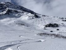
Avalanches: We ski triggered a couple of slow-moving facet sluffs that entrained the top 6” of facets on a sheltered, near treeline slope.
Weather: Winds and clouds started increasing around noon. No real snow transport, just some facets rolling and bouncing along the snow surface.
Snowpack: Got one crack in a small hard drift that propagated about 6 feet. Snow surfaces varied from hard drifts to wind crusts to sastrugi to cohesionless ~2 mm facets.

Photos:

5629
Read Full Observation
11/22/22

Collapsing drift

Date of Observation: 11/22/2022
Name: Zach Guy and Evan Ross

Zone: Southeast Mountains
Route Description: Skinned out to Carbonate Hill via Pearl Pass Road and returned the same route.

Observed avalanche activity: Yes
Avalanches: A small wet loose avalanche off of the SW side of Star Peak, probably ran yesterday.
Weather: Mild temps, some high thin clouds at times. Light winds
Snowpack: Observed one alarmingly loud collapse on a cross-drifted terrain feature on Carbonate Hill, on a SW aspect ATL. The slab was thin but hard. The loading pattern from last week’s winds appears to have blown snow off of all aspects near ridgeline start zones and deposited into concave catchments lower on slopes. Surfaces are wind-affected, hard, and variable above treeline, often with weak facets below hard wind crusts. Below treeline the snowpack is 8″ or less of cohesionless facets, ~2mm. Let’s just say the ski quality out there is sub-par.

Photos:

5628

Read Full Observation
11/20/22

No feedback from wind slab problem

Date of Observation: 11/10/2022
Name: Zach Guy

Zone: Northwest Mountains
Route Description: Purple Ridge, traveled on E, NE, and N aspects to 12,300′

Observed avalanche activity: Yes
Avalanches: Some minor dry loose avalanches triggered by solar warming yesterday and today off of steep, rocky terrain features.
Weather: Clear, light ridgetop winds, temperatures rebounding.
Snowpack: Went hunting for feedback from our wind slab problem. There were only a few features of concern that I could safely approach and stomp around on, and I got minimal cracking. In contrast, these same types of features were more reactive late last week.
Otherwise, most terrain has soft snow that continues to facet and weaken. It’s becoming unsupportive below treeline and on shallower, rocky areas near treeline.

Photos:

5625

Read Full Observation
The blog.