Observations

01/15/23

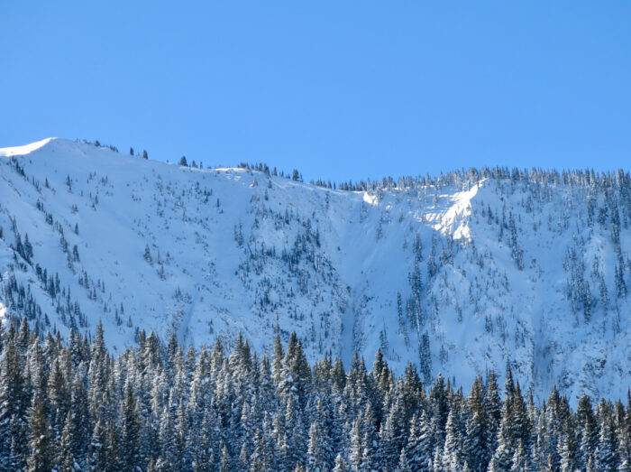
West Brush Creek – sunny side Teo tour

Date of Observation: 01/15/2023
Name: Eric Murrow

Zone: Southeast Mountains
Route Description: Brush Creek TH to West Brush Creek on snowmobile. Toured up sunny side of Teocalli to 11,600 feet.

Observed avalanche activity: No
Avalanches: none observed. Visibility was obscured so I never got a chance to see Union Chutes terrain or even the South Face of Teocalli.
Weather: Light snow and wind through around noon. Snowfall and wind picked up around 1pm — new snow accumulations of around 5 inches at 230pm at 11,500.
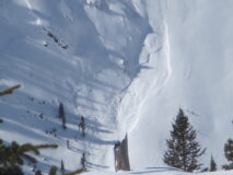
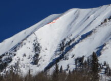
Snowpack: I dug two profiles, one on a south slope below the treeline and another on an east slope near the treeline (see images). Oddly enough, the first profile on south produced propagating results at three different interfaces (all facets below crust collapses). However, I skinned up through 1,600 feet of this fairly open terrain and never got a collapse or sign of instability even while ski-cutting steep test slopes on the way down. The east profile produced no propagating results in standardized tests, but when I removed most of the slab above the 12/20 facet layer, I was able to reproduce moderate propagating results. These results seem to show a decrease in sensitivity overall but genuine concern for triggering avalanches from shallow locations where the wind or terrain has created trigger points.

While descending in the afternoon, there was a clear change in storm snow. I was able to easily produce ski-length cracks in the top inch of storm snow. Not a problem where I was skiing, but a clear indication that places with more storm snow or wind drifting were developing a new surface storm snow problem.

Photos:

5901

Read Full Observation
01/15/23

Hot Pow

Date of Observation: 01/15/2023
Name: Zach Kinler

Zone: Northwest Mountains
Route Description: Viewed from Ohio Pass Trailhead

Observed avalanche activity: Yes
Avalanches: Observed a shallow but widely propagating slide in the upper snowpack on a south aspect in the Anthracites. It likely ran Friday with the warming.
Weather:
Snowpack:


[/gravityforms]

5900

Read Full Observation
01/15/23

Gothic 7am weather update

Date of Observation: 01/15/2023
Name: billy barr

Zone: Southeast Mountains
Route Description: Gothic

Weather: Snow starting just a few hours ago and light with 1½” new and water 0.13″ as another week of gloom starts up. Currently overcast and snowing lightly with a light SW wind and the overnight temperature range was 22-23ºF after high’s the past 2 days of 40 and 36F. Current snowpack is at 51″ with average for this date 42″. Snowfall is 14% below average but SWE is 9% above.

5898

Read Full Observation
01/14/23

Upper Slate

Date of Observation: 01/14/2023
Name: Evan Ross

Zone: Northwest Mountains
Route Description: Upper Slate. 9,500-11,000. E and NE

Observed avalanche activity: No

Weather: A Partly cloudy sky in the morning became mostly cloudy by early afternoon. Generally light winds. Mild temps.

Snowpack: This was just a weather station visit for some site maintenance. Along the way, I didn’t notice any obvious signs of instability. Generally, the snow surface in this area didn’t look partially concerning with the incoming storm, but I eventually started to find a few locations with small surface hoar. A low-angle NE slope at 11,000ft had an HS of 260cm. A meadow near Pittsburg at 9,300ft had an HS of 165cm.

5897

Read Full Observation
01/13/23

Ruby Range

Date of Observation: 01/13/2023
Name: Evan Ross

Zone: Northwest Mountains
Route Description: Ruby Range near Irwin. 11,000 to 13,000ft. NE-E-SE

Observed avalanche activity: Yes
Avalanches: 1 undocumented cornice avalanche on Mt Owen. Difficult to date, but probably early in the last storm. Fresh roller balls and tiny wet loose avalanches, primarily on SE-S-SW. Stayed up high all afternoon and didn’t get a good feel for wet avalanche activity at lower elevations.

Weather: Pleasant day in the alpine. Calm wind. High temps at Scarps ridge were just below freezing. High clouds created a partly cloudy sky

Snowpack: As expected, no obvious signs of instability. Managing old wind slabs, cornices, and sluffs were the primary avalanche problems encountered. We avoided areas with a below-average snowpack depth and southerly-facing slopes in the alpine. Snow surfaces were lovely. Even the wind effect was soft, a little thicker but still soft. Small SH on the snow surface all the way up at 13,000ft on ridgelines.

[/gravityforms]

5895

Read Full Observation
01/13/23

Weekly Snowpack Summary January 6-12, 2023

The weekly summary is here. A week of storms that dropped over 2 feet of snow ended on Thursday 1/12 as a high pressure system moved into the valley complete with daytime highs in the upper 30’s and even lower 40’s. Saturday evening looks to be the transition into the next stormy period.


Weekly Summary January 6-12 compressed

Read Full Observation
01/12/23

Very Large Avalanche in the Pencil

Date of Observation: 01/12/2023
Name: Evan Ross

Zone: Northwest Mountains
Route Description: Mt Axtell

Observed avalanche activity: Yes
Avalanches: A very large avalanche in the Pencil, on Mt Axtell. It appears to have released on the weak layers near the bottom of the snowpack. Couldn’t see the avalanche debris, but given the size of the crown and the amount of snow entrained I’d estimate it was a D3.

Photos:

5894

Read Full Observation
01/12/23

Avalanche activity viewed from ski area

Date of Observation: 01/12/2023
Name: Ben Pritchett

Zone: Northwest Mountains/Southeast Mountains
Route Description: Viewed from ski area

Observed avalanche activity: Yes
Avalanches: Natural activity from the recent cycle
Weather:
Snowpack:


[/gravityforms]

5893

Read Full Observation
01/12/23

Photos from West Elk Air

Date of Observation: 01/12/2023

Zone: Northwest Mountains/Southeast Mountains
Route Description: Flight around the forecast area

Observed avalanche activity: Yes
Avalanches: Aerial images of numerous large avalanches from the recent cycle courtesy of Peter Smith and West Elk Air.
Weather:
Snowpack:


[/gravityforms]

5892

Read Full Observation
01/12/23

Mt. Baldy

Date of Observation: 01/12/2023
Name: Zach Kinler

Zone: Northwest Mountains
Route Description: Washington Gulch past Elkton and then up lookers left ridge of South Bowl. Quick tour up to Elkton knob upon return.

Observed avalanche activity: Yes
Avalanches: A handful of avalanches in the NW mountains on SE-E-NE aspects near and above treeline. These were all wind slabs formed over the previous 2 days and generally D1.5 with a couple D2s. No fresh persistent slabs were seen in the deeper snowpack. Observed 2 large slides on the West side of Gothic that looked to have started as wind slabs and then stepped down deeper in the snowpack.
Weather: Cold in the valley, quite pleasant once above 10,000′ especially in the abundant sunshine. Winds were calm below treeline and light near treeline. Occasional Moderate winds were observed moving snow on a few of the highest peaks in the range.
Snowpack: Travelling mainly on Southerly aspects from 10,800-12,100′ snowpack depth was generally between 150-180 cm deep on the uniform, planar slopes. Certain features were much shallower and some deeper. There was about 45 cm of settled snow from the 1/10-1/11 cycle. The upper few inches of snow on steeper southerlies was moist. Other than 2 small collapses on drifted SE features I observed no cracking or collapsing elsewhere. A profile on a SSW aspect near treeline produced an ECTP23 on 1-1.5mm facets near the ground(4 finger minus hardness). The slab here was just over 100 cm thick with the bottom few centimeters being Pencil hard.


[/gravityforms]

5891

Read Full Observation
The blog.