Observations

01/30/23

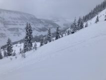
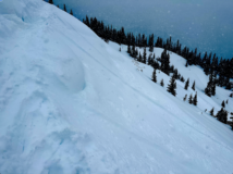
Irwin storm slabs

Date of Observation: 01/30/2023
Name: Irwin Guides

Zone: Northwest Mountains
Route Description: Irwin Tenure

Observed avalanche activity: Yes
Avalanches: SS-ASc-R1-D1-I 35cm X 100′ X 80′ EBM below Bender cliff band. Numerous small storm slabs 6-12″ thick E/W aspects NTL.
Weather: Today started out windy to say the least with SW winds in the 40’s for a six hour run and gusts in the 70’s. Mid day things tapered off a bit as winds shifted to the W. Snowed S-1 until this afternoon, snowing S3 at times.
Snowpack: NTL/ATL W was getting scoured until the later part of the day. Significant loading on E. Storm slab became more reactive to AS as the day progressed. Only traveled E in the AM as visibility allowed observed significant loading and wind wales below cliff bands.

5948

Read Full Observation
01/30/23

Stormy

Date of Observation: 01/30/2023
Name: Zach Guy

Zone: Northwest Mountains
Route Description: Mt Axtell, mostly below treeline, poked into ridgeline near treeline terrain too.

Observed avalanche activity: Yes
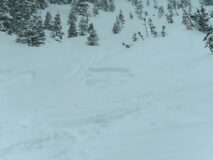
Avalanches: Some small sluffing and micro slabs with ski cuts BTL
Weather: Light to moderate snowfall rates this morning, with a few inches on the skin track and a few more by midday. Moderate winds with significant previous and ongoing transport as we got into more wind exposed terrain.
Snowpack: Below treeline: very soft slab (12”, F) on a soft lightly faceted interface, not much propagation; ski cuts would crumple small slabs and behave more like sluffs.
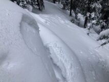
Near treeline in wind exposed terrain (Wang Chung and 4th Bowl) there were obvious drifts; flat light and the high consequence terrain here made it difficult to get any feedback.

Photos:

5947

Read Full Observation
01/29/23

Some cracking and unstable tests, West Brush Creek

Date of Observation: 01/29/2023
Name: Zach Guy

Zone: Southeast Mountains
Route Description: Union Chutes area, up to 11,500′.

Observed avalanche activity: No
Avalanches: No recent natural activity that I could see in this area.
Weather: Mild day, with no snow and light wind where we were, but I could see ongoing snow transport on Whetstone and Gothic Peak.
Snowpack: The mid-January near surface facet layer (the storm interface) is about 8″ to 12″ deep in sheltered terrain below treeline and 16″ to 24″ deep in leeward terrain near treeline. It produced cracking on the few steeper slopes that we ski cut; but felt more stubborn than what I saw yesterday. ECTs produced moderate propagating results on this layer on a drifted slope NTL, as well as hard propagating results on faceted snow near the ground. Because of large cornices guarding leeward features, and wind slabs too thick and stiff here for comfortable ski cuts, I didn’t seek out feedback in the most suspect terrain. HS is 105 near the creek and variable near ridgetop because of winds; 135 cm where we measured.

Photos:

5946

Read Full Observation
01/29/23

Gothic weather update

Date of Observation: 01/29/2023
Name: billy barr

Zone: Southeast Mountains
Route Description: Gothic Townsite

Observed avalanche activity: No
Weather: Saturday snow was very dense and windblown, then a pause overnight with light density snow starting back towards sunrise so it sort of averages out at 3″ new and 0.25″ of water. Strong afternoon winds on Saturday slowing up around 9 p.m. Currently overcast with very light snowfall and a light SW breeze while the snowpack sits at 58″, which is 24% above average for this date. Temperature is a small range after a high of 21F and low of 12F. billy

5945

Read Full Observation
01/28/23

Storm slabs on Schuylkill Ridge

Date of Observation: 01/28/2023
Name: Zach Guy

Zone: Northwest Mountains
Route Description: Schuylkill Ridge, northeasterly aspects to 11,400′

Observed avalanche activity: Yes
Avalanches: Numerous skier and rider triggered storm slabs from D1 to D1.5, depending on the length and steepness of the terrain. There were also a few naturals that ran earlier in the storm, probably yesterday.
Weather: Light snowfall in the morning, light graupel in the afternoon. Moderate winds with moderate transport at ridgetop.
Snowpack: About 15″ of low density storm snow (F). Reactive storm slabs on terrain features steeper than about 37 degrees. The crowns that I looked at failed within the storm snow on low-density stellar dendrites that fell yesterday, although there is also a small-grained near surface facet layer at the storm interface. No significant drifting where we traveled except just below ridgeline, where slabs were a bit thicker and stiffer, up to 18″, 4F.

Photos:

5944

Read Full Observation
01/28/23

Storm slabs at Irwin

Date of Observation: 01/28/2023
Name: Irwin Guides

Zone: Northwest Mountains
Route Description: Irwin Tenure

Observed avalanche activity: Yes
Avalanches: Widespread Touchy Storm Slabs to D1 near and below TL
Weather: OVC, Hi 17/8, WSW 10-25 g30-50, S-1 to S2
Snowpack: Widespread Touchy Storm Slabs reflective of our 16″ HST plus or minus wind transport, limited to D1 in size. There was significant wind transport near and above TL.

5943

Read Full Observation
01/28/23

Anthracite Mesa-Coneys

Date of Observation: 01/28/2023
Name: Andrew Breibart

Zone: Southeast Mountains
Route Description: Washington Gulch to Coneys via normal skin track.

Observed avalanche activity: No
Weather: Moderate to strong winds from the west on the ridge with snow transport into first bowl and second bowl. In the lower 1/3 of the slope and in the valley bottom, moderate downslope winds with blowing snow. Intermittent periods of S1 snowfall. Wind was the main cause of changes in snow depth and texture. skies were obstructed which precluded the ability to observe avalanche activity.
Snowpack: skin track snow depth: 30 cm (12) inches in the lower part of the skin track and up to 53 cm (21) inches below the ridge on a leeward slope.
summit ridge snow depth: above convex corner was about 25 cm (10 inches) and approximately 10 cm (4 inches) above first bowl.

5942

Read Full Observation
01/28/23

SE Zone Avalanches

Date of Observation: 01/28/2023
Name: Frank Stern

Zone: Southeast Mountains
Route Description: Red Lady Glades

Observed avalanche activity: Yes
Avalanches: SSE aspect, 11,000′, SS-N-D2-R1-i
SSE aspect, 10,000′ SS-N-D2 R1-i
Weather: Snowy and windy
Snowpack: 12″ fresh

5941

Read Full Observation
01/27/23

Lower Wolverine Basin

Date of Observation: 01/27/2023
Name: Eric Murrow

Zone: Southeast Mountains
Route Description: Slate River TH to Gunsight Pass Road and up through middle portion of Wolverine Basin.

Observed avalanche activity: No
Avalanches: Around 1pm storm totals reached 4″ and slopes steeper than about 38 degrees easily produced Loose Dry avalanches in the storm snow.
Weather: Light snow in the AM increased to moderate rates with a few periods of high-intensity snow. We traveled through reasonably protected areas, but there was a clear increase in wind speeds in the afternoon. Storm totals near 5 inches around 230 pm.
Snowpack: Traveled through east and northeasterly terrain from 9,000 – 11,000 feet. Snow depth ranged from about 120 – 145cm. No cracking or collapsing. I dug a hasty profile on a slope that naturally avalanched around 1/4 and found around 90cm of snow that was generally fist and 4-finger hard. The basal weak layer was intact near the ground and was fist hard. I suspect further down the slope the avalanche that ran on 1/4 scoured into basal weak layers even though basal weak layer was present at the very top of the start zone (see photo). I was able to trigger Loose Dry avalanches in the storm snow on this 200-foot slope that entrained about 10 inches into the snowpack due to the shallow weak snowpack.

Old snow surfaces in this area were comprised of near surface facets around .7mm in size.

Photos:

5940

Read Full Observation
01/27/23

Weekly Snowpack Summary January 20-26, 2023

The weekly snowpack summary is here. The week was generally clear and the valley only saw short lived bouts of new snow. Winds increased towards the end of the week and fresh wind slabs were built by Friday morning. A stormy pattern this weekend will bring several inches to a foot of new snow.

Weekly Summary January 20 – 26, 2023 Compressed


Read Full Observation
The blog.