Observations

03/02/23

Natural activity from the storm: NW Mountains

Date of Observation: 03/02/2023
Name: Zach Guy

Zone: Northwest Mountains
Route Description: West Elk Air flight covering most of the forecast zone. This ob highlights activity in the Northwest Mountains.

Observed avalanche activity: Yes
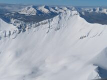
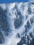
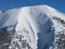
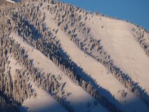
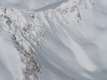
Avalanches: The Tuesday/Wednesday storm produced numerous wind slab avalanches, D1.5 to D2, see photos. Most of these appeared to run on Tuesday as well as a handful on Wednesday. The last pulse of the storm on Wednesday also produced many small loose avalanches and a handful of thin storm slabs involving just Wednesday’s storm snow. I spotted two fresh persistent slab avalanches that failed on old weak layers, one was a wind slab that stepped down a few feet on an east facing, windloaded ATL slope near Coffee Pot Pass, in the Southeast Mountains. The other was on a steep, shallow east facing slope near treeline on East Beckwith in the Northwest Mountains. That slope has slab avalanched at least twice this year, so it has an unusually shallow snowpack.
Weather: Clear, light winds.

Photos:

6063

Read Full Observation
03/02/23

Large skier triggered avalanche on Wednesday on Whetstone, and a few more naturals from SE Mtns

Date of Observation: 03/01/2023
Name: Zach Guy

Zone: Southeast Mountains
Route Description: Southeast mountains, viewed from Highway 135 and Mt. CB

Observed avalanche activity: Yes
Avalanches: A large avalanche on Whetstone Octogon was reportedly skier triggered on 3/1. The avalanche looks like it gouged to near the ground on a slope that is very shallow. Plus a few more naturals from the storm. See photos and details.

Photos:

6062

Read Full Observation
03/02/23

Natural activity from the storm: SE Mtns

Date of Observation: 03/02/2023
Name: Zach Guy

Zone: Southeast Mountains
Route Description: West Elk Air flight covering most of the forecast zone. This ob highlights activity in the Southeast Mountains.

Observed avalanche activity: Yes
Avalanches: The Tuesday/Wednesday storm produced numerous wind slab avalanches, D1.5 to D2, see photos. Most of these appeared to run on Tuesday as well as a handful on Wednesday. The last pulse of the storm on Wednesday also produced many small loose avalanches and a handful of thin storm slabs involving just Wednesday’s storm snow. I spotted two fresh persistent slab avalanches that failed on old weak layers, one was a wind slab that stepped down a few feet on an east facing, windloaded ATL slope near Coffee Pot Pass, in the Southeast Mountains. The other was on a steep, shallow east facing slope near treeline on East Beckwith in the Northwest Mountains. That slope has slab avalanched at least twice this year, so it has an unusually shallow snowpack.
Weather: Clear skies, no wind drifting this morning except on White Rock Mtn.

Photos:

6061

Read Full Observation
03/02/23

Gothic 7am Weather Update

Date of Observation: 03/02/2023
Name: billy barr

Zone: Southeast Mountains
Route Description: Gothic

Weather: Wednesday had an obscured cloud cover all day with very light but steady snow, then snow after dark before clearing after midnight and turning colder. New snow was 4″ with 0.30″ of water and the snowpack is at 69½”. The high temperature was 23F and it dropped to the current -8. The wind was thankfully light and currently it is calm. This is the first visibility in a while but i have not checked for slide activity yet.

6060

Read Full Observation
03/01/23

Irwin Area Explosive Results

Date of Observation: 03/01/2023

Zone: Northwest Mountains
Route Description: Irwin Area

Observed avalanche activity: Yes
Avalanches: E aspects reactive to AE 4F+ slabs failing on a small grained FC layer from the 2/26
interface. Knocked out some of the hang fire from Pre E and jumped with all our might on the rest but only
got it to inch down but wouldn’t budge.
Premature Evacuation SS-AE-R1-D1.5-I FC (70cm x 23m x 54m)
NC Shooter SS-AE-R1-D1-I FC (40cm x 15m x 53m)
Hollywood & Vine SS-AB-R1-D1-I FC (30cm x 15m x 50m)s

Snowpack: W aspects BTL lacked any slab in the recent storm snow. The 2″ from last night was
reactive and picked up enough speed to run full track on terrain >37 deg. 30-70 cm thick cross loads on EBM .
Buried MFC on Sunny shoulder seem to be breaking down and getting weaker.

Photos:

6059

Read Full Observation
03/01/23

MT Emmons

Date of Observation: 03/01/2023
Name: Zach Guy Evan Ross

Zone: Southeast Mountains
Route Description: Mt Emmons. 9,000-11,400ft. NW-N-E

Observed avalanche activity: No
Avalanches: Poor visibility, but nothing we could see.

Weather: Light snow with about 2″ of new by 2pm. Calm winds.

Snowpack: No avalanche problems were encountered while skiing steep slopes. Minimal sluffing in the low-density snow that was accumulating today. Wind loading patterns from yesterday were not recognizable with the more recent snow that has accumulated since the winds died off. This week’s total storm accumulations have settled to around 20 to 30cm.

We dug a test profile on a 34-degree, east-facing slope at 10,700ft. HS was around 265. ECTN within the storm snow. Modified deep tap ect produced N results on both the valentines and late January interfaces.

Photos:

6058

Read Full Observation
03/01/23

Remotely triggered persistent slab near Friends Hut

Date of Observation: 03/01/2023
Name: Eric Murrow

Zone: Southeast Mountains
Route Description: Friends Hut area, shared via InReach

Observed avalanche activity: Yes
Avalanches: D2 remote east ntl. 2-4 feet deep. Couldn’t get to crown but crust/facet above crown likely culprit.

Photos:

[/gravityforms]

6057

Read Full Observation
03/01/23

Friends Hut weather

Date of Observation: 03/01/2023
Name: Eric Murrow

Zone: Southeast Mountains
Route Description: Friends Hut update via InReach message.
Weather: HST 11″/.9″ , 14″/1.2″ since 2/26. Efficient winds A/NTL yesterday but quiet around hut last night. Light snowfall started early this AM

6055

Read Full Observation
03/01/23

Gothic weather

Date of Observation: 03/01/2023
Name: billy barr

Zone: Southeast Mountains
Route Description: Gothic townsite

Observed avalanche activity: No
Weather: Snow Tuesday ran until mid afternoon and then held off until after midnight with 24 hour total of 5″ new and water content 0.44″. Only light but dense snow in the past few hours. The wind stayed strong yesterday but has stopped and there was even a bit of clearing before midnight as the temperature dropped to -7F but with the clouds it is currently back up to 8. Currently obscured and calm with a few flakes of snow. Snowpack is at 66½”
Snowpack:

6054

Read Full Observation
02/28/23

Kebler zone

Date of Observation: 02/28/2023
Name: jeff banks

Zone: Northwest Mountains
Route Description: Kebler zone

Observed avalanche activity: No
Weather: howling winds along Kebler road and zero visibility at times
snow increased to 2-3cm/hr ~1:30PM with low density fluff
Snowpack: Intense snow transport + drifting in the open Kebler road areas

Snow not affected by wind in the thick old growth forest -No drifting or wind slab- @ 9,500-10,700
Lots of tree bombs releasing

Numerous hand shears showed the new snow well bonded to the old surface.
Cohesive, denser Mid-storm layer 10cm thick (heavily rimed + graupel) with a little localized cracking, but un-reactive on steep micro terrain log pillows.

6053

Read Full Observation
The blog.