Date of Observation: 10/22/2021
Name: Zach Guy and Eric Murrow
Zone: Northwest Mountains
Route Description: Paradise Divide, generally traveling on N and NW aspects near and above treeline.
Observed avalanche activity: Yes
Avalanches: A small wet loose avalanche from recent warm temps.
Weather: Mild temps, thin scattered cloud cover. Light winds and no blowing snow.
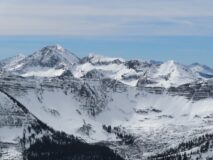
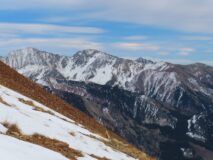
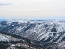
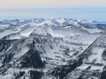
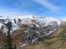
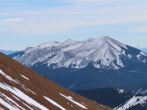
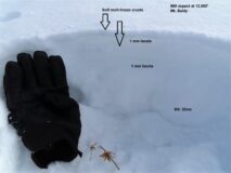
Snowpack: This snow surface will be a future weak layer. In the Northwest Mountains, continuous snow coverage has survived on the northern half of the compass on most near and above treeline slopes, with thinner coverage below treeline. In the Southeast Mountains, coverage is also thinner with more ground roughness breaking up the continuity. The photos below exemplify current coverage. Near and above treeline, we found the snowpack has faceted throughout on shady aspects: 1 mm F to F+ facets. Snow depth on shady aspects is about 10″ on average, with drifted areas up to 2 feet deep. The snowpack structure is entirely faceting on due north, with one or several thin crusts near the surface on NE and NW aspects. The snowpack transitions towards a homogenous layer of melt-freeze grains on west aspects. On southern aspects, coverage is spotty on all but the most snow-favored peaks in the Ruby Range.
Photos:
-

-
Purple Ridge
-

-
D1 Wet Loose on Baldy
-

-
Baxter Basin and Ruby Range
-

-
Queen Basin
-

-
1mm facets on northerlies
-

-
Gothic
-

-
Schuylkill Ridge and Scarp Ridge
-

-
Cinnamon and Treasury
-

-
Schuylkill and Peeler Peak
-

-
Purple Ridge
-

-
Double Top
-

-
Whetstone
-

-
Hand pit showing weak snow on Mt. Baldy
Avalanche Report #1
Estimated avalanche date: 10/21/2021
Number of Avalanches: 1
Location
Location: Mount Baldy
Location Specific:
Start Zone Elevation: ATL: Above Tree Line
Aspect: W
Characteristics
Trigger: Natural
Trigger modifier:
Type: Wet Loose
Failure Plane: Within storm snow
Size
Relative Size: R1 very small
Destructive Size: D1- Relatively harmless to people
Avg. crown height (inches):
Avg. width (feet):
Avg. vertical run (feet): 500
Involvements
# of people caught:
# of partial burials:
# of full burials:
Additional comments:


