Observations

11/11/21

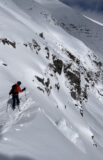
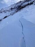
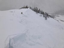
Two natural avalanche obs

Date of Observation: 11/11/2021
Name: Eric Murrow

Zone: Northwest Mountains
Route Description: East end of Baldy Mountain

Observed avalanche activity: Yes
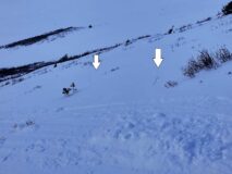
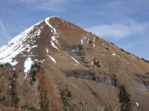
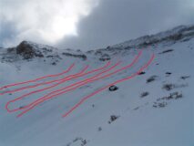
Avalanches: From the pavement, I spotted 2 naturals along Scarp Ridge. A D2 and a D1.5 in Peeler Basin. Visibility was poor, but both avalanches appeared to only involve recent storm snow.
Weather: Partly to mostly cloudy skies. West-northwesterly winds were blasting snow into the atmosphere in the AM but relaxed and were only drifting on and off by the PM.
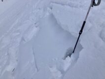
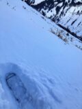
Snowpack: Storm totals were about 10″ at 12,000 feet. We avoided the most obvious drifted, northerly terrain features in the area, but did stomp on a few small slopes around 12K that faced north without signs of instability. No signs of instability on wind-sheltered slopes facing east near and just above treeline.

Photos:

[/gravityforms]

4999

Read Full Observation
11/11/21

Quieting down

Date of Observation: 11/11/2021
Name: Zach Guy

Zone: Northwest Mountains
Route Description: Southern Ruby Range. Traveled mostly on east and west aspects to 11,800 ft.

Observed avalanche activity: No
Avalanches: Dropped a loveseat-sized cornice on a suspect leeward slope. It produced only sluffing.
Weather: Light westerly winds with occasional light transport on high peaks. Few clouds increased to broken skies. No precip.
Snowpack: We found minimal signs of wind drifting and minimal signs of instability, in stark contrast to yesterday’s tour. Settled storm totals here range from 8″ to 14″. The new snow is on the faceted or crusty interface well described in previous observations. Total snow depth near treeline is generally about 18″ to 24″ deep.

Photos:

4998

Read Full Observation
11/10/21

Remote triggered wind slabs

Date of Observation: 11/10/2021
Name: Zach Guy

Zone: Northwest Mountains
Route Description: Traveled on east and northeast aspects of Mt. Baldy to 12,000 ft.

Observed avalanche activity: Yes
Avalanches: A handful of natural activity ran during last night’s snowfall, mostly small, with one longer running D2. We remotely triggered a couple of small pockets of wind slab from about 30 feet away, and remotely triggered a larger D1.5 wind slab that was about 50 feet wide and ran about 600 feet over rocks.
Weather: Light snowfall. Light to moderate northwest winds with short periods of drifting snow.
Snowpack: 6″ to 8″ of new storm snow over a generally weak and faceted snowpack (.5 – 1.5mm facets) mixed with a few crusts on more easterly aspects. Fresh drifts up to 2 feet thick. We noted consistent collapsing and shooting cracks up to 50 feet on every wind loaded feature, along with some shooting cracks where winds have stiffened the snow surface. These all appeared to be failing on the storm interface. In wind-protected areas, we noted only minor cracking. Stability test in a wind-sheltered slope showed no propagation.


[/gravityforms]

4997

Read Full Observation
11/10/21

Gothic 7 a.m.

Date of Observation: 11/10/2021
Name: billy barr

Zone: Southeast Mountains
Route Description: Gothic

Weather: Winter weather for a bit as it started to snow after dark, continuing steadily light to moderate until around 5 a.m. with 5½” new and 0.46″ of water in a dense snowfall. Snowpack is at the winter’s deepest of 5½”. A warm night as yesterday’s high was 49ºF and overnight low just 27ºF, which is the current. It is cloudy and the wind is light from the west.

4996

Read Full Observation
11/09/21

Pre-storm observations from Purple Ridge

Date of Observation: 11/09/2021
Name: Eric Murrow

Zone: Northwest Mountains
Route Description: Northerly side of Purple Ridge. Ascended from the head of Slate River Valley.

Observed avalanche activity: No
Avalanches: None
Weather: Partly to mostly cloudy. Light winds and mild temperatures.
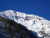
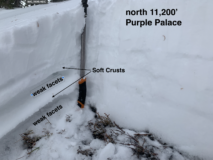
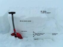
Snowpack: The goal of this trip was to look at old snow surfaces and observe faceting on shaded slopes at upper elevations. The past week of clear nights has slowly weakened and faceted the snow surfaced on most slopes on the north half of the compass. Grain size remains relatively small around .5-1mm (see photo). Northerly slopes above ~10,000′ are not going to bond well with incoming snow. I dug a profile in an area with the deepest accumulations this season; the oldest snow near the ground is well-faceted, but was moist and appears to be rounding (see profile). In general, the faceted surface appears to be of more concern for the incoming storm than the weak snow on the ground. Snow coverage is pretty continuous on northerly slopes above ~10,000′ and will be a weak layer to keep an eye on with snowy weather forecasted for the second half of the week.

Northerly slopes below -10,500′ often had a soft, faceted melt-freeze crust at the surface.

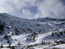
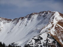
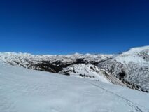
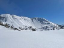
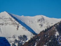
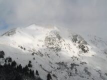
See additional photos for examples of snow coverage around the CBAC forecast area.  Sorry for the blurriness.

Photos:

[/gravityforms]

4995

Read Full Observation
11/04/21

Paradise Divide

Date of Observation: 11/04/2021
Name: Ben Pritchett

Zone: Northwest Mountains
Route Description: Parked at Schofield Pass, skied up Cinnamon Mountain’s NE bowl.

Observed avalanche activity: Yes
Avalanches: One large avalanche ran during the November 2 storm off Peeler Peak’s northeast face. This soft-looking slab avalanche broke around 800 feet wide and ran around 800 feet downslope. We saw a handful of small avalanches in the storm snow in very steep wind-drifted alpine terrain features.
Weather: Ridgeline Wind Speed: 5-10 mph
Ridgeline Wind Direction: NW
Wind Loading: None
Temperature: 28 F
Sky Cover: Clear
Depth of Total Snow: 65 cm
Weather Description: Balmy late fall day. Bluebird skies. Temperatures rose above freezing at 12,000 feet for around 2 hours. Valley bottom temperatures made it well into the 40’s.
Snowpack: Around a foot of snow fell on Tuesday, November 2 in this area.
On sheltered northerly-facing slopes, the storm snow sits on 2 or 3 dense and supportive old-snow layers. Below the new snow/old snow interface we found a thin layer of facets below a crust which could pose a problem as slabs develop on top of this structure, but it poses no concern at the moment.
Above treeline, these buried old snow surfaces are highly variable, so the recent storm snow sits on bare ground, glaze ice, stiff sun-hardened crusts, or dense old drifts.
On southerly-facing slopes, the storm snow settled to only a few inches, mostly resting on bare ground, or old, slick drifts from the late October storm. These sun-exposed slopes moistened by late morning.
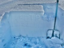
We observed no cracking or collapsing. ECT’s did not propagate below the crust under the storm snow. We did get one ECTP near the ground where we found a sheltered slope with larger facets buried near the ground (see profile), but this structure appears isolated in the terrain.

Photos:

4992
Read Full Observation
11/03/21

Elkalanche

Date of Observation: 10/30/2021
Name: Evan Ross

Zone: Southeast Mountains
Route Description: Cement Mountain

Observed avalanche activity: Yes
Avalanches: 2nd hand report of a small avalanche triggered by a herd of Elk crossing the slope. The avalanche appears to have release from a previously wind-loaded portion of the slope where the snowpack was deeper. Estimated N to NE aspect around 11,400ft.
Weather:
Snowpack:

Photos:

4991

Read Full Observation
11/03/21

Gothic weather

Date of Observation: 11/03/2021
Name: billy barr

Zone: Southeast Mountains
Route Description: Gothic

Observed avalanche activity: No
Avalanches:
Weather: Steady but generally light snowfall but a very dense snow with 3″ new and 0.36″ of water and the snowpack is at 2½” deep. There was some clearing during the night while staying mild with the low 22ºF and the current 25. No wind at all (my favorite wind speed).
Snowpack:

4989

Read Full Observation
10/28/21

Upper Slate River

Date of Observation: 10/27/2021
Name: Eric Murrow

Zone: Northwest Mountains
Route Description: Purple Ridge area

Observed avalanche activity: No
Avalanches: none observed, but limited visibility
Weather: Mostly cloudy skies with very light snowfall through 3pm. Moderate winds with strong gusts at ridge top from the northwest. Snow transport was visible across alpine terrain all day.
Snowpack: Storm totals ranged from 4 inches at valley bottom at 9,700′ to 11 inches at treeline. I traveled between 9,700′ and 12,000′ on east and northerly aspects. Below treeline I only found old snow beneath the recent storm on northerly aspects. All northerly slopes below treeline showed soft crusts and facets below the recent storm snow (see photo). Not enough new snow to form an avalanche problem on sheltered, northerly terrain below treeline. No cracking or collapsing.

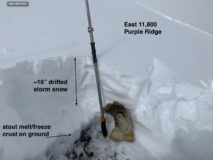
I traveled on easterly aspects near and just above treeline and commonly found a stout melt/freeze crust directly on the ground with 10″ to 24″ of windblown storm snow resting above (see photo). I was able to produce a few cracks running up to 30 feet in drifted snow but cracks were shallow in just the top few inches of storm snow. Probing revealed a few isolated locations immediately below ridge top that had facet/crust combinations below the recent storm, but in this area, they were only found in old drifts.

Photos:

4985

Read Full Observation
10/27/21

Naturals on Baldy

Date of Observation: 10/27/2021
Name: Zach Guy

Zone: Northwest Mountains
Route Description: Emerald Bowl. Traveled on E and NE aspects to 11,800′

Observed avalanche activity: Yes
Avalanches: A natural cycle of avalanches, D1 to D2 in size, came off of Baldy’s Emerald Bowl sometime in the past 12 hours. Likely wind slabs, although the start zones were already blown smooth again. Also a small windslab ran today on Bellview.
Weather: Cold and blustery. Moderate to strong northwest winds were actively transporting snow all day at all elevations. Mostly cloudy skies with a few light snow showers.
Snowpack: Several red flags pointed towards dangerous conditions at upper elevations today: fresh naturals, active windloading, storm totals approaching 12″, and shooting cracks in wind drifted slopes. Drifts were generally 2 to 3′ thick, up to 4F hard. In windsheltered(ish) terrain, I did not see evidence of storm slab instabilities; no cracking, and no unstable test results. The 8″ to 12″ of storm snow was fist hard, right-side-up on top of fist hard, 1mm facets (NE aspects) or crust/facet sandwiches or just homogenous crusts (East aspects).

Photos:

4984

Read Full Observation
The blog.