Observations

11/25/21

Ruby Range

Date of Observation: 11/25/2021
Name: Evan Ross

Zone: Northwest Mountains
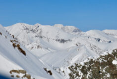
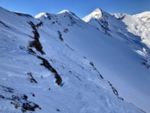
Route Description: Kebler Pass portion of the Ruby Range. Traveled on NE to SE aspects between 10,000 and 12,800ft.

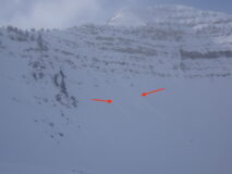
Observed avalanche activity: No
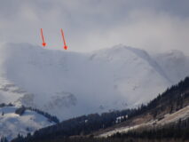
Avalanches: Nothing notable
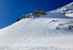
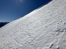
Weather: Beautiful clear day. In the alpine the winds were just strong enough to keep snow in saltation. Didn’t see too much for snow plumes off the peaks.
Snowpack: Between about 10,000 and 11,600ft we traveled on easterly and southeasterly aspects with nothing of note other than a moist snow surface.

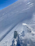
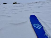
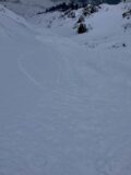
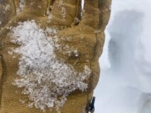
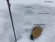
Above 11,600ft we primarily traveled on easterly to slightly northeasterly aspects. Ski pen average about 15cm’s on a nice thick creamy snow surface. Moving into the alpine, the thicker wind-loaded drifts were the primary thing that dictated our travel. Those slabs averaged around 30cm’s thick on up to 45cm’s thick in the couple places I poked around. Those drifts were sitting on the well-documented weak old snow surfaces. Facets and soft crusts over facets, nothing confident inspiring. Pushed on a few small wind-loaded terrain things with no results. The thicker nature of those slabs made the avalanche problem feel more stubborn to trigger.

New snow depths down low were settling quickly in the sun, around the 4 to 5″ range. Moving into the alpine the new snow depths were too variable to give much of an estimate.

Photos:

5030

Read Full Observation
11/24/21

Bit of a refresh out the Slate River Valley

Date of Observation: 11/24/2021
Name: Eric Murrow

Zone: Northwest Mountains
Route Description: Eastern side of Schuylkill Peak from Poverty Gulch

Observed avalanche activity: Yes
Avalanches: Limited visibility during the tour but nearby there were several very small, natural loose avalanches in the storm snow on north and northeast aspects starting from cliffy/rocky areas. None gained enough mass to gauge into the snowpack. Later in the day, once skies clear around 4pm, I went for a pavement tour looking for avalanche activity in the Ruby Range and didn’t see any significant activity, just a few more small Loose Dry avalanches.
Weather: Cloudy skies in the morning with light snowfall slowly transitioned to partly cloudy skies by the PM. Winds were light throughout the tour even on ridgetop at 11,700 feet. New snow accumulations reached about 7 inches at 11,700 feet; valley bottom at 9,300′ was only about 3 inches.
Snowpack: We traveled on north, northeast, and east aspects to treeline. In general, the snowpack continues to facet and lose strength. Snow depths were commonly around 60 to 90 cm with boot penetration very close to the ground. Grain size in the old snow is commonly 1.5 to 2mm in size. We went hunting for fresh slab formation on a leeward, northeast-facing slope at 11,700′ and basically found a weak, faceted snowpack with 7 inches of new snow resting on the junk. No evidence of drifting, or Wind Slab formation on the tour. While driving around just before sunset, I was able to spot some fresh cornice formation above treeline on east and southeast-facing ridgelines.

Photos:

[/gravityforms]

5029

Read Full Observation
11/24/21

Gothic 7am Weather Report

Date of Observation: 11/24/2021
Name: billy barr

Zone: Southeast Mountains

Weather: Overcast and mild all night with a steady but light snowfall. There is 3″ new snow ( (just slightly under at 7 cm) with 0.25″ of water and no wind. Snowpack is that 3″. Snow let up for a bit but seems to be starting again. Yesterday’s high was 44ºF and today’s low, and current, 25ºF.

Read Full Observation
11/23/21

Elk Basin Pre-storm

Date of Observation: 11/23/2021
Name: Eric Roberts

Zone: Northwest Mountains
Route Description: 11:00-14:20
Toured up Elk Creek to ridgeline of Elk Basin to assess coverage and instability before storm moves in.Sky cover deteriorated and winds picked up around 12:30 with light precipitation moving in from the NW. No test pits were done, and I skied back on the skin track with some fresh turns.

Observed avalanche activity: No
Avalanches:
Weather: SCT->BKN->OVC by 12:30pm
Light to Moderate NNW winds increasing to consistent moderate SW winds with sporadic strong gusts.
36°F @ 9,400′
31°F @ 11,000′
S-1@13:00, S1 @13:30 (12,000′)
No riming observed
Snowpack: Overall, the snowpack is inconsistent and terrain/aspect dependent which has been the trend. No tests were conducted but snowpack in sheltered and exposed terrain shows poor structure.
Most wind sheltered areas do not have a slab component with unsupportive and cohesionless facets making up the bulk of the snowpack.
As the winds picked up, active transport was visible with plenty of low-density snow available for this storm to throw around.
The surface hoar observed from 9,800′-11,500′ will be tomorrows potential weak layer if there is enough accumulation from this pulse.
Where surface hoar isn’t present, 1-4″ of fresh or wind stiffened snow exists over a 1-2cm MFcr 10,000′ and up.

Photos:

5023

Read Full Observation
11/22/21

Poor Weathered Snowpack

Date of Observation: 11/22/2021
Name: Evan Ross

Zone: Northwest Mountains
Route Description: Purple Ridge. NE-E, 9,500-12,000ft.

Observed avalanche activity: No
Avalanches:
Weather: Beautiful day. Calm wind, lots of sun, warm temps. Feels like we are headed into spring.
Snowpack: Ooo snowpack. The skiing is still lovely, but the sun, wind and dry weather are not being kind to what snowpack there is. On a couple east and north facing bowls above treeline, the ski tracks from yesterday that were around 12″ deep, were now raised to the surface of the snow. Those sneaky winds have already been redistributing the recent fresh snow. The sun was creating a moist snow surface on the easterly slopes we traveled and on some northeasterly slopes below treeline. The snowpack structure at the moment can be simplified to just weak. Facets, crusts, plenty of junk.

Pushed on some fresh wind drifts near treeline with no results. No other avalanche concerns observed.

Photos:

5020

Read Full Observation
11/22/21

Mount Baldy East Basin

Date of Observation: 11/22/2021
Name: Eric Roberts, J. Caprio, W. Gilliam

Zone: Northwest Mountains
Route Description: 08:45-15:00
Our group of three toured from Schofield Pass Road near Friends Lake to our high point of 12, 400 in the East Basin of Mount Baldy.
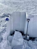
We conducted test pits above treeline with results showing poor stability overall and false stable conditions. Great skiing conditions overall on North-East aspects as we descended near our skin track with no incidents. Beautiful day!

Observed avalanche activity: No
Avalanches:
Weather: Clear
Calm
31°F @ 11,375′ (10:30)
No Precipitation
Snowpack: Snow Surface:
10,500′-11,500′ :20-40cm with wind kissed surface with NSF up to 10cm below surface. Wind slabs are present 10-15cm below surface in exposed terrain. There is a Melt-freeze crust/facet combo on ENE aspects approximately 15cm below surface.
11,500′-12,400′: 1-4″ of Fresh low density snow in sheltered areas ranging to unsupportive wind stiffened surfaces with HS 40-120cm.

Overall, our focus was to assess the SE zone and look for slab formation above treeline.
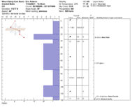
Instability tests at 11,375′ showed results of low-moderate strength with propagation potential, but there is evidence of false stable conditions.
Compression tests showed sudden results, at the base (120cm), despite the moderate results.
ECT’s varied in propagation potential, but more alarming is once again the fracture character of a sudden collapse at the base, despite the high results.
The upper snowpack in this location is complex and variable and the 1F-4F wind slab(20cm down) is potentially bridging the deeper, weaker snow. Time, warmer temps, shallow terrain and additional loads will potentially allow one to penetrate these layers.
A temperature gradient is present in the upper snowpack. 0-20cm below surface.
Surface hoar feathers 1-3mm were observed in the north facing treeline between 10,000′-10,600′.

Photos:

5019

Read Full Observation
11/21/21

Small windslsb

Date of Observation: 11/21/2021
Name: Sam Lesnikoski

Zone: Northwest Mountains
Route Description: Near purple palace

Observed avalanche activity: Yes
Avalanches: Skier triggered small wind slab that ran predominantly in storm snow on easterly facing crust on our exit. Had we been above more serious terrain consequences would have been heightened.
Weather: Sunny and warm
Snowpack: Around five inches new on top of a pile of facets and and a variably distributed sun crust on solar aspects.

Photos:

5018

Read Full Observation
11/21/21

P-Divide

Date of Observation: 11/21/2021
Name: Evan Ross

Zone: Northwest Mountains
Route Description: Paradise Divide. NW to N around 11,600ft.

Observed avalanche activity: Yes
Avalanches: Just a few small sluffs and soft slabs that ran above treeline on steep slopes having received some wind-loading
Weather: Clear and calm.
Snowpack: Call it around 5″ of new snow that skied deeper thanks to our weakening snowpack. The new snow was very cold and lacked any cohesion where we traveled. Comparing conditions today versus traveling in the same area a couple weeks ago, any support in the snowpack back then is now turning into the sand box effect. Defiantly weak out there and we didn’t encounter much of any slab on this short afternoon tour.

The predominant wind-loading patter from the last storm appeared to be from the northerly winds at the end of that storm.

Photos:

5017

Read Full Observation
11/20/21

4”!

Date of Observation: 11/20/2021
Name: Jack Caprio

Zone: Northwest Mountains
Route Description: Purple Ridge

Observed avalanche activity: Yes
Avalanches: Small D .5 dry loose sluffing in steep north aspects.
Weather: Overcast all day. Intermittent periods of S-1 snowfall. Around 3 pm, precipitation rate increased to consistent S1.
Snowpack: About an inch of new snow this morning at the valley bottom. Above 12,000’ there was about 3-4 inches of fresh snow. New snow was reactive on steep slopes producing sluff on every turn. The sluffs ran the length of the slope but did not gouge into the rest of the snowpack. The snowpack on north facing terrain was very weak top to bottom, without a slab. East facing terrain in this area had a thin breaker crust below the new snow, making for punchy conditions.

5016

Read Full Observation
11/20/21

Getting weaker

Date of Observation: 11/20/2021
Name: Zach Guy

Zone: Northwest Mountains
Route Description: Schofield Pass area, traveled on E and NE aspects to 12,200 ft.

Observed avalanche activity: Yes
Avalanches: Skier triggered a shallow but long-running sluff in the new snow.
Weather: Light winds, light snowfall. Snowfall rates started increasing as we left around 4 p.m.
Snowpack: 2″ to 3″ of new snow. No signs of instability while traveling in steep terrain. In windsheltered terrain, the snowpack is now completely faceted throughout with ski pen close to the ground. Facets are 1mm in size near the surface and up to 2mm near the ground, generally fist hard to fist+ hard. In windier locations this structure is capped by a stiff wind crust of varying thickness; on easterly aspects, capped by a thin melt-freeze crust. We tested an isolated old drift NTL and got hard, non-propagating results below a 15″ hard slab.

Photos:

5015

Read Full Observation
The blog.