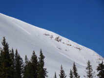
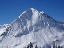
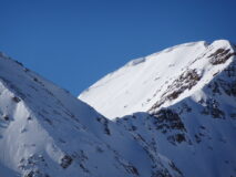
Observations

12/02/21

Mapping weak layer distribution

Date of Observation: 12/02/2021
Name: Zach Guy

Zone: Northwest Mountains
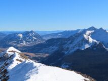
Route Description: With a weather pattern change expected next week, we traversed through the Ruby Range covering a lot of aspects and basins to map out the current snow surface, which could become a major persistent weak layer for the season.

Observed avalanche activity: Yes
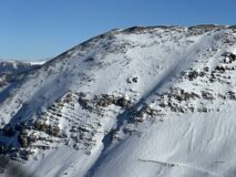
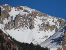
Avalanches: A few very thin wind slabs on SE aspects of Oh-Be-Joyful Peak that might have run during Tuesday night’s increased winds, D1 in size.
Weather: Unbelievably warm. Light westerly winds.
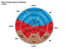
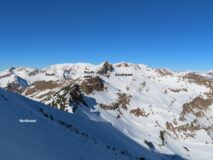
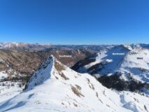
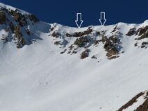
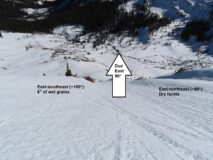
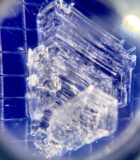
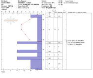
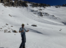
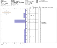
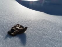
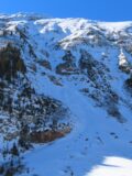
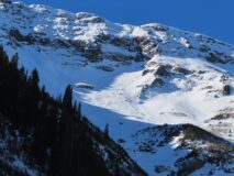
Snowpack: See the sketch below which generalizes surface conditions. The biggest takeaway is that there will be significant differences in stability depending on aspect if next week’s storms deliver us a slab. The northern third of the compass is by far holding the weakest snow, both at the surface and throughout. It is especially weak in shallower areas, wind sheltered areas, and/or at lower elevations. I spent a lot of time looking at east aspects: there are some dramatic transitions in surface conditions that happen over only a small change in compass direction (see photo below). Over the span of ~20° or 30° near due east, the surface changes from dry to thin crust to a crust that is 6″ thick or so. In general, the snow on easterly aspects isn’t as weak as I’m used to seeing during dry spells of similar length in years past, due to the unusually warm temps. I didn’t travel much on westerly slopes, but expect similarities there. Southeast to southwest aspects have melt grains going deep into or throughout the entire pack where snow exists. The surface hoar from Sunday night’s event has been mostly destroyed by wind and sun.
These observations pertain strictly to slopes steep enough to avalanche; lower angled slopes have notable differences in surface characteristics and coverage. Furthermore, terrain features shaded by pine trees have colder, drier snowpacks than what I’ve generalized for open slopes.

Photos:

5043

Read Full Observation
12/02/21

Elk Basin

Date of Observation: 12/02/2021
Name: Eric Roberts

Zone: Northwest Mountains
Route Description: 11:00-15:45
Toured Elk Creek towards Scarp Ridgeline to assess snow instability and coverage before potential storm pulse moves in next week.
Descended same route with spring-like surface conditions back to Kebler Rd.
Sunny, warm day with no alarming results.

Observed avalanche activity: No
Avalanches:
Weather: CLR
Calm winds BTL-NTL, with light W wind near ridgeline 12,000’+.
36F @ 9,400’ (11:00)
42°F @ 11,850’ (13:30)
No Precipitation
No riming observed
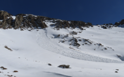
Snowpack: Snow Surface: 2-12mm surface hoar feathers 9,800’-10,800 in sheltered terrain.
Roller balls present at 11:30 on Southerly aspects
Widespread moist surfaces with a 2-3cm thick MFcr above unsupportive wind stiffened snow and/or NSFs @ 11,000+ in non-shaded areas.

Ski/boot pen: 15cm/ 5-30cm

Overall, the snowpack is sporadic and terrain/aspect dependent, specifically NW-NE aspects harboring 10-65cm with an upside-down structure.
Test results showed poor structure, moderate, strength and low propagation propensity due to inconsistent slab layering and continuity.
Most wind sheltered areas do not have a slab component, mainly unsupportive and cohesionless facets making up the bulk of the pack. Areas where a slab recipe is found are wind-packed slopes, leeward slopes and ridge lines where assessing for overhead hazard could mitigate exposure.

Photos:

5042

Read Full Observation
12/01/21

Site visit to Cassi Peak avalanche

Date of Observation: 12/01/2021
Name: Eric Murrow Zach Kinler

Zone: Northwest Mountains
Route Description: Rustlers Gulch up westerly slopes to Cassi Peak area

Observed avalanche activity: Yes
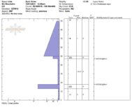
Avalanches: No new avalanches. We visited an avalanche on a west-facing slope at 12,700 feet that was previously reported on 11/29. This slab avalanche appeared to be triggered by a very small loose avalanche. The snow surface at the crown was soft and faceted. Cross-loading formed the slab on a break in the terrain. Of note with this avalanche was a melt/freeze crust near the ground with 2mm facets sandwiched between the crust and the overlying slab. The lowest crust served as the bed surface. The slab structure was isolated on this slope to the cross-loaded terrain break. A ridge immediately west of this avalanche causes the slope to be shaded from the afternoon sun.
Weather: Clear skies and mild temperatures. Very calm air mass with hardly a breath of wind.
Snowpack: We almost entirely traveled on westerly slopes from 9,700 – 12,700 feet. We carried our skis across mostly dirt with occasional patches of faceted snow behind shady tree fences until 11,000 feet. Above 11,000 the snow coverage became just continuous enough to skin. Upper elevation, sunny slopes were mostly bare ground and upper elevation northerly slopes were thin, but with continuous coverage. We ascended and descended immediately adjacent to the avalanche and found a stack of crust and facets 30 – 50 cms deep without slab structure.

Photos:

[/gravityforms]

5041

Read Full Observation
12/01/21

Grimsby on southwest aspects

Date of Observation: 11/30/2021
Name: Than Acuff and Zach Guy

Zone: Southeast Mountains
Route Description: Traveled on southwest aspects below treeline near Mt. Crested Butte

Observed avalanche activity: No
Snowpack: Skied in steep avalanche terrain and saw no signs of instability. Mostly just dirt and sagebrush.

5040

Read Full Observation
11/29/21

Recent slab?

Date of Observation: 11/29/2021
Name: Zach Guy

Zone: Northwest Mountains
Route Description: Schofield Pass area. Traveled on W, NW, and N aspects between 10,700 and 12,500 ft.

Observed avalanche activity: Yes
Avalanches: Saw what looks like a recent slab avalanche, D1.5 in size; it failed in a west-facing cirque near Cassie Peak. It looks like it failed in older snow layers close to the ground. I’m guessing it was triggered by a very small wet loose in the past few days.
There was also a handful of previously undocumented wind slab avalanches from the last storm on NE aspects of Baldy, D1 to D1.5 in size.
Weather: Unseasonably warm, calm winds, clear skies.
Snowpack: Widespread surface hoar growth on flat or shady aspects below about 11,800 ft. Snowpack is generally faceted throughout, 1 mm near the surface and up to 3mm near the ground. It’s hard to find any lingering midpack except in previously wind-blasted terrain. We dug into a previously cross-drifted slope with no concerning pit results. In wind protected terrain, boot pen is to the ground, ski pen also getting close to the ground. West aspects were moist or wet this afternoon on near and below treeline slopes.

Photos:

5038

Read Full Observation
11/28/21

Crested Butte Bush

Date of Observation: 11/28/2021
Name: Zach Guy

Zone: Northwest Mountains
Route Description: Upper Slate, traveled on east and northeast aspects to 12,000 ft.

Observed avalanche activity: No
Weather: A whole lotta nothing. Few clouds, light winds, mild temps.
Snowpack: Ski cut a few previously drifted features (below a cornice and in a crossloaded gulley) with no signs of instability. Surfaces continue to facet, eroding away at any slabs that formed last week. The melt-freeze vs dry snow line is right around 90* due east. Snowpack remains supportive to skis near and above treeline and becomes trapdoor or too shallow for making quality turns below treeline.

5037

Read Full Observation
11/27/21

South side of Anthracites

Date of Observation: 11/27/2021
Name: Ben Pritchett

Zone: Northwest Mountains
Route Description: Pic from the highway en route to Rainbow Lake.

Observed avalanche activity: No

Photos:

5036

Read Full Observation
11/27/21

Anthracite Range

Date of Observation: 11/27/2021
Name: Evan Ross, Eric Murrow

Zone: Northwest Mountains
Route Description: 8,800ft to 11,800ft on north facing terrain.

Observed avalanche activity: No
Avalanches: Few small sluffs, nothing notable.
Weather: Clear sky and calm wind. Thin overcast clouds moved around 2pm.
Snowpack: When we started the tour I couldn’t stand my ski pole up, thats a bad sign. By our high point the snowpack was averaging around 65cm’s deep. We had a serious group discussion on how to manage our main objective when it appeared to have a good fetch and notable wind-loading. In the end, any form of a slab in the terrain was isolated and discontinuous. Thankfully ski pen was around 15-30cm’s and the turns are real nice when they don’t find the ground.

Photos:

5035

Read Full Observation
11/26/21

Poverty Gulch

Date of Observation: 11/26/2021
Name: Evan Ross Eric Murrow

Zone: Northwest Mountains
Route Description: Toured on northerly facing terrain from 9,500ft to 11,500ft.

Observed avalanche activity: No
Avalanches: Nothing notable. Some roller balls on southerly facing slopes and both dry/wet sluffs from the last couple days.
Weather: Clear and warm. Calm wind.
Snowpack: On this tour, the last Tuesday/Wednesday storm had made no deference in the avalanche conditions that were being reported previous to the storm. Just a nice refresh on the surface. We didn’t encounter any wind-loading or wind effected snow. Around 11,000ft the HS was about 80cm. You could still find areas with a 4f mid-pack, in the otherwise generally faceted and soft snowpack. Ski pen averaged about 15cm.

5032

Read Full Observation
11/26/21

Upper Slate River obs

Date of Observation: 11/25/2021
Name: Eric Murrow

Zone: Northwest Mountains
Route Description: Purple ridge area. Ascended and descended through east and northeasterly terrain from 9,600 – 11,800 feet.

Observed avalanche activity: Yes
Avalanches: Observed a couple of natural avalanches that likely ran on Wednesday 11/24. Slab avalanches were above treeline in drifted terrain facing east or southeast. Appeared to only involve the most recent storm snow.
Weather: Beautiful Thanksgiving day. Temperatures rebounded quickly in the AM and winds remained light even at treeline on an exposed ridge. Storm total from the previous day was around 8 inches.
Snowpack: While traveling around a drifted easterly ridgeline, I found mostly soft drifts up to 18 inches thick. Did not experience any cracking or collapsing, but I avoided suspect terrain features with the most significant drifting. On easterly slopes near treeline, the recently drifted storm snow was resting on a fairly soft, 1-2cm melt/freeze crust. This crust was resting on fist-hard, faceted snow.  A generally poor-looking structure particularly if you found a slope with a thick drift resting above.  While descending below treeline I traveled through northeasterly terrain looking to see if I could produce Dry Loose avalanches but the storm snow has not faceted enough yet to produce any significant sluffing.

Photos:

[/gravityforms]

5031

Read Full Observation
The blog.