Observations

04/01/22

Searching for the problem

Date of Observation: 04/01/2022
Name: Evan Ross

Zone: Northwest Mountains
Route Description: 9,000ft to 12,000ft on a variety of aspects.

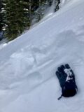
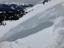
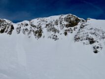
Avalanches: There were a couple of D1 wind slabs out some small loose wet avalanches, but really uneventful.

Weather: Snowfall ended in the morning and the sky became partly cloudy through the mid-day before increasing in the late afternoon. Winds died down mid-day, but otherwise were transporting snow at upper elevations.

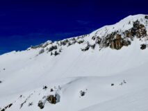
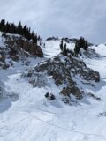
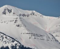
Snowpack: Welp I tried, but I sure didn’t find much. It’s interesting, the last two storms have come in somewhat upside down with layers of softer perception particles and/or graupel near the bottom of the slab. These layers are capable of producing avalanches, and they have… but they have also quickly quieted down. Triggering a wind slab on these interfaces seems possible, but I didn’t manage to find the most concerning areas. At near treeline elevations, these slabs seem to be baking in quickly with the warm temps and strong sun lately. Above treeline may be more problematic.

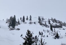
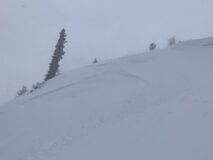
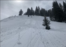
I targeted several wind-loaded locations and each time I didn’t find them to be currently very problematic. So call it a strikeout. However, the potential was obviously there and wind slab management would have been key.

In northerly wind-sheltered areas, there was around a foot of recent snow from these last two storms. The potential weak layers were better preserved in these areas, but I never found enough of a slab to create a more widespread storm slab issue. As you travel to lower elevations the recent snow accumulations have been zapped down and offered some creamy turns but was also not problematic.

Photos:

5531
Read Full Observation
04/01/22

Lower Grand Traverse route

Date of Observation: 3/31/22 and 04/01/2022
Name: Zach Kinler

Zone: Southeast Mountains
Route Description: Lower Grand Traverse route. Deer Cr and West Brush Cr areas. 9,000-9,500′

Observed avalanche activity: No
Avalanches:
Weather: Clear skies led to quick warming on southerly aspects as temps rose above freezing both days. A nice freeze on 3/31 gave way to a very weak freeze on 4/1. NW winds were generally light with an occasional moderate gust in open areas.
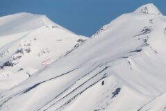
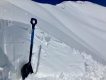
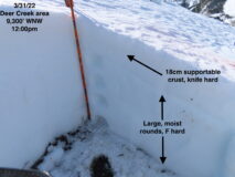
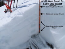
Snowpack: Targeting low elevation shoulder aspects on the GT course, I was tracking surface crusts and snowpack structure. Both East and West aspects below 9,500′ in this zone have similar depth and structure. HS was around 70 cm with a fully supportable 6-8″ MFcr forming Wednesday night. Below this crust was moist, large-grain rounds to the ground. By Friday midday on East aspects, the crust was supportive to ski but not to boot. If this crust does not break down today, it will with tomorrow’s warming. This will create a shallow, yet somewhat wet mess on these slopes.


[/gravityforms]

5530

Read Full Observation
04/01/22

Gothic 7am Weather Update

Date of Observation: 04/01/2022
Name: billy barr

Zone: Southeast Mountains

Weather: Cloudy and warm with generally light but steady snow overnight stopping at sunrise as it seems to be clearing a bit. There was 4½” new snow and a dense 0.39″ of water with the snowpack is at 52½”. Light wind with an occasional gust to 15 mph westerly. Despite the warm temperature before the snow started at 29F and a low overnight of 24F the snow surface did seem to crust up so should make a surface for the new snow while solidifying the snowpack a bit. So maybe some surface sluffs. Currently mostly cloudy and 24F with light wind and no snow.

5529

Read Full Observation
03/31/22

Photos of recent wind slabs

Date of Observation: 03/31/2022
Name: Evan Ross

Zone: Northwest Mountains
Route Description: Ruby Range near Irwin

Observed avalanche activity: Yes
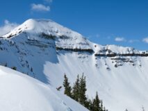
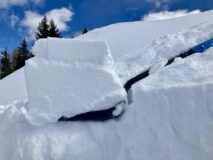
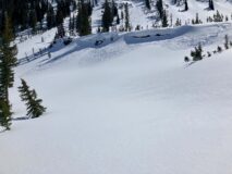
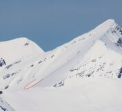
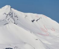
Avalanches: The Ruby Range had a good natural avalanche cycle yesterday. Wind slabs had failed on north to east to south-facing slopes, mostly above treeline. The crowns were generally shallow, but some had fairly wide propagation through the start zones. Most avalanches appeared to be on the lowest end of a D2.

There were several D1 loose wet avalanches on easterly and south easterly facing slopes that ran today.
Weather: Clear and calm. Cloud cover quickly increased around just after noon.

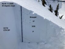
Snowpack: Traveled on a number of steep, small terrain features on NE to E to SE between 10,500 and 12,400ft with only 1 notable result. Dug into several different slopes looking at the recent storm snow down to the 3/29 interface. The snowpack structure was fairly simple and could be summarized similarly for all those locations. The recent storm snow has a notable density change with stronger snow over softer snow. In some areas, it’s just a thin layer of softer precipitation particles near the 3/29 interface and in others, it’s layers of graupel. While we did find a notable layer of faceted grains at the 3/29 interface yesterday on a north-facing slope, I wasn’t able to find any notable persistent weak layers above the 3/29 interface in today’s observation. ECT test didn’t produce results and CT test produced moderate results on the density change with a rough fracture character. Slabs averaged in the 6 to 12 inch range, but I was able to find some wind drifted features with slabs near 2 feet thick.

Photos:

5528

Read Full Observation
03/31/22

Rider triggered wind slab

Date of Observation: 03/31/2022

Zone: Northwest Mountains
Route Description: Baxter Basin

Observed avalanche activity: Yes
Avalanches: Snowboarder triggered a wind slab 2/3 down a chute, was able to ride off of the slab without getting caught. Also a large slab off of Oh-Be-Joyful Peak

Photos:

5527

Read Full Observation
03/31/22

Natural slab avalanches in the Ruby Range

Date of Observation: 03/31/2022
Name: Zach Guy

Zone: Northwest Mountains
Route Description: Viewed from Mt. CB.

Observed avalanche activity: Yes
Avalanches: Could see about 10 slab avalanches in the Ruby Range that ran during yesterday or last night’s wind event, ranging from D1.5 to D2, generally above treeline. One gouging wet loose below treeline that looks like it ran Tuesday or maybe even Wednesday.
Weather: Thin cloud cover increased mid day.

Photos:

5526

Read Full Observation
03/31/22

Human Triggered Wind Slab

Date of Observation: 03/30/2022

Zone: Northwest Mountains
Route Description: Irwin Area

Observed avalanche activity: Yes
Avalanches: We saw a far more reactive snowpack today than yesterday, due to a notable density change and moderate NW winds overnight. Popped out a couple slides very easily with good propagation. By the afternoon, the snow was spongy and squeaky, and low on the west wall and an ever so slight zipper crust had already formed.

Photos:

5525

Read Full Observation
03/30/22

Several skier triggered wind slabs

Date of Observation: 03/30/2022
Name: Zach Guy Evan Ross

Zone: Northwest Mountains
Route Description: Poverty Gulch, 9,500ft to 11,500ft. N, NE, SE.

Observed avalanche activity: Yes
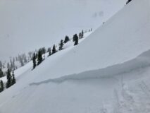
Avalanches: Skier triggered several small wind slabs on N, NE, and SE aspects between about 10,500ft and 11,500ft. These each released in storm snow, just above the 3/29 interface. Crowns averaged 6″ to 10″ thick.

Weather: The first 3/4th of the day consisted of a mostly cloudy sky with a few short breaks. Cloud cover began to decrease in the afternoon. Where we traveled the wind was moderate with a variable direction and transported snow through the day. As the sky was clearing in the afternoon, the winds looked strong in the alpine from west to northwest with lots of blowing snow.

Snowpack: Recent snow accumulations have settled down to 1″ to 3″ in the valley and 3″ to 6″ at upper elevations. Wind slabs were the only avalanche concern we encountered. The new snow was thick or slabby feeling, and conditions made it difficult to identify wind-loaded terrain features. The skier-triggered wind slabs were breaking above the 3/29 interface, on a density change in the storm snow.

On northerly facing slopes at upper elevations, the 3/29 interface was a thin crust over lightly faceted grains or no crust and just faceted grains. There wasn’t enough snow to create a widespread new snow avalanche problem on this interface and additional wind-loading was necessary. We aborted one up route when we encountered a slab around a foot thick on faceted grains near ridgeline that we couldn’t avoid.

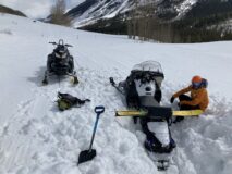
Down in the valley, the road was still punchy with snowmobile skis and tracks sinking deeply at times. Talked to on group that was looking for a quick ski near the trailhead and aborted because the snowpack wasn’t supportable. In the afternoon our snowmobiles were at times sinking deeply on the road.

Photos:

5524

Read Full Observation
03/30/22

April 1 Snow Surveys

Date of Observation: 03/30/2022
Name: Andrew Breibart

Zone: Southeast Mountains
Route Description: Keystone snow course
Crested Butte snow course

Observed avalanche activity: No
Avalanches: NA

Weather: Early AM Keystone: obscured skies, 30 degrees F, light to moderate winds
Late AM and early PM: CB snow course: mostly cloudy and clearing, light to moderate winds, above freezing.

Snowpack: Keystone (lower Red Lady Glades): 2 inches of new snow. supportive: Average snow depth: 43 inches; average SWE: 14.6 inches; density 34%
CB snow course (Slate River Valley near town): 1 inch of new snow, which appeared to ablate within two hours on site. Unsupportive snow on and off skin tracks. We had ski pen 2 to 4 inches while skinning. Average snow depth: 39 inches; average SWE: 12.7 inches; density 32%. Had melt water at the bottom of the pack in 4 of 12 samples. (side note: Slate River is starting to have increased runoff relative to the winter low flow).

5523

Read Full Observation
03/29/22

Freezing temps up high and mushy snowpack down low

Date of Observation: 03/29/2022
Name: Eric Murrow

Zone: Northwest Mountains
Route Description: Snowmobile tour around Kebler Pass area and ski tour up Elk Creek.

Observed avalanche activity: No
Avalanches: Did not observe any natural avalanches. Skier triggered a tiny loose avalanche on a northeast aspect in the moist storm snow below treeline that ran on top of the soft crust that formed overnight. I suspect that longer slopes below 11,000 feet would have allowed a loose avalanche in the storm snow to gouge into the wet snow below.
Weather: Mostly cloudy skies, periodic light snowfall with a few periods of S1-S2, and moderate westerly winds at upper elevations. Mild temperatures below treeline and a few periods of sunshine. New snow accumulations ranged from 2 – 7 inches along the Kebler corridor at 4pm.
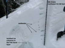
Snowpack: The storm snow was moist and sticky on all aspects below treeline, and the sunny terrain features I traveled on to treeline. At low elevations, the crust below the storm snow was very thin and soft. East, south, and west slopes below treeline felt trap door and punchy. A quick profile on a northeast slope below treeline showed a good amount of liquid water lingering in the snowpack that was draining into the February facet layer. Crusts became supportive to skis somewhere around or just above 11,000 feet. Crusts at 12,000 feet were up to 2 inches thick. I poked into wind drift around 12 inches thick and did not see any cracking or signs of instability. Winds were efficiently transporting the storm snow onto the east half of the compass at 12k.

Photos:

5521

Read Full Observation
The blog.