Observations

04/07/22

A few kernels short of corn conditions on sunny alpine terrain

Date of Observation: 04/07/2022
Name: Eric Murrow

Zone: Northwest Mountains
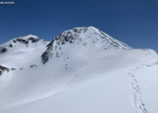
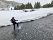
Route Description: Slate River to Poverty Gulch. Up Poverty Gulch to Ruby Range spine between Augusta and Purple Mountain.

Observed avalanche activity: No
Weather: Clear skies, seasonably cool temps, and westerly winds blowing around 15 gusts to 30’s.  Temps nearing 40 below treeline, and mid-20s above treeline.
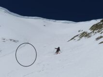
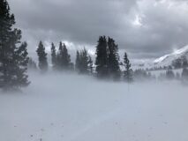
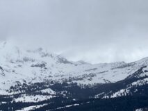
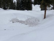
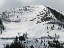
Snowpack: Above treeline, the snow surface largely remained frozen on east to south aspects; just enough softening to make for ‘grippy’ corn conditions but far from good. Around 11k and below riding conditions softened nicely on the south half of the compass, but not enough to cause any loose avalanche concerns. Moving through a large alpine basin, I found stiff slabs, 3-10 inches thick, from the recent extreme wind event were scattered about, more commonly found near treeline than above. They often looked smooth and had a slightly off-white color. I stomped on a few of these recent drifts on small features without result but avoided them on steeper terrain with consequence. This area has received the most snowfall over the past week, and on east through south features, near and above treeline, I found 4-12 inches of snow that could be entrained in a loose wet avalanche IF conditions warm enough during the next few days.

Photos:

5542

Read Full Observation
04/07/22

Creamy Gothic

Date of Observation: 04/07/2022
Name: Zach Guy and Jack Caprio

Zone: Southeast Mountains
Route Description: Traveled on south to east aspects of Gothic Mtn up to 12,600 ft.

Observed avalanche activity: No
Avalanches: Nothing recent
Weather: Moderate northerly winds kept things cool. Clear skies. Some periods of blowing snow off of Gothic this morning, mostly just swirling or blowing into the atmosphere.
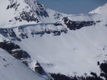
Snowpack: No signs of instability while skiing in steep terrain. There’s about 2″ to 3″ of dense storm snow well bonded to a stout melt-freeze crust (4/5 crust). In exposed areas, winds stripped the recent snow away down to the crust. We found a few pockets of drifted slabs in the bottom half of the mountain; they were in the 3″ to 8″ thick range and unreactive to ski cuts. The largest and most dense of these was halfway down the east face in a concave gulley, and we simply skirted around it, given the consequences of a small slide there. The dry snow surface got moist on southeast aspects and produced a couple of minor rollerballs, while it stayed dry on east and northeast aspects. The 4/5 crust stayed solidly frozen on all aspects through 1 p.m.

Photos:

5541

Read Full Observation
04/06/22

Wind aftermath

Date of Observation: 04/06/2022
Name: Eric Murrow

Zone: Southeast Mountains and Northwest Mountains
Route Description: Mount Emmons

Observed avalanche activity: No
Avalanches: none observed
Weather: Clear skies with seasonably cool temperatures. Westerly winds blowing 10-20 and gusts around 40 above treeline.  On a few occasions, the wind did find soft snow to transport, but no significant loading was observed.
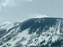
Snowpack: I traveled through northeast, east, southeast, and south leeward terrain features looking for recent slab formation from the wind event and did not find any in the terrain I traveled. I observed lots of wind erosion on north and northwest alpine slopes. I did see a few features inset in gullies or chutes with smooth textures that looked suspicious for holding a thin, hard slab. I would guess there are isolated terrain features with recent hard slab formation but in the big picture it looked like the wind blasted the snow into the atmosphere or lower down slopes below common start zones.

Photos:

5540

Read Full Observation
04/05/22

A bit breezy

Date of Observation: 04/05/2022
Name: Zach Guy

Zone: Northwest Mountains
Route Description: Skied on easterly aspects near Ohio Pass and snowmobiled up to Scarp Ridge, traveling near and below treeline.

Observed avalanche activity: No
Avalanches: Can we call falling trees an avalanche? If so, there were several large (D2) trees that blew over, along with numerous smaller ones (D1-1.5).
Weather: Extreme wind gusts alternating with moderate lulls out of the west. Sustained flagging off of all of the high peaks and occasional periods of whiteout/blowing snow at all elevations. Intermittent periods of light graupel. Mild temps.
Snowpack: Went hunting for wind slabs, and for the most part, I couldn’t find them. Winds were so strong that blowing snow didn’t seem to be getting deposited anywhere that I traveled. I traversed below two corniced, east-facing ridgelines near treeline, the types of features that normally collect wind slabs, and the snow surface was scoured down to yesterday’s sun crust. A bit lower on the slope, I found a few thin drifts up to 3″ thick that produced mini-wind slab avalanches to ski cuts. I have more uncertainty about loading patterns, or lackthereof, in the alpine, where there was a steady stream of pluming snow off of the peaks all afternoon.

Photos:

5539

Read Full Observation
04/05/22

Little bit of everything

Date of Observation: 04/05/2022
Name: Evan Ross

Zone: Southeast Mountains
Route Description: 9,000ft to 11,400ft. N to E. Mt Emmons

Weather: Graupel pelting eye balls. Overcast. Trace of new snow.

Snowpack: The valley and lower elevations are a punchy wet mess. E and NE snow surfaces were better frozen as we got up to 10,000ft. Due north skied ok down to about 10,400ft. No avalanche problems encountered.

Photos:

5538

Read Full Observation
04/04/22

Backcountry is still open for business

Date of Observation: 04/04/2022
Name: Zach Guy

Zone: Southeast Mountains
Route Description: Teocalli Mtn. Traveled mostly on southerly aspects to 13,200 ft.

Observed avalanche activity: Yes
Avalanches: Nothing new. A handful of small wind slabs and wet loose avalanches from last week, along with a number of previously undocumented large wet avalanches from the big warmup in late March, both wet slabs and gouging wet loose, D1.5-D2 in size.
Weather: Scattered cloud cover this morning gave way to few clouds by mid day. Cool temps and light ridgetop winds at noon.
Snowpack: No signs of instability on steep terrain. The recent snow, up 4″ to 6″ here, was redistributed by winds at higher elevations with localized drifts up to a foot thick that were unreactive to ski cuts. The snow is transitioning to almost-corn on south aspects and still dry powder on north. There was a dusting of snow yesterday that accumulated on melt-freeze crusts. That low density snow is starting to facet above the crust, but it was also getting cooked on sunny aspects.

Photos:

5537

Read Full Observation
04/03/22

Quiet snowpack

Date of Observation: 04/03/2022
Name: Zach Guy

Zone: Northwest Mountains
Route Description: Mt. Axtell, northerly aspects to 11,800 ft.

Observed avalanche activity: No
Avalanches: Nothing recent
Weather: Light winds, no blowing snow. Overcast and obscured cloud cover. A pulse of moderate snowfall came through just after noon, otherwise minimal precip.
Snowpack: No signs of instability on steep terrain. About 6″ of settled storm snow from the past week above dry snow on north terrain and a 2″ meltfreeze crust on northeasterly left behind after last week’s warmup.
There was evidence of very light rain last night to about ~10,500ft and a dusting of snow higher up. We didn’t poke around on any proper above treeline terrain because visibility was too poor. Near treeline, the recent wind transport has eroded northerly terrain and reverse loaded the drifted snow onto the flat summit ridgeline facing south, where it got cooked yesterday. My biggest concern, which we didn’t find evidence of, would be a relatively small, lingering crossloaded wind slab somewhere in wind affected northerly terrain.
I dug one pit to test for persistent slab concerns in a wind-eroded north facing alpine slope, wondering about the potential to initiate/propagate a failure from a shallow spot. The answer was a hard no here. The dryspell weak layer is the same hardness as the overlying slab, and it produced no concerning results in tests (ECTX, PST100/100).

Photos:

5535

Read Full Observation
04/02/22

Wetting storm snow

Date of Observation: 04/02/2022
Name: Zach Guy and Evan Ross 

Zone: Northwest Mountains
Route Description: Traveled on various aspects to 11,600 ft in the Slate and Poverty Gulch areas.

Observed avalanche activity: Yes
Avalanches: A handful of small loose wet avalanches ran today at all elevations. Most were on easterly aspects where we traveled.

Weather: A mix of sun and clouds. Sun had the upper hand in the morning, clouds took the lead in the afternoon. Light to moderate westerly winds, with periods of snow transport observed off of high peaks. Warm temps.

Snowpack: The recent storm snow, up to 18″, got wet or moist at the surface on all but due north aspects, spurring numerous rollerballs and a handful of minor wet loose slides. Near and below treeline, we tested steep rollovers and previously drifted slopes with ski and snowmobile cuts without any notable results; some occasional minor cracking. Stability test results on a due north slope produced non-propagating results at the storm interface.

Photos:

5534

Read Full Observation
04/01/22

Small Wind Slabs in the Taylor Pass to Star Pass area

Date of Observation: 04/01/2022
Name: GT Field Teams

Zone: Southeast Mountains
Route Description: Taylor Pass to Star Pass area

Avalanches: 6x naturals 4x ASc. A few inches of dry snow between 1cm 3/31 crust and bomber 2/26 crust

Snowpack: SE ATL WSa reactive 7-10″ thick up to 14. Running on 3/31 crust. All D1’s on small features; long slopes would be approaching D2.

5533

Read Full Observation
04/01/22

Quick morning tour near town

Date of Observation: 04/01/2022
Name: Evan Ross

Zone: Southeast Mountains
Route Description: ENE 9,000 to 9,500ft

Avalanches: Small wind slab in Coon Bowl. Nothing notable in the Whetstone area, or around CB.

Snowpack: At 11am, east had a soft refrozen 4″ crust that was supportable to skis but not boots. The rest of the snowpack below had been wetted and appeared to consist of large grains but I didn’t look in detail. The recent snow had been zapped down to 2cm’s. This terrain will probably become unsupportable during the next warm-up.

Photos:

5532

Read Full Observation
The blog.