Observations

01/20/22

AIARE LEVEL 1 COURSE

Date of Observation: 01/20/2022
Name: BILLY RANKIN

Zone: Southeast Mountains
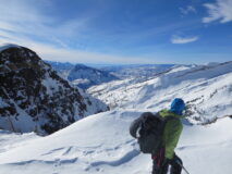
Route Description: Snodgrass Frontside

Observed avalanche activity: No
Avalanches: None
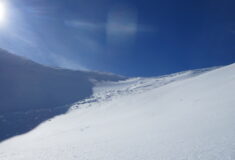
Weather: Clear, Sunny, warm, High temps in the mid 20’s, wind picked up at the end of the day
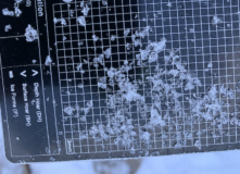
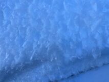
Snowpack: HS: 80-120 We dug a profile on a NE aspect below tree line on a 20 degree slope:
HS: 120cm: 5cm’s of facets on the surface 110cm’s of 1F to Pencil+ Hard Midpack on top of 5cm’s rounding facets 2mm on the ground (Dec 6) but discontinous.
CT24 SC on the Dec 6 Interface, 2mm rounding facets.
ECTX
PST End 70/110 on Dec 6 Interface.

5266

Read Full Observation
01/19/22

Improving basal weak layers and newly forming surface weak layers

Date of Observation: 01/19/2022
Name: Eric Murrow Zach Kinler

Zone: Northwest Mountains
Route Description: Snowmobile out Kebler Pass to Cliff Creek trail. Skinned around from 10,200 – 10,900 feet on East Beckwith.

Observed avalanche activity: Yes
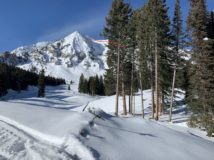
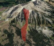
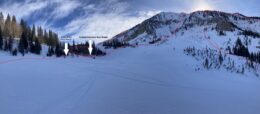
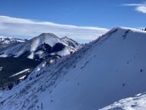
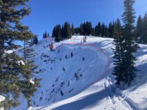
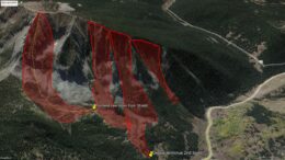
Avalanches: Took a closer look at a previously reported avalanche on East Beckwith. This avalanche likely failed around 12/31, was D4 in size and ran approximately 1.25 miles from crown to toe of debris. It trimmed mature trees along the edge of its deposition zone and terminus. Another impressive avalanche from the Holiday natural cycle. See photos and estimated path in Google Earth image.
Weather: Thin high cloud cover to mostly clear skies. Generally light winds below treeline and moderate temperatures.
Snowpack: Near Horse Ranch Park at 8,900 feet the snow depth was 115cm and increased to nearly 250cm at 10,900 on East Beckwith. Basal weak layers in a northeast-facing test profile site at 10,500 feet were 4f+ to 1f- in hand hardness, rounding, and 2-4mm in size. The slab at this semi-sheltered site was around 2 meters thick or slightly more. Facets .5mm (a bit larger but generally below 1mm) were present on protected northerly terrain. An east-facing slope at 10,800 feet had a 1cm melt/freeze crust at the surface with small facets below. A due south slope at 10,800 feet had wet snow at the surface 5cm thick.

Photos:

5265

Read Full Observation
01/19/22

Side slipping & side stepping…

Date of Observation: 01/19/2022

Zone: Southeast Mountains
Route Description: North side of Snodgrass to Gothic, White Ridge to Queen Basin, Gothic Road back to Snodgrass TH. 9,400-12,400 feet, mostly N aspects.

Observed avalanche activity: No
Avalanches:
Weather: Clear & calm. Warm in the sun, cold in the shade.
Snowpack: Sometimes it is even worse than it looks! Pretty much side slipped down an entire north-facing couloir into Queen Basin on as-firm-as-it gets wind board. Threw one turn in near the bottom just to make sure I remembered how. Looked like a previous party had a fairly similar experience. Even the apron was wind-hammered, but the textured snow allowed for some choppy and punchy turns. Protected north-facing, BTL slopes are still holding soft, faceting snow. Anything with a southern tilt seems to be quite crusty. Fun times!

5264

Read Full Observation
01/19/22

Cement Creek

Date of Observation: 01/19/2022

Zone: Southeast Mountains
Route Description: Poking around down in the south end of the valley at 12,000ft, NW facing slope

Observed avalanche activity: No
Avalanches:
Weather: Calm , Cold
Snowpack: 120cm snowpack Slight Wind Effect up high. Surface Faceting down lower around 9500ft

Photos:

5263

Read Full Observation
01/19/22

East River/Copper Creek

Date of Observation: 01/18/2022
Name: Josh Jones

Zone: Southeast Mountains
Route Description: From Snodgrass up the S-SE side of Redrock up and over to Queens Basin. Then return on Copper Creek.

Observed avalanche activity: No
Avalanches: Old activity from previous cycle. Old buried debris on the N couloir on Redrock Mountain.
Weather: Calm, fluctuating sky-cover throughout the day.
Snowpack: Observed stable conditions on all aspects of the compass. Still practiced safe regrouping practices. Unsupportive snow found on previously loaded ridge-tops near rocky outcroppings. Previously avalanched north facing gullies left firm, barely edge-able snow. Inconsistent crusts found on all aspects, less predictable on northerly slopes. Favorable riding conditions found in NW facing sheltered terrain below treeline.

5262

Read Full Observation
01/18/22

Scarps To OBJ

Date of Observation: 01/18/2022
Name: Evan Ross & Zach Guy

Zone: Northwest Mountains
Route Description: Up the RLB skin track. Out Scarps. Drop to Peeler Basin and out OBJ. 9,000ft to 12,300ft. Primary traveling on aspects facing the northern half of the compass.

Observed avalanche activity: No
Avalanches: All old avalanches from the holiday avalanche cycle.

Weather: Increasing and decreasing sky. Anything from clear to overcast throughout the day. Clam wind.

Snowpack: This tour didn’t encounter a moment where it felt like there was a chance of triggering a slab avalanche. Small sluffs on steep northerly slopes were about it. Managing regrouping areas for the very unlikely chance of triggering a large to very large avalanche seemed to be the best travel advice.

West and NW aspects at NTL elevations had the most dramatic changes from trigger points to a deeper snowpack. Otherwise, we didn’t find ourselves managing trigger point travel advice. Other aspects are either, deep, blown off, or non-problematic.

On a northerly facing slope NTL the snow surface consisted of .5mm or smaller NSF. The snowpack is still supportive to boots NTL/BLT elevations and you can actually take both skis off at once without sinking deeply, which isn’t typical for our snowpack this time of year.

5261

Read Full Observation
01/18/22

Fun Facts: 5th Bowl on Axtell

Date of Observation: 01/18/2022
Name: Whitney Gilliam

Zone: Northwest Mountains
Route Description: Axtell 5th Bowl (Green Lake)

Observed avalanche activity: Yes
Avalanches: Previously undocumented hard slab avalanche off of the E/NE side of 5th bowl. Crushed Green Lake.

Photos:

5260

Read Full Observation
01/17/22

I made my probe disappear

Date of Observation: 01/17/2022
Name: Zach Kinler

Zone: Northwest Mountains
Route Description: Upper Poverty Gulch to the north side of Augusta. 9,000′-12,000′.

Observed avalanche activity: No
Avalanches: No new avalanches
Weather: Perfect weather for an alpine tour, Clear skies, broke out of the inversion above about 10,000 ft. Calm to light northerly breezes.
Snowpack: Deep. No signs of instability. Probing across a few easterly aspects at upper elevations which had not avalanched previously, I was not able to find the ground with a 300 cm probe and just about broke the probe getting it through the incredibly hard slabs. Surfaces are a bit roughed up on many north through east aspects. Variable crusts on anything tipping to the south.


[/gravityforms]

5259

Read Full Observation
01/17/22

Fun Facts: 3rd and 4th Bowl of Mt. Axtell

Date of Observation: 01/17/2022
Name: Zach Guy

Zone: Northwest Mountains
Route Description: Skied northerly aspects to 12,000 ft. on Axtell

Observed avalanche activity: Yes
Avalanches: Nothing recent. Got a closer look at carnage from the last cycle in 3rd and 4th Bowl. There is a full-depth crown that runs from the edge of 2nd Bowl to the far edge of the Pencil, but not into Wang Chung. This slide snapped a bunch of trees up to a foot in diameter near its trim line, and the debris merged with 2nd Bowl debris. The crown might have connected to the 2nd Bowl avalanche (previously documented). The slide on the Shield (previously documented) ran just short of a mile, snapping mature trees in its trimline, well out of site of the start zone. The alpha angle from the furthest tree snapped is 19 degrees. There really isn’t anywhere within the runouts of 2nd, 3rd, or 4th bowls that you could have stood safely during December 31st.
Weather: Mostly clear. Inverted temps. Calm winds.
Snowpack: No signs of deep instabilities. Near-surface facet sluffing on open faces, changes to firm wind board in confined terrain where winds get channeled. The Pencil and Shield crowns broke at the ground, so the little snow that is there now is subject to strong temperature gradients. That’s a good recipe for advanced faceting and repeat offenders once the bedsurfaces get reloaded with snowfall. We encountered surface hoar growth as we descended into the inversion, at about 9600′

Photos:

5258

Read Full Observation
01/17/22

White Rock

Date of Observation: 01/17/2022
Name: Evan Ross

Zone: Southeast Mountains
Route Description: Brush Creek to White Rock Mountain. 10,000ft to 13,500

Weather: Beautiful day. Few clouds. Steady light wind in the alpine.

Snowpack: Nice to keep stretching our legs into all parts of our forecast area while getting out to enjoy the sunshine. The alpine in this area is very blown and wind affected once you are above treeline. We didn’t observe any avalanche problems above treeline. Not much to report on really. Lots of ski traffic in the Brush Creek area and it’s great to see everyone out getting some cool lines that finally have a nice snowpack.

5257

Read Full Observation
The blog.