Observations

02/19/22

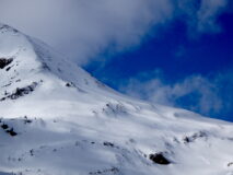
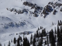
Couple More Avalanche Observations

Date of Observation: 02/19/2022
Name: Evan Ross

Zone: Northwest Mountains
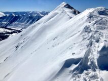
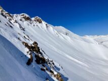
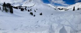
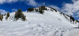
Route Description: Upper Washington Gulch. Mostly observing between 11,400-12,700ft on E-SE-S aspects.

Observed avalanche activity: Yes
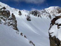
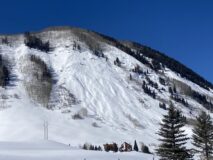
Avalanches: 2 notable slab avalanches that looked to be a day or two old.

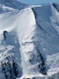
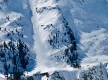
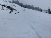
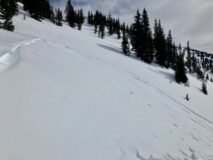
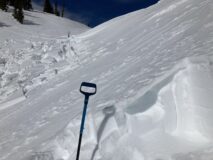
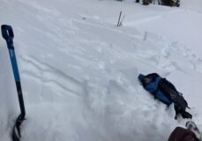
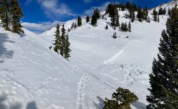
Purple Ridge, NE, 11,000t NTL. Heavly crossloaded terrain featuer. Best guess is that the crown averaged in the 6 to 12″ range, and maybe a bit deeper where it broke into the wind wale. D2 in size.

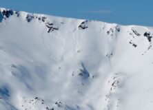
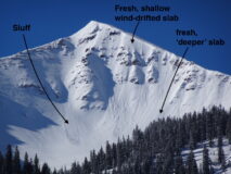
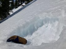
Rock Creek, SE, 12,500ft ATL. 1 D1.5 wind slab breaking near the ridge line. 1 D1.5 slab breaking below a cliff band that was likely triggered by some form of sluff off the ridge.

Weather: Clear, fairly consistent wind NTL blowing in the teens, moderate winds in the alpine continuing to drift snow at times.

Snowpack: Fresh wind-loading was isolated in the terrain and not common across the same specific terrain features. I still encountered a few fresh wind-slabs that I chose to avoid throughout the day. Avalanche problems in general on this tour felt fairly isolated as much of the terrain was simply blown back to firmer old layers.

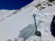
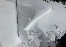
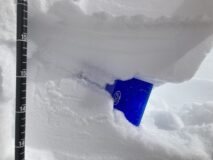
The most concerning thing I encountered was one area where I found multiple stacks of wind boards sandwiching layers of weak facets. This was a south-facing slope at 12,000ft that had seen multiple wind-loading events. I could only observe snowpack structure in the low-angle sections of the slope, somewhere in the 25-degree range. In one area near the bottom of the slope, and in another area near the top of the slope. It would have been interesting to see how much different the structure would have been on the actual steeper section of the slope. The snowpack structure was similar to what I found earlier in the week on low-angle SE to SW slopes near Paradise Divide.

Photos:

5357
Read Full Observation
02/19/22

Still weak

Date of Observation: 02/19/2022
Name: Zach Guy

Zone: Southeast Mountains
Route Description: Climax Chutes. E and NE aspects to 10,800 ft.

Observed avalanche activity: Yes
Avalanches: Loose dry sluffing is still the primary concern here, although not as widespread as my last visit a couple of weeks ago because sun crusts have encroached on east aspects and wind crusts are scattered about. Still triggered a handful of small sluffs that entrained anywhere from 6″ to 12″, starting to gouge deeper into the pack near rock bands.
Weather: Clear skies, calm winds where we traveled.
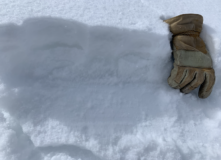
Snowpack: 2″ of recent snow is faceting into small grains (~.5mm), on top of well-developed, very weak facets (2 mm). Wind crusts and sun crusts capping facets in some terrain. The transition from thin sun crust to dry facet occurred at roughly 75 degrees, ENE, depending on tree shading and slope angle.

Photos:

5356

Read Full Observation
02/18/22

Nice riding conditions on NW aspect NTL and a few natural slabs from Thursday night

Date of Observation: 02/18/2022
Name: Eric Murrow

Zone: Northwest Mountains
Route Description: Baxter Basin area

Observed avalanche activity: Yes
Avalanches: I observed a couple of natural slab avalanches in the near treeline elevation band – small size on northeast and east aspects. These slides were not visible at 3 pm on Thursday afternoon.
Weather: Seasonably cool temperatures with gusty winds above treeline and generally light winds in the basin.
Snowpack: We skied a northwest-facing piece of terrain near treeline and found around 5 inches of new snow resting on a patchwork of thin wind boards or soft near-surface facets. We selected terrain to avoid recent and previous wind-loading. Probed extensively on the uptrack looking for thicker hard slabs beneath the new snow and did not find anything of concern.

Photos:

5355

Read Full Observation
02/18/22

Ruby Range by Irwin

Date of Observation: 02/18/2022
Name: Evan Ross

Zone: Northwest Mountains
Route Description: Primary 11,000 to 12,600ft on NE-E facing terrain.

Observed avalanche activity: Yes
Avalanches: A few recent shallow slabs or dry sluffs at this end of the Ruby Range. All from some form of recent wind loading. D1’s.

Weather: Partly Cloudy. Moderate winds were consistently blowing snow at upper elevations. The wind appeared to be decreasing in the afternoon, or the snow fetch was drying out.

Snowpack: Weirdness ontop of the old snow NSF junk about sums it up. The old wind board over facets that formed over a week ago now, is inconsistent and has no rime or reason in its distribution at ATL elevations. We didn’t encounter anywhere with an avalanche problem related to this, but we did find thin wind-boards over the NSF that lead to uncertainty about whether we would randomly encounter something thicker or more problematic. In the afternoon we snowmobiled around some NTL previously wind-loaded terrain with no notable results.

Where there wasn’t an old wind board on the NSF, it was just the recent snow on the NSF. There wasn’t enough new snow to create a slab over the weak layer. Managing for wind slabs was great travel advice. We didn’t encounter much for a wind slab but we were not traveling on a ridgeline. Up higher near the ridgelines it didn’t look like there was a good distribution of fresh wind-loading as many areas looked blown off or just not very loaded.

Photos:

5354

Read Full Observation
02/18/22

Sluffs on Gibson Ridge

Date of Observation: 02/18/2022
Name: Zach Guy

Zone: Southeast Mountains
Route Description: E/NE aspect of Gibson Ridge. Viewed from Highway 135.

Observed avalanche activity: Yes
Avalanches: A few long running sluffs, D1 or maybe 1.5 in size, that appear to be recently skier or snowboarder triggered.

Photos:

5353

Read Full Observation
02/17/22

A bit less new snow than expected on Purple Ridge

Date of Observation: 02/17/2022
Name: Eric Murrow

Zone: Northwest Mountains
Route Description: Up standard Purple Ridge track and descended from the ridge through Purple Palace.

Observed avalanche activity: Yes
Avalanches: Observed numerous small Loose Dry avalanches on north through east aspects coming out of rocky upper elevation terrain. One fresh shallow slab immediately below a ridge top in Wolverine Basin and another deeper-looking crown on an northeasterly-facing part of the apron in Wolverine.
Weather: Partly cloudy skies in mid-morning, orographically driven cloud cover and very light snowfall midday over the spine of the Ruby Range, and clearing skies by sunset. Moderate northerly winds with stronger gusts through 1pm shifting to the northwest later in afternoon.
Snowpack: New snow accumulations maxed out at 5 inches on Purple Ridge near treeline. North to northwest winds transported snow throughout the day in the Ruby Range onto east through south aspects at upper elevations. At ridgetop, I was able to get some ski-length cracking in fresh cornice formation, but drifted features up to 14 inches deep did not crack. On shaded slopes below treeline, I found the 5 inches of storm snow resting on a mix of weak facets, friable melt/freeze crusts, and supportive windboard and did not find signs of instability. It seems like there were isolated Wind Slabs up high, the potential for old hard slabs from previous winds, and sluffs on weak shady slopes, but no Storm Slab problem.

Photos:

5352

Read Full Observation
02/17/22

Large natural avalanche on East Beckwith

Date of Observation: 02/17/2022
Name: Eric Murrow

Zone: Northwest Mountains
Route Description: Observation from East Beckwith via social media message

Observed avalanche activity: Yes
Avalanches: Large natural avalanche on a northeast aspect. Appears to be a slab, but can’t make out the exact details. Certainly large enough to bury and kill a person.
Weather:
Snowpack:

Photos:

5351

Read Full Observation
02/17/22

Fluff, slough, frozen tracks & crust…

Date of Observation: 02/17/2022

Zone: Southeast Mountains
Route Description: A few laps at Coney’s. 9,600-10,800 ENE aspects. Started on the standard skin track, but traversed north into the open terrain; climbed the ridge just south of the main bowl.

Observed avalanche activity: Yes
Avalanches: Soft sloughs (small) on everything over 35 degrees.
Weather: Clear skies. 10 degrees at 9AM warming into the 20s by the end of the tour. Light N wind at the ridge.
Snowpack: 5-8cm of new snow on a firm crust. In the steepest terrain (at the top and near the bottom), new snow was sloughing easily. If the terrain were steeper I could imagine the sloughs moving fast and far.

5350

Read Full Observation
02/16/22

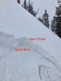
Powder on the sand box

Date of Observation: 02/16/2022
Name: Eric Murrow & Evan Ross

Zone: Northwest Mountains
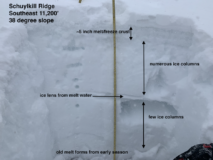
Route Description: Schuylkill. NE-E-S, 9,000-11,300ft.

Observed avalanche activity: Yes
Avalanches: More skier triggered sluffs. The most notable was initiated on the first turn off the ridge and ran 1,000ft and through a good section of 35-degree terrain in the avalanche track. That part wasn’t necessarily new. However, the additional new snow added enough volume to push this sluff to the line of a D2 avalanche. NE facing slope.  Low in the track, the moving loose avalanche released a small, thin hard slab where previous winds drifted snow.

Weather: Mostly cloudy with convective bursts of snow moving through like a summertime thunderstorm. During the clearings, the snow was clearly blowing off of Scarps Ridge and periods of moderate winds where drifting snow at lower NTL elevations.

Snowpack: 4″ of new snow was measured at 4pm, 9,700ft. We didn’t encounter any changes to the current list of avalanches problems. Mostly just added volume for the loose snow avalanche problem and drifting snow at upper elevations.

The old snow surface in many areas is extremely weak. Similar to early season conditions when we have a large-grained faceted snowpack that is just starting to accumulate new snow. The only difference is that it’s February and the weak layer is widespread. Northerly facing slopes are a sandbox of NSF. Easterly facing slopes and some NE facing slopes had a thin collapsible crust capping those same large-grained and very weak NSF. Some of those crusts looked like they could collapse with little load and aid in propagation. Any triggered avalanche, slab or loose, would then gouge into the weak old snow, gaining additional volume.

South and SE-facing slopes in this area had strong crusts with many peculation columns extending into the snowpack below. Here we couldn’t initiate sluffs in the new snow on 38-degree slopes.

Photos:

5349

Read Full Observation
02/15/22

Check on the P-Divide Avalanche

Date of Observation: 02/15/2022
Name: Evan Ross

Zone: Northwest Mountains
Route Description: Slate River to Paradise Divide.

Observed avalanche activity: Yes
Avalanches: Headed up to the previously reported avalanche on Paradise Divide for a little check-in since it didn’t quite fit the mold. This avalanche failed on a thin crust capping 1mm, very soft, faceted grains over harder 1F hard faceted grains. The slab above was P+ hard. As reported, the crown was in fairly low angle southerly facing terrain.

After closer inspection, this appeared to be a monster wind wale that failed on a weaker than average south-facing snowpack due to the lower angle of the terrain. The fetch for this avalanche is massive, square mile range. The fetch from the paradise divide area has created a number of hard slabs that have loaded into the SE to SW facing slopes below the pass.

In a location near the crown, on a steeper 35 degree south-facing slope, without the recent wind loading. The surface crust was 3 to 4cm’s thick, with large percolation column extending into the facets. The snowpack here was only about 100cm’s deep and didn’t have much layering given the lack of storms this winter.

I didn’t encounter any obvious signs of instability while traveling on the margins of some of the other hard slabs in the area. Once you were out on the slabs there was no way the weight of a human was going into the snowpack given how hard the snow now is. However if you did manage to find a trigger point you could get a similar result to this avalanche. The snowpack has most likely become quieter since the last party had come through this area.

Weather: Mostly cloudy, with a nice break in the clouds early afternoon for things to both warm and soften up. Overcast by late afternoon. Warm and breezy.

Snowpack: Snow surface obs between 11,500ft and 10,500ft. Westerly slopes were made up of large-grained facets in some areas, and a 2cm crust capped the facets in other areas. A slight change in slope angle or aspect allowed for the crust vs straight facets. SW and SE aspects had a slightly stronger crust but still very concerning with a load. On south facing slopes, the crust was in the 3 to 4 cm range with big percolation column going down into the facets. Not much layering in this snowpack given the few storms this winter and dry 2022…

Photos:

5348

Read Full Observation
The blog.