Observations

03/07/22

Shlabby

Date of Observation: 03/07/2022
Name: Than Acuff

Zone: Northwest Mountains
Route Description: BTL NE

Observed avalanche activity: No
Avalanches: Just some minimal sluffing up high on steep NE slopes
Weather: partly cloudy with periods of snow and some winds
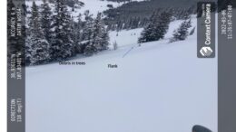
Snowpack: 4-5″ new from day before. Snow getting stiffer, feeling a little shlabby out in open from the winds but still getting it in the face. Some shattering in surface of snow at top of rolls out in the open where the wind got to it

5464

Read Full Observation
03/07/22

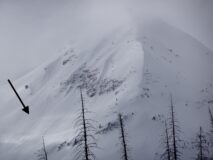
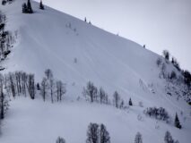
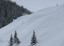
Large slab triggered on Schuylkill Ridge

Date of Observation: 03/07/2022
Name: Zach Guy

Zone: Northwest Mountains
Route Description: Traveled on NE, E, SE, and S aspects of Schuylkill Ridge to 11,400 ft.

Observed avalanche activity: Yes
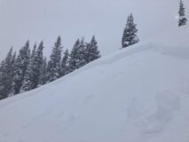
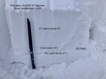
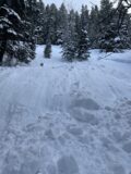
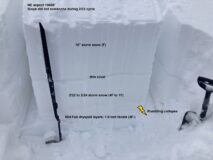
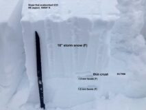
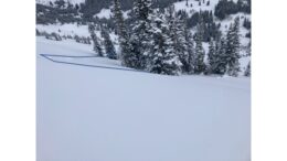
Avalanches: I was hunting for signs that one of the dozens of bed surfaces on Schuylkill Ridge is reactivating. I stomped on and ski cut a handful of slopes that ran during the 2/23 cycle without anything interesting until I put in a ski cut above the ENE side of Birthday Bowl, which produced a D2 slab avalanche about 5 feet in front of my skis..maybe we can call that remotely triggered. The slab was about 100 feet wide, 20″ thick, and ran a few hundred feet shy of the bench. The snow structure there was soft snow from the recent storm over the bed surface from the last cycle, which is a soft melt-freeze crust capping facets. From where I triggered it, the slide failed on the facets.  However, as I traced the length of the crown, at some point it stepped up above the crust. So it failed on a combination of old snow and storm interface. I also spotted a small slab that failed midway down the Shield in Redwell Basin, breaking in the storm snow.
Weather: Light winds and very light snowfall this morning. Around 2 p.m., there was a stronger but brief pulse of moderate snowfall, followed by winds increasing out of the northwest. Snow was actively cross-drifting at lower elevations from down-valley winds, and I saw efficient transportation into Red Lady Bowl as I was leaving the trailhead.
Snowpack: 12″ to 18″ of storm snow. No obvious signs of instability underfoot while traveling on an established skin track and while occasionally jumping off the skin track fishing for collapses. I got some localized cracking in drifted features isolated to ridgetop and in a cross-drifted gulley near valley bottom.
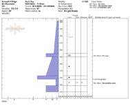
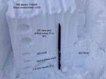
On a due east aspect NTL where the entire persistent slab structure is intact, I got hard propagating results about 3 feet down. On due east aspects, the 3/5 crust was about 5 cm thick and 1F hard on steep slopes (see profile). On slopes that avalanched during the last cycle, tests produced failures below the storm snow that did not propagate on the weak facets left behind after the avalanches. The slope that avalanched had a similar structure as the latter ones I tested with ECTs.
On SE aspects, that same crust is very thick and supportive. The storm snow appeared to be bonding fairly well to that crust on southerly aspects; ski cuts on slopes up to 40 degrees only produced minor sluffing in the top few inches of snow.

Photos:

5463

Read Full Observation
03/07/22

Human triggered avalanche

Date of Observation: 03/05/2022

Zone: Southeast Mountains
Route Description: Hiking up NE slope between Meridian Lake and Washington Gulch Rd.

Observed avalanche activity: Yes
Avalanches: Friend triggered avalanche from below while hiking up the slope and was caught, getting partially buried.
Weather:
Snowpack:

Photos:

5462

Read Full Observation
03/07/22

Gothic A.M. report

Date of Observation: 03/07/2022
Name: billy barr

Zone: Southeast Mountains
Route Description: Gothic townsite

Observed avalanche activity: No
Weather: Snow started in the evening going steady but light overnight with 5½” new and water 0.33″. Wind light from the southwest. Currently obscured with light snow and light SW wind. The temperature range the last 24 hours was a high of 31F and the low, and the current, of 10F. Snowpack is at winters deepest of 69″.
Snowpack: The snowpack is still collapsing but i saw no signs of avalanche activity.

5461

Read Full Observation
03/06/22

Face shots on Red Lady…

Date of Observation: 03/06/2022

Zone: Southeast Mountains
Route Description: 9,200-12,300 feet, SE aspect; standard route.

Observed avalanche activity: No
Weather: Calm wind, mid to upper teens and overcast in the morning. By the afternoon, intermittant light snow and moderate SW wind.
Snowpack: A foot or so of super low density snow on a firm crust. No signs of instability, not even a little sluffing at the top. Occasionally, an edge would bump the underlying crust. Even with flat light, and at times low visibility, we spent the better part of the day lapping the bowl; floating on clouds of snow! A concern would be for the increasing winds to form fresh windslabs overnight.

5460

Read Full Observation
03/06/22

Snodgrass Collapses

Date of Observation: 03/06/2022
Name: Ben Ammon

Zone: Southeast Mountains
Route Description: Snodgrass

Observed avalanche activity: No
Snowpack: Multiple small collapses above 10,600′ on NE and SW terrain. All in sheltered terrain, fairly thick trees which likely helped protect from the sun in the SW terrain. Also got one small slope to collapse on a SW slope around 10,000′. Traveled a lot of terrain between 10 and 11k’ on S and SW around 35 degrees and noted no other signs of instability. No slab forming in the storm snow. Face shots likely.

5459

Read Full Observation
03/06/22

The tale of two snowpacks

Date of Observation: 03/06/2022
Name: Zach Guy

Zone: Southeast Mountains
Route Description: Anthracite Mesa. Traveled mostly on NE and SW aspects to 10,900 ft.

Observed avalanche activity: Yes
Avalanches: We saw a couple of small natural soft slabs that likely ran yesterday on the storm interface (a sun crust) on cross drifted, south facing, below treeline slope. Decent visibility looking towards Schuylkill Ridge and couldn’t see any fresh large slides.
Weather: Overcast with light snowfall filling in this afternoon. Light winds with moderate gusts out of the southwest shifting to west. No blowing snow where we were; couldn’t see the alpine.
Snowpack: Up to 16″ of settled storm snow, still fist hard. Once we ventured off of the beaten skin track on Coney’s, we got numerous rumbling collapses about 3 feet deep on the mid-February dryspell layer. These were on NE aspects and a WNW aspect on slopes less than 35 degrees. Most of these collapses required a few hard stomps with my skis to initiate, a couple went while simply breaking trail. Conversely, on southerly aspects, our only concerns were managing storm snow instabilities over thick crusts left behind by the warmup. The new snow appears to be bonding well to the storm interface below the treeline on those sunny aspects, based on ski cuts and a lack of cracking in steep terrain. I poked into one bedsurface from the 2/23 cycle on a NE aspect. The dryspell facets are still intact (and worse off than slopes that haven’t avalanched) but it doesn’t seem as if this storm produced enough of a slab for repeat offenders here yet; I got non-propagating pit results and no signs of instability on the slope.

Photos:

5458

Read Full Observation
03/06/22

Small slide-Coneys

Date of Observation: 03/06/2022
Name: Andrew Breibart Jonathan Cuppett

Zone: Southeast Mountains
Route Description: Washington Gulch TH to Coneys

Observed avalanche activity: Yes
Avalanches: We observed one avalanche below the ridge line near the high point of the mesa. Appears to be SS-N-R1-D1-o. Failure occurred on convexity in a wind loaded area below the ridge line. The fetch near the ridge has no vegetation. Slope angle of the crown appears to be between 30-35 degrees. We think the failure occurred on melt freeze crust.
Weather: obstructed skies and light winds.
Snowpack: Up to 16 inches of new snow in the past 48 hours. Standing about 15 feet apart on the ridge above the avalanche in this observation, we both each felt a localized collapse.

Photos:

5457

Read Full Observation
03/05/22

Cold smoke pow

Date of Observation: 03/05/2022
Name: Eric Murrow

Zone: Northwest Mountains
Route Description: Slate River rd out to Pittsburg.

Observed avalanche activity: Yes
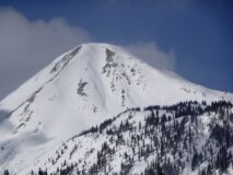
Avalanches: Lots of Loose avalanches in the storm snow at all elevations – small in size. Numerous small slabs breaking in the storm snow below treeline – small in size. Observed a debris pile below Climax Chutes on far lookers right end that may have been close to a D2 but could not see start zone well enough to make sense. East face of Cinnamon appeared to have a slab avalanche below the cornice but I wasn’t able to identify with confidence.
Weather: Light snowfall from 10 to 1pm and intermittent snowfall with some sunshine between 1 – 330. Winds remained light below treeline, but I could hear it blowing at upper elevations.
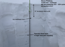
Snowpack: Near Pittsburg, 18″ of very low-density storm snow. Winds below treeline were light with some evidence at valley bottom of transport overnight. A few glimpses into alpine terrain revealed transport near and above treeline on to leeward east aspects. Sheltered terrain had a Loose Dry avalanche problem and a few features, gently kissed by the wind, produced cracking up to 20 feet, but behaved much like a Loose Dry avalanche due to low-density storm snow. Stability test on northeast slopes below treeline produced no results. Looking at the February weak layer on a slope that did not avalanche during last week’s natural cycle showed increased hardness (4 finger) and rounding but remains much weaker than the overlying slab. Traveled through a northeast-facing slope that avalanched at the end of last week’s natural cycle without signs of instability but the February weak layer was still present. An east-facing slope had a 3-4cm melt/freeze crust beneath the storm snow.

Photos:

5456

Read Full Observation
03/05/22

Gothic 7am weather update

Date of Observation: 03/05/2022
Name: Billy Barr

Zone: Southeast Mountains
Route Description: Gothic townsite

Observed avalanche activity: No
Avalanches:
Weather: Only a brief light snow around sunset Friday but then moderate to heavy snow starting a few hours before sunrise. Currently obscured cloud cover with moderate snowfall and light SW wind. There was 9½” new snow with water totaling a light density of 0.62″. Current snowpack at 59½”. There had been 4 days of record high temperature until yesterday but mild overnight last night with the low, and current, of 20F. billy
Snowpack:

5455

Read Full Observation
The blog.