Date of Observation: 04/06/2021
Name: Eric Murrow Ben Pritchett
Zone: Northwest Mountains
Location: Slate River corridor to Angel Pass area
Aspect: North, North East, East, South East, South, South West, West, North West
Elevation: 8,900′. – 11.600′
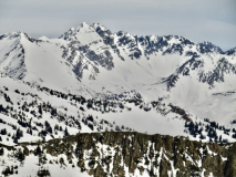
Avalanches: Numerous recent wet avalanches on northeast through east through south through west aspects. Many were small, but some were large, gouging Wet Loose avalanches. A couple of recent Wet Slabs were observed as well. Two fresh avalanches occurred today on northeast slopes of Schuylkill Ridge – a full-depth Wet Slab below treeline and a gouging long-running Wet Loose avalanche.
Weather: Very warm temperatures with thin high clouds passing by through early afternoon. Light winds from southwest below ridgetop.
Snowpack: Spring transition is well underway, with no dry snow observed on any snow surfaces. Near treeline on a north facing slope, we found about 2 inches of wet polycrystals on the snow surface, with a moist snowpack below that showed signs of yesterday’s meltwater percolating down around a foot and a half deep. The recent meltwater was frozen into widespread horizontal ice lens, likely around old melt-freeze crust buried in mid March. We dug a profile adjacent to a 48 hour old Wet Slab avalanche. The avalanche and our test profile were located on steep southeast-facing slopes with signs of light wind-loading. We measured a 230-300cm deep snowpack. The top of the crown was around 12,000′ and our profile was at a similar elevation to the middle portion of the slab that released (~11,700′). We found a pooled layer of meltwater 50cm below the snow surface that had spread horizontally through an old layer of large-grained facets below a melt-freeze crust. This layer corresponded to depth of the avalanche’s flanks. The slab broke deeper (up to ~100cm) near the crown, higher on the slope. Snowpack tests were not relevant as too much water had flowed through the snowpack since the avalanche released. Generally, the snowpack was pencil hard, with a few harder layers of frozen melt water. We couldn’t determine the hardness of the wetted weak layer since it was a frozen mixture of previously weak facets, an old crust, and newly frozen horizontal and vertical ice masses.
Photos:
-
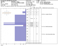
- Profile adjacent to a Wet Slab avalanche that ran on April 3rd. Profile dug ~48 hours after avalanche.

-
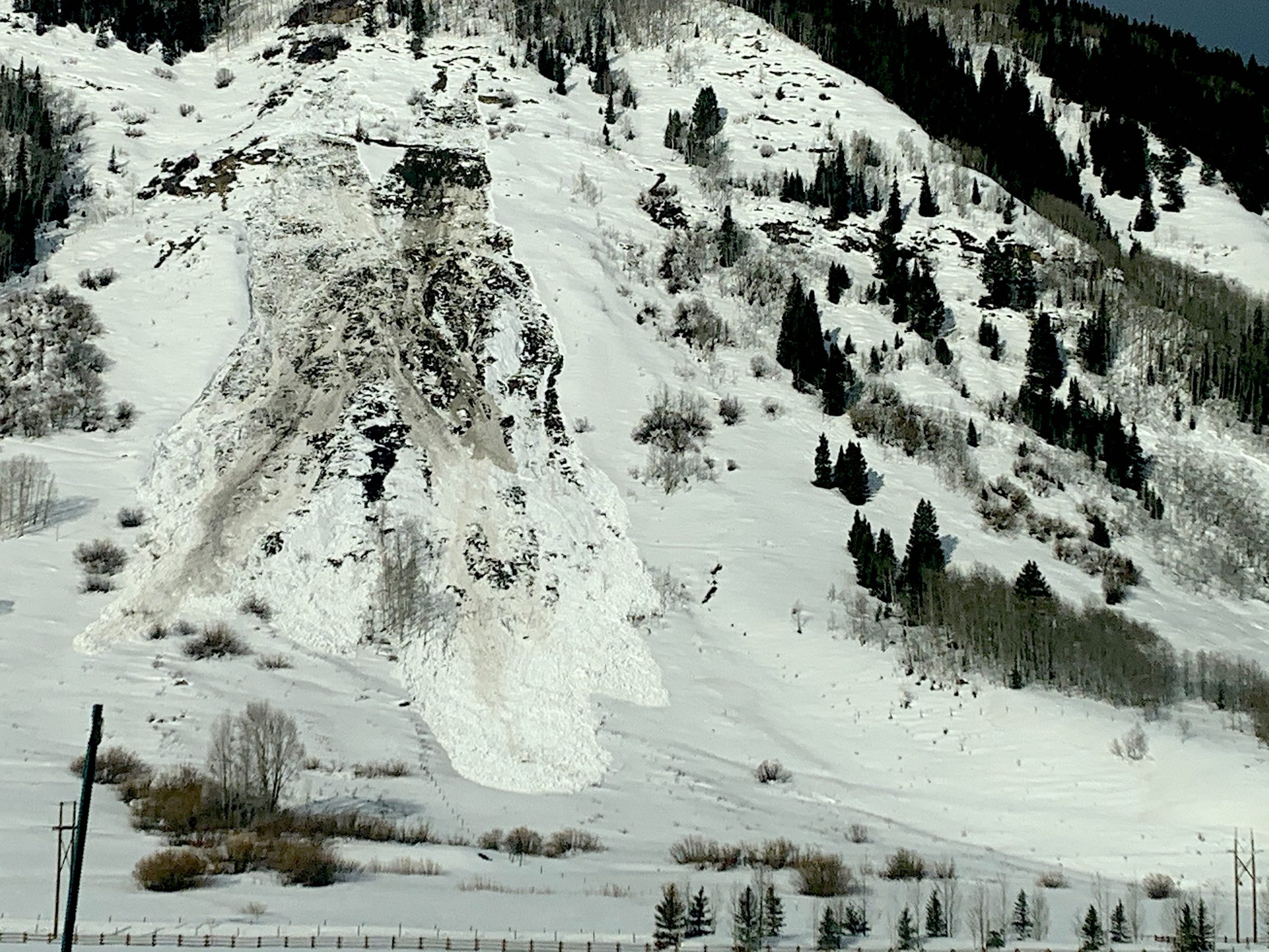
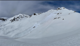
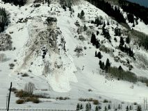
- A full-depth Wet Slab avalanche ran near the Schuylkill Ridge skin track on a northeast-facing slope below treeline. The avalanche released mid-day April 5th.

-
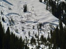
- 3 small Wet Slab avalanches that ran on April 5th on this east northeast-facing slope below treeline.

-
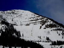
- A Wet Slab gouged to near the ground on the southwest-facing slopes below Gold Top (12,240′).

-
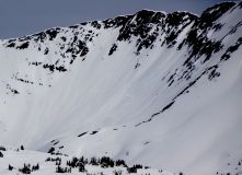
- A Wet Slab avalanche ran on on this alpine southeast-facing slope below Pt. 12,104′ around 1pm on April 3rd.

-
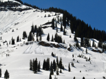
- Numerous small Wet Loose avalanches and a small, shallow Wet Slab in WSC Bowl of Mount Baldy.

-

- Wet Slab triggered by a loose avalanche on southwest aspect near Avery Peak. Likely ran April 3 or 4.

-
- Wet Slab triggered by a loose avalanche on easterly aspects above Pittsburg. Likely ran April 3 or 4.

-
- A Wet Slab avalanche ran April 4th, connecting to a gouging Wet Loose avalanche that ran April 3rd..