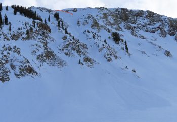
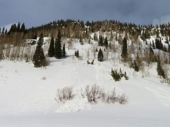
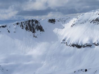
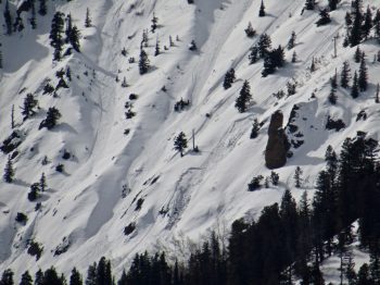
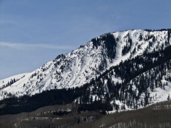
Location: Cement Creek Area
Date of Observation: 03/12/2020
Name: Cosmo
Subject: Cement creek
Elevation: 9300’
Weather: 2.5” new snow @ 6:30am. Overnight low of about 30 degrees.
Afternoon wet snow check
Location: Kebler Pass Area
Date of Observation: 03/11/2020
Name: Eric Murrow
Subject: Afternoon wet snow check
Aspect: North, North East, East, South East, South
Elevation: 9,200′ – 11,500′
Weather: Overcast skiers after 11 am with a lowering ceiling throughout the afternoon. By 3pm visibility became obscured from low clouds. Light snow throughout the afternoon but no real accumulations. Light winds at ridgetop.
Snowpack: Poked a few holes on south and southeast facing slopes below treeline in the snow favored part of the forecast area. HS ranged from about 90 to 120 cm. Water from last week’s warm spell drained to the ground at all locations on south and southeast below treeline. Surfaces were 1-2 inches of moist, recent snowfall with crust between 5 to 10 cm below. Crusts were supportive to boots and wet loose avalanches concerns were not present through 330pm. One additional pit on a slightly drifted, southeast slope at 11,400′, I found snow depth around 180cm with numerous ice lens’ and percolation columns throughout the snowpack. Water appears to have drained through the snowpack to the ground at this site as well.
Shaded slopes through 11,500 feet had 5 to 6 inches of accumulations over the past few days. The top inch or two of recent snow was moist, and produced pinwheels and roller balls while skiing, but was short of producing Wet Loose avalanches. Snowpack below the surface was dry and winter-like.
Photos:
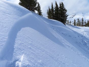
- Roller balls and pinwheels on east-facing slope below treeline. Representative of numerous E and NE slopes in the area.
Gothic Mountain
Location: Paradise Divide Area
Date of Observation: 03/11/2020
Name: Evan Ross
Subject: Gothic Mountain
Aspect: North East, East, South, South West
Elevation: 9,500-12,500
Weather: Low level fog/clouds over the upper Crested Butte Valley in the AM hours. Mostly cloudy sky above with the sun shining through a few holes. Light winds at ridgeline. S-1 precipitation at times with no notable accumulation. Light misting and rain around sunset in CB. That rain didn’t appear to add much measurable water. While watching outdoor furniture, chairs became wet, but never started dripping #science.
Snowpack: No avalanche concerns encountered on a 8am to 1pm tour. Southerly slopes remained supportive and soft surface crusts stayed well intact. Upper elevation easterly slopes had about 5-6″ of soft snow that has accumulated this week with no avalanche concerns or wind slab issues encountered. Below 10,500ft on easterly slopes ski pen was an inch or two with soft crust topping the rest of the snowpack. S-1 precipitation at times with accumulations near 1/4 to 1/2 inch.
Elkton Plot and BTL NE
Location: Paradise Divide Area
Date of Observation: 03/11/2020
Name: Zach Kinler
Subject: Elkton Plot and BTL NE
Aspect: North East, East
Elevation: 9,000′-10,400′
Avalanches: No new avalanches observed.
Weather: Overcast with off and on snow showers, S2 max. 1.5″ of wet accumulations above 10,000′. Light down valley NW breeze with temps in the mid-30s.
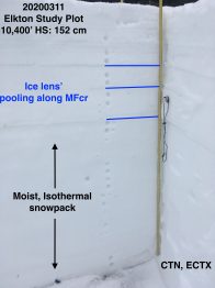
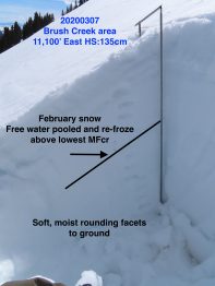
Snowpack: At the Elkton Study Plot, the 152 cm snowpack has gone isothermal and is moist to the ground. Free water has pooled and frozen very consistently along multiple MFcr in the upper snowpack. There is no persistent slab concern in this snowpack as previous weak layers are now ice lens’ or moist, rounded and un-reactive. This site receives strong solar radiation this time of year and is tilted slightly south.
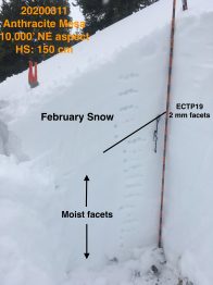
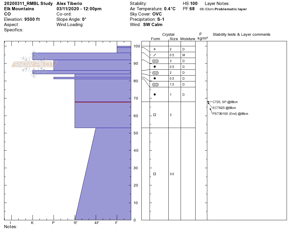
On a NE slope at 10,000′, HS was the same but the overall structure was quite different. There was no free water or crusts in this pack. The February snow is a Fist-1F slab resting over 4F rounding facets. This snowpack was nearly isothermal and slightly moist however faceted layers are still weak and moderate ECTP results were observed at the 2/3 interface(2mm facets). While unlikely to trigger currently, a large loading event may still stress this snowpack.
Low elevation southerlies
Location: Crested Butte Area
Date of Observation: 03/10/2020
Name: Zach Kinler
Subject: Low elevation southerlies
Aspect: East, South East, South, South West, West
Elevation: 9,000′-9,500′
Avalanches:
No new avalanches observed
Weather: Broken to Overcast skies, temps in the mid-30s, Consistent down valley breeze kept things cool in the lower Slate River Valley.
Snowpack: 1″ of wet snow resting on crusts from E-S-W. Moist crusts remained supportive to skis and with a little bit of new snow, skied decently. Wet Loose avalanche issues were not encountered on this terrain as clouds and wind limited heating with little new snow.
Small Avalanches And Great Snow
Location: Paradise Divide Area
Date of Observation: 03/09/2020
Name: Zack Kinler & Evan Ross
Subject: Small Avalanches And Great Snow
Aspect: North, North East, South, South West
Elevation: 9,000-12,000
Avalanches: A couple fresh Loose Wet avalanches that were small in size on southerly facing terrain at 10,000ft. Skier triggered several small and thin Wind Slabs at upper elevation northerly facing slopes near ridge lines.
Weather: Light winds, mostly cloudy, with some nice windows of sun to improve visibility and heat the snow surface on sunny slopes.
Snowpack: Northerly terrain offered up excellent riding conditions with only some small avalanche problems on wind-loaded terrain. Recent storm totals were 5″ at 10,500ft. In general that new snow was bonding well with old snow surfaces and no avalanche concerns were found at mid and lower elevations. Nearing ridgeline in the 11,500-12,000ft range, grapple and storm instabilities were found in the recent snow. Interestingly, some skier triggered crowns propagated fairly wide and were only 2″ thick. Right near ridgeline were there was just a little extra wind-loading some crowns neared 6″. All and all this avalanche problem was small and easy to manage. In 40+ degree terrain near ridgeline, triggering was easy and would clean out the hazard. On upper 30-degree slopes near ridgeline, these slabs were slow-moving and easy to ski through our out of if triggered. This avalanche problem could grow slightly in size with the little forecasted snow, but at the same time, I’d expect that same interface to become more stubborn to trigger.
In the late afternoon, low elevation southerly slopes were again wet and punchy. If you encountered that same snowpack on steep terrain, a small loose snow avalanche could gouge deeper into the snowpack and accumulate mass.
- Crown up to 6″ near ridgeline
- Fairly wide propagating 2″ crown
- Small skier triggered Wind Slabs. 3/9
- Small skier triggered Wind Slab
- Thin and small skier triggered Wind Slab accumulating some mass in bigger terrain.
- Example of fresh loose wet avalanche on southerly facing slopes near 10,000ft.
- On old cornice avalanche on an easterly facing slope at near 12,000ft.
Cement
Location: Cement Creek Area
Date of Observation: 03/09/2020
Name: Cosmo
Subject: Cement
Elevation: 9300-12000
Weather: Partly cloudy and pretty warm. Storm totals ranged from <1” down low to 2.5 or 3 inches up higher.
Snowpack: Variable. All aspects had some kind of crust, though north facing slopes up high the crust was pretty minimal. Had one collapse with shooting cracks late in the afternoon on low angle SE facing terrain at 10000’. Failed on crust about 20 cm down from snow surface. Cracks ran about 40 yards across the slope along a convexity and about 25 or 30 yards down slope. Snow surface and collapsed later were very wet. Below 10k’ snowpack is pretty rotten.
A wet mess, to a sea of crusts, to pow, and a Mosquito ❤️
Location: Brush Creek Area
Date of Observation: 03/07/2020
Name: Evan Ross & Zach Kinler
Subject: A wet mess, to a sea of crusts, to pow, and a Mosquito
Aspect: North East, East
Elevation: 9,000-11,500
Avalanches: A few small wet loose avalanches from yesterday on steep south facing slopes.
Weather: Partly cloudy with intense sun at times and a cooler feel with clouds other times. Calm winds throughout the day, until gaining ridgeline in the afternoon with a light southwesterly breeze.
Snowpack: Low elevations were a wet mess and generally unsupportive to boot. We got out of that by climbing up some below treeline ENE facing slopes where a colder and deeper snowpack provided a bit more support but still not supportive to boots in many spots. The upper 8cm’s was wet. By the time we moved into more easterly facing terrain at 11,000ft the snow surface was already crusting back over. Here, moist snow was found all the way to the ground, and water had recently moved through the upper snowpack and was pooling around the 2/3 crust down ~50cm. Once that upper snowpack refreezes there will be no more concern for Persistent Slabs breaking deeply into the snowpack until the upper snowpack either melts back down or we see a very large loading event. We finished on NE facing terrain, on those slopes anything with a slight easterly tilt or the low angles had a thin crust on the snow surface.
Wet Avalanche issues were the main concern we encountered.
Small Wet Slab
Location: Crested Butte Area
Date of Observation: 03/06/2020
Subject: Small Wet Slab
Aspect: East
Elevation: 10,600ft
Avalanches:
A small Wet Slab Avalanche on an east aspect below treeline.
- Small Wet Slab. East Aspect 10,600ft. 3/6


