Concerning structure on some slopes that previously avalanched.

CB Avalanche Center2016-17 Observations

Location: Paradise Divide Area
Date of Observation: 01/17/2017
Name: Evan Ross, Alex Ban’ass
Subject: Concerning structure on some slopes that previously avalanched.
Aspect: East, South East, South, South West
Elevation: 9,700-12,500

Avalanches: Loose snow avalanche city baby! Brings to mind Zach Guys favorite song, “its going down”, but mostly it had already gone down. East to northeast facing slopes looked to have the most activity. The biggest terrain produced D 1.5’s otherwise just D1 slufffs. Watched a few roller balls on southerly facing slopes before noon. As well as some previous loose snow avalanches as well.

viewed some large crowns on northeasterly terrain from the last cycle.
Weather: Not a lick of wind and clear sky. Overcast clouds hanging out just west of the divide and south of scarps ridge.
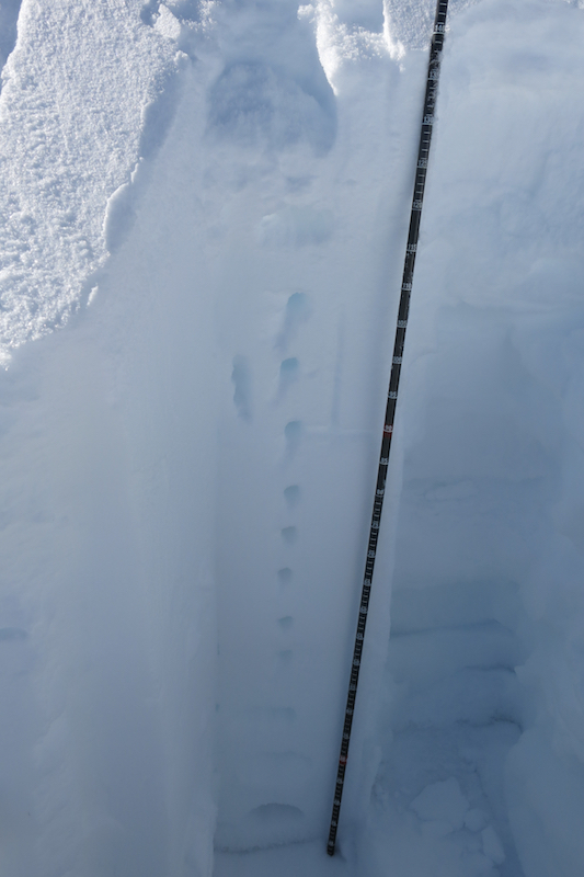
Snowpack: Didn’t found a single crust in the snowpack by probe while traveling on SE to SW between the elevations above. Probed to 260cm and never felt the ground either, through the terrain. No signs to instability observed in this terrain.

The outlier was an alpine ENE facing start zone at 12,450ft. Sure looked deep, but HS was only 140cm. Obviously this slope had previously avalanched but unfortunately the weak layer was still present. A 100cm F to P hard slab was sitting over 1 to 2mm faceted particles at the interface, with 3mm depth hoar at the base. CT11 SC on the depth hoar. CTM SP on decomposing stellars about 40cm down. No results at the new snow, 1-2mm faceted particles interface. Mostly bailed on the objective due to the poor structure.

The concerning structure on the ENE facing slope.

Looks deep, but isn’t.

Deep crown on Northeast aspect of Cascade Peak.

Lots of previous loose snow avalanches, mostly on east to northeast aspects.

large crown on north aspect of Pealer Peak.

Taylor Canyon Slide

CB Avalanche Center2016-17 Observations

Location: Taylor Canyon
Date of Observation: 01/17/2017
Name:
Subject: Taylor Canyon Slide
Aspect:
Elevation:

Avalanches: See photo of debris from an avalanche that ran across Taylor Canyon near the dam. We believe this ran 1/12/17.
Weather:
Snowpack:

16002735_10154783499267860_6458282787806427539_n

Rollerballs and unreactive pit results.

CB Avalanche Center2016-17 Observations

Location: Cement Creek Area
Date of Observation: 01/17/2017
Name: Zach Guy
Subject: Rollerballs and unreactive pit results.
Aspect: South East
Elevation: 8500-9700

Avalanches: Windshield tour of lower Taylor Canyon. Spotted 4 or 5 crowns from last cycle, D2 in size or less, on E to N aspects, which were probably the only slopes holding snow prior to the storm. See photos.
Weather: Valley fog, scattered to few clouds above the fog. Mild temps. Light ridgetop winds.
Snowpack: Natural rollerballs and small loose wet on SE aspects BTL. No other signs of instability.
One quick pit on SE BTL showed 75 cm of 1F slab over F+ 1mm moist rounding facets (Jan 1 interface). ECTX results, with a non-propagating BRK results with additional loading steps.

SE BTL. 1F 75 cm slab over F+ moist, rounding facets. Non-propagating results

Old crown. NE aspect BTL

Old crown. NE aspect BTL

Above the clouds

CB Avalanche Center2016-17 Observations

Location: Kebler Pass Area
Date of Observation: 01/17/2017
Name: KIRK H
Subject: Above the clouds
Aspect: North East
Elevation: 12090

Avalanches: Many visible natural “slough” like slides . Not very deep but ran a fair distance.
Weather: Calm , Sunny above the inversion.
Snowpack: Snowpack seems to be pretty solid . No signs of instability during our tour . Starting to see some surface Hoar developing

D4 slide on Scarp Ridge

CB Avalanche Center2016-17 Observations

Location: Kebler Pass Area
Date of Observation: 01/16/2017
Name: Zach Guy
Subject: D4 slide on Scarp Ridge
Aspect: North West
Elevation: 11900 ft

Avalanches: A handful of recent D1 to D1.5 wet loose and dry loose avalanches on various aspects. Investigated the very large slide on NW aspect of Scarp Ridge. It was about 1,700 feet wide, ran 900 vertical and reached its historic runout 2,300 feet down the path and snapped mature trees. The crown was about 5 feet deep on average and gouged to the ground the whole track, up to pencil hard. Quick estimate of ~50,000 tons of debris . There was about a foot of new snow on the bed surface, so it likely ran towards the end of the storm, maybe 1/13 or so? HS-N-R5-D4-O.
Observed several other long running debris piles and an old crown. See photos.
Weather: Valley fog and thin overcast skies. Light easterly winds. S-1 developed in the afternoon.
Snowpack: Crown profile: 155 cm slab, up to P hard, over 1F+ hard, .2-.3 mm rounding facets. (Jan 1 interface I think). This is a NW facing slope that is often scoured and thin following storms, and it appears that it held a very shallow snowpack in the upper start zone (less than 30 cm thick) before our big January storm.

Old, partially filled crown. D2.5? E/SE aspect.

Debris

Debris

Crown

R4, Long running debris below Schuylkill Ridge, SE aspect NTL start zone.

Bent trees and long running, R4 debris, north aspect off of Mt. Emmons.

Downed trees and skeeters

CB Avalanche Center2016-17 Observations

Location: Crested Butte Area
Date of Observation: 01/16/2017
Name:
Subject: Downed trees and skeeters
Aspect: North East
Elevation: TL, BTL

Avalanches: Remnants of sluffs from past couple of days that have stiffened, no activity while skiing 40-degree pitches. Snow settling from in the face on saturday to in the waist on Sunday to in the knees on Monday while skiing
Weather: high 20’s, slight breeze
Snowpack: Several trees down on skin track, looked to have fallen Sunday evening. And our second sighting of a mosquito, global weirding

Cement Creek

CB Avalanche Center2016-17 Observations

Location: Cement Creek Area
Date of Observation: 01/16/2017
Name: ADB
Subject:
Aspect: South, South West
Elevation: BTL

Avalanches: no instabilities on skin track or on concave slopes
Weather: Obscured skies and calm with intermittent periods of sun making an appearance.
Snowpack: 2.5 cm (1 inch) of new snow. Snow started to stick to skins on last round.

Avy 1 Snodgrass

CB Avalanche Center2016-17 Observations

Location: Crested Butte Area
Date of Observation: 01/15/2017
Name: Irwin Guides
Subject: Avy 1 Snodgrass
Aspect: North East, East
Elevation: 10,700-11,000

Avalanches:
Weather: Mostly Cloudy in the morning and seemed to break up a bit in the afternoon. at 9:00 air temp was -1c, rose to 0c in the afternoon. It was warm, real warm (Karin’s toes didn’t even get cold today) None to Light winds. No new precip.
Snowpack: HS 225on N to NE aspect
Right side (Abby Lane) up snowpack with gradual density increasing with depth. One hard CT22 / 27 (RP) observed 80cm down on preserved stellars/Df’s to size 2. No Na or skier triggered activity other than small stuffing from steep features on Gothic. No signs of instability during our up or down. Ski pen 20-30cm in supportive snowpack. Surface snow warmed to 0C during afternoon to elevation 10,700ft.

Round Mountain

CB Avalanche Center2016-17 Observations

Location: Crested Butte Area
Date of Observation: 01/15/2017
Name: Donny Roth
Subject: Round Mountain
Aspect: North, West, North West
Elevation: 8,600-10,800

Avalanches:
Weather: Overcast skies, no precip, calm and warm. Recorded a high temp of 38ºF at 10,000’ at 14:30. It was 32ºF at the 8,600′ at 15:30. Did it cool down or was there an inversion? Not really important. It was warm and the snow was getting manky.
Snowpack: No signs of instabilities. Even the surface sluffing we noticed yesterday had diminished, except for steep, north aspects where the only dry snow could be found. Everything except steep, north aspects were being effected by radiation. The trees started to shed snow about 11:30AM. More southern aspects definitely got warm enough to be moist on the surface – future crusts? Ski pen and boot pen were pretty similar throughout the day – a sign of a strong “mid-pack.” Average HS was over 150cm, except for places that slid during the storm cycle and places with ridges of talus

Walrod observations

CB Avalanche Center2016-17 Observations

Location: Cement Creek Area
Date of Observation: 01/15/2017
Subject: Walrod observations
Aspect: East, South East
Elevation: BTL

Avalanches: Crossed one massive debris pile in Walrod (large enough to snap trees/destroy a car) and a smaller debris pile near the Wall. E to SE aspects BTL. Could no longer see the crowns.
Weather:
Snowpack: Boot top ski pen. Snow depth deeper than a ski pole.