Estimated avalanche date: 12/31/2021 Number of Avalanches: 2
Location
Location: Beckwith Range Location Specific: Start Zone Elevation: ATL: Above Tree Line Aspect: N
Characteristics
Trigger: Natural Trigger modifier: Type: Hard Slab Failure Plane: Old snow
Size
Relative Size: R4 large Destructive Size: D3 – could destroy a car, wood-frame house, or snap trees Avg. crown height (inches): Avg. width (feet): Avg. vertical run (feet):
Involvements
# of people caught: # of partial burials: # of full burials:
Additional comments: Wide crowns in a couple of the cirques above Lost Lake
Zone: Southeast Mountains Route Description: Near Gothic townsite
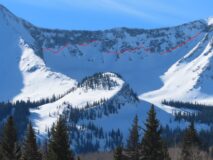
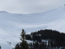
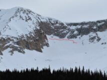
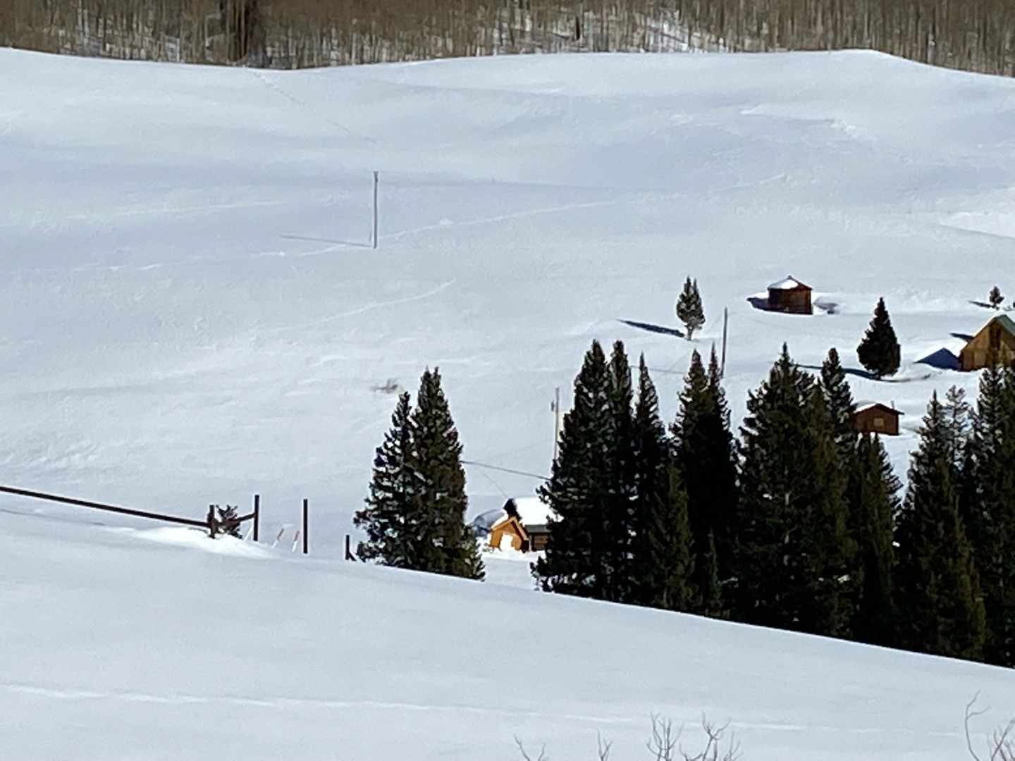
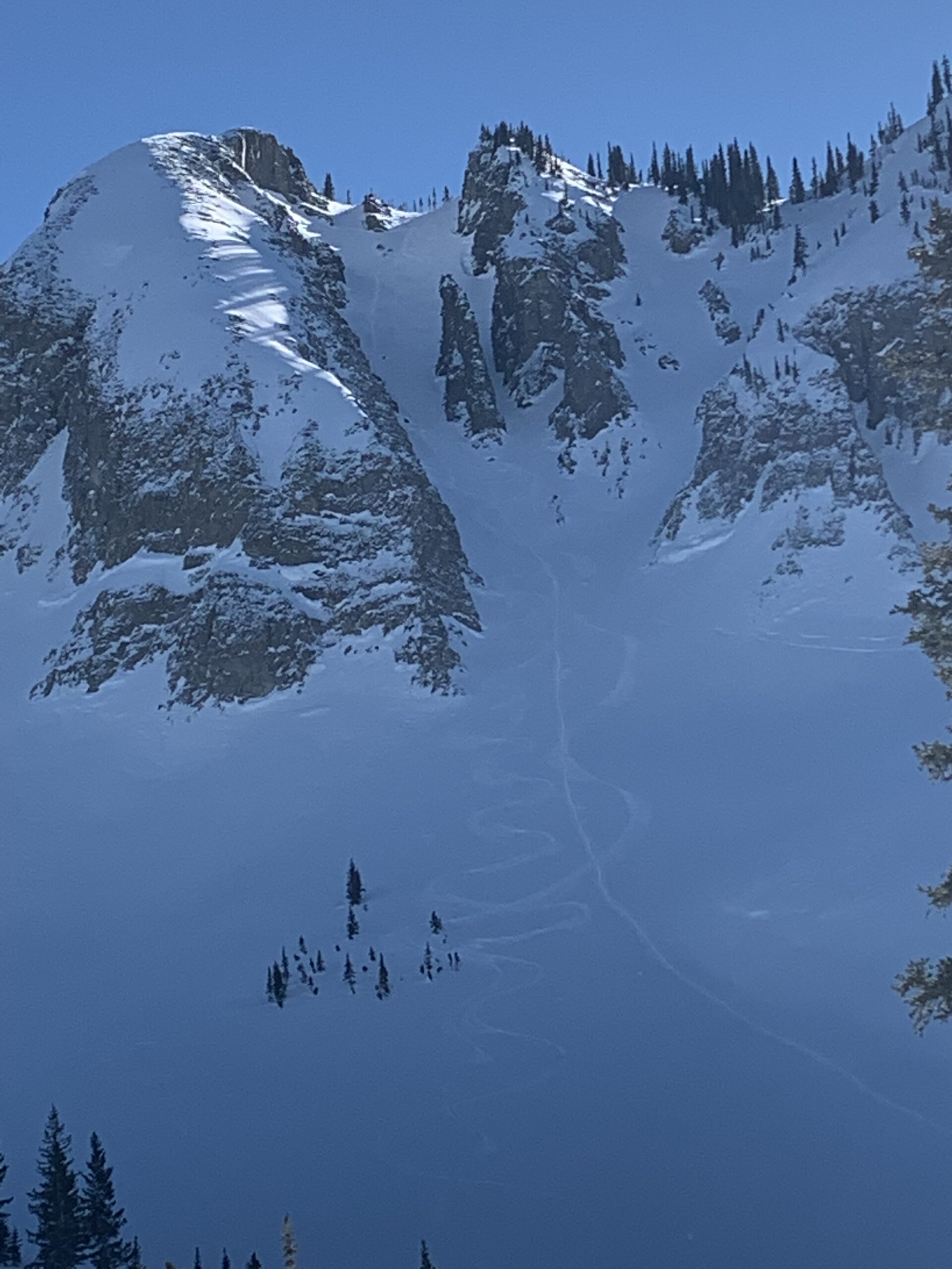
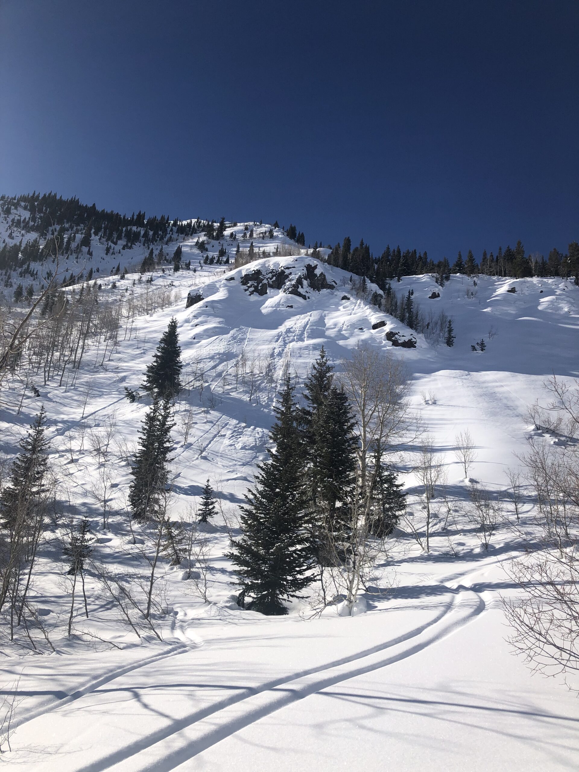
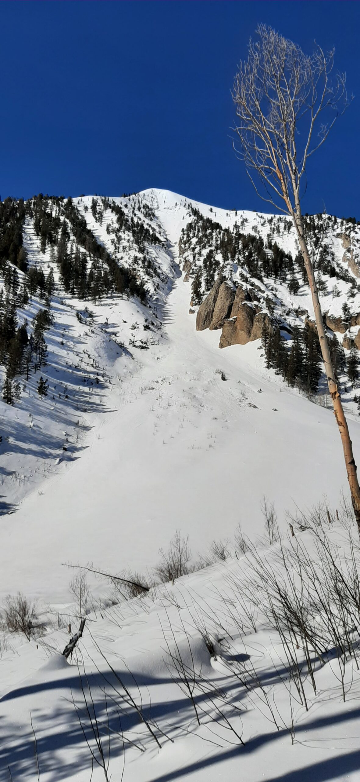
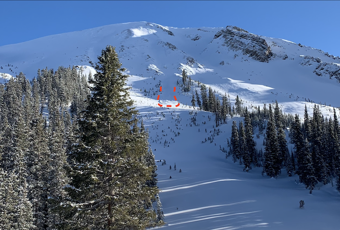
Observed avalanche activity: Yes Avalanches: See photos of debris and damage from the deep slab that ran off of the east face of Gothic around New Year’s Eve.
Photos:
The outhouse attached to this building got pushed over by debris
Date of Observation: 01/23/2022 Name: Peter Horgan
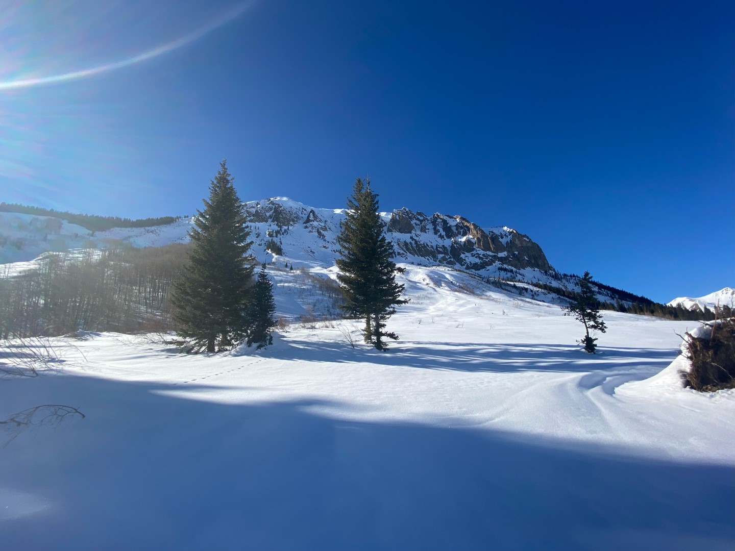
Zone: Northwest Mountains Route Description: We descended one of the chutes above Green Lake on the far looker’s left side of Axtel. Refer to the picture attached here.
Observed avalanche activity: No Avalanches: No avalanches were observed. Given the current awareness/concern around sluff, I wanted to report that we did not have any sluffing at this location. Snowpack: The snowpack was measured at 235cm near the bottom of the chute.
Relative Size: R1 very small Destructive Size: D1- Relatively harmless to people Avg. crown height (inches): Avg. width (feet): Avg. vertical run (feet):
Involvements
# of people caught: # of partial burials: # of full burials:
Zone: Southeast Mountains Route Description: Emmons and Climax areas, 9,000 to 11,000
Observed avalanche activity: Yes Avalanches: Loose snow N facing in easternmost Climax chute 10,000′, D1, looks like natural release, 2 further east natural, Wolverine Basin 11,500′ east facing Weather: Sunny and calm Snowpack: Solid
Zone: Southeast Mountains Route Description: 8,700-11,300 feet; SE, E & NE aspects.
Observed avalanche activity: Yes Avalanches: D1 loose wet avalanche on a rocky, east-facing slope. Picture is not the best, but looker’s left side of the start zone. Weather: Single digits in the morning, warming into the 20s later in the day. Sunny and clear. Steady WNW wind was loading leeward slopes ATL. Snowpack: Pole probing throughout the tour revealed an HS of 100-120cm. 5-10cm of new snow. Sheltered (BTL) NE terrain skied well. E & SE terrain exhibited varying levels of crusty-ness.
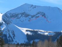
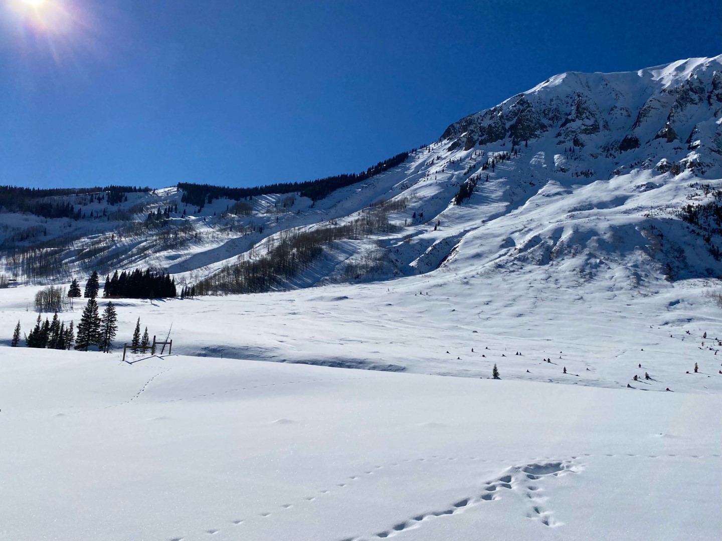
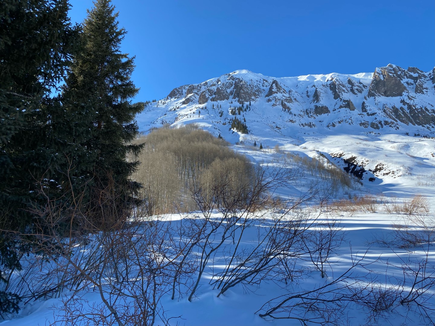
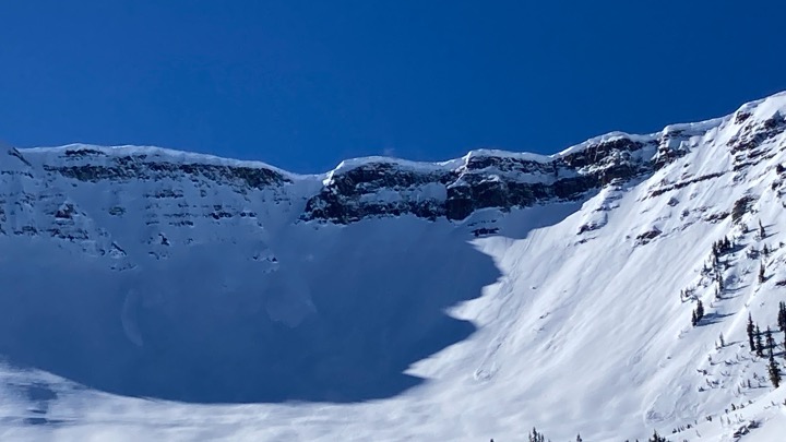
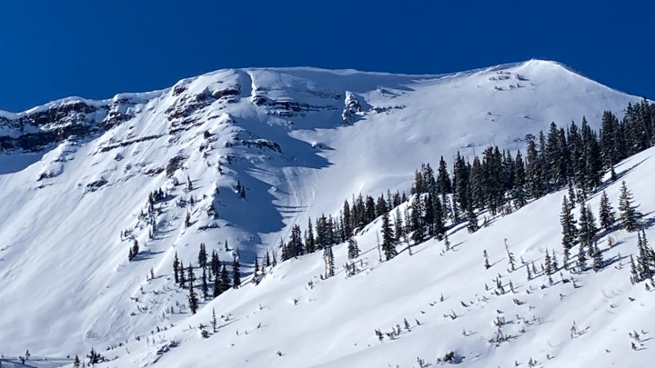
Zone: Southeast Mountains Route Description: Gothic Mountain from Washington Gulch. Traveled on south through west aspects to 12,600 ft.
Observed avalanche activity: Yes Avalanches: Skier triggered a shallow wet-ish loose sluff that ran about 900 vertical feet down a steep SW facing chute, small in size, but large enough to take you for a ride. There was a small natural loose dry that ran yesterday from an adjacent slope. Weather: Gorgeous sunny day. Inverted temps. Light ridgetop winds, no snow transport observed anywhere in the zone. Snowpack: Storm snow has settled to 2″ or 3″. We found isolated drifts up to 15″ thick along the summit ridge of Gothic from previous east winds blowing up the face. The drifts formed on rocks on west-facing terrain, so they weren’t a hazard here.
Further January weak layer documentation: The facets on south aspects are capped by a thick, stout crust with occasional percolation columns into the weak layer. There are small radiation recrystallization facets on the surface; I suspect they got cooked today? Westerly aspects look similar to east aspects from yesterday but with thinner or non-existent wind crusts capping the facets. Tested for deeper instabilities in a shallow west-facing slope and got unreactive results, although the basal weak layer was embedded in talus and not continuous across the pit.
Photos:
A pair of loose snow avalanches in long-running gullies of Gothic Mountain
Snow structure in a shallow west facing pit
Thick crusts on south aspects.
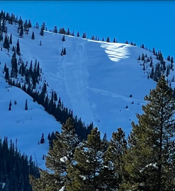
East face of Gothic. Because this path ran late in the storm, it now has a very shallow snowpack which is causing more advanced faceting.
Best guess at runout from the 12/31 slide off of the East face of Gothic. Estimated from reading debris textures, although winds and new snow have concealed some of the evidence now.
Relative Size: R1 very small Destructive Size: D1- Relatively harmless to people Avg. crown height (inches): 3 Avg. width (feet): Avg. vertical run (feet): 900
Involvements
# of people caught: # of partial burials: # of full burials:
Relative Size: R1 very small Destructive Size: D1- Relatively harmless to people Avg. crown height (inches): 4 Avg. width (feet): Avg. vertical run (feet): 1000
Involvements
# of people caught: # of partial burials: # of full burials:
Date of Observation: 01/22/2022 Name: Eric Murrow Ben Prichett
Zone: Southeast Mountains Route Description: Cement Creek to Flag Creek to Spring Creek to Taylor River Rd to Upper Taylor and back into Cement Creek. A good portion of this route was just outside the CBAC forecast area to the east.
Observed avalanche activity: Yes Avalanches: Observed evidence of several unreported D3 avalanches from the major cycle at the end of December in Upper Taylor drainage, and one fresh Wind Slab avalanche on the north slopes of Mount Tilton, D1.5. Weather: Clear skies and light to calm winds below treeline. Generally 1 to 3 inches of new snow from Friday’s small storm, with around 6 inches in the localized area near Upper Taylor Creek. Snowpack: We measured snow depths in numerous places on this long snowmobile tour: 135cm in middle Cement Creek at 10,000′, 175cm in the headwaters of Cement Creek at 11,500′ near Hunter Creek, 110 cm near Spring Creek Reservoir at 9,900′, 135cm near the head of Spring Creek, and 90cm at the junction of Taylor Road and Taylor Pass Rd at 10,000′.
Photos:
A crown was not visible, but this was likely a fresh Windslab avalanche on the north slopes of Tilton, D1.5.
Date of Observation: 01/22/2022 Name: Andrew Breibart
Zone: Southeast Mountains Route Description: Red lady skin track to gunsight pass to Redwell to Wrong Chute to the OBJ CG
Observed avalanche activity: Yes Avalanches: sloughs on scarp ridge-NE aspect ATL (see pictures)
Weather: calm, clear, and warm in the sun.
Snowpack: 2 inches of new snow within past 24 hours on south side on Mt Emmons. New snow lays on top of slick melt freeze crust. 6 to 8 inches of new snow within past 24 hours on the north side. Ski pen on the north side is mostly 4 to 5 inches and soft under foot. While skiing wrong chute, we released fast moving sluffs below the road in steeper terrrain. We observed sluffs along Scarp Ridge which occurred within the past 24 hours (see pictures).
Date of Observation: 01/22/2022 Name: Zach Guy and Evan Ross
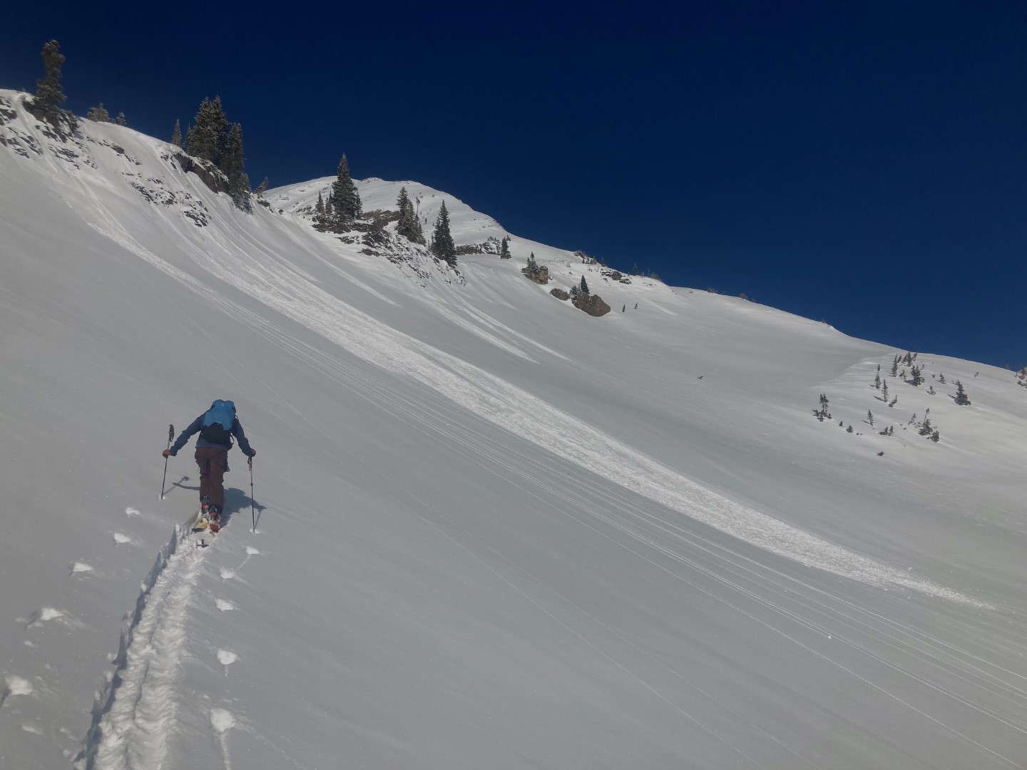
Zone: Northwest Mountains Route Description: Traveled on easterly and southerly aspects in Poverty Gulch to 12,500 ft.
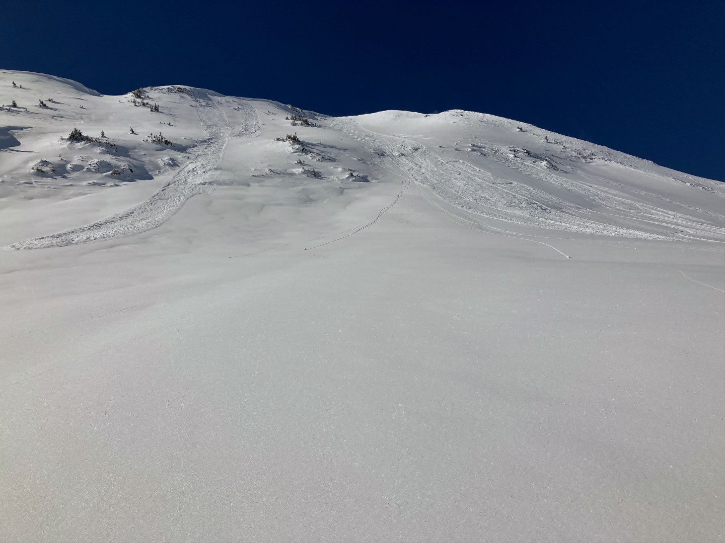
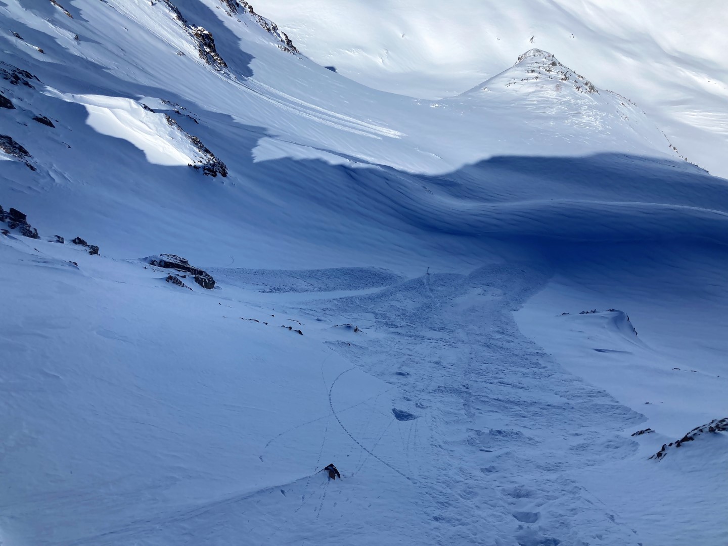
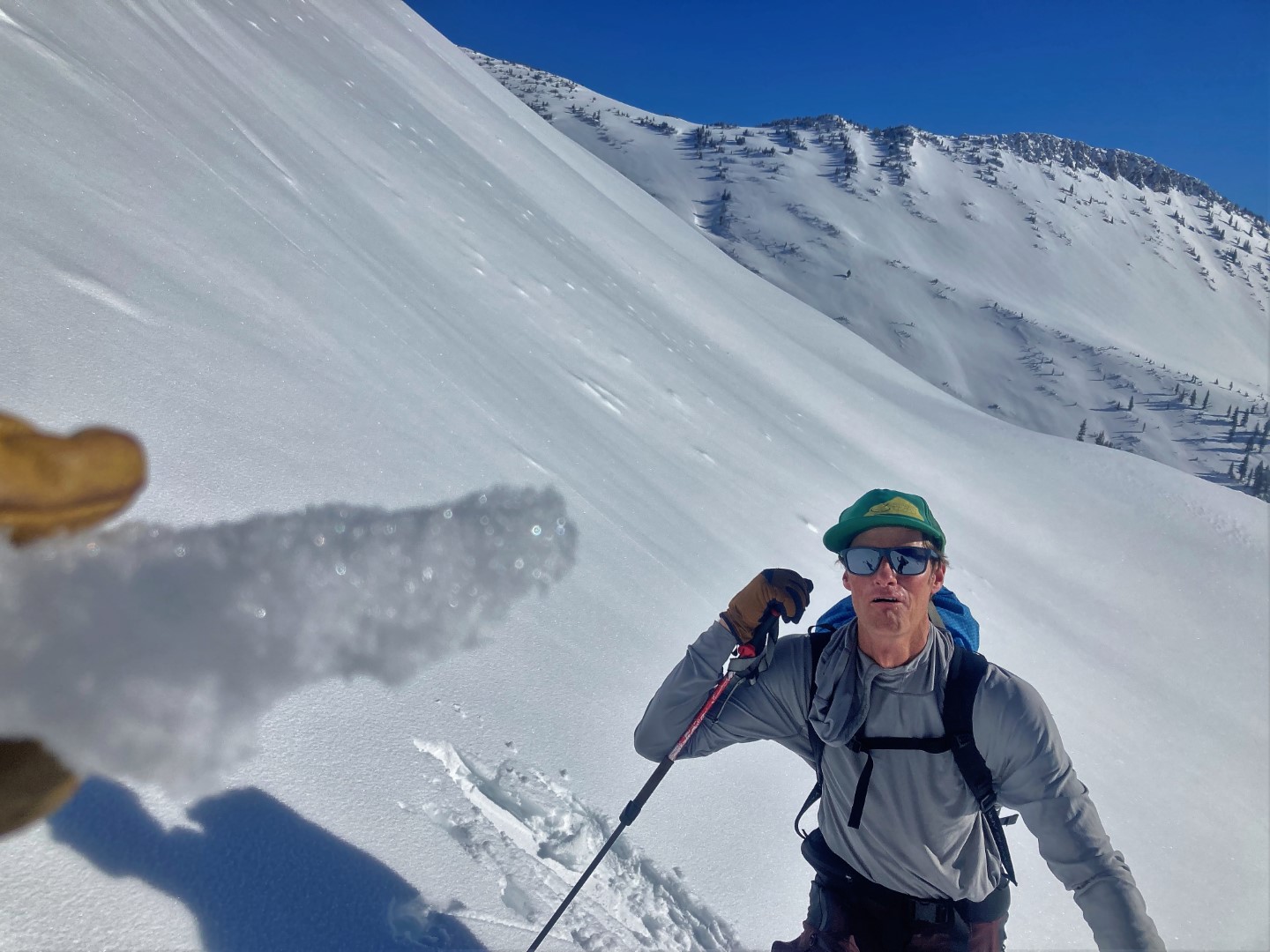
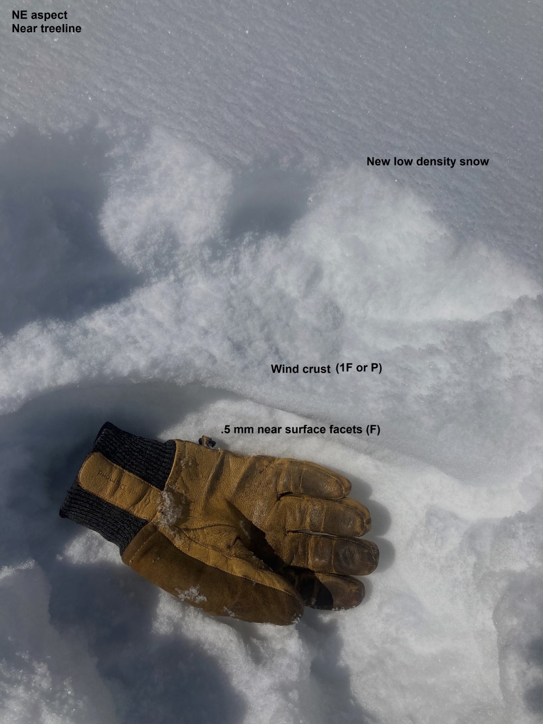
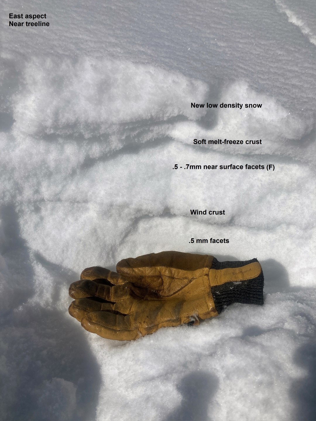
Observed avalanche activity: Yes Avalanches: Numerous loose snow avalanches in the new snow ran today or yesterday, most were very small. A few ran far enough/ gained enough volume to pose a hazard in consequential terrain, D1 in size. We skier triggered a handful of similar sluffs, along with a few of a wetter variety on sunnier aspects. Near mountain top, we triggered a few small soft slabs by tossing rocks onto a suspect north-facing slope. Those slopes had seen just enough wind to add some cohesion to the new snow, and the slabs failed on the weak, faceted snow at the storm interface. Weather: Clear skies. Calm winds until we reached an exposed ridgeline at 12,000′, where there was just enough wind to cause light drifting. Snowpack: About 4″ of new, low-density snow. Our obs focused on documenting the freshly buried near-surface weak layers that have been forming this month. At near and above treeline elevations, the January weak layer is characterized by small grained facets, often capped by either wind or sun crusts. The facets are generally fist hard, .5 mm in size, with a few up to .7 mm. Capping crusts are spatially variable depending on wind and sun exposure. Wind crusts vary in thickness and tend to be hard (1F or harder) throughout much of the alpine terrain. Sun crusts are generally soft (4F) and collapsible, up to 2cm thick, on E to SE aspects. They presumably get a bit thicker on due south and southwest, where we had limited travels.
Photos:
An example of the numerous very small sluffs involving the top few inches of snow
Some of the larger sluffs were in long-running terrain like this.
Several small soft slabs triggered by tossing rocks onto this slope. The new snow had just enough cohesion from winds to form a soft slab.
Soft sun crust (2cm thick) on a S/SE aspect, with facets below it and low density snow above it
Wind board capping facets on a NE aspect
Sun crusts and wind crusts above facets on an east aspect.
Relative Size: R1 very small Destructive Size: D1- Relatively harmless to people Avg. crown height (inches): Avg. width (feet): Avg. vertical run (feet): 800
Involvements
# of people caught: # of partial burials: # of full burials:
Additional comments: A few of the larger sluffs were on Mineral Points east face.
Relative Size: R1 very small Destructive Size: D1- Relatively harmless to people Avg. crown height (inches): Avg. width (feet): Avg. vertical run (feet): 100
Involvements
# of people caught: # of partial burials: # of full burials:
Relative Size: R1 very small Destructive Size: D1- Relatively harmless to people Avg. crown height (inches): Avg. width (feet): Avg. vertical run (feet):
Involvements
# of people caught: # of partial burials: # of full burials:
Relative Size: R1 very small Destructive Size: D1- Relatively harmless to people Avg. crown height (inches): Avg. width (feet): Avg. vertical run (feet):
Involvements
# of people caught: # of partial burials: # of full burials: