


Likelihood is a description of the chance of encountering a particular avalanche problem. It combines the spatial distribution of the problem and the sensitivity or ease of triggering avalanche. The spatial distribution indicates how likely you are to encounter the problem in the highlighted avalanche terrain. The sensitivity indicates how easy it is to trigger avalanches when you do encounter them. Sensitivity includes both natural or spontaneous release and human triggered avalanches.
Aspect/Elevation
The Aspect/Elevation diagram describes the spatial pattern of the Avalanche Problem by aspect (the direction a slope faces) and elevation band (Above, Near, or Below Treeline). The diagram will be filled with gray where you are most likely to encounter the Avalanche Problem . You can view the diagram as you would a mountain on a topographic map. The outer ring represents the Below Treeline elevation band, middle ring Near Treeline, and the inner ring Above Treeline. The diagram is oriented like a compass, with the top wedges representing north aspects, the left wedges representing west, etc.
Problem Type
Avalanche Problems are categories of avalanche activity. The Problems may not describe all avalanche activity you might observe, but they categorize the avalanches by how we manage the risk in the terrain. This approach focuses on relevant observations you can make in the field and how to treat the avalanche risk.
The forecasts list up to three current Problems, along with the spatial distribution, the likelihood of avalanches, and anticipated size. Forecasters provide specific details in a short paragraph.
Below Treeline
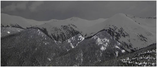
Below Treeline is the lowest of three elevation bands used in the CBAC’s forecasts. It extends from valley floors or snowline to Near Treeline. Open areas and sparse trees are possible. Snowfall tends to be less than the other elevation bands. Tree cover shelters the snow from wind effects.
Near Treeline
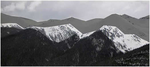
Near Treeline is the middle of the three elevation bands used in the CBAC’s forecasts. It is a transition zone between dense forests and treeless alpine areas. It is the narrowest of the three elevation bands, extending only a few hundred feet above and below the treeline. It varies locally, and is not a constant elevation or width.
Above Treeline
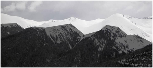
Above Treeline is the highest of the three elevation bands used in the CBAC’s forecasts. It includes alpine areas where the most snow falls and the winds are the strongest. It is not an exact elevation, but a characteristic of the terrain, beginning as the treeline transitions into open slopes extending to ridges and the tops of the highest peaks.
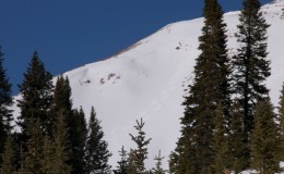
Baldy
Name: Brandon Clifford
Title: Baldy
Location: Paradise Divide Area
Date of Observation: 11/19/2014
Aspect: South
Elevation: 12,805′
Avalanches: None.
Weather: Sunny with 0-5 (mph) wind.
Snowpack: Thin on top with better snow on leeward slopes.
-
- Baldy turns
-
- Baldy turns in bowl
-

- Baldy wind lip
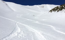
Great skiing on Baldy Peak in November.
November 19th – Sunny
24 Hour Weather Outlook
Weather Discussion: Nunc ac ipsum vel nulla dignissim auctor. Nulla gravida fermentum tempus. Phasellus ut mollis lorem, a auctor mi. In rutrum turpis sit amet feugiat tincidunt. Fusce sollicitudin mi tellus, non tincidunt nulla sodales in. Nam eu suscipit enim. Nullam eu massa ultrices, lobortis orci vel, scelerisque metus.
Temperature:10˚
Wind Speed (mph):10 – 20 mph
Wind Direction:S
Sky Cover:Clear
Snow (in):0″
48 Hour Weather Outlook
Weather Outlook: Nunc ac ipsum vel nulla dignissim auctor. Nulla gravida fermentum tempus. Phasellus ut mollis lorem, a auctor mi. In rutrum turpis sit amet feugiat tincidunt. Fusce sollicitudin mi tellus, non tincidunt nulla sodales in. Nam eu suscipit enim. Nullam eu massa ultrices, lobortis orci vel, scelerisque metus.
Tomorrows Temperatures:10-15
Tomorrows Wind Speeds (mph):10-20 mph
Tomorrows Wind Directions:SW
Tomorrows Sky Cover:Mostly Clear,Few Clouds
Tomorrows Snow (in):0″
Todays Forecast
Weather Discussion: Nunc ac ipsum vel nulla dignissim auctor. Nulla gravida fermentum tempus. Phasellus ut mollis lorem, a auctor mi. In rutrum turpis sit amet feugiat tincidunt. Fusce sollicitudin mi tellus, non tincidunt nulla sodales in. Nam eu suscipit enim. Nullam eu massa ultrices, lobortis orci vel, scelerisque metus.
Temperature:10˚
Wind Speed (mph):10-20 mph
Wind Direction:N
Sky Cover:Clear
Snow (in):0″

Mount Owen Jenga Chute Avalanche
The CBAC got up to Mount Owen today to investigate yesterday’s slide that caught and carried two skiers as they boot packed up Jenga Chute. The slide broke above the pair near the top of the couloir as they were about halfway up the chute. The area received 10-12″ of snow on the night of November 2nd which fell on a variety of surfaces ranging from bare ground to up to 2ft residual of snow from the few storms that rolled through the Elk Mountains in October.
The avalanche should be classified SS-AF-R2-D1.5-O/G. The slope angle ranged from 37-41º on an ENE facing slope (61º). It ran ~400 vertical feet from ~12,600ft to 12,200ft. Debris width spread about 60ft wide, ranging in depth from 40-150cm deep.
The snow structure of the slab in the couloir consisted of two distinct graupel layers that fell in our most recent storm, capped by a thin windslab generally 3-6″ deep created by light winds during and after the storm; however, the new snow has drifted into 1-2ft deep isolated pockets. The slab failed and ran on a 4cm “pencil+” hard melt freeze crust from the October 12th storm, although it did scour down to rock within parts of slide path. Up to 50cm of 1-2mm faceted grains remained below the bed surface, which will continue to mature/grow in size as the season progresses, likely causing more concerning instabilities in the months to come, in this location and surrounding slopes.
The CBAC would like to genuinely and humbly thank those involved for sharing their experience for the greater awareness of our Crested Butte backcountry community as we plunge into another winter.