Snodgrass

CB Avalanche Center2015-16 Observations

Location: Crested Butte Area
Date of Observation: 01/17/2016
Name: Evan Ross
Subject: Snodgrass
Aspect: North East
Elevation: 9,400-10,200

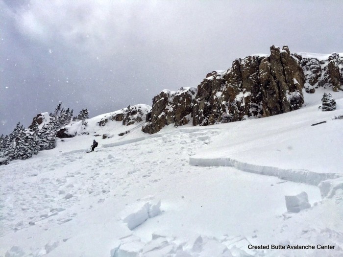
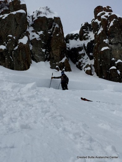
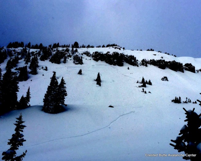
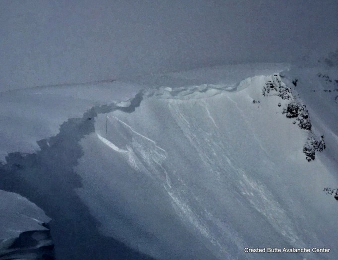
Avalanches: Several naturel avalanches in the alpine. Fresh D2 debris could be seen below the east face of Gothic and the Spork. The White Mountain massif had at least one R1-D2 windslab on a cross loaded rib.
Weather: Mostly Cloudy. S1 snow showers obscuring the sky at times. A few down valley gusts drifting snow but mostly light winds throughout the day.
Snowpack: HS in the 90-110 range. Not a big change in snowpack structure from slopes that avalanched during the Christmas cycle and lower angle areas that didn’t avalanche. Just a weak structure all around with about 6-7″ of new storm snow from the last several days over mostly fist hard facets. boot pin to the ground. No avalanche problems found in the terrain we traveled through.

A few terrain features looked like they may have some small cross loaded windslabs.

Natural wind slab on White Mountain Massif, cross loaded southeast aspect. R1-D2.

Avalanches at Kebler Pass & Irwin

CB Avalanche Center2015-16 Observations, Snow Profiles

Location: Kebler Pass Area
Date of Observation: 01/17/2016
Name: Zach Guy
Subject: Avalanches at Kebler Pass & Irwin
Aspect: West, Southeast
Elevation: N/BTL

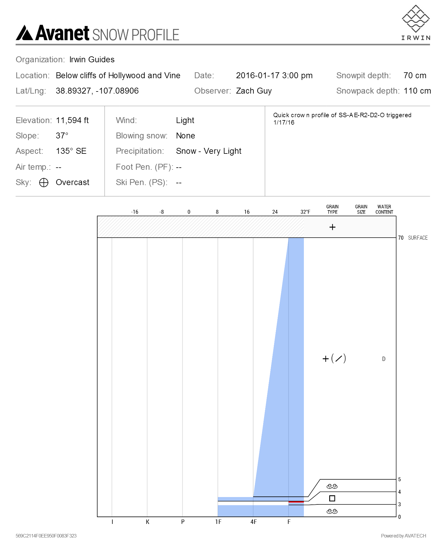
Avalanches: On a SE aspect near treeline, a 2lb handshot triggered a large soft slab, 65 cm deep and ~200 ft wide, that failed in a thin facet layer below the Jan 14th meltfreeze crust.  SS-AE-R2-D2-O.  See profile. Widespread storm slab instability with more than a dozen natural and skier/snow cat triggered soft slabs (Fist hard, 3-10” deep, failing on precip particles) along various aspects of Kebler Pass Road and on Irwin terrain. Minor propagation decreased through the day (max 60 feet wide, avg 20-30 ft), and easily managed, ran more like loose snow avalanches. Harmless in size. SS-ASc/AK/N-R1-D1-S
Weather: Calm to light winds, with moderate gusts from S to W. S-1 to S2 snowfall. Overcast skies.
Snowpack: 18” of very low density snow with minimal wind affect fell last night. On west aspects N/BTL, the storm interface (Jan 14th near-surface facet layer) is ~30” deep in relatively windsheltered terrain; deeper or shallower in wind affected terrain. One pit in an untrafficked area showed the layer is unreactive; size/hardness change was indistinct, with small grained rounding facets at the interface. See profile 1. On SE aspects near treeline, the slab was 26″ deep, but denser from wind effects, over reactive crust/facet/crust sandwiches. See profile 2 and avalanche ob.

Upper snowpack on a west aspect near treeline
1/17. Crown Profle SS-AE-R2-D2-O

1/17. Crown Profle SS-AE-R2-D2-O

1/17. Explosive triggered slab avalanche at Irwin. SE aspect NTL.

1/17. Explosive triggered slab avalanche at Irwin. SE aspect NTL.

1/17. Explosive triggered slab avalanche at Irwin. SE aspect NTL.

1/17. Explosive triggered slab avalanche at Irwin. SE aspect NTL.

1/17. Explosive triggered slab avalanche at Irwin. SE aspect NTL.

1/17. Explosive triggered slab avalanche at Irwin. SE aspect NTL.

Mountain Weather

CB Avalanche CenterWeather

Date: 01/17/2016

Our latest fast moving shot of snow and increased winds moved through our area just before sunset yesterday and we will see continued unsettled weather today, with an increase in winds aloft and increased upward motion producing periods of heavier snowfall this morning. Look for higher elevations to continue to pick up light snow through Monday under favorable orographics and cold air advection. Temperatures and winds should moderate after today’s more violent windy storm slides past the Elk Mountains.

Snodgrass

CB Avalanche Center2015-16 Observations

Location: Crested Butte Area
Date of Observation: 01/16/2016
Name: Irwin Guides
Subject:
Aspect: North, North East
Elevation: 9600-10800

Avalanches:
Weather: High around 15F, small period of S-1towards the end of the afternoon, Light winds out of NE. Scattered sky most of the day.
Snowpack: HS ranges from 85-100 cm. 10 cm of new snow from the last storm. No signs of instability, 26cm boot pen/15cm ski pen, CT20 on the ground facet layer. 3-4 cm facets on the ground. There is aspect of a 4f soft slab in this area. I skied the north ski of snodgrass yesterday and the snow did not have any aspect of a slab.

East River/White Mountain

CB Avalanche Center2015-16 Observations

Location: Crested Butte Area
Date of Observation: 01/16/2016
Name: Ian Havlick
Subject: East River/White Mountain
Aspect: East, South East, South, South West, West
Elevation: 8800-11300

Avalanches: no new avalanches observed
Weather: Scattered to broken skies, with some pleasant sun in the morning. Cold and steady N-NW winds all day, no new snow. no sensible solar radiation.
Snowpack: 3″ new, semi-dense wind effected snow overnight, blown around into various thicknesses of wind crust/slab 3-24″ deep in some areas. All new snow fell on large facets, ski pen was still 20cm, boot pen to ground. Did feel two medium sized whoomphs while travelling on the thickest fresh wind drifts of the day near a small ridgeline. Steady and significant windloading E-SE-S aspects above treeline.

Copper Creek near Gothic

CB Avalanche Center2015-16 Observations

Location: Crested Butte Area
Date of Observation: 01/16/2016
Name: Evan Ross
Subject: Copper Creek Level 1 Obs
Aspect: North, West
Elevation: 9000-10500

Avalanches:
Weather:
Snowpack: Short tour up copper creek to west facing slide path around 10400f btl. No Avalanche problems on slopes less then 35 degrees. Could have found small sluffs on steeper slopes. Found 1, 2-8″ wind slab over nsf with shooting cracks. Slab was only about 15 feet long and 3 feet wide. Looked like a few other very small wind slabs in the terrain. Cold temps and gusty westerly winds blowing snow at times.

Gothic Area

CB Avalanche Center2015-16 Observations

Location: Crested Butte Area
Date of Observation: 01/15/2016
Name: Donny
Subject: Gothic Area
Aspect: East
Elevation: 9,500′ to 11,200′

Avalanches:
Weather: Light snow until about 3PM, HST 4″ to 6″; Moderate north wind in valley and ridges; temps in the teens all day.
Snowpack: No signs of instabilities all day. New snow of 4″ to 6″ is still fist hard, and only slightly slabbing up in a few places. Average HS between 60cm and 80cm. SkiPen of 30cm to 40cm all day. BootPen basically full depth.

Scarp Ridge

CB Avalanche Center2015-16 Observations

Location: Kebler Pass Area
Date of Observation: 01/16/2016
Name: Zach Guy
Subject: Scarp Ridge
Aspect: North East
Elevation: 12,000 ft

Avalanches: Most terrain obscured by poor vis, but saw one natural wind slab on a wind loaded NE aspect above treeline. ~2ft crown, mostly filled in already, failed earlier in this storm. SS-N-R1-D2-U. Very small wind slab failed again in same path today.
Weather: Moderate to strong SW winds with moderate snow transport. S-1. Broken to overcast skies
Snowpack: 15″ of storm snow, with drifts up to several feet thick.

1/16. Larger crown getting filled in, smaller crown above it. NE aspect above treeline.

1/16. Larger crown getting filled in, smaller crown above it. NE aspect above treeline.

Mountain Weather 1/16/2016

CB Avalanche CenterWeather

Date: 01/16/2016

Embedded shortwaves under strong northwest flow continue to bring unsettled weather to our mountains. We should see a short lull and some patchy sunshine today before the next disturbance arrives tonight into tomorrow. We’ll be on the southern edge of the system, and our favored northern and western mountains should pick up another decent shot of snow before a brief respite on Monday. Look for 4-8″ by the end of the weekend under continued moderate to strong alpine winds.

Schuylkill Ridge

CB Avalanche Center2015-16 Observations

Location: Paradise Divide Area
Date of Observation: 01/15/2016
Name: Zach Guy and Brian Lazar
Subject: Schuylkill Ridge
Aspect: North East, East
Elevation: 9,200-11,300

Avalanches: On a NE aspect NTL, we kicked a small cornice that triggered a loose snow avalanche gouging into old facet layers and ran 1,100 vertical feet. Given the gulley feature it ran through, the slide could have injured or buried someone. L-AC-R1-D1.5-O. No other avalanche activity observed.
Weather: Overcast decreased to broken skies. S-1 snowfall in the morning. Moderate SW ridgetop winds, with light snow transport. Plumes from NW winds observed on Mt. Emmons as we left the trailhead in the afternoon.
Snowpack: 5 cm of storm snow over a widespread near surface facet layer. Minimal wind affect below leeward ridgelines, with drifts 10-15 cm. New snow was noticeably more wind affected mid to lower on the slope from cross-loading down valley winds. Observed drifts up 25cm thick with cracking up to 10 feet on steep rollovers, but no avalanches. HS in old refilling avalanche paths was 50-80cm. More a like 120-150 in areas that didn’t avalanches, but there weren’t many paths in this area that didn’t run. Most of the terrain avalanched during Xmas cycle leaving only weak snow 50-80 cm and almost entirely facets, with 5cm of new snow on top. Just below ridgelines the drifts the suspected wind slabs avalanche problem was not there. Suspect there are stiffer wind-drifted slabs near Kebler that got more snow to move, and also up ATL where winds were stronger.

obs_38542_11251-r

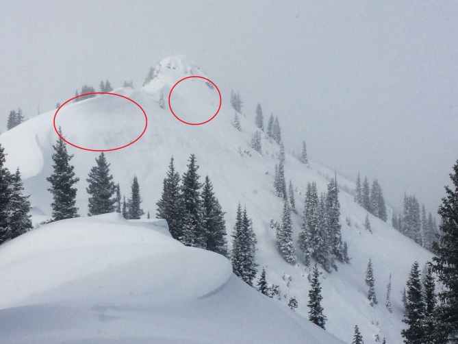
NE aspect near treeline on Schuykill Ridge. The red oval indicates areas we thought we would find developing wind-drifted slabs, but there was little wind affect up near ridgeline.   Surprisingly more wind affect closer to valley floor from down valley crossloading.

obs_38542_11254-r

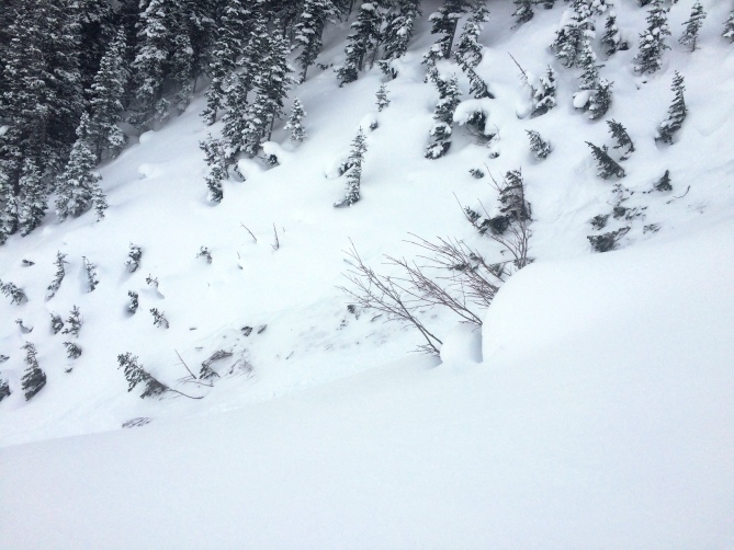
Looking into the narrow gulley where a Loose Dry avalanche plunnged 1200 feet. Schuylkill Ridge 1.15.16