Location: Cement Creek Area Date of Observation: 01/16/2017 Name: ADB
Subject: Aspect: South, South West Elevation: BTL
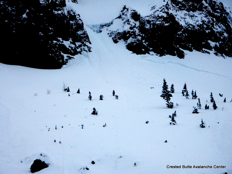
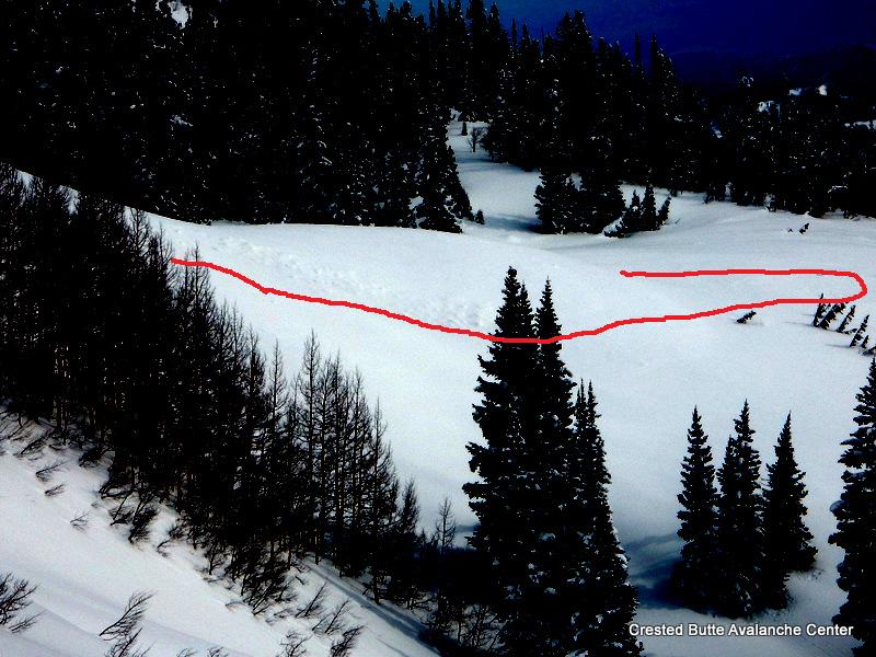
Avalanches: no instabilities on skin track or on concave slopes Weather: Obscured skies and calm with intermittent periods of sun making an appearance. Snowpack: 2.5 cm (1 inch) of new snow. Snow started to stick to skins on last round.
As the low pressure system responsible for the continuous cloud cover, and skiff of snow overnight moves across Texas, another small low pressure system near Baja will keep the chance of light snow and cloud cover the Elk mountains today. After this system passes throughout the day, the weak trough will slide east, bringing a period of much anticipated, and proper Colorado blue sky days to the area until Thursday. Details of our storm late in the week are still unclear, but expect a return to snowy and stormy conditions to finish out the third week of January.
Today
High Temperature: 30 Wind Speed: 10-20 Wind Direction: NE Sky Cover: Overcast Snow: 0-2″
Tonight
Low Temperature: 15 Wind Speed: 10-20 Wind Direction: N, NE Sky Cover: Overcast Snow: 0-1″
Tomorrow
High Temperature: 33 Wind Speed: 5-15 Wind Direction: N, NW Sky Cover: Mostly Clear Snow: 0″
Location: Crested Butte Area Date of Observation: 01/15/2017 Name: Irwin Guides
Subject: Avy 1 Snodgrass Aspect: North East, East Elevation: 10,700-11,000
Avalanches: Weather: Mostly Cloudy in the morning and seemed to break up a bit in the afternoon. at 9:00 air temp was -1c, rose to 0c in the afternoon. It was warm, real warm (Karin’s toes didn’t even get cold today) None to Light winds. No new precip. Snowpack: HS 225on N to NE aspect
Right side (Abby Lane) up snowpack with gradual density increasing with depth. One hard CT22 / 27 (RP) observed 80cm down on preserved stellars/Df’s to size 2. No Na or skier triggered activity other than small stuffing from steep features on Gothic. No signs of instability during our up or down. Ski pen 20-30cm in supportive snowpack. Surface snow warmed to 0C during afternoon to elevation 10,700ft.
Location: Crested Butte Area Date of Observation: 01/15/2017 Name: Donny Roth
Subject: Round Mountain Aspect: North, West, North West Elevation: 8,600-10,800
Avalanches: Weather: Overcast skies, no precip, calm and warm. Recorded a high temp of 38ºF at 10,000’ at 14:30. It was 32ºF at the 8,600′ at 15:30. Did it cool down or was there an inversion? Not really important. It was warm and the snow was getting manky. Snowpack: No signs of instabilities. Even the surface sluffing we noticed yesterday had diminished, except for steep, north aspects where the only dry snow could be found. Everything except steep, north aspects were being effected by radiation. The trees started to shed snow about 11:30AM. More southern aspects definitely got warm enough to be moist on the surface – future crusts? Ski pen and boot pen were pretty similar throughout the day – a sign of a strong “mid-pack.” Average HS was over 150cm, except for places that slid during the storm cycle and places with ridges of talus
Location: Cement Creek Area Date of Observation: 01/15/2017
Subject: Walrod observations Aspect: East, South East Elevation: BTL
Avalanches: Crossed one massive debris pile in Walrod (large enough to snap trees/destroy a car) and a smaller debris pile near the Wall. E to SE aspects BTL. Could no longer see the crowns. Weather: Snowpack: Boot top ski pen. Snow depth deeper than a ski pole.
Location: Crested Butte Area Date of Observation: 01/15/2017 Name: Arden Feldman
Subject: Mt. Emmons Aspect: Elevation: B/N/ATL
Avalanches: No avalanches observed from Mt. Emmons other than D1 loose avalanches off of steep rocks and cliffs on most aspects and the same small slab avalanche on a SW aspect NTL observed in the obs titled “goooooood” from earlier today. Weather: Broken skies with some sun, calm winds even at ridgetop, S-1 snowfall late in the afternoon. Snowpack: No Instabilities noted. Dug down to the storm interface on a S aspect BTL. Found a right side up slab sitting on rounding facets with little to no sun crust at the interface. A minor sun crust was beginning to form at the surface on S aspects BTL when the sun disappeared behind clouds late in the afternoon.
Location: Cement Creek Area Date of Observation: 01/15/2017 Name: Ian Havlick, Evan Ross
Subject: Aspect: South, South West, West Elevation: 9,700-11,200
Avalanches: Found one D2 avalanche, likely ran Jan 10th, steep west facing slope associated with rock band. Weather: Calm winds. Overcast sky. Green housing and warm temperature warming the snow surface. Snowpack: Skiing in areas that on a normal winter don’t have enough snow to ski, are sweet, but may hold the most concerning snowpack at the moment. Lower cement creek had an HS in the 120 to 150cm range on westerly aspects. About 10cm of 3mm striated facets were F+ hard at the base of the snowpack. Above these large grained facets were another 20cm of 1-2mm faceted grains, with our January storm stacked on top. This concerning snowpack structure gave pause, due to the depth of the weak layer falling into the human triggered realm and overall just weak appearance. As you rolled into more southwesterly aspects the HS decreased and the snowpack transitioned with a potentially collapsable crust with 3mm facets below.
No collapses or obvious signs of instability felt while traveling in this terrain. Snowpack structure showed what is possible, lack of signs to instability showed the stubborn nature of the problem.
Quick assessment on a southerly facing 25 degrees slope showed the new years day interface down 90cm. That crust interface felt soft by probe. No obvious signs to instability again. Heavy borderline moist snow at the surface.
3mm striated grains F+ hard with a slab on top. Part of this slope had avalanched and cleaned out the weak layer while much of it hadn’t and the weak layer was preserved.
IMG_2073
Snowpack tapered from west to southwest. On southwest a potentially collapsible crust facet structure developed.
IMG_2071
In the foreground the Southwesterly facing part of the slope had and HS of 60cm with the collapsible crust structure. The middle of the slope had an HS of 150cm with F hard 3mm facets at the ground.
Location: Crested Butte Area Date of Observation: 01/15/2017 Name: Zach Guy
Subject: Finally some visibility Aspect: North East, East, South East, South, South West Elevation: 9,500 -12,400
Avalanches: Good visibility looking at northerly aspects of Scarp Ridge, Schuylkill Ridge, Coneys, and E/N aspects of Ruby Range. Flat light looking northeast towards the Elk Divide. Not much for fresh avalanche crowns (See photos). Saw one D3 on a NW aspect ATL of Scarp that failed near the end of the storm, and couple of other partially filled in crowns. Subtle evidence of some very large avalanches that ran sometime during the storm off of Gothic, but the crowns are completely gone now, so can’t classify the avalanches. U-N-R4-D3-U debris piles below the Spoon (S aspect), SW gulley, and Spork (SE aspect). The one below the Spork looked to be at least 20 feet deep (D3.5?), and was a couple hundred yards or less from hitting Gothic Road. This could have been the combined pile of multiple slides. From my vantage, I didn’t see any debris piles that ran R5 or max runouts. Weather: Thin broken clouds. Calm winds, mild temps. S-1 around sunset. Snowpack: HS on SW aspects NTL was variable, from 240 cm to less than 100cm. The New Year’s crust was generally 150-200 cm deep, easy to ID with probe. I targeted a thin spot to dig and found advanced depth hoar below the crust, CT SC results, but didn’t propagate in 2 ECTs because talus interrupted the continuity of the layer in that spot. On SE aspects ATL, I probed into two adjacent starting zones. One had HS of 300 cm, the other had HS of 150 cm. Although the crown was no longer visible the latter had clearly run sometime during the storm (probably on mid storm layers?) and you could see debris in the flats. I dug into that slope and found about 120 cm slab over 4F 1.5mm facets, still surprisingly unsintered. On Snodgrass (E/NE aspect BTL), HS was 280 cm in start zones. Snow surfaces became moist on southerly tilts at lower elevations, and formed a thin, soft crust. Traveled on various aspects with no signs of instability except shallow but long running sluffs.
East aspect NTL on Gothic. Looks like maybe a larger crown that was filled in, because I couldn’t make out the debris.
Far running debris (D3.5?) below SE face of Gothic, came within a few hundred yards of Gothic Road.
Long running debris below SW gulley of Gothic
Long running debris below mini spoon (S NTL)
Concerning structure/ suspect trigger point on SW aspect NTL.
Location: Crested Butte Area Date of Observation: 01/15/2017 Name: Andy
Subject: Down Valley Aspect: North East, East Elevation: 9,300
Avalanches: None observed from viewpoint. Weather: Light Fog, 25 degrees. No Wind. Snowpack: 20″-40″ Depth. Sun Crust forming from yesterday’s late sun on South faces. Very stiff HS all the way to large facets at the ground-snow interface. Lots of collapsing in the gullies and on ridges.