
Star pass conditions

CB Avalanche Center2016-17 Observations

Location: Brush Creek Area
Date of Observation: 01/24/2017
Name: John lewis
Subject: Star pass conditions
Aspect: North, North East, East, South East, South, South West, West, North West
Elevation: 11000 and above

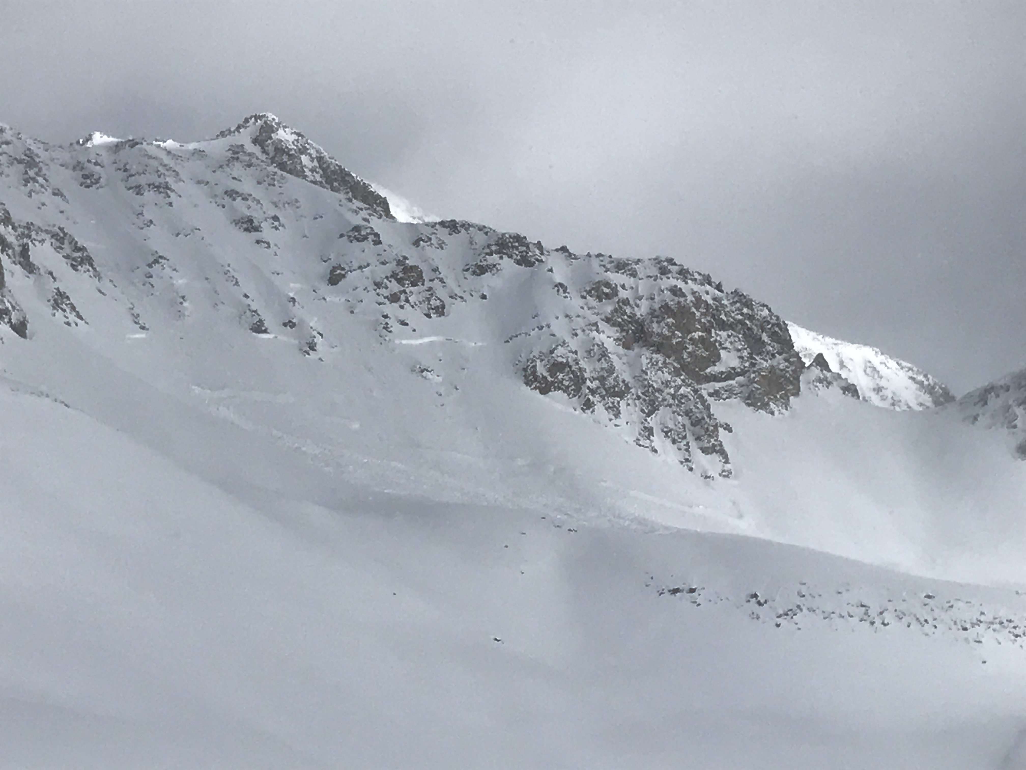
Avalanches: Fresh wind slab avalanches could be scene on star and pearl pass. Star men’s avalanche looked to be D2R3. Multiple point release avalanches started to naturally occur through out the day in and around the whole bowl.
Weather: 24 inches fresh snow at friends hut
Snowpack: A wind slab covered all aspects of the slopes around pearl pass and around friends hut, even the flat ground right outside friends hut. 24 inches of fresh snow fell at friends hut and high winds continued through the night. The fresh snow started to set up to a storm slab almost immediately. The wind slab was failing on slopes 35 degrees and great on most aspect.

IMG_2101
IMG_2080
IMG_2079

Explosive triggered avalanche at Irwin

CB Avalanche Center2016-17 Observations

Location: Kebler Pass Area
Date of Observation: 01/26/2017
Name: Irwin Guides
Subject: Explosive triggered avalanche at Irwin
Aspect: South
Elevation: NTL

Avalanches: Snow Safety team had one result. SS-AE-R1-D1.5-O Sunny shoulder left. Failed 45cm down on 1.5mm facets above a MFcr. I believe this is the 1/23 interface. We’ve gotten 112″ since the 1/19th and 31″ since 1/23.
Weather: Cold!
Snowpack: H2D 4″ .25SWE.

Low hazard south of forecast area

CB Avalanche Center2016-17 Observations

Location: Taylor Canyon
Date of Observation: 01/26/2017
Name: Zach Guy
Subject: Low hazard south of forecast area
Aspect: North, North East, East, South East, South
Elevation: Below treeline

Avalanches:
Weather:
Snowpack: Traveled near and around Taylor Canyon. HS ~100 cm. Only 6″ or less over the 1/19 interface (crust or NSF, no SH observed), and the upper snowpack is now entirely faceted and weak, with thin faceted crusts on sunnier aspects. Snowpack is quickly faceting throughout. I saw no avalanche concerns other than shallow facet sluffing, and we traveled on numerous steep slopes.

Deceptive, touchy, and unusual surface hoar problems

CB Avalanche Center2016-17 Observations

Location: Crested Butte Area
Date of Observation: 01/26/2017
Name: Zach Guy
Subject: Deceptive, touchy, and unusual surface hoar problems
Aspect: North East, East, South East
Elevation: 9,000-10,300 ft

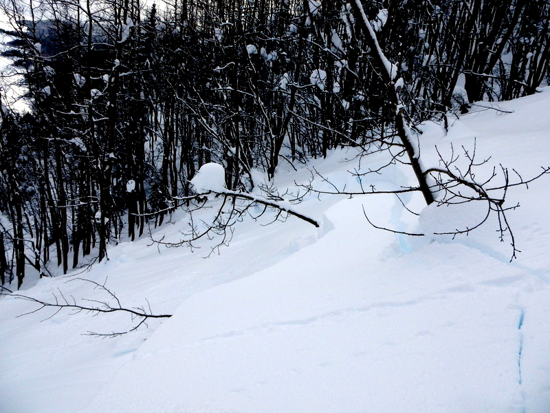
Avalanches: See video. Skier triggered 7 soft slab avalanches 15-20″ deep on the 1/19 surface hoar layer, D1 to D2, depending on terrain size, on E and NE aspects below treeline. One was remote triggered, several were in surprisingly dense aspen trees, several broke onto slope angles as low as 31 and 32 degrees. One broke higher above me than expected and knocked me off my feet. Every slope steep enough to slide went except for slopes that had already naturally avalanched. Also observed a fresh animal triggered and sympathetic slide on a SW aspect below treeline.
Weather: Broken to scattered skies. Minimal precip. Calm winds. Cold temps
Snowpack: The usual bag of tricks aren’t working. No collapsing or cracking observed on low angle terrain, stability tests weren’t concerning, yet every slope we touched steeper than 33 degrees avalanched on surface hoar about 15-20″ deep. Test results were:
SE aspect, 10200 ft in sparse aspens. No surface hoar observed, ECTN H, BRK 30cm deep on small, rounding facets.
NE aspect, 10100 ft in a windsheltered opening. 1mm SH 33 cm deep. ECTN M, PC/BRK on the surface hoar.
In the past 3 days, I have yet to find propagating results in an ECT but getting consistent avalanches on the surface hoar layer. The ECT appears to be unreliable for our current conditions, or else spatial variability is very pronounced.

D1 animal triggered and sympathetic slide. SW aspect BTL, new in past 24 hours. Tracks in and tracks out…all good.

Natural that ran during the storm in relatively thick aspens.

Skier triggered slide in relatively thick aspens

Crowns were all 15-20″ thick, on the 1/19 SH.

Remotely triggered slide from 20 feet away.

Skier triggered from edge of path, propagated back to 32 degree slope.

Skier triggered, pulled out to 31 degree ridge.

Skier triggered slab on Emmons

CB Avalanche Center2016-17 Observations

Location: Crested Butte Area
Date of Observation: 01/26/2017
Name: John Eliot Hedges
Subject:
Aspect: North
Elevation: 10,000 ft

Avalanches: 18″-20″ persistent slab @ 30-35 degrees, skier triggered – 35 yard crown, debris built to a quick stop around 60 yards below trigger point. Obvious signs of other stress throughout these trees. Advise caution! No damage/injury
Weather:
Snowpack:

16387019_1097197810390346_7188491251514544435_n
16344175_1097203147056479_1446178111_n
16299107_1097197713723689_2311910093070773317_n
16142421_1097197497057044_6996541826134540929_n

Natural slide in Coon Basin

CB Avalanche Center2016-17 Observations

Location: Crested Butte Area
Date of Observation: 01/26/2017
Name: Jafar Tabaian
Subject: Natural slide in Coon Basin
Aspect: South East
Elevation:

Avalanches:
Weather:
Snowpack:

Screen-Shot-2017-01-26-at-1.01.57-PM
IMG_20170126_103517
IMG_20170126_103514

Column Test for Fun

CB Avalanche Center2016-17 Observations

Location: Crested Butte Area
Date of Observation: 01/26/2017
Name:
Subject: Column Test for Fun
Aspect: South West
Elevation: 9012

Avalanches: Gullies on the NE aspect of the ravine had slid.
Weather: Calm, No Snow,
Snowpack: Did a quick column test and got SP on SS at 40 cm.

Mountain Weather 1/26/2017

CB Avalanche CenterWeather

Date: 01/26/2017

Today we’ll remain in the effects of a departing storm to the east. Cold northwesterly flow will keep producing orographic snow showers and mostly cloudy sky west of Crested Butte and partly cloudy sky east of Crested Butte. The Kebler Pass and Paradise Divide areas could pick up another 2 to 4” of snow today, with only and inch or so possible elsewhere. Temperatures start to slowly warm Friday and the sky will begin to clear as we head into drier weather for the weekend.

January 13th – 19th: Cut Off Low and Surface Hoar Formation under Brief High Pressure

CBAC2016 - 17 Weekly Snowpack Summaries, Weekly Snowpack Summaries

By Arden Feldman            CBAC Intern

The same cut off low from January 12th continued to impact Colorado until the 16th. It slowly meandered from Baja to the Arizona/Mexico Border and finally on to Texas while spinning multiple ripples of moisture into our area with increasingly less favorable atmospheric flow directions. This kept light snow showers and cloud cover over Crested Butte until the 16th. Schofield received .5” of SWE on the 13th and .4” of SWE on the 14th. CBMR reported 3” of new snow on the morning of the 14th, another 3” on the 15th, and 1” on the 16th.


1/13/17 – Satellite image showing the cut off low near Baja sending moisture into Colorado.


The weak trough slowly slid its way far enough east to allow for high pressure to build over Colorado on the 16th. The high pressure lasted through the end of the week, allowing for the first major break in storminess in over two weeks. A pleasant reminder that the sun does in fact still exist! Although the sun was out at high elevations, impressive inversions created spectacular valley fog unusual for our area. Clear, calm nights allowed for widespread surface hoar growth. At the end of the week, on the evening of the 19th, snow began to fall again, burying the surface hoar and making it our next problematic persistent weak layer.

1/16/17 – Unusual valley fog below Mount Crested Butte.


1/19/17 – Surface hoar sitting on top of a soft crust on a southwest aspect.


Last week’s historic storm left us with dense slabs, generally 3-5 feet thick, plastered across all aspects. These slabs are sitting on persistent weak layers at the storm interface and down near the ground. Clearing skies over the week finally gave views of avalanches that occurred during the storm cycle. Several large, natural deep slab avalanches, up to size D4, were observed. With the calm weather, avalanche instabilities slowly stabilized over the week. The deep persistent slab problem lurking in our snowpack was the main avalanche concern with storm slabs coming off the problem list by the 15th. The deep slab problem was slowly healing and represented a low likelihood but very high consequence event. No deep slab avalanches were reported occurring in our zone over the week but one deep slab did run naturally in the neighboring Aspen zone on the 17th.

1/13/17 – CBAC Snodgrass Snow Study Plot profile showing the thick slab formed during the historic storm that is sitting upon healing weak layers.


1/16/17 – Extent of debris pile of D4 avalanche on northwest aspect of Scarp Ridge that destroyed mature timber.


1/16/17 – Partially filled in crown of D2.5 avalanche on an east aspect of Mt. Emmons.


1/17/17 – Crown of deep slab avalanche on northeast aspect of Cascade Peak.


1/17/17 – D3 deep slab avalanche that ran naturally on the 17th in the neighboring Aspen zone.

Snowmobile slide above Kebler Road

CB Avalanche Center2016-17 Observations

Location: Kebler Pass Area
Date of Observation: 01/25/2017
Name: Irwin Guides
Subject: Snowmobile slide above Kebler Road
Aspect:
Elevation:

Avalanches: Snowmobile triggered slide off Kebler by gravel pit
Weather: COLD (below 0 at 12,000′ all day), overcast skies, Mod SW winds w/ Strong gusts, periods of s-1 with 2″ new at study plot
Snowpack: Lots of collapsing, no movement of snowpack in Irwin Terrain.

Photo courtesy Kyle Waller