Avalanche off of Gothic

CB Avalanche Center2016-17 Observations

Location: Crested Butte Area
Date of Observation: 02/09/2017
Name: billy barr
Subject: Avalanche off of Gothic
Aspect:
Elevation:

Avalanches: The big slide off the peak area of Gothic ran, I believe between 1-3 p.m. today. Ran off old snow and no where did it run to ground, but had a decent amount of debris. A size 3 (I do not know new system) with a guess of a fracture 3-4 feet deep and ran about 2700 feet. Also some little sluffs up the valley.
Weather: a record high of 47F today.
Snowpack:

Gothic Townsite Snow Obs

CB Avalanche Center2016-17 Observations

Location: Crested Butte Area
Date of Observation: 02/08/2017
Name: billy barr
Subject: Gothic Townsite Snow Obs
Aspect:
Elevation: 9300

Avalanches:
Weather: Well, I was sort of close- overnight was 5″ and 0.70″ of water- which is probably the densest snowfall I have ever recorded (14% water- usually around 6% this time of year). The 24 hour total was not much better with 10.5″ new snow and water of 1.15″. Snowpack at 82 1/2″ deep. Strong wind that has started to let up a bit, about 8-14 W and gusts to 20. Sky now overcast as cloud cover lifts a bit. Snow stopped around 5:30. New snow is like lead. Temp. range overnight 29 to 30F- nice and warm. Though using the term ‘nice’ with anything to do with current weather is not quite apropos. billy
Snowpack:

Mountain Weather 2/9/2017

CB Avalanche CenterWeather

Date: 02/09/2017

Some morning cloudiness will give way to sunny, and warm conditions today ahead of our next major winter storm arriving tomorrow afternoon. We will see strong solar radiation, light winds, and unseasonably warm temperatures approaching the 40º mark. It’ll be a cooker. On Friday, southerly winds will steadily increase throughout the day, bringing another day of very warm temperatures. Clouds will then thicken mid afternoon, with snow beginning late Friday evening. Models will continue to clarify the accumulation picture, but at this point, the weekend storm is looking like another warm, dense, 1-2 feet of snow. Accumulations already look to hinge on how quickly that rain changes to snow…Yes, rain below 10,000ft changing to snow. But today, SUN!

Irwin and CB South Corridor Avalanche Obs

CB Avalanche Center2016-17 Observations

Location: Kebler Pass Area
Date of Observation: 02/08/2017
Name: Ian Havlick
Subject: Irwin and CB South Corridor Avalanche Obs
Aspect: North, North East, East
Elevation: 8,600-12,000

Avalanches: Observed:
-two size 1.5 windslabs triggered on E-facing terrain with large explosives 5-12# shots.
– two size 1.5 windslabs on ENE facing Scarp Ridge at 11,600ft, 1-2ft deep
-Size 2.5 windslab on N facing Whetsone in M-Face Bowl, failing below cornice, running over cliff band and triggering secondary slide below ,hard to tell depth, but 2-3ft?
-Handful of Hwy 135 slides, steep, windloaded pockets, 1-2ft deep
Weather: decreasing winds mid morning, snow tapering as well. Sun at times and warming temperatures to 32º.
Snowpack: dramatically less reactive snowpack than Tuesday during storm. very dense, 16% snow, continued light windloading at ridgetop.

IMG_1513
IMG_1512
IMG_1508
IMG_1507

Rumbling collapses on south aspect

CB Avalanche Center2016-17 Observations

Location: Crested Butte Area
Date of Observation: 02/08/2017
Name: Ben Pritchett
Subject: Rumbling collapses on south aspect
Aspect: South East, South, South West
Elevation: 9,000-11,000′

Avalanches: We saw evidence of snowpocalypse avalanching, with severed tree limbs scattered poking out of the snow surface mid track. The start zone for this path was deeply drifted back in by last night’s gusty winds with no surface clues of what did and didn’t slide.
Weather: Storm breaking, with overcast skies becoming broken. Brief waves of graupel throughout the morning. Precip ended at noon.
Snowpack: Numerous rumbling collapses in open (non-treed) slopes. My partner, who backcountry skis 3-5 times a week, commented “that’s more collapsing than I’ve heard all season.” Average snow height ranged from 120-140cm, up to 160cm by 11,000′. Failure layer was the moist 1mm facets below the Feb 6th crust, now burdened with 20-25cm of graupel from this storm. These moist facets were riddled with moist/weak percolation columns extending below the moist 4cm thick Feb 6 crust. The crust was significantly weaker than it would be if were frozen and dry. Today it was marginally supportive on skis and 1F hard. With a good freeze, this snowpack structure will become strong and supportive. Until then, it could be a concern in wind-loaded and very steep / unsupported terrain, or if we get a big load in the near future.

IMG_3985

Upper Cement Creek obs

CB Avalanche Center2016-17 Observations

Location: Cement Creek and Crested Butte Areas
Date of Observation: 02/08/2017
Name: Zach Guy and Evan Ross
Subject: Upper Cement Creek obs
Aspect: East, South East, South West
Elevation: 9000-10500

Avalanches: Decent views of below treeline and some near treeline slopes in Cement Creek Drainage with no signs of avalanche activity. Spotted a few D1 to D1.5 natural wind slabs on easterly slopes along HWY 135 below treeline and what looked like a D2 on a SE aspect of White Mtn above treeline. See photos.
Weather: Felt like an April storm. S2 with periods of S5. Overcast skies began clearing midday. Warm temps. Calm winds at our elevation; some plumes observed off of higher peaks once we got visibility.
Snowpack: 30-40 cm of dense storm snow, appeared to be bonding fairly well to underlying crusts. We observed several crust sandwiches at the storm interface on SW and SE aspects BTL, but they didn’t appear to have concerning facet layers between. There were some rounding 1mm facets below the lowest crust layer (Feb 4th crust). ECTN above the crusts in a wind protected SW slope. Storm snow continued to settle through the day and we saw some rollerball activity in the afternoon.

D2. SE aspect White Mtn.

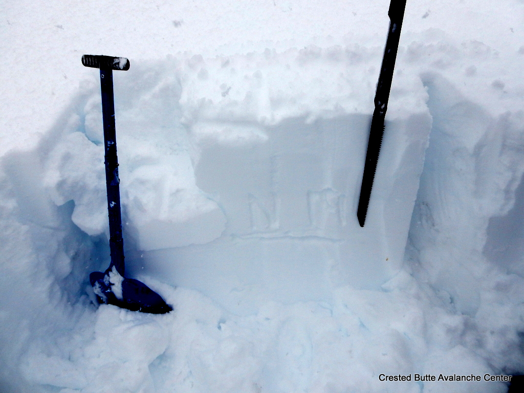
WSW aspect at 10,500 ft. About 35 cm of dense storm snow over a pair of thin crusts. ECTN 19, BRK just above the crusts. 1mm rounding facets below the lowest crust.

Rollerballs observed on steep E, S, and SW aspects today.

D1 BTL. NE aspect.

D1.5 NE aspect BTL.


Mountain Weather 2/8/2017

CB Avalanche CenterWeather

Date: 02/08/2017

The snow and wind peaked early this morning, and we will see high pressure begin to push the back end of this storm out of the area by mid morning.  Light orographic snowfall may hang on across the highest terrain near Crested Butte, but by this afternoon, we will see clearing skies and temperatures plummet.  Thursday will be mostly sunny, before another large and prolonged storm (though even warmer than this storm with rain at lower elevations), looks dead set on the Elk Mountains starting Friday and lasting through much of the weekend. 

Irwin Tenure

CB Avalanche Center2016-17 Observations

Location: Kebler Pass Area
Date of Observation: 02/07/2017
Name: Irwin Guides
Subject: Irwin Tenure
Aspect: East, South East, South, South West, West
Elevation: 10,000-12,000

Avalanches: Numerous D1-1.5 windslabs breaking at skis on aggressive ski cuts and shooting cracks up to 30′ across or downslope. No unusual persistent slab behavior observed. Windslabs found on lee and crossloaded terrain features from strong SW winds.
Weather: 8″ storm snow this morning, accumulated to 11″ storm snow. Snowfall rates ranged between 1-2″/hr at times. Winds increased and intensified throughout the day with gusts easily into the 60s at ridgetop. Temperatures rose gradually throughout the day to 27º at study plot (10k) and rose to 21ºF at ridge (12k).
Snowpack: 5″ .5swe during day making storm total 11″ 1.1″swe of heavy dense snow which fell on 2″ of lighter, stellars yesterday. SW winds blowing steady 30-40mph with stronger gusts and creating 2-4′ drifts. Windslabs failing just above widespread suncrusts and windboard. Will continue to monitor new snow and accumulation and development of more widespread storm slabs overnight.

unnamed-1
unnamed

Shallow storm slabs

CB Avalanche Center2016-17 Observations

Location: Kebler Pass Area
Date of Observation: 02/07/2017
Name: Evan Ross, Alex Bannas
Subject: Shallow storm slabs
Aspect: North, North East
Elevation: 10,000-11,400

Avalanches: Touchy storm slabs. Some incredibly small roller balls/sluffs would fracture slopes within the storm snow. Some of these fractures would propagate through the terrain and pop shallow storm slabs on steeper slopes. Most triggered storm slabs where D1.5’s. where the terrain was larger with more relief, these slabs would accumulate more snow and become D2’s.

Several of these crowns where far enough below ridgelines that the problem wasn’t specific to wind loading.

Lots of natural small sluffing in steep terrain. Watched at least one of these step down into a wider storm slab.
Weather: Obscured sky. Warm near freezing temps. S2 snowfall through the day. Winds light to moderate out of the south as the wrapped around the big massif of East Beckwith.
Snowpack: About 30cm of new snow on the old snow interface in the mid afternoon. New snow was graupely and somewhat dense fist to fist+ snow. Storm slabs were failing in the upper 10 to 15cm of new snow with a bit of a density change of F+ over F snow. Old snow surface didn’t appear to be particularly concerning. Not much for NFS at this new/old interface. Start zones in this area had about 260cm of snow and had seen previous avalanching. Measured one area that hadn’t previously avalanched at 370cm. Also on this deeper slope, no CT result below the old snow interface in a 130cm deep pit. While setting up a DT test, found the 1/19 SH down 100cm, sandwiched between 1f+ hard snow.

Ski cuts produced shooting cracks on slopes under 35 degrees.

IMG_2708
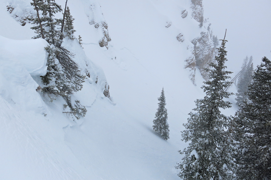
Ski cuts and stomping released shallow storm slabs on slopes over 35 degrees. Some of these storm slabs gouged down to the old snow interface entraining more mass that produced D2 avalanches.

IMG_2704