Mountain Weather

CB Avalanche CenterWeather

Date: 03/30/2018

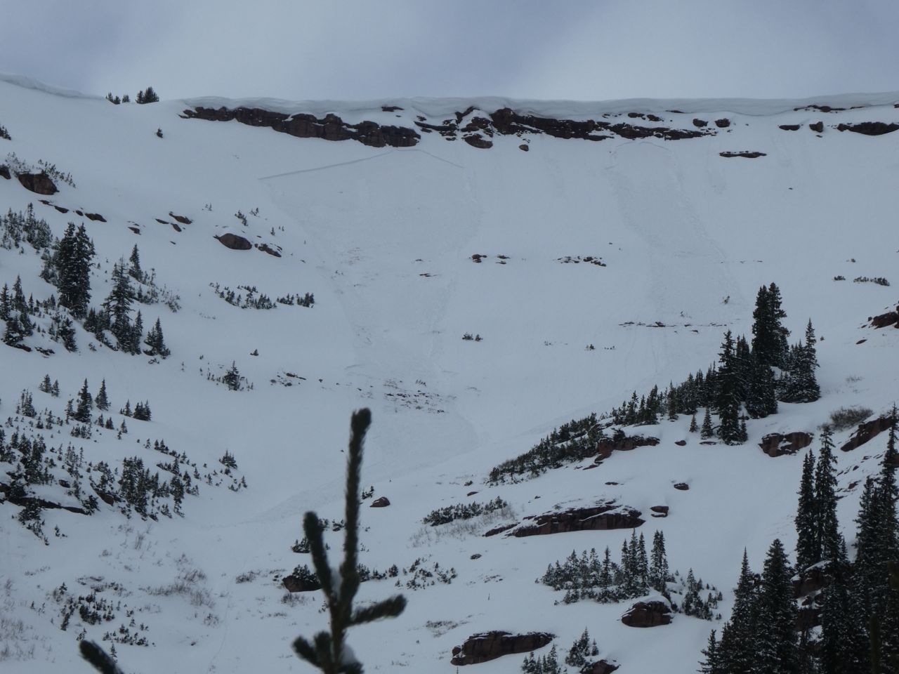
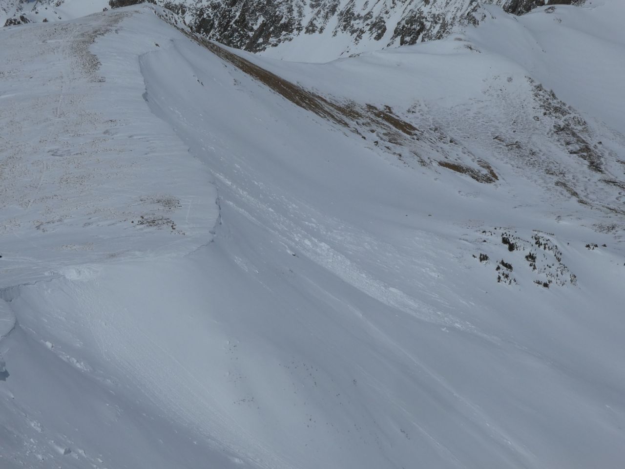
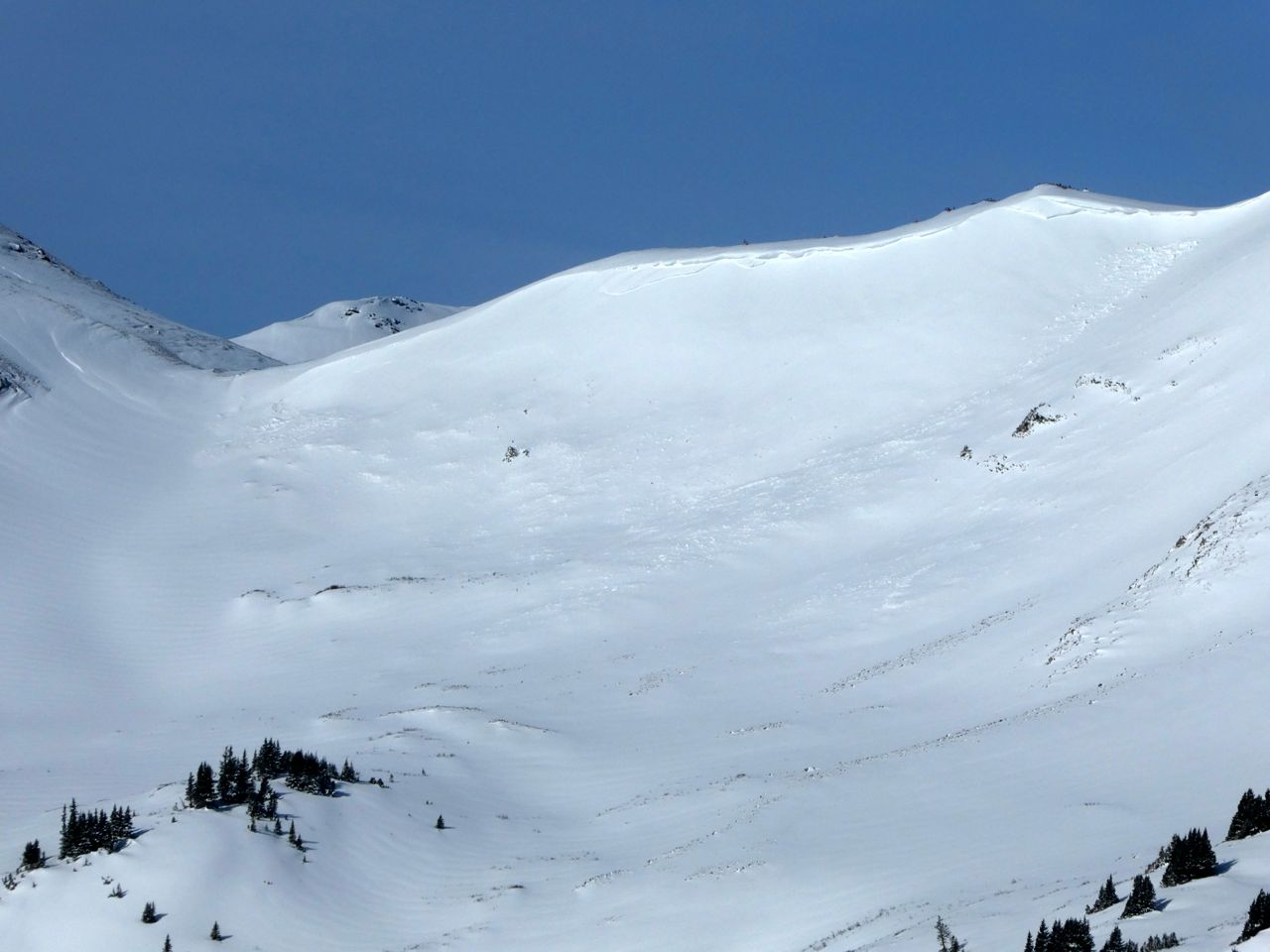
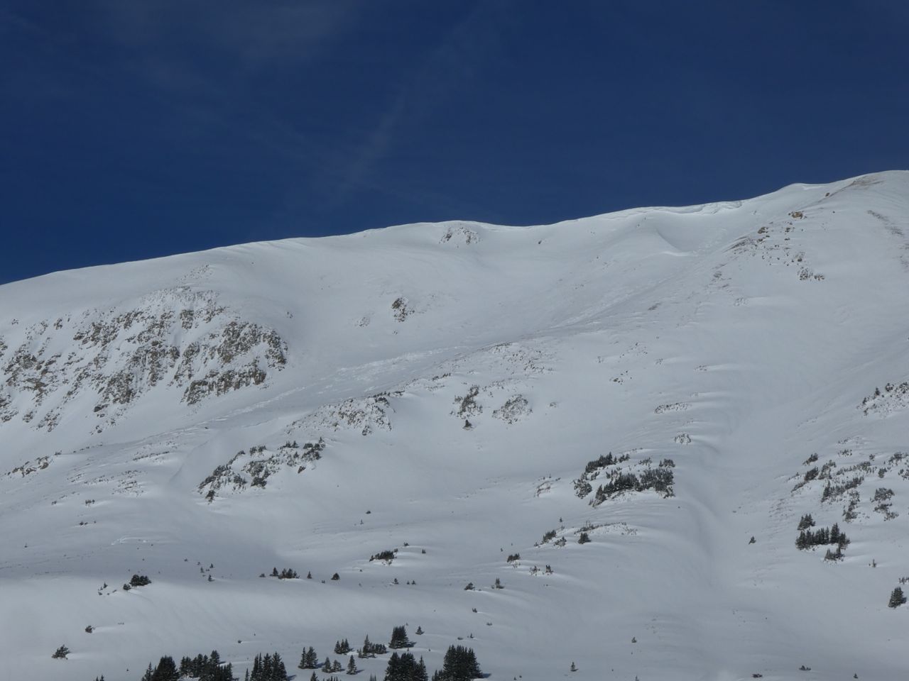
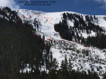
Yesterday’s showery snowfall along the Elk Mountain spine produced about 1″ of new snow in the Kebler and Schofield Pass areas, with winds gusting into the 20s and 30s overnight.

Clear skies will take hold as the ridge wobbles over the central Rockies. Northern Colorado may see redeveloping snowfall tonight, but the Elk Mountains should stay dry with only an increase of clouds expected. We should see 5-10º warmer temperatures across the forecast area as flow shifts from the northwest to more westerly, bringing in warmer drier air from the Great Basin and Utah desert. Looking ahead, the flow stays dry, with gradually warming temperatures through the weekend. Long term looks dry as well, with a Bering Sea ridge setting up over the Aleutian Islands and that high pressure steering significant moisture south toward Mexico.

  • Today

    High Temperature: 36
    Winds/Direction: 10-20/W
    Sky Cover: Partly Cloudy
    Irwin Snow: 0
    Elkton Snow: 0
    Friend’s Hut Snow: 0

  • Tonight

    Low Temperature: 20
    Winds/Direction: 10-20/WNW
    Sky Cover: Partly Cloudy
    Irwin Snow: 0
    Elkton Snow: 0
    Friend’s Hut Snow: 0

  • Tomorrow

    High Temperature: 40
    Winds/Direction: 10-20/W
    Sky Cover: Partly Cloudy
    Irwin Snow: 0
    Elkton Snow: 0
    Friend’s Hut Snow: 0

Post GT Slides

CB Avalanche Center2017-18 Observations

Location: Brush Creek Area
Date of Observation: 03/24/2018
Name: North Face Grand Traverse Snow Safety Team

Subject: Post GT Slides
Aspect: North, East, South East
Elevation: Alpine/BTL

Avalanches:

Numerous D1 and a few D2 Natural Avalanches observed on N, E, SE aspects Alpine/ BTL (Most appeared to be triggered by Cornice Failure.)

Weather: SCT. / Winds Light W
Snowpack: 13″ new on the 23rd w/ 1.7″ SWE. Widespread 5mm Surface faceting observed on the morning of the 24th skinning up to the pass. 51 ” of snow was loaded on Lee side of Start Pass

Photos:

Coney’s

CB Avalanche Center2017-18 Observations

Location: Crested Butte Area
Date of Observation: 03/29/2018
Name: Whitney Gilliam

Subject: Coney’s
Aspect: North East
Elevation: 9,800 ft

Avalanches:

Snowboard triggered wet loose near base of Coney’s at about 1030am.

Weather: Mostly clear skies, consistent ~ 10 – 15 mph wind from NW with gusts up to ~25. Blowing snow observed on Gothic and Mt. Baldy.
Snowpack: Did not observe

Photos:

Mountain Weather March 29, 2018

CB Avalanche CenterWeather

Date: 03/29/2018

Last night’s dirty ridge, or moist northwest flow, left about 3″ in the high country from Irwin to Paradise Divide and along the Elk crest, tapering down to just a skiff of snow near town.
With high pressure on the Pacific Coast and Low Pressure over the Great Plains, Colorado remains in the crosshairs of a weak northwest jet stream. Today we’ll see this breezy northwest flow continue, with a few clouds and a chance for a snowflake or two in the afternoon over the high peaks.

  • Today

    High Temperature: 30
    Winds/Direction: 10 to 20, gusting to 30, Northwest
    Sky Cover: Increasing clouds
    Irwin Snow: 0 to 1″
    Elkton Snow: 0 to 1″
    Friend’s Hut Snow: 0 to 1″

  • Tonight

    Low Temperature: 20
    Winds/Direction: 5 to 15 West Northwest
    Sky Cover: Mostly Clear
    Irwin Snow: 0
    Elkton Snow: 0
    Friend’s Hut Snow: 0

  • Tomorrow

    High Temperature: 37
    Winds/Direction: 10 to 20, gusting to 30, West
    Sky Cover: Mostly Clear
    Irwin Snow: 0
    Elkton Snow: 0
    Friend’s Hut Snow: 0

Mountain Weather March 28, 2018

CB Avalanche CenterWeather

Date: 03/28/2018

A weak low pressure system ran through southern Colorado yesterday into New Mexico last night. Now we sit in the northwest flow on the backside of that trough for the next couple days. There’s enough moisture embedded in this breezy Northwest flow that we’ll see a few orographically driven showers this afternoon and evening. Accumulations will be greatest over the high peaks of the Ruby Range and the Elk Mountains. Not much if any snow for town.

  • Today

    High Temperature: 31
    Winds/Direction: 10 to 20, gusting to 30 in PM, Northwest
    Sky Cover: Overcast
    Irwin Snow: 2 to 4″ this evening
    Elkton Snow: 2 to 4″ this evening
    Friend’s Hut Snow: 3 to 5″ this evening

  • Tonight

    Low Temperature: 10
    Winds/Direction: 10 to 20, gusting to 30, Northwest
    Sky Cover: Overcast
    Irwin Snow: 0 to 1″
    Elkton Snow: 0 to 1″
    Friend’s Hut Snow: 0 to 1″

  • Tomorrow

    High Temperature: 32
    Winds/Direction: 10 to 20, Northwest
    Sky Cover: Mostly Cloudy
    Irwin Snow: 0
    Elkton Snow: 0
    Friend’s Hut Snow: 0

West Brush Creek

CB Avalanche Center2017-18 Observations

Location: Brush Creek Area
Date of Observation: 03/27/2018
Name: Ben Pritchett

Subject: West Brush Creek
Aspect: North East, East, South East
Elevation: 9,000′ – 12,200′

Avalanches:

Several from 3/23 and 3/24, all failing on faceted weak layers.

Weather: Warm, with intense radiation and convective showers.
Snowpack: Persistent problem lingers above 11,000′. We found clean, sharp facets and reactive tests on East aspects above 11,000′ and Southeast as you near 12,000′. These persistent weak layers are stubborn to trigger, but certainly still possible.

Photos:

Mountain Weather

CB Avalanche CenterWeather

Date: 03/27/2018

Split flow continues with the polar jet moving moisture to our north, and a closed low pressure to our south spinning wrap around moisture onto the Front Range and east facing Sawatch. Just as a late night spring breaker stumbles toward home, the closed low spins off toward Oklahoma throughout the day. Weak northwest flow brings broken pieces of moisture into our area mountains but accumulations will remain light. Unsettled weather and mild temperatures continue through the week, but no single precipitation band looks too significant.

  • Today

    High Temperature: 33
    Winds/Direction: 5-15/E
    Sky Cover: Mostly Cloudy
    Irwin Snow: 1-3″
    Elkton Snow: 1-3″
    Friend’s Hut Snow: 1-3″

  • Tonight

    Low Temperature: 15
    Winds/Direction: 5-15/NNW
    Sky Cover: Partly Cloudy
    Irwin Snow: 0-1″
    Elkton Snow: 0-1″
    Friend’s Hut Snow: 0-1″

  • Tomorrow

    High Temperature: 33
    Winds/Direction: 5-15/NW
    Sky Cover: Mostly Cloudy
    Irwin Snow: 0-2″
    Elkton Snow: 0-2″
    Friend’s Hut Snow: 0-2″

Mountain Weather

CB Avalanche CenterWeather

Date: 03/26/2018

A complicated storm system is splintering across the Great Basin today, and uncertainty remains about how much snowfall we can expect in the Elk Mountains. Scattered snow showers can be expected, but accumulations will likely remain minimal. Westerly winds will kick above treeline today with this passing front and temperatures should reach the low 30s. If I had a day off, I might roll over to the Monarch Pass area tomorrow as a wrap around moisture component could favor the Sangre de Cristos and Sawatch. More unsettled weather arrives on favorable northwest flow Wednesday afternoon.

  • Today

    High Temperature: 32
    Winds/Direction: 10-20/WSW
    Sky Cover: Increasing clouds
    Irwin Snow: 0-2″
    Elkton Snow: 0-2″
    Friend’s Hut Snow: 0-2″

  • Tonight

    Low Temperature: 13
    Winds/Direction: 5-15/N
    Sky Cover: Mostly Cloudy
    Irwin Snow: 0-1″
    Elkton Snow: 0-1″
    Friend’s Hut Snow: 0-1″

  • Tomorrow

    High Temperature: 33
    Winds/Direction: 5-15/N
    Sky Cover: Mostly Cloudy
    Irwin Snow: 1-3″
    Elkton Snow: 1-3″
    Friend’s Hut Snow: 1-3″

Axtell, NNE, 11,500′ Skier Triggered

CB Avalanche Center2017-18 Observations

Location: Crested Butte Area
Date of Observation: 03/25/2018
Name: Tom Runcie

Subject: Axtell, NNE, 11,500′ Skier Triggered
Aspect: North, North East
Elevation: 11,500′

Avalanches:

Skier triggered slide in a small terrain feature. I skied over a rollover into a small concave chute. Slab broke just above me, about 10″ deep and maybe 30-40′ wide and pushed me through the choke of the chute. Was able to ski out of the slide. Debris didn’t make it even down to a flat spot. It ended up being pretty benign, but it got my blood pumping! 7 other skier runs in the same zone had no evidence of instability.

Weather: Thin high clouds, warm, light winds with occasional gusts.
Snowpack: 195cm depth, dug to about 125cm depth. Got into a very stiff 1F+ mid pack at about 80cm depth that went to 185cm depth based on probing. Low quality fracture within the storm snow at CTE5 and another just below at CTM 15. Very difficult shearing throughout the column.

Photos:

Washington Gulch near treeline observation

CB Avalanche Center2017-18 Observations

Location: Paradise Divide Area
Date of Observation: 03/25/2018
Name: Eric Murrow

Subject: Washington Gulch near treeline observation
Aspect: North East
Elevation: 11600’

Avalanches:

Observed one very small skier triggered wet loose avalanche avalanche on Coneys, approximately 10,400 feet east aspect from either today or yesterday.

Weather: Overcast skies with light winds.
Snowpack: Went to check out northerly near treeline slopes. Poked a hole at “top of the world” and found HS of 130cm on NE slope. Of note was thin weak crust at the base of 3/23 storm snow from warm temps or a small bit of rain. Storm snow bonded well to this crust and the crust was well bonded to the snow below. A layer of facets was present 50cms below surface and produced an ECTP 13. Not sure how widespread this is across forecast area, but warrants consideration. Below facets was pencil hard snow. See photo.

Photos: