

Date of Observation: 02/25/2023
Name: Rob Strickland
Zone: Northwest Mountains
Route Description: PBR
Observed avalanche activity: Yes
Avalanches: Small wind slab: ATL > east
Weather: Delightful
Snowpack: Deep, calm, and warming
Date of Observation: 02/25/2023
Name: Rob Strickland
Zone: Northwest Mountains
Route Description: PBR
Observed avalanche activity: Yes
Avalanches: Small wind slab: ATL > east
Weather: Delightful
Snowpack: Deep, calm, and warming
Date of Observation: 02/25/2023
Name: Eric Murrow
Zone: Southeast Mountains
Route Description: Recreational day out Upper Cement Creek/Brush Creek
Observed avalanche activity: Yes
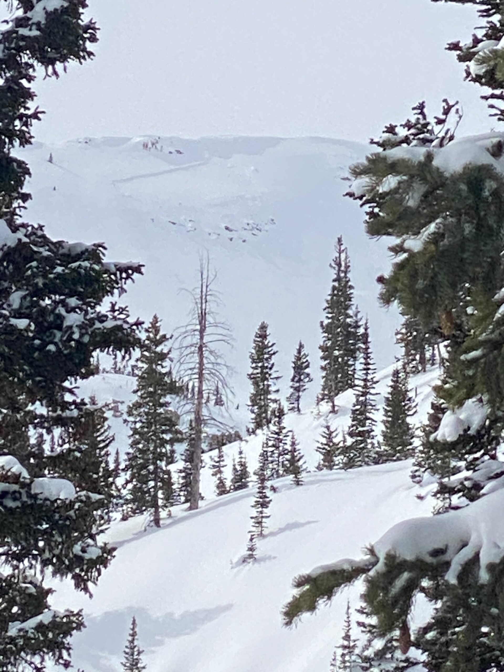
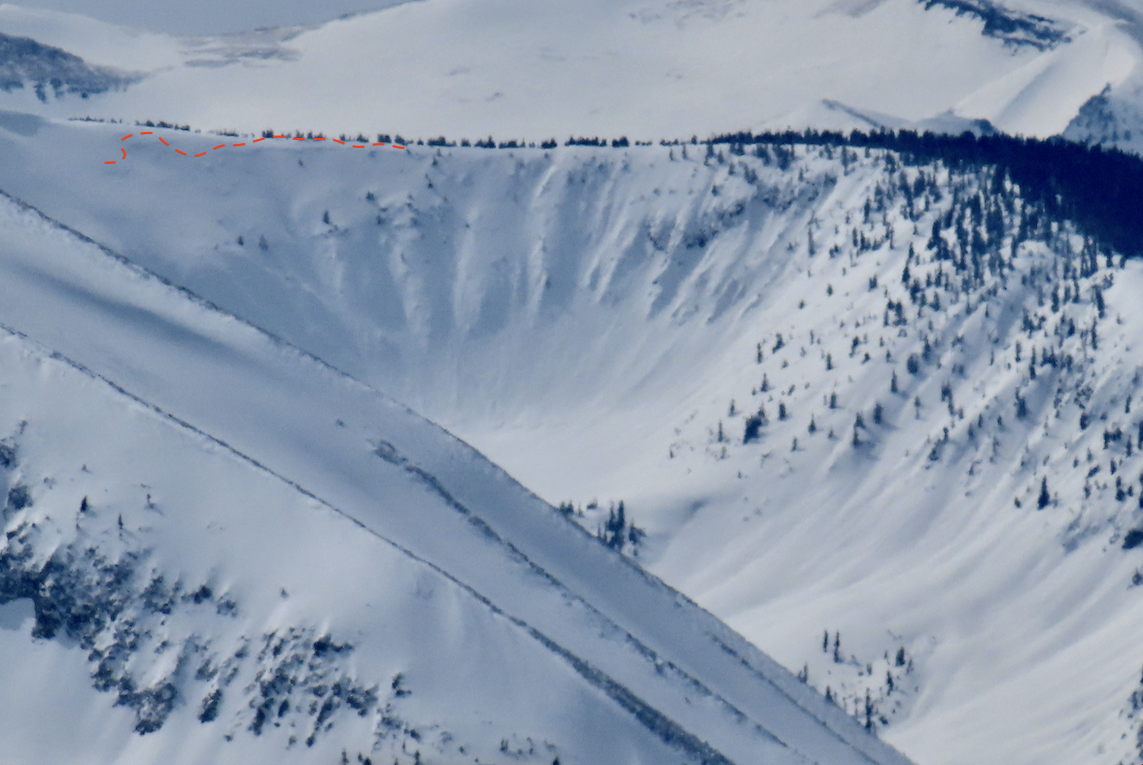
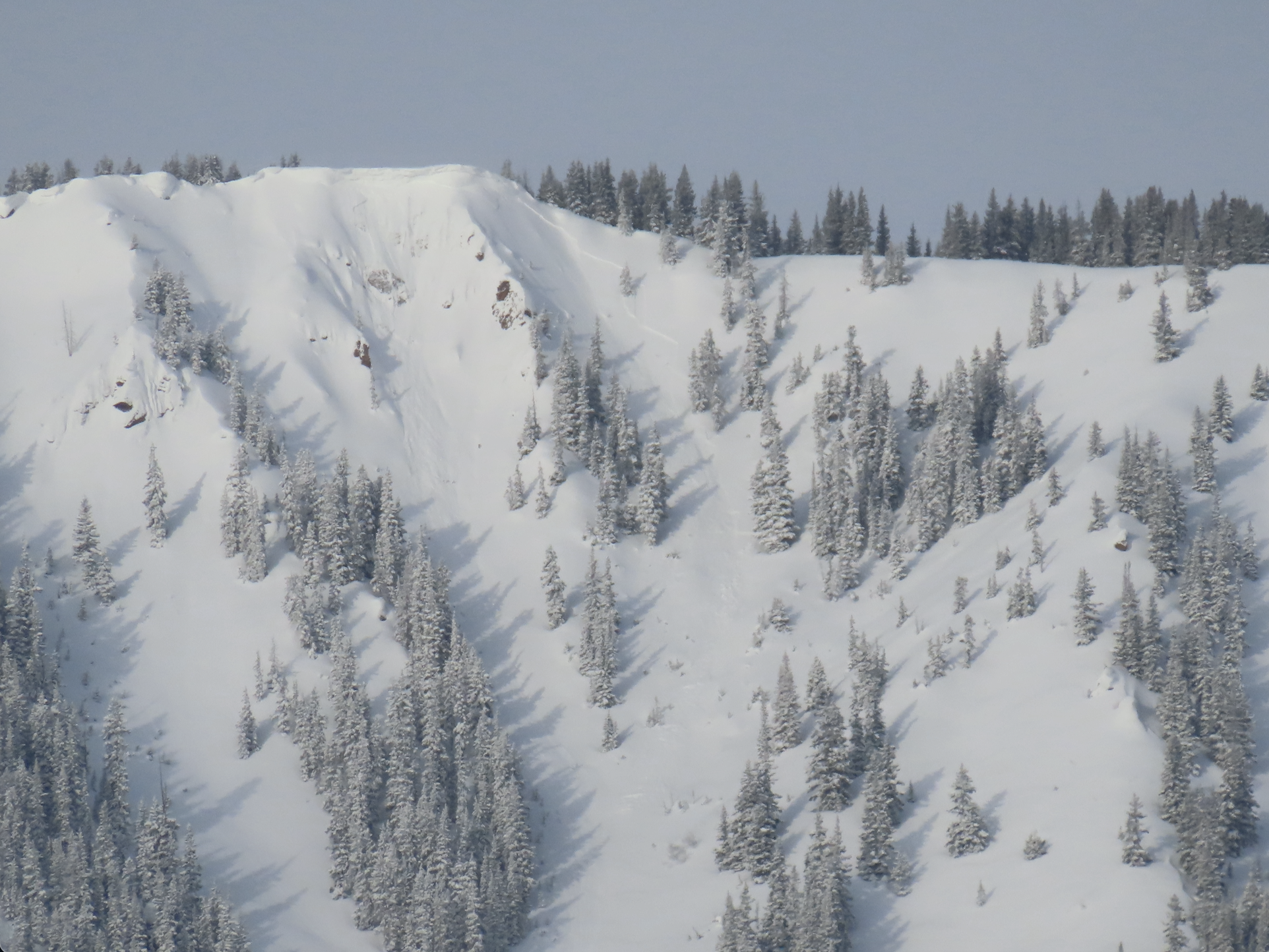
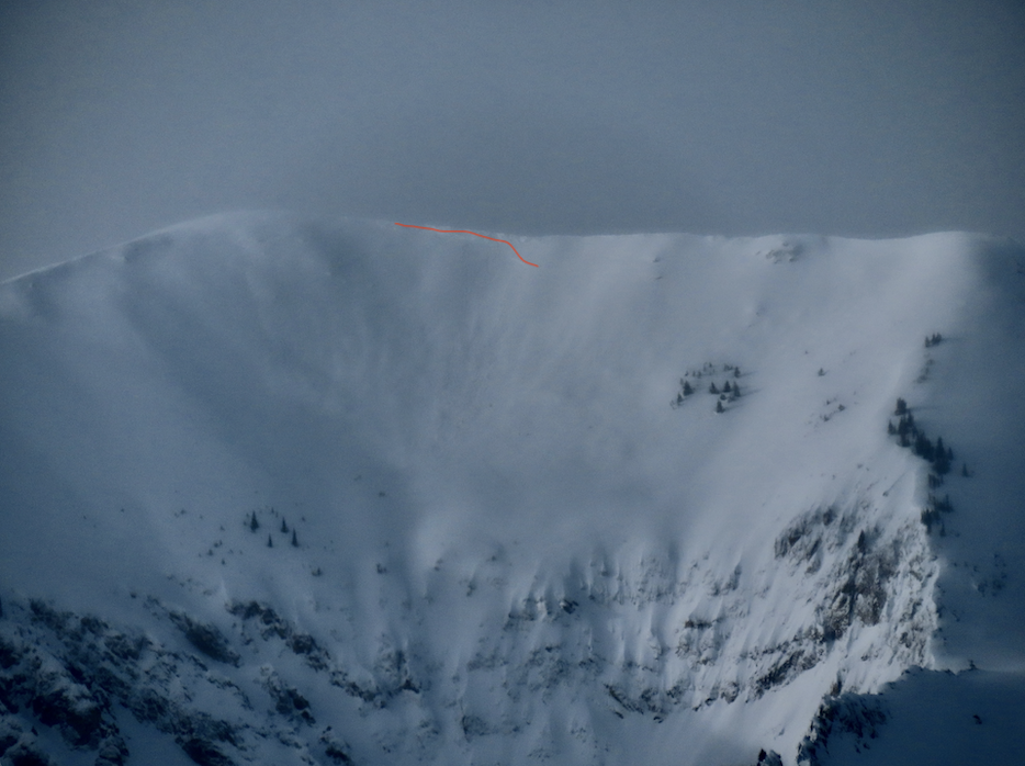
Avalanches: One recent natural avalanche on the northeast side of Double Top. The north Bowl on Cement Mountain had debris in the basin but the crown looked well drifted in (see photo). The northeast cirque on Carbon Peak had suspicious-looking crown markings but the photo was inconclusive (see photo). No other obvious large avalanches were observed looking into SE mountains from the head of Hunter Creek.
Weather: Thin high clouds, mild air temps, and moderate winds above treeline.
Snowpack: Solar aspects became moist at mid to low elevations by the afternoon; some roller ball activity. Recent storm totals settled to around 10-12 inches at the head of Hunter Creek.

Date of Observation: 02/16/2023
Name: Evan Ross
Zone: Northwest Mountains
Route Description: Washington Gulch. 10,000 to 12,600
Observed avalanche activity: No
Avalanches: Any old wind slab or storm slab avalanches from last week have been blown back over. No notable natural avalanches stood out.
Weather: Overcast to mostly cloudy with thin high clouds most of the day. Clearing in the later afternoon. Consistent moderate winds above 11,500ft, that also tapered off in the later afternoon.
Snowpack: The alpine consisted of some monster drifts, loaded planner bowls with good-looking snow, and exfoliated crusts. When we moved through old wind slabs they felt stubborn. We avoided the biggest loaded terrain features. In the afternoon snow surfaces on west were moist at 11,000ft. Later noticed roller balls on SW and W from similar elevations and lower. A test pit on a 30-degree west-facing slope at 10,500ft had a layer of NSF down 45cm that produced a hard ECTN result.
Date of Observation: 02/25/2023
Name: Andrew Breibart
Zone: Southeast Mountains
Route Description: Washington Gulch TH-Snowcross course next to the road-standard skin track to First Bowl.
Observed avalanche activity: Yes
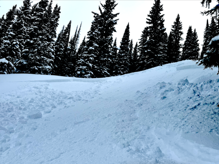
Avalanches: Observed two small avalanches (D0.5-D1) below cornices on Skooks. These were likely observed in obs from 2/24/23.
Weather: calm in the valley bottom and within the trees with a light wind on the ridge line. Mostly cloudy and temperatures were very warm except on the ridge line in the light wind.
Snowpack: On the lower uptrack observed very small roller balls traveling less than 30 feet on >20 degree slope on one open area. Ventured off the skin track and had no cracking or collapsing. I kicked off very small roller balls that traveled less than 30 feet in this area on open terrain >20 degrees. There was no entrainment of snow from any of the rollerballs.
Riding snow was about 6 inches deep (15 cm deep) on south side of first bowl (NE aspect). Snow was warming quickly. On the ridge, I scraped patches of snow from my skis before the descent.
On the ski out, we talked to two skiers who skied Anthracite Mesa south of Coneys and across from Snodgrass T.H. They said snow clumped up to a few inches on their skis during their descent. They were still scraping snow when we passed them on the skin out.
The weekly snowpack summary is here. Strong winds and consistent snowfall dominated the week after the warm temps on Saturday 2/19.
Weekly Summary February 17 – 23, 2023 copy
Date of Observation: 02/24/2023
Name: Evan Ross
Zone: Northwest Mountains
Route Description: Slate River. 9,000ft to 11,000ft. NE-E,S.
Observed avalanche activity: No
Avalanches: None
Weather: Headed out after the morning pulse of wind and snow. Gained Ridgeline around 11am with moderate southwest winds. S-1 to S1 from 10am through mid-day. The snow and wind tapered out in the afternoon.
Snowpack: Traveled cautiously near bigger wind-loaded terrain features. Otherwise skied aggressively with no observed signs of instability. Density changes in the recent storm snow could be observed in small column tests and on wind-loaded test slopes. At 11,000ft a low 34-degree south-facing slope had thick crusts in the upper snowpack, under this past week’s recent snow accumulations.
Date of Observation: 02/23/2023
Name: Irwin Cat-Ski
Zone: Northwest Mountains
Route Description: Irwin Guides cat-ski tenure.
Observed avalanche activity: Yes
Avalanches: SS-AE-R2-D2-I FC (35cm x 40m x 100m)
SS-AE-R1-D1.5-I FC (35cm x 20m x 80m)
SS-AE-R1-D1.5-I FC (35cm x 20m x 60m)
SS-AE-R1-D1-I FC (25cm x 15m x 50m)
Weather:
Snowpack: “Triggered a couple size 2 avalanches out of our east terrain with explosives.”
Date of Observation: 02/23/2023
Name: Eric Murrow
Zone: Southeast Mountains
Route Description: Hwy 135 obs and tour up sunny side of Mount Emmons.
Observed avalanche activity: Yes
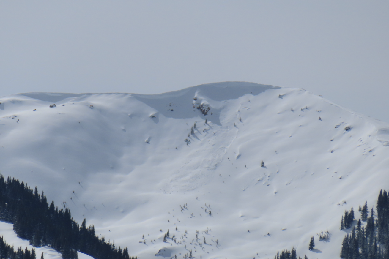
Avalanches: While driving to town I got a glimpse of a few naturals in drifted terrain on Whetstone that appeared to only involve the storm snow. Slides pictured are from the Octagon zone (D1.5) and Barcelona Bowl (D2-ish). Brief glimpse of Main Bowl and Hidden Lake basin suggested more activity but the views were too brief to really see what happened.
On Emmons, I observed a few D1.5 naturals in the drifted terrain below the skinner near treeline but never was able to see the crowns below the cornice.
Weather: Cold temps were tolerable at the valley bottom and decreased to unpleasant levels above treeline. Winds above treeline were commonly light to moderate with an occasional strong gust. Snowfall was very light from 10 am to 3 pm, with less than an inch of accumulation. Some snow transport was observed midday loading into easterly terrain.
Snowpack: Storm totals ranged from 10 to 14 inches. In sheltered areas, I did not get any cracking in the storm snow and a test profile site from a northeast feature produced no propagating results in the upper 3 feet of the snowpack. Once I started to find drifted snow near and above treeline, I was able to reliably get cracks to shoot 10 feet but much less reactive than Wednesday. Stomping above and kicking cornices into drifted terrain did not produce any results.
Date of Observation: 02/23/2023
Name: Dan Hohl
Zone: Southeast Mountains
Route Description: Toured up skier’s R side of Raccoon Glades. Triggered two loud collapses at 11,100′ on a S facing slope. Dug down approximately 3′ to a near crust facet layer that is the likely culprit behind the failures.
Observed avalanche activity: No
Avalanches:
Weather:
Snowpack:
Date of Observation: 02/22/2023
Name: Sam Lesnikoski
Zone: Northwest Mountains
Route Description: Standard anthracite’s skin track and ski runs
Observed avalanche activity: No
Avalanches: None observed
Weather: Cold. Light wind and snow through out the day tapering by afternoon
Snowpack: Surprisingly little wind effect, minimal ridge top loading. Storm snow was dense with no results in terrain over 35 degrees. Stomping on ridge top windrifts and convexities produced only minor cracking.