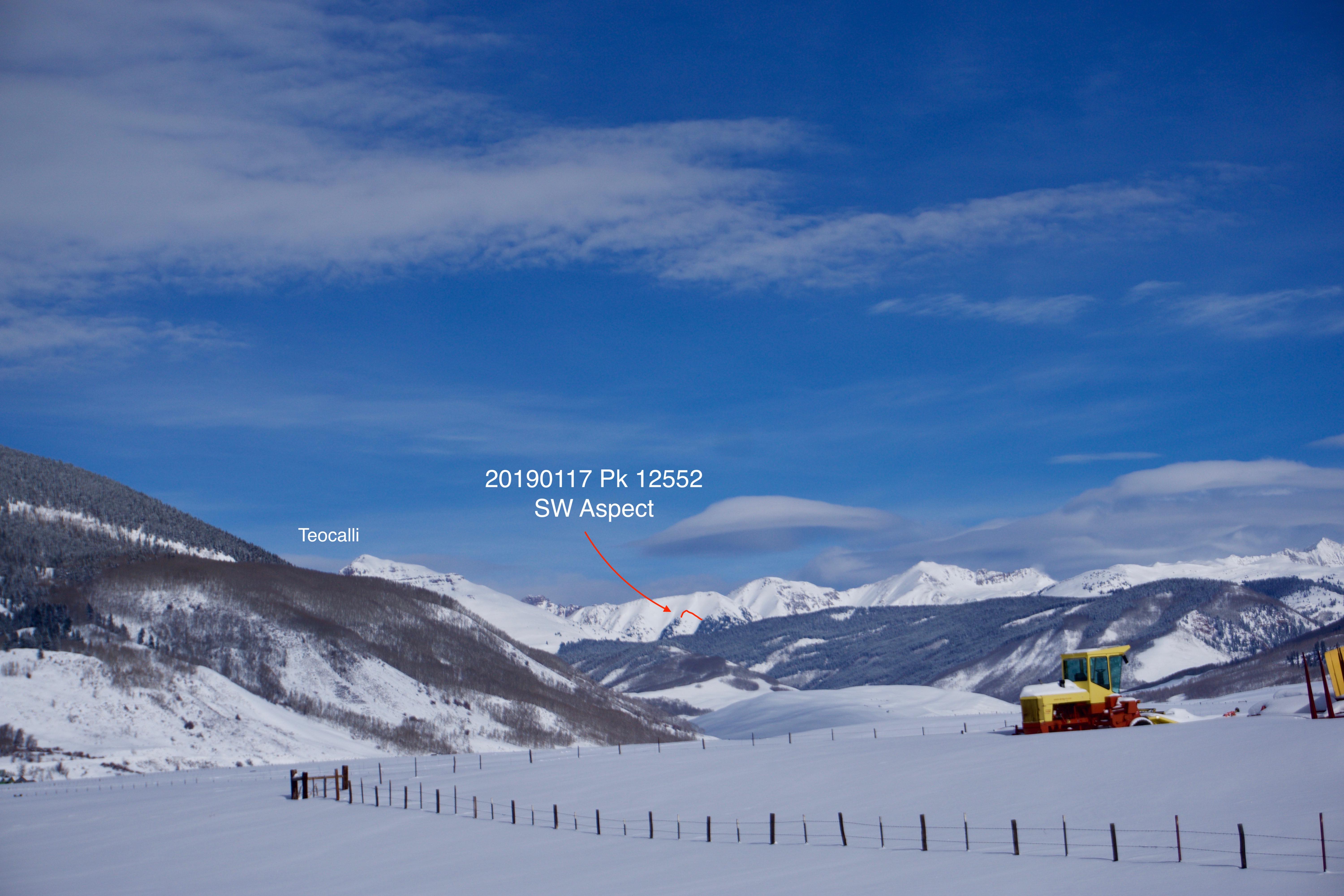
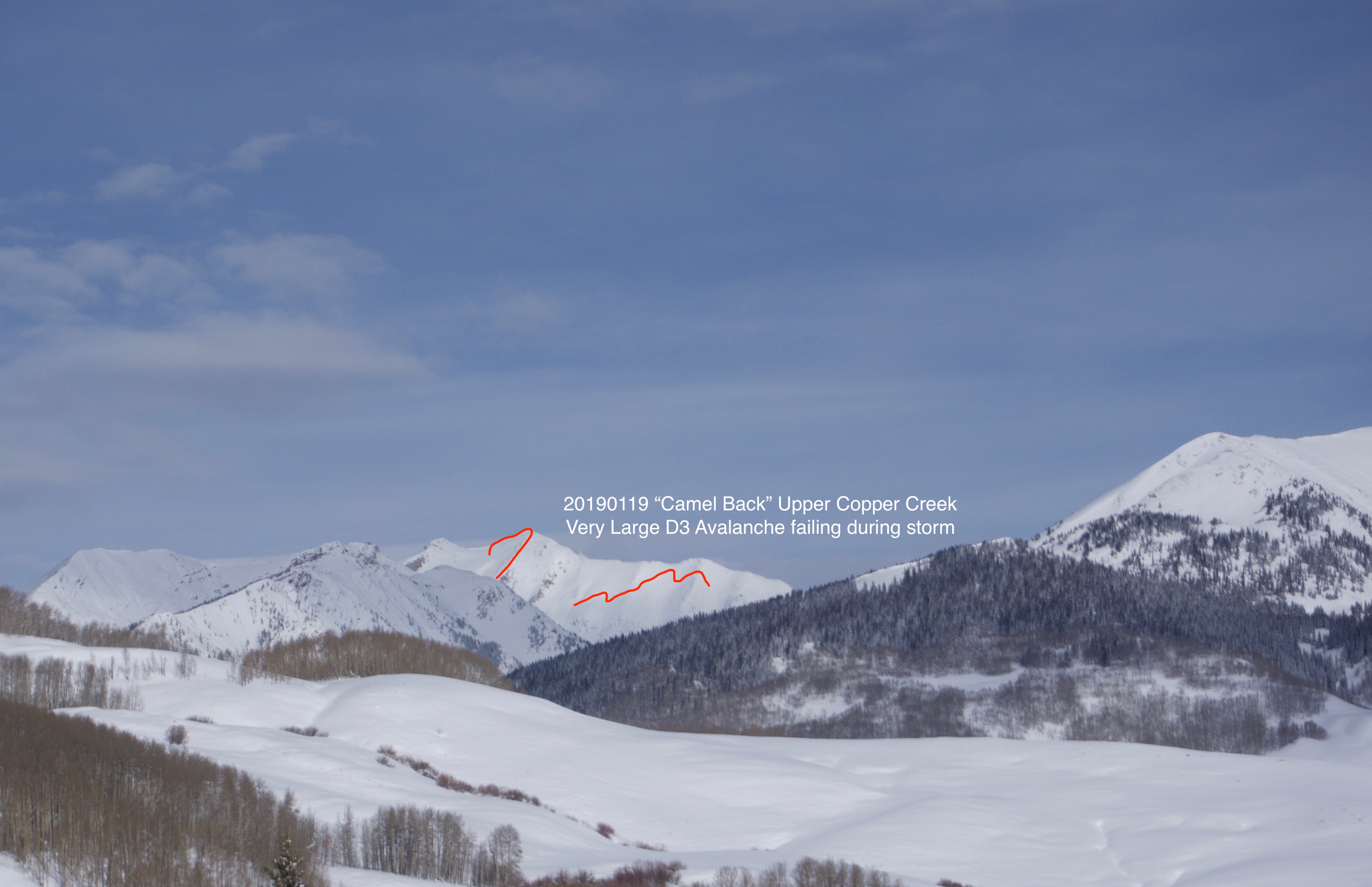
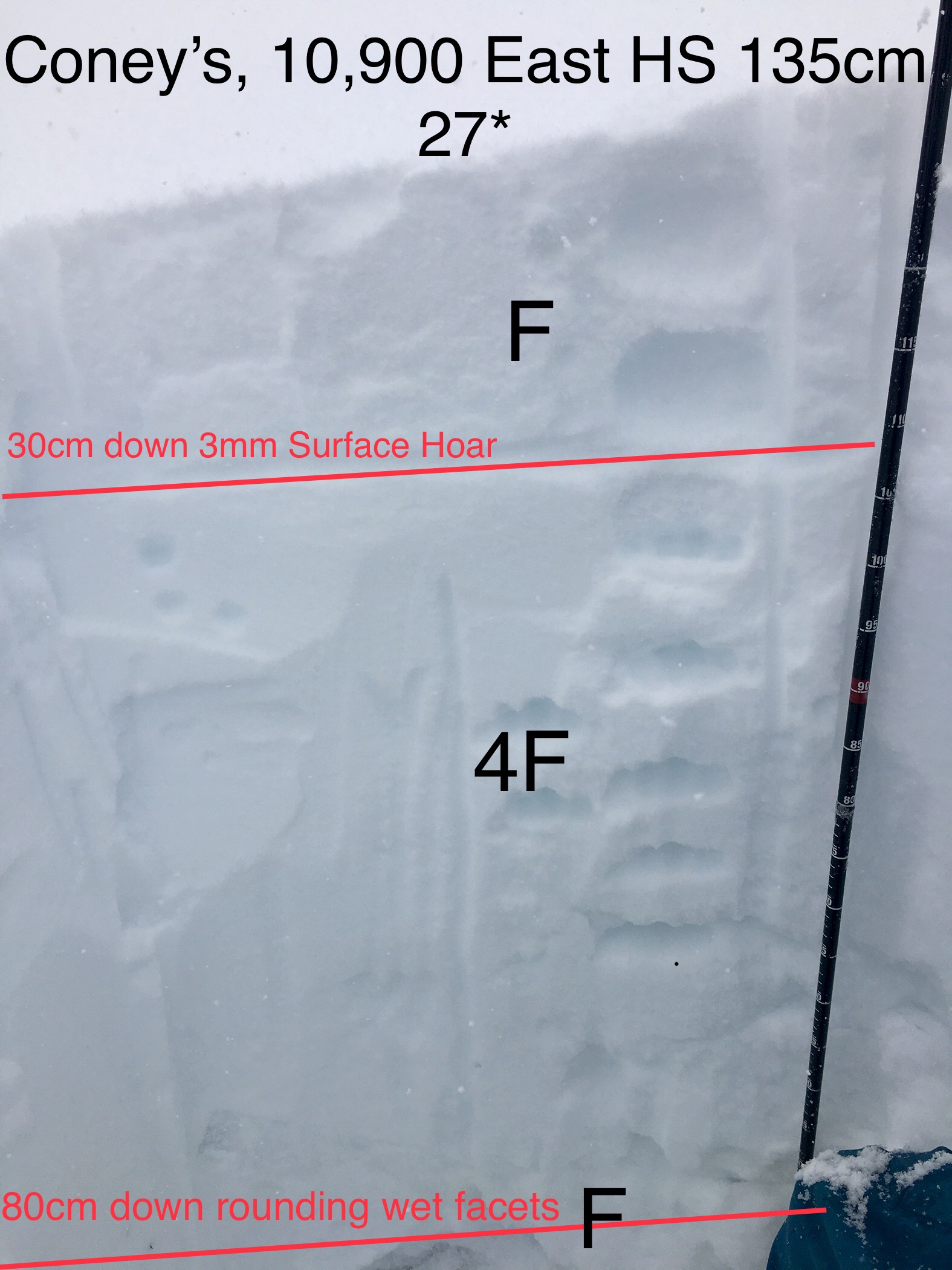
Mountain Weather for 11,000ft

CB Avalanche CenterWeather

Date: 01/18/2019

The abundant moisture that has been streaming into Colorado on SW flow overnight has made a lovely impact on Colorado with good snow totals for many areas and mountains. Precipitation rates look to start backing down after sunrise this morning. We’ll probably see lingering snow showers through noon in the Crested Butte Area as a building ridge to our west starts shutting down the moisture tap. Orographic snow showers should continue longer in the Kebler Pass and Paradise divide area as the flow becomes to west and northwest throughout the day. A cold front has also moved in with temperatures continuing to drop after sunrise and they will be slow to increase today. Dry weather is in the forecast for the weekend. Models are showing some moisture coming over the ridge that could lead to high clouds on Saturday and we’ll have to see how far the moisture pushes into Colorado. The next storm lines up Sunday night, ya baby!

  • Today

    High Temperature: 18 to 22
    Winds/Direction: 15 to 25 WNW G35
    Sky Cover: Overcast
    Irwin Snow: 4 to 6
    Elkton Snow: 4 to 6
    Friend’s Hut Snow: 3 to 5

  • Tonight

    Low Temperature: 5 to 10
    Winds/Direction: 10 to 20 NW
    Sky Cover: Partly Cloudy
    Irwin Snow: 0 to 2
    Elkton Snow: 0 to 2
    Friend’s Hut Snow: 0 to 2

  • Tomorrow

    High Temperature: 20 to 25
    Winds/Direction: 10 to 20 NW G30
    Sky Cover: Partly Cloudy
    Irwin Snow: 0
    Elkton Snow: 0
    Friend’s Hut Snow: 0

Washington Gulch

CB Avalanche Center2018-19 Observations

Location: Paradise Divide Area
Date of Observation: 01/17/2019
Name: Zach Kinler

Subject: Washington Gulch
Aspect: North East, East, West
Elevation: 9,000-10,400

Avalanches:

Observed several D1-D2+ avalanches on West aspects Above, Near and Below Tree line from recent storm.

Weather: Sunny and warm early transitioned into clouds, wind and light snow. High ~ -3.0C. Strong winds with loading snow observed on peaks and ridge lines.

Snowpack: HS @ 10,400: 148 cm. 30 cm recent storm snow.

Photos:

Anthracite Mesa-Coneys Day after storm

CB Avalanche Center2018-19 Observations

Location: Crested Butte Area
Date of Observation: 01/17/2019
Name: ADB

Subject: Anthracite Mesa-Coneys Day after storm
Aspect: East
Elevation: BTL

Avalanches:

May have observed a couple R1-D1 slides on Schuykill but hard to tell from afar. These occurred mid slope.

Weather: Obstructed skies gave way to broken skies. light to calm winds in valley bottom and in the trees. Moderate winds on the ridgeline with surface snow transport into first bowl.
Paradise Divide area: Moderate to strong winds at ATL. Consistent blowing snow on summits of Baldy and other peaks. Winds direction was from the west (see picture).

Snowpack: Since yesterday’s observations: 2 to 6 inches of wind deposited snow.
no cracking or collapsing. snow was more supportive than yesterday morning.
appears that graupel (<1cm) may have fallen at the end of the snowfall period. graupel on surface formed a scattered layer and doesn’t appear to be widespread.
couldn’t see the remotely triggered avalanche in first bowl from 1/16 observations as recent snow covered any trace.

Photos:

Cement Creek Tour

CB Avalanche Center2018-19 Observations

Location: Cement Creek Area
Date of Observation: 01/17/2019

Subject: Cement Creek Tour
Aspect: North, North West
Elevation: 9800-10200 feet

Avalanches:

None observed.

Weather: Clear in the morning becoming slightly over cast as the day went on. Wind was calm, picking up to a slight breeze around mid afternoon, coming out of the NW. Cold in the valley bottoms and warming with elevation gain, though the shaded northern aspects stayed pretty chilly all day.

Snowpack: By and large the snowpack was not supportive to Rando skis until just below 10000 feet, and then it was supportive only intermittently. Experienced one large collapse at just over 10000′. Could not see any shooting cracks but collapse was large and loud enough to startle me. Only other collapses of the day were at lower elevations. These were much smaller feeling and did not seem to propagate more than a few inches past my ski tips. Dug a pit at 10200′ on NNW aspect BTL. Snow depth 100cm. Upper 20cm was new storm snow. Below that was soft “slab” 4-finger to fist hardness, softening with depth. At ~40cm above ground level it became coarse grained sugar from there on down. Compression test produced failure @ 20 cm below snow surface after 8 taps from the wrist. Failed again at about 50 cm below snow surface after 5 taps from the elbow, though second failure did not really sheer on any kind of bed surface. It was more like the “slab” just sort of crumbled.

Photos:

Windshield Tour of Avalanches in Upper East River Basin

CB Avalanche Center2018-19 Observations

Location: Crested Butte Area
Date of Observation: 01/17/2019
Name: Ian Havlick

Subject: Windshield Tour of Avalanches in Upper East River Basin
Aspect: East, South East, South, South West, West
Elevation: 9-12500

Avalanches:

Several D3 avalanches observed deeper in the northern and eastern zones where 1-1.5″ snow water equivalent fell yesterday and strong winds at ridge top continued transporting snow. Surprised to see as many slides fail midstorm on southwest and west facing terrain. Aspects up to this point have lacked much avalanche activity. We are phasing out of those aspects offering safer passage in the backcountry I fear… especially with this next big wave of moisture tonight and tomorrow.

Weather: Increasing Clouds, partly cloudy, light breeze in valley, strong winds at ridgetop. Temps were milds.

Snowpack:

Photos:

Slate River Holding Up

CB Avalanche Center2018-19 Observations

Location: Paradise Divide Area
Date of Observation: 01/17/2019
Name: Evan Ross

Subject: Slate River Holding Up
Aspect: North East
Elevation: 9,000-10,600

Weather: Patly to mostly cloudy sky. The thick clouds didn’t move in until later afternoon. Calm winds where we were down in the valley. Blowing snow off the peaks. Winds had picked up in the valley at 4pm on the way home and where blowing snow.

Snowpack: Thick pow with no signs to instability. No cracks, noise, nothing. The deep snowpack is handling the ~15″ HST well. In the whole Slate River Valley and everything that can be seen further around, only one D 1.5 avalanche was seen from the last storm. That also goes for the thiner snowpack near Mt Emmons. The old crowns on the Climax Chutes could still be seen. The Climax Chutes had a few small loose snow avalanches in the steepest terrain. HS at 10,500ft averaged 165cm.

Irwin Cat Operation

CB Avalanche Center2018-19 Observations

Location: Kebler Pass Area
Date of Observation: 01/16/2019
Name: Irwin Cat Operation

Subject: Irwin Cat Operation
Aspect:
Elevation:

Avalanches:

Avalanche observations: Numerous SS-ASr-R2/3-D1.5-I on west facing terrain, these were shallow storm slabs running full track and remotely. Widespread propagation across numerous start zones (Thortons skirt trigger thru D&D).Triggering was very sensitive in the AM, but by 1400, slab was stiffening and triggering was a bit more stubborn but still remote in nature. Shooting cracks and slumping in Binge, but did not propagate.

Weather: Weather summary: Poor visibility, strong WSW gusts recorded at Scarp Ridge since 2Am, but winds were often gusting out of the east on slope. Gusts went over 50 since 2pm out of the WSW. S1-S2 snow showers.

Snowpack: 6″ of 9% started our morning with an 1″per hr till 1300. We picked up 3″ by 1400 at the Study plot. Storm was skiing soft, but surface was wind stiffened on exposed terrain. Ski pen ~25cms but stiffening towards end of day. West and East were loaded/cross loaded and south was more storm pressed. Old crust was visible in scoured chokes like Sonic, Candy’s and NC, But Jaybirds-Bender were loaded.

Photos:

Coney’s tour & remote trigger

CB Avalanche Center2018-19 Observations

Location: Crested Butte Area
Date of Observation: 01/16/2019
Name: Dave Bumgarner

Subject: Coney’s tour & remote trigger
Aspect: North East
Elevation: 10903

Avalanches:

On our 3rd lap I remotely triggered a slide in first bowl. It was in the typical spot that gets wind loaded, the debris ran to the prominent trees in the middle of the bowl. Photo of crown attached (not good quality).

Weather: Sky: overcast most of the day
Wind: was calm in the morning and picked up to moderate at ridge line.
Precip: S2 most of the day
Temp: mid 20s

Snowpack: Did not see any signs of instability for most of the tour.
25-30cm of new snow

Photos:

Coneys Hot Dogs, Storm Slabs getting strong!

CB Avalanche Center2018-19 Observations

Location: Crested Butte Area
Date of Observation: 01/16/2019
Name: Will Nunez

Subject: Coneys Hot Dogs, Storm Slabs getting strong!
Aspect: North East, East
Elevation: 10,900

Avalanches:

No signs of any instability in terrain under 35*
One small storm sluff NE nose of coneys.

Weather: Obscure, S1 and pulses of S2, mod wind with strong gusts NW, temps I. The 20s.

Snowpack: HS 90-135cm, New snow ranged from 4-12”, 30cm of F new snow resting on 3mm buried surface Hoar, 50cm 4FtoF rounding facets to the ground. New storm snow was becoming stronger throughout the day.

Photos:

Mountain Weather for 11,000ft

CB Avalanche CenterWeather

Date: 01/17/2019

Wednesday’s storm was just the pre-show warmup. The real performance is about to take the stage. Thursday will be a transition day. High clouds will begin increasing this morning, after last nights clear sky. We are looking ahead to a mostly cloudy sky with a few breaks. Moisture, like lots of moisture, is about to begin streaming into Colorado on southwest to west flow. Snow showers will begin late today and intensify overnight. We have good moisture, lift, and favorable flow, it’s on people! The temperature at the start of this storm will be fairly warm, with colder air moving in later in the storm. Friday will see snow showers taper in general with some areas seeing those snows last a bit longer under NW flow. Drier weather will take us through the weekend with another storm coming in for early next week.

  • Today

    High Temperature: 25 to 30
    Winds/Direction: 10 to 20 WSE
    Sky Cover: Mostly Cloudy
    Irwin Snow: 1 to 2 PM
    Elkton Snow: 1 to 2 PM
    Friend’s Hut Snow: 1 to 2 PM

  • Tonight

    Low Temperature: 14 to 19
    Winds/Direction: 15 to 25 G 35, WSW
    Sky Cover: Mostly Cloudy
    Irwin Snow: 15 to 17
    Elkton Snow: 12 to 14
    Friend’s Hut Snow: 10 to 12

  • Tomorrow

    High Temperature: 15 to 20
    Winds/Direction: 10 to 20 NW
    Sky Cover: Overcast
    Irwin Snow: 4 to 6
    Elkton Snow: 4 to 6
    Friend’s Hut Snow: 3 to 5